›››
Aruba
Aruba
Population
108.0K
Rank #191Source: World Bank
Capital
Oranjestad
Source: REST Countries
Region
Americas
Latin America & Caribbean
Source: REST Countries
GDP (Nominal)
$4.27B
Rank #162Source: World Bank
Land Area
180 km²
Rank #205Source: REST Countries
Life Expectancy
76.353 yrs
Source: World Bank
Historical Trends
Population Trend (5-Year)
Source: World Bank
GDP Trend (5-Year, Nominal USD)
Source: World Bank
Geography
Area: 180 km²
Landlocked: No
Independent: No
Climate: tropical marine; little seasonal temperature variation
Terrain: flat with a few hills; scant vegetation
Elevation: lowest point: Caribbean Sea 0 m highest point: Ceru Jamanota 188 m
Natural Hazards: hurricanes; lies outside the Caribbean hurricane belt and is rarely threatened
Environmental Issues: difficulty in properly disposing of waste produced by large numbers of tourists; waste burning that occurs in the landfill causes air pollution and poses an environmental and health risk; ocean...
Land Use: agricultural land: 11.1% (2016 est.) forest: 2.3% (2016 est.) other: 86.6% (2016 est.)
Geography Note: a flat, riverless island renowned for its white sand beaches; its tropical climate is moderated by constant trade winds from the Atlantic Ocean; the temperature is almost constant at about 27 degrees...
Natural Resources
NEGLwhite sandy beaches foster tourism
People & Society
Fertility Rate
1.60
Population
108.0K
Ethnic Groups
Aruban (66%)Colombian (9.1%)Dutch (4.3%)Dominican (4.1%)Venezuelan (3.2%)Curacaoan (2.2%)Haitian (1.5%)Surinamese (1.2%)Peruvian (1.1%)Chinese (1.1%)other (6.2%)
Religions
Roman Catholic (75.3%)Protestant 4.9% (includes Methodist (0.9%)Adventist (0.9%)Anglican (0.4%)other Protestant (2.7%)Jehovah's Witness (1.7%)other (12%)none (5.5%)unspecified (0.5%)
Economy
GDP per Capita
$39,498.594
GDP per Capita PPP
50,649.302
(2024)
(2024)
GNI per Capita
35,570
(2024)
(2024)
Gini Index
Not Available
Unemployment
Not Available
Inflation
4.257%
(2019)
(2019)
Public Debt
Not Available
Energy
Electricity Access
100%
(2023)
(2023)
Renewable Energy
8.8%
(2022)
(2022)
CO₂ Emissions
0.556 Mt
(2024)
(2024)
Energy Intensity
2.9 MJ/$
(2022)
(2022)
Renewable Electricity
14.797%
(2021)
(2021)
Environment
Forest Coverage
2.333% of land
(2023)
(2023)
Communications
Internet Users
97.17%
(2017)
(2017)
Mobile Penetration
130.648%
(2022)
(2022)
Broadband Subscribers
17.486%
(2022)
(2022)
Transportation
Air Transport Freight
Not Available
Container Port Traffic
57,062 TEU
(2021)
(2021)
Airports
2,276
Rail Lines
N/A
Roads Total
N/A
Military
Military Forces
no regular military forces
Education
Pre-Primary Enrollment
103.521%
(2015)
(2015)
Primary Enrollment
107.717%
(2024)
(2024)
Secondary Enrollment
124.379%
(2024)
(2024)
Tertiary Enrollment
14.066%
(2024)
(2024)
Education Spending
3.619% of GDP
(2021)
(2021)
Pupil-Teacher Ratio
14.789:1
(2012)
(2012)
Health
Physicians per 1,000
Not Available
Safe Water Access
96.74%
(2016)
(2016)
Safe Drinking Water
Not Available
Under-5 Mortality
Not Available
Maternal Mortality (World Bank)
Not Available
Governance
Women in Government
Not Available
Voice & Accountability
1.02
(Strong)
(2023)
(Strong)
(2023)
Political Stability
1.43
(Strong)
(2023)
(Strong)
(2023)
Government Effectiveness
0.80
(Above Average)
(2023)
(Above Average)
(2023)
Regulatory Quality
0.95
(Above Average)
(2023)
(Above Average)
(2023)
Rule of Law
1.27
(Strong)
(2023)
(Strong)
(2023)
Control of Corruption
0.71
(Above Average)
(2023)
(Above Average)
(2023)
Government
Government Type
parliamentary democracy; part of the Kingdom of the Netherlands
Legal System
civil law system based on the Dutch civil code
Executive Branch
chief of state: King WILLEM-ALEXANDER of the Netherlands (since 30 April 2013); represented by Governor General Alfonso BOEKHOUDT (since 1 January 2017) head of government: Prime Minister Evelyn...
Legislative Branch
description: unicameral Legislature or Staten (21 seats; members directly elected in a single nationwide constituency by proportional representation vote; members serve 4-year terms) elections: last...
Judicial Branch
highest courts: Joint Court of Justice of Aruba, Curacao, Sint Maarten, and of Bonaire, Sint Eustatius and Saba or "Joint Court of Justice" (sits as a 3-judge panel); final appeals heard by the...
International Organizations
National Symbols
Flag Description
blue, with two narrow, horizontal, yellow stripes across the lower portion and a red, four-pointed star outlined in white in the upper hoist-side corner; the star represents Aruba and its red soil...
National Symbols
Hooiberg (Haystack) Hill; national colors: blue, yellow, red, white
National Anthem
name: "Aruba Deshi Tera" (Aruba Precious Country) lyrics/music: Juan Chabaya 'Padu' LAMPE/Rufo Inocencio WEVER note: local anthem adopted 1986; as part of the Kingdom of the Netherlands, "Het...
Safety
Homicide Rate
1.935 per 100,000
(2014)
(2014)
Travel Information
Language(s): Dutch, Papiamento
Currency: AWG (ƒ)
Timezone(s): UTC-04:00
Landlocked: No
Independent: No
Driving Side: Right
Calling Code: +297
Week Starts: Monday
Photos
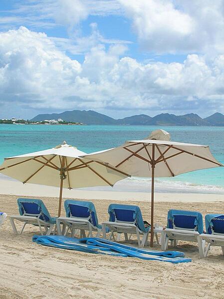
The land mass seen across Rendezvous Bay is the island St. Martin, which is separated from Anguilla by the Anguilla Channel. Rendezvous Bay houses the longest beach in Anguilla and is the site of the Battle of Anguilla (1796). The engagement took place during the Napoleonic Wars; the French were dispatched from St. Martin and landed on the beach of Rendezvous Bay. The invaders destroyed Anguilla's plantations, which by 1821 had almost entirely disappeared from the island. Although, the French were eventually routed by the British, the island's plantations never recovered, forcing many Anguillans into maritime occupations.
The land mass seen across Rendezvous Bay is the island St. Martin, which is separated from Anguilla by the Anguilla Channel. Rendezvous Bay houses the longest beach in Anguilla and is the site of the Battle of Anguilla (1796). The engagement took place during the Napoleonic Wars; the French were dispatched from St. Martin and landed on the beach of Rendezvous Bay. The invaders destroyed Anguilla's plantations, which by 1821 had almost entirely disappeared from the island. Although, the French were eventually routed by the British, the island's plantations never recovered, forcing many Anguillans into maritime occupations. • CIA World Factbook • 2020
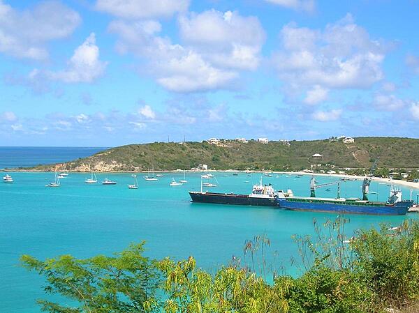
The village of Sandy Ground is Anguilla's main port and harbor. It contains a large salt pond that is part of Anguilla's salt industry. While Anguilla's salt resources are smaller than other area islands, it benefits from its more accessible location for shipping.
The village of Sandy Ground is Anguilla's main port and harbor. It contains a large salt pond that is part of Anguilla's salt industry. While Anguilla's salt resources are smaller than other area islands, it benefits from its more accessible location for shipping. • CIA World Factbook • 2020
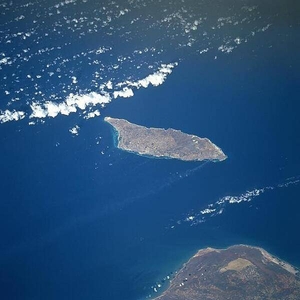
Aruba is a semi-arid island that experiences little variation in temperature throughout the year. Rainfall, which occurs mostly in November and December, averages less than 50 cm (20 in) a year. The red soil on the island is poor and thin and the thorny vegetation is quite drought resistant. Tourism and the refining of oil brought in from nearby Venezuela (whose northern coast appears below) are the major industries. Oraniestad, located on the northwest coast, is the major city of the island. Image courtesy of NASA.
Aruba is a semi-arid island that experiences little variation in temperature throughout the year. Rainfall, which occurs mostly in November and December, averages less than 50 cm (20 in) a year. The red soil on the island is poor and thin and the thorny vegetation is quite drought resistant. Tourism and the refining of oil brought in from nearby Venezuela (whose northern coast appears below) are the major industries. Oraniestad, located on the northwest coast, is the major city of the island. Image courtesy of NASA. • CIA World Factbook • 2020
CIA World Factbook • 2020
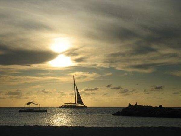
A peaceful, golden Caribbean sunset.
A peaceful, golden Caribbean sunset. • CIA World Factbook • 2020
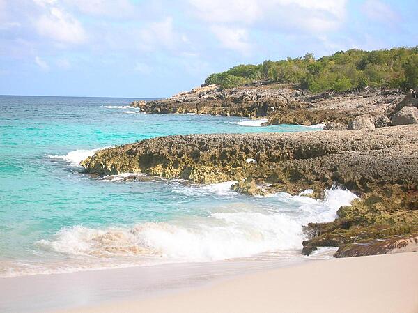
Anguilla, one of the Leeward Islands in the Caribbean, is composed of scrub-covered coral and limestone, which can be seen in this photograph of Limestone Bay. The island's many bays and pristine beaches draw visitors from around the world, making tourism Anguilla's main industry.
Anguilla, one of the Leeward Islands in the Caribbean, is composed of scrub-covered coral and limestone, which can be seen in this photograph of Limestone Bay. The island's many bays and pristine beaches draw visitors from around the world, making tourism Anguilla's main industry. • CIA World Factbook • 2020
23 photos available
View All Photos→Data sources: World Bank, UN Data • Updated daily •Learn about our data