›››
Bangladesh
Bangladesh
Population
173.6M
Rank #8Source: World Bank
Capital
Dhaka
Source: REST Countries
Region
Asia
South Asia
Source: REST Countries
GDP (Nominal)
$450.12B
Rank #35Source: World Bank
Land Area
147.6K km²
Rank #93Source: REST Countries
Life Expectancy
74.672 yrs
Source: World Bank
Historical Trends
Population Trend (5-Year)
Source: World Bank
GDP Trend (5-Year, Nominal USD)
Source: World Bank
Geography
Area: 147,570 km²
Landlocked: No
Independent: Yes
Climate: tropical; mild winter (October to March); hot, humid summer (March to June); humid, warm rainy monsoon (June to October)
Terrain: mostly flat alluvial plain; hilly in southeast
Elevation: mean elevation: 85 m lowest point: Indian Ocean 0 m highest point: Keokradong 1,230 m
Natural Hazards: droughts; cyclones; much of the country routinely inundated during the summer monsoon season
Environmental Issues: many people are landless and forced to live on and cultivate flood-prone land; waterborne diseases prevalent in surface water; water pollution, especially of fishing areas, results from the use of...
Land Use: agricultural land: 70.1% (2016 est.) forest: 11.1% (2016 est.) other: 18.8% (2016 est.)
Geography Note: most of the country is situated on deltas of large rivers flowing from the Himalayas: the Ganges unites with the Jamuna (main channel of the Brahmaputra) and later joins the Meghna to eventually...
Natural Resources
natural gasarable landtimbercoal
People & Society
Fertility Rate
2.16
Population
173.6M
Ethnic Groups
Bengali at least (98%)other indigenous ethnic groups (1.1%)
Religions
Muslim (89.1%)Hindu (10%)other (0.9%)
Economy
GDP per Capita
$2,593.416
GDP per Capita PPP
9,646.77
(2024)
(2024)
GNI per Capita
2,820
(2024)
(2024)
Gini Index
30.9
(2022)
(2022)
Unemployment
3.635%
(2024)
(2024)
Inflation
10.466%
(2024)
(2024)
Public Debt
Not Available
Energy
Electricity Access
99.5%
(2023)
(2023)
Renewable Energy
25%
(2021)
(2021)
CO₂ Emissions
124.191 Mt
(2024)
(2024)
Energy Intensity
1.93 MJ/$
(2021)
(2021)
Renewable Electricity
1.502%
(2021)
(2021)
Environment
Forest Coverage
14.49% of land
(2023)
(2023)
Communications
Internet Users
44.503%
(2023)
(2023)
Mobile Penetration
114.355%
(2023)
(2023)
Broadband Subscribers
7.892%
(2023)
(2023)
Transportation
Air Transport Freight
98.85 M ton-km
(2023)
(2023)
Container Port Traffic
3,200,236 TEU
(2022)
(2022)
Airports
72,684
Rail Lines
2,877 km
Roads Total
391,657.53 km(©IRF)
Military
Military Forces
Bangladesh Defense Force: Bangladesh Army, Bangladesh Navy, Bangladesh Air Force; Ministry of Home Affairs: Border Guard Bangladesh (BGB), Bangladesh Coast Guard, Ansars, Village Defense Party (VDP)...
Personnel Strength
estimates of the size of the Bangladesh Defense Force vary; approximately 165,000 total active personnel (135,000 Army; 16,000 Navy; 14,000 Air Force); 38,000 Border Guards
Military Expenditure (USD)
$4.03B
Military Expenditure (% of GDP)
0.94%
Military Expenditure History
1.3% of GDP (2019) 1.3% of GDP (2018) 1.2% of GDP (2017) 1.4% of GDP (2016) 1.4% of GDP (2015)
Deployments
1,300 Central African Republic (MINUSCA); 1,650 Democratic Republic of the Congo (MONUSCO); 115 Lebanon (UNIFIL); 1,300 Mali (MINUSMA); 1,600 South Sudan (UNMISS) (2020)
Equipment & Inventories
the Bangladesh Defense Force inventory is comprised of mostly Chinese and Russian equipment; since 2010, China and Russia are the chief suppliers of arms to Bangladesh; Bangladesh is currently...
Service Age & Obligation
16-21 years of age for voluntary military service; Bangladeshi nationality and 10th grade education required; officers: 17-21 years of age, Bangladeshi nationality, and 12th grade education required
Education
Pre-Primary Enrollment
36.381%
(2021)
(2021)
Primary Enrollment
106.491%
(2024)
(2024)
Secondary Enrollment
64.3%
(2024)
(2024)
Tertiary Enrollment
23.73%
(2024)
(2024)
Education Spending
2.034% of GDP
(2024)
(2024)
Adult Literacy Rate
79%
(2022)
(2022)
Pupil-Teacher Ratio
30.055:1
(2018)
(2018)
Health
Physicians per 1,000
0.722
(2023)
(2023)
Safe Water Access
98.783%
(2024)
(2024)
Safe Drinking Water
59.125%
(2024)
(2024)
Under-5 Mortality
30.6 per 1,000
(2023)
(2023)
Maternal Mortality (World Bank)
20.435 per 100,000
(2021)
(2021)
Hospital Beds per 1,000
74.563
(2021)
(2021)
UHC Coverage Index
54
(2023)
(2023)
Measles Immunization
97%
(2024)
(2024)
Social Indicators
Extreme Poverty Rate
5.9%
(2022)
(2022)
Food Insecurity
10.4%
(2023)
(2023)
Youth NEET Rate
9.634%
(2024)
(2024)
Governance
Women in Government
20.857%
(2023)
(2023)
Voice & Accountability
-0.75
(Below Average)
(2023)
(Below Average)
(2023)
Political Stability
-0.91
(Below Average)
(2023)
(Below Average)
(2023)
Government Effectiveness
-0.70
(Below Average)
(2023)
(Below Average)
(2023)
Regulatory Quality
-0.91
(Below Average)
(2023)
(Below Average)
(2023)
Rule of Law
-0.50
(Below Average)
(2023)
(Below Average)
(2023)
Control of Corruption
-1.12
(Weak)
(2023)
(Weak)
(2023)
Government
Government Type
parliamentary republic
Legal System
mixed legal system of mostly English common law and Islamic law
Executive Branch
chief of state: President Abdul HAMID (since 24 April 2013); note - Abdul HAMID served as acting president following the death of Zillur RAHMAN in March 2013; HAMID was subsequently indirectly...
Legislative Branch
description: unicameral House of the Nation or Jatiya Sangsad (350 seats; 300 members in single-seat territorial constituencies directly elected by simple majority popular vote; 50 members - reserved...
Judicial Branch
highest courts: Supreme Court of Bangladesh (organized into the Appellate Division with 7 justices and the High Court Division with 99 justices) judge selection and term of office: chief justice and...
National Symbols
Flag Description
green field with a large red disk shifted slightly to the hoist side of center; the red disk represents the rising sun and the sacrifice to achieve independence; the green field symbolizes the lush...
National Symbols
Bengal tiger, water lily; national colors: green, red
National Anthem
name: "Amar Shonar Bangla" (My Golden Bengal) lyrics/music: Rabindranath TAGORE note: adopted 1971; Rabindranath TAGORE, a Nobel laureate, also wrote India's national anthem
Safety
Homicide Rate
2.342 per 100,000
(2018)
(2018)
Travel Information
Language(s): Bengali
Currency: BDT (৳)
Timezone(s): UTC+06:00
Landlocked: No
Independent: Yes
Driving Side: Left
Calling Code: +880
Car Sign: BD
Week Starts: Sunday
Photos
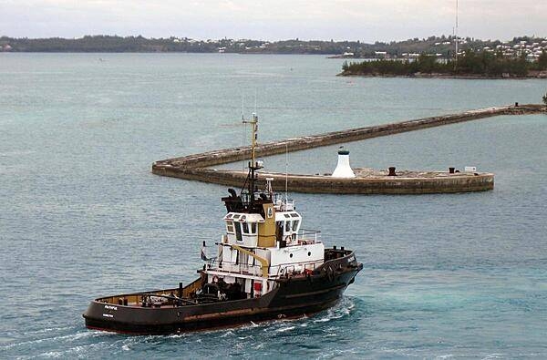
Tugboat at King's Wharf.
Tugboat at King's Wharf. • CIA World Factbook • 2020
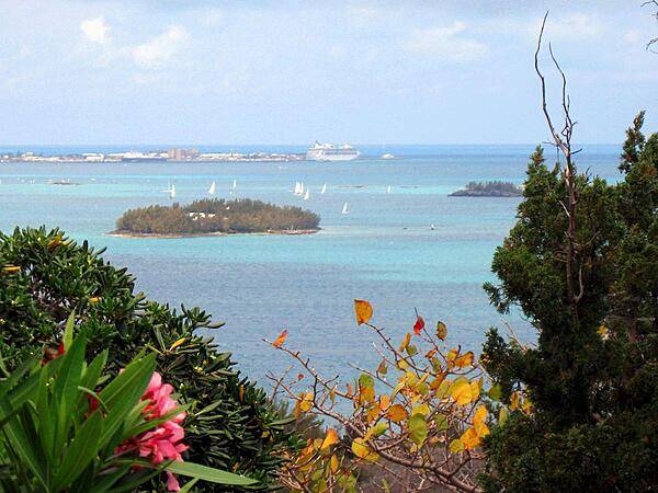
The view east toward King's Wharf from Gibbs Hill with sailboats and cruise ship in the distance.
The view east toward King's Wharf from Gibbs Hill with sailboats and cruise ship in the distance. • CIA World Factbook • 2020
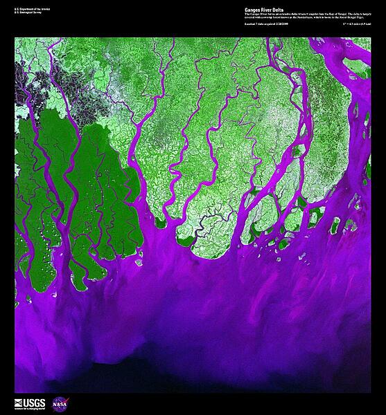
The Ganges River forms the largest tide-dominated delta in the world where it empties into the Bay of Bengal. This false-color satellite image vividly displays the large amount of sediment (violet), carried from as far away as the Himalayas, that precipitates when it abruptly encounters the sea. The delta is largely covered with a swamp forest known as the Sunderbans, which is home to the Royal Bengal Tiger. Image courtesy of USGS.
The Ganges River forms the largest tide-dominated delta in the world where it empties into the Bay of Bengal. This false-color satellite image vividly displays the large amount of sediment (violet), carried from as far away as the Himalayas, that precipitates when it abruptly encounters the sea. The delta is largely covered with a swamp forest known as the Sunderbans, which is home to the Royal Bengal Tiger. Image courtesy of USGS. • CIA World Factbook • 2020
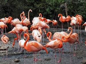
Flamingos at the Bermuda Zoo.
Flamingos at the Bermuda Zoo. • CIA World Factbook • 2020
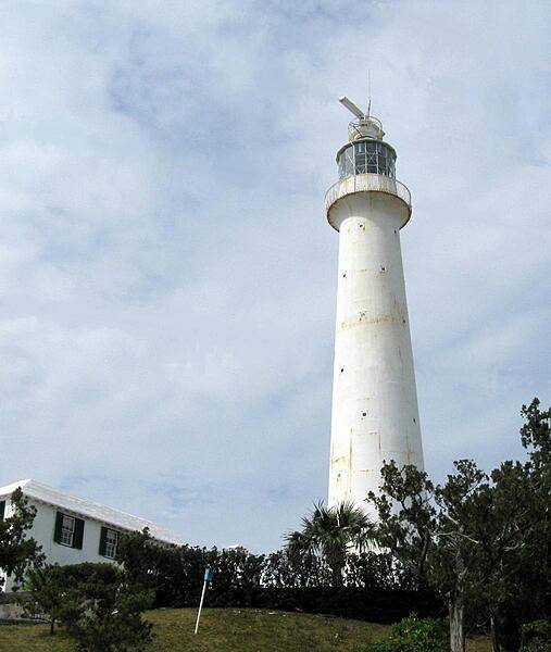
Gibbs Hill Lighthouse, built in 1846, is the oldest cast-iron lighthouse in the world.
Gibbs Hill Lighthouse, built in 1846, is the oldest cast-iron lighthouse in the world. • CIA World Factbook • 2020
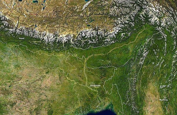
Satellite image showing Bangladesh and nearby countries. Bangladesh itself is bordered by India on its east, north, and west sides, and by Burma on the southeast. The snow-covered mountain chain is the Himalayas; to their north lies the Tibetan Plateau. Image courtesy of NASA.
Satellite image showing Bangladesh and nearby countries. Bangladesh itself is bordered by India on its east, north, and west sides, and by Burma on the southeast. The snow-covered mountain chain is the Himalayas; to their north lies the Tibetan Plateau. Image courtesy of NASA. • CIA World Factbook • 2020
7 photos available
View All Photos→Data sources: World Bank, UN Data • Updated daily •Learn about our data