›››
Curacao
Curacao
Population
156.0K
Rank #186Source: World Bank
Capital
Willemstad
Source: REST Countries
Region
Americas
Latin America & Caribbean
Source: REST Countries
GDP (Nominal)
$3.56B
Rank #166Source: World Bank
Land Area
444 km²
Rank #193Source: REST Countries
Life Expectancy
76.8 yrs
Source: World Bank
Historical Trends
Population Trend (5-Year)
Source: World Bank
GDP Trend (5-Year, Nominal USD)
Source: World Bank
Geography
Area: 444 km²
Landlocked: No
Independent: No
Climate: tropical marine climate, ameliorated by northeast trade winds, results in mild temperatures; semiarid with average rainfall of 60 cm/year
Terrain: generally low, hilly terrain
Elevation: lowest point: Caribbean Sea 0 m highest point: Mt. Christoffel 372 m
Natural Hazards: Curacao is south of the Caribbean hurricane belt and is rarely threatened
Environmental Issues: problems in waste management that threaten environmental sustainability on the island include pollution of marine areas from domestic sewage, inadequate sewage treatment facilities, industrial...
Land Use: agricultural land: 10% (2011 est.) forest: 0% (2011 est.) other: 90% (2011 est.)
Geography Note: Curacao is a part of the Windward Islands (southern) group in the Lesser Antilles
Natural Resources
calcium phosphatesaloessorghumpeanutsvegetablestropical fruit
People & Society
Fertility Rate
1.20
Population
156.0K
Ethnic Groups
Curacaoan (75.4%)Dutch (6%)Dominican (3.6%)Colombian (3%)Saban (1.5%)Haitian (1.2%)Surinamese (1.2%)Venezuelan (1.1%)Aruban (1.1%)other (5%)unspecified (0.9%)
Religions
Roman Catholic (72.8%)Pentecostal (6.6%)Protestant (3.2%)Adventist (3%)Jehovah's Witness (2%)Evangelical (1.9%)other (3.8%)none (6%)unspecified (0.6%)
Economy
GDP per Capita
$22,832.895
GDP per Capita PPP
32,693.294
(2024)
(2024)
GNI per Capita
22,590
(2024)
(2024)
Gini Index
Not Available
Unemployment
Not Available
Inflation
2.622%
(2019)
(2019)
Public Debt
Not Available
Energy
Electricity Access
100%
(2023)
(2023)
Renewable Energy
2.8%
(2021)
(2021)
CO₂ Emissions
Not Available
Energy Intensity
10.39 MJ/$
(2021)
(2021)
Renewable Electricity
18.262%
(2021)
(2021)
Environment
Forest Coverage
0.158% of land
(2023)
(2023)
Communications
Internet Users
68.127%
(2017)
(2017)
Mobile Penetration
93.798%
(2023)
(2023)
Broadband Subscribers
31.513%
(2023)
(2023)
Transportation
Air Transport Freight
Not Available
Container Port Traffic
96,000 TEU
(2022)
(2022)
Airports
N/A
Rail Lines
N/A
Roads Total
N/A
Military
Military Forces
no regular military forces; the Dutch Government controls foreign and defense policy; the Dutch Caribbean Coast Guard (DCCG) provides maritime security
Service Age & Obligation
no conscription
Education
Pre-Primary Enrollment
94.017%
(2020)
(2020)
Primary Enrollment
109.168%
(2023)
(2023)
Secondary Enrollment
123.43%
(2023)
(2023)
Tertiary Enrollment
23.084%
(2013)
(2013)
Education Spending
5.443% of GDP
(2024)
(2024)
Pupil-Teacher Ratio
Not Available
Health
Physicians per 1,000
Not Available
Safe Water Access
100%
(2024)
(2024)
Safe Drinking Water
Not Available
Under-5 Mortality
Not Available
Maternal Mortality (World Bank)
Not Available
Social Indicators
Extreme Poverty Rate
Not Available
Food Insecurity
Not Available
Youth NEET Rate
42.22%
(2020)
(2020)
Governance
Women in Government
Not Available
Voice & Accountability
Not Available
Political Stability
Not Available
Government Effectiveness
Not Available
Regulatory Quality
Not Available
Rule of Law
Not Available
Control of Corruption
Not Available
Government
Government Type
parliamentary democracy
Legal System
based on Dutch civil law
Executive Branch
chief of state: King WILLEM-ALEXANDER of the Netherlands (since 30 April 2013); represented by Governor Lucille A. GEORGE-WOUT (since 4 November 2013) head of government: Prime Minister Ivar ASJES...
Legislative Branch
description: unicameral Parliament of Curacao (21 seats; members directly elected by proportional representation vote to serve 4-year terms) elections: last held on 28 April 2017 (next to be held in...
Judicial Branch
highest courts: Joint Court of Justice of Aruba, Curacao, Sint Maarten, and of Bonaire, Sint Eustatius and Saba or "Joint Court of Justice" (sits as a 3-judge panel); final appeals heard by the...
International Organizations
National Symbols
Flag Description
on a blue field a horizontal yellow band somewhat below the center divides the flag into proportions of 5:1:2; two five-pointed white stars - the smaller above and to the left of the larger - appear...
National Symbols
laraha (citrus tree); national colors: blue, yellow, white
National Anthem
name: Himmo di Korsou (Anthem of Curacao) lyrics/music: Guillermo ROSARIO, Mae HENRIQUEZ, Enrique MULLER, Betty DORAN/Frater Candidus NOWENS, Errol "El Toro" COLINA note: adapted 1978; the lyrics,...
Travel Information
Language(s): English, Dutch, Papiamento
Currency: ANG (ƒ)
Timezone(s): UTC-04:00
Landlocked: No
Independent: No
Driving Side: Right
Calling Code: +599
Car Sign: CW
Week Starts: Monday
Photos
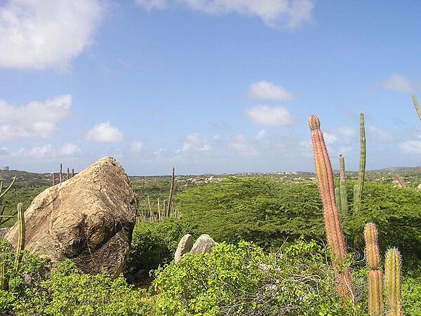
Desert vegetation at Arikok National Park. The park extends over about 18% of the island.
Desert vegetation at Arikok National Park. The park extends over about 18% of the island. • CIA World Factbook • 2020
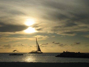
A peaceful, golden Caribbean sunset.
A peaceful, golden Caribbean sunset. • CIA World Factbook • 2020
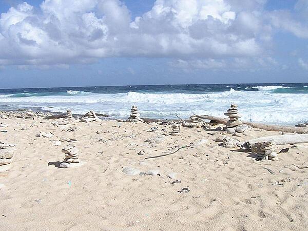
Rock figurines on a beach along the east shore.
Rock figurines on a beach along the east shore. • CIA World Factbook • 2020
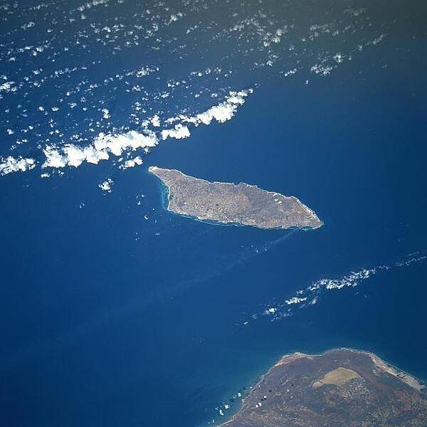
Aruba is a semi-arid island that experiences little variation in temperature throughout the year. Rainfall, which occurs mostly in November and December, averages less than 50 cm (20 in) a year. The red soil on the island is poor and thin and the thorny vegetation is quite drought resistant. Tourism and the refining of oil brought in from nearby Venezuela (whose northern coast appears below) are the major industries. Oraniestad, located on the northwest coast, is the major city of the island. Image courtesy of NASA.
Aruba is a semi-arid island that experiences little variation in temperature throughout the year. Rainfall, which occurs mostly in November and December, averages less than 50 cm (20 in) a year. The red soil on the island is poor and thin and the thorny vegetation is quite drought resistant. Tourism and the refining of oil brought in from nearby Venezuela (whose northern coast appears below) are the major industries. Oraniestad, located on the northwest coast, is the major city of the island. Image courtesy of NASA. • CIA World Factbook • 2020
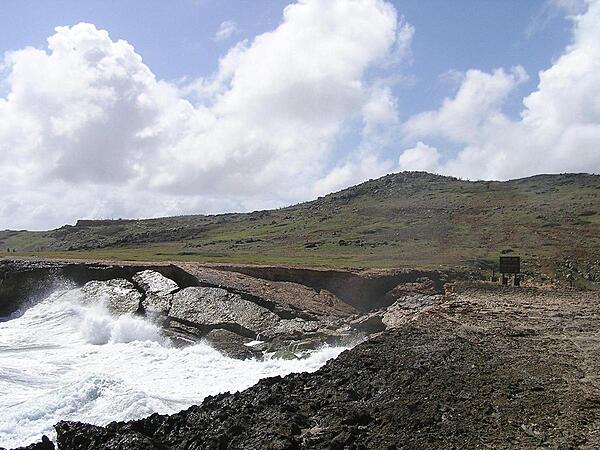
A fallen sea arch at Boca Andicori.
A fallen sea arch at Boca Andicori. • CIA World Factbook • 2020
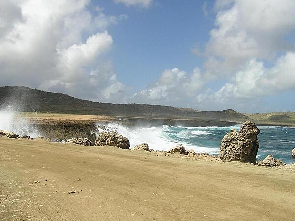
East shore near Budi.
East shore near Budi. • CIA World Factbook • 2020
7 photos available
View All Photos→Data sources: World Bank, UN Data • Updated daily •Learn about our data