›››
Algeria — Media Gallery
22 items available (flags, maps, photos)
Photos
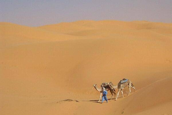
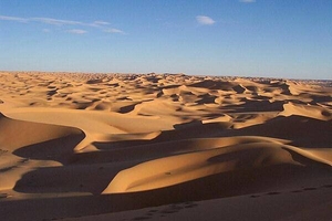
Trekking through the desert.
Trekking through the desert. • CIA World Factbook • 2020
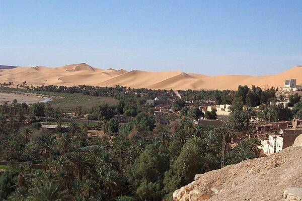
The oasis village of Taghit in the Sahara.
The oasis village of Taghit in the Sahara. • CIA World Factbook • 2020
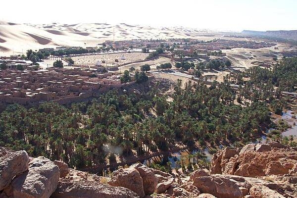
Another view of the oasis village of Beni Abbes.
Another view of the oasis village of Beni Abbes. • CIA World Factbook • 2020
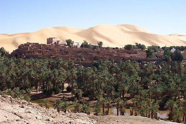
The oasis village of Taghit in the Sahara is known for its surrounding massive dunes. The oasis waters may be seen in the foreground. The site is southwest of Algiers, about 200 km (120 mi) from Beni Abbes.
The oasis village of Taghit in the Sahara is known for its surrounding massive dunes. The oasis waters may be seen in the foreground. The site is southwest of Algiers, about 200 km (120 mi) from Beni Abbes. • CIA World Factbook • 2020
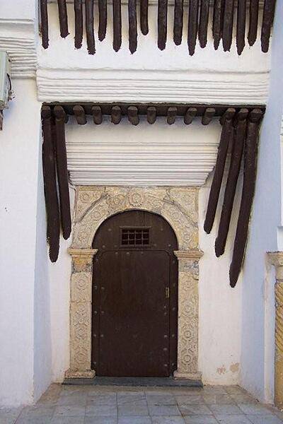
An ornate doorway in the Algiers Casbah.
An ornate doorway in the Algiers Casbah. • CIA World Factbook • 2020
The oasis village of Taghit in the Sahara.
The oasis village of Taghit in the Sahara. • CIA World Factbook • 2020
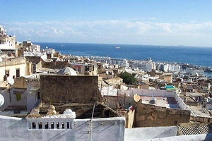
Algiers rooftop view of the Mediterranean.
Algiers rooftop view of the Mediterranean. • CIA World Factbook • 2020
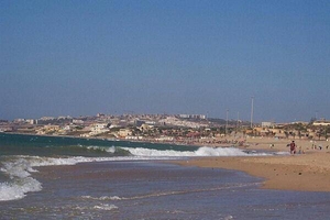
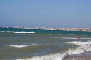
A beach west of Algiers.
A beach west of Algiers. • CIA World Factbook • 2020
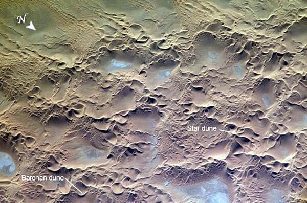
The Issaouane Erg (sand sea) is located in eastern Algeria. Ergs are vast areas of moving sand with little to no vegetation cover. The most common landforms in the image are star dunes and barchan (or crescent) dunes. Star dunes are formed when sand is transported from variable wind directions, whereas barchan dunes form in a single dominant wind regime. Occasional precipitation fills basins formed by the dunes; as the water evaporates, salt deposits are left behind which appear as bluish-white areas. Image courtesy of NASA.
The Issaouane Erg (sand sea) is located in eastern Algeria. Ergs are vast areas of moving sand with little to no vegetation cover. The most common landforms in the image are star dunes and barchan (or crescent) dunes. Star dunes are formed when sand is transported from variable wind directions, whereas barchan dunes form in a single dominant wind regime. Occasional precipitation fills basins formed by the dunes; as the water evaporates, salt deposits are left behind which appear as bluish-white areas. Image courtesy of NASA. • CIA World Factbook • 2020
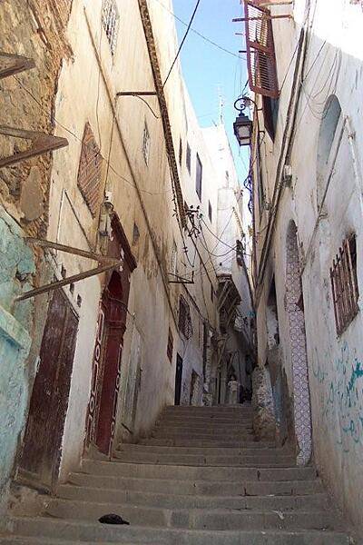
The modern city of Algiers lies near the Mediterranean coast, while the older city is on a steep hill crowned by the Casbah, or Citadel. This view is of a typical Casbah stairway.
The modern city of Algiers lies near the Mediterranean coast, while the older city is on a steep hill crowned by the Casbah, or Citadel. This view is of a typical Casbah stairway. • CIA World Factbook • 2020
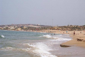
A beach used by tourists west of Algiers.
A beach used by tourists west of Algiers. • CIA World Factbook • 2020
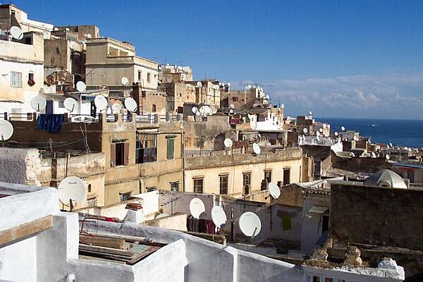
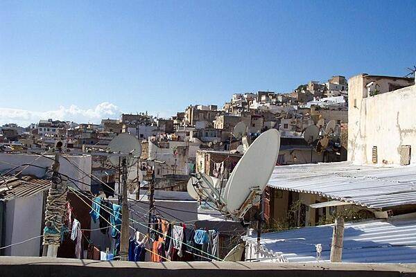
Satellite dishes are ubiquitous in Algiers.
Satellite dishes are ubiquitous in Algiers. • CIA World Factbook • 2020
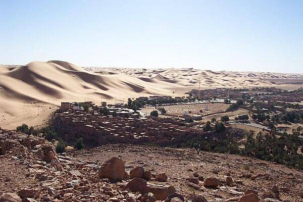
Mountains of sand loom over the oasis village of Taghit in the Sahara.
Mountains of sand loom over the oasis village of Taghit in the Sahara. • CIA World Factbook • 2020
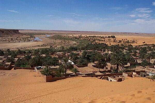
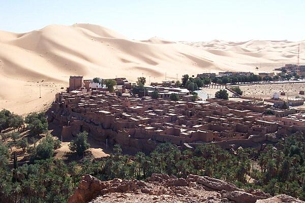
The oasis ksar (Berber village) of Beni Abbes. The site was first inhabited in the 12th century by a tribe from Mauritania. The town today has an old part made up of semi-attached houses, granaries, mosques, baths, ovens, and shops, and a new part with a research center composed of a museum, zoo, and botanical garden. The old part has been largely uninhabited for decades, but enough remains to give a good representation of traditional desert architecture.
The oasis ksar (Berber village) of Beni Abbes. The site was first inhabited in the 12th century by a tribe from Mauritania. The town today has an old part made up of semi-attached houses, granaries, mosques, baths, ovens, and shops, and a new part with a research center composed of a museum, zoo, and botanical garden. The old part has been largely uninhabited for decades, but enough remains to give a good representation of traditional desert architecture. • CIA World Factbook • 2020
Algiers on the Mediterranean coast.
Algiers on the Mediterranean coast. • CIA World Factbook • 2020
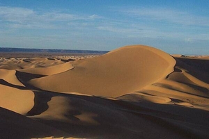
Sahara dunes at sunset.
Sahara dunes at sunset. • CIA World Factbook • 2020
Sahara dunes at sunset.
Sahara dunes at sunset. • CIA World Factbook • 2020
Algiers rooftop view.
Algiers rooftop view. • CIA World Factbook • 2020
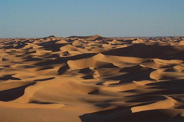
Sahara dunes at sunset.
Sahara dunes at sunset. • CIA World Factbook • 2020
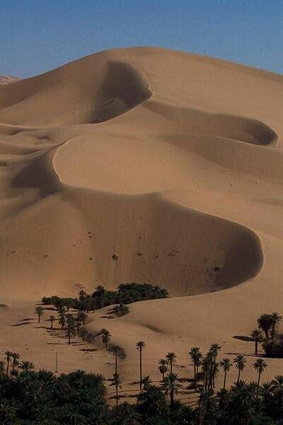
Dunes encroaching on an oasis.
Dunes encroaching on an oasis. • CIA World Factbook • 2020
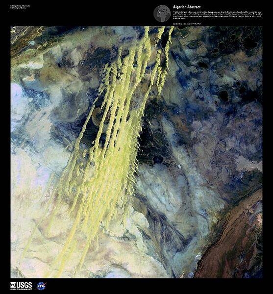
What look like pale yellow paint streaks slashing through a mosaic of mottled colors are ridges of wind-blown sand that make up Erg Iguidi, an area of ever-shifting sand dunes extending from Algeria into Mauritania. Erg Iguidi is one of several Saharan ergs, or sand seas, where individual dunes often surpass 500 m - nearly a third of a mile - in both width and height. The center and upper right of the enhanced satellite image is black sandstone rock. The light blue and white areas are chalky deposits and salt crusts left behind after water in the area evaporated. Image courtesy of USGS.
What look like pale yellow paint streaks slashing through a mosaic of mottled colors are ridges of wind-blown sand that make up Erg Iguidi, an area of ever-shifting sand dunes extending from Algeria into Mauritania. Erg Iguidi is one of several Saharan ergs, or sand seas, where individual dunes often surpass 500 m - nearly a third of a mile - in both width and height. The center and upper right of the enhanced satellite image is black sandstone rock. The light blue and white areas are chalky deposits and salt crusts left behind after water in the area evaporated. Image courtesy of USGS. • CIA World Factbook • 2020
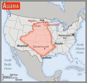
Area comparison map
Area comparison map • CIA World Factbook • 2020
Media source: CIA World Factbook (2020) — Public Domain