›››
Honduras
Honduras
Population
10.8M
Rank #88Source: World Bank
Capital
Tegucigalpa
Source: REST Countries
Region
Americas
Latin America & Caribbean
Source: REST Countries
GDP (Nominal)
$37.09B
Rank #105Source: World Bank
Land Area
112.5K km²
Rank #102Source: REST Countries
Life Expectancy
72.884 yrs
Source: World Bank
Historical Trends
Population Trend (5-Year)
Source: World Bank
GDP Trend (5-Year, Nominal USD)
Source: World Bank
Geography
Area: 112,492 km²
Landlocked: No
Independent: Yes
Climate: subtropical in lowlands, temperate in mountains
Terrain: mostly mountains in interior, narrow coastal plains
Elevation: mean elevation: 684 m lowest point: Caribbean Sea 0 m highest point: Cerro Las Minas 2,870 m
Natural Hazards: frequent, but generally mild, earthquakes; extremely susceptible to damaging hurricanes and floods along the Caribbean coast
Environmental Issues: urban population expanding; deforestation results from logging and the clearing of land for agricultural purposes; further land degradation and soil erosion hastened by uncontrolled development and...
Land Use: agricultural land: 28.8% (2011 est.) forest: 45.3% (2011 est.) other: 25.9% (2011 est.)
Geography Note: has only a short Pacific coast but a long Caribbean shoreline, including the virtually uninhabited eastern Mosquito Coast
Natural Resources
timbergoldsilvercopperleadzinciron oreantimonycoalfish
People & Society
Fertility Rate
2.50
Population
10.8M
Ethnic Groups
Mestizo (mixed Amerindian and European) (90%)Amerindian (7%)Black (2%)White (1%)
Religions
Roman Catholic (46%)Protestant (41%)atheist (1%)other (2%)none (9%)
Economy
GDP per Capita
$3,426.435
GDP per Capita PPP
7,486.019
(2024)
(2024)
GNI per Capita
3,020
(2024)
(2024)
Gini Index
45.7
(2024)
(2024)
Unemployment
4.91%
(2024)
(2024)
Inflation
4.606%
(2024)
(2024)
Public Debt
Not Available
Energy
Electricity Access
95.6%
(2023)
(2023)
Renewable Energy
45.9%
(2021)
(2021)
CO₂ Emissions
12.293 Mt
(2024)
(2024)
Energy Intensity
4.22 MJ/$
(2021)
(2021)
Renewable Electricity
64.621%
(2021)
(2021)
Environment
Forest Coverage
56.273% of land
(2023)
(2023)
Communications
Internet Users
58.279%
(2023)
(2023)
Mobile Penetration
74.415%
(2023)
(2023)
Broadband Subscribers
4.362%
(2023)
(2023)
Transportation
Air Transport Freight
1.144 M ton-km
(2023)
(2023)
Container Port Traffic
923,321 TEU
(2022)
(2022)
Airports
16,565
Rail Lines
N/A
Roads Total
17,595.57 km(©IRF)
Military
Military Forces
Honduran Armed Forces (Fuerzas Armadas de Honduras, FFAA): Army, Honduran Naval Force (FNH; includes marines), Honduran Air Force (Fuerza Aerea Hondurena, FAH), Honduran Public Order Military Police...
Personnel Strength
the Honduran Armed Forces (FFAA) have approximately 15,500 active personnel (7,500 Army; 1,500 Navy; 2,500 Air Force; 4,000 Public Order Military Police)
Military Expenditure (USD)
$0.58B
Military Expenditure (% of GDP)
1.57%
Military Expenditure History
1.6% of GDP (2019) 1.6% of GDP (2018) 1.7% of GDP (2017) 1.7% of GDP (2016) 1.7% of GDP (2015)
Equipment & Inventories
the FFAA's inventory is comprised of mostly older imported equipment from Israel, the UK, and the US; since 2010, Honduras has received limited amounts of military equipment from Colombia, Israel,...
Service Age & Obligation
18 years of age for voluntary 2- to 3-year military service; no conscription
Education
Pre-Primary Enrollment
33.77%
(2021)
(2021)
Primary Enrollment
78.969%
(2024)
(2024)
Secondary Enrollment
51.764%
(2024)
(2024)
Tertiary Enrollment
25.323%
(2019)
(2019)
Education Spending
4.55% of GDP
(2023)
(2023)
Adult Literacy Rate
88.25%
(2024)
(2024)
Pupil-Teacher Ratio
25.598:1
(2017)
(2017)
Health
Physicians per 1,000
0.489
(2020)
(2020)
Safe Water Access
95.729%
(2024)
(2024)
Safe Drinking Water
65.516%
(2024)
(2024)
Under-5 Mortality
15.5 per 1,000
(2023)
(2023)
Maternal Mortality (World Bank)
15.166 per 100,000
(2021)
(2021)
Hospital Beds per 1,000
67.438
(2021)
(2021)
UHC Coverage Index
64
(2023)
(2023)
Measles Immunization
75%
(2024)
(2024)
Social Indicators
Extreme Poverty Rate
15.7%
(2024)
(2024)
Food Insecurity
14.8%
(2023)
(2023)
Youth NEET Rate
8.666%
(2024)
(2024)
Governance
Women in Government
27.344%
(2024)
(2024)
Voice & Accountability
-0.45
(Below Average)
(2023)
(Below Average)
(2023)
Political Stability
-0.46
(Below Average)
(2023)
(Below Average)
(2023)
Government Effectiveness
-0.80
(Below Average)
(2023)
(Below Average)
(2023)
Regulatory Quality
-0.55
(Below Average)
(2023)
(Below Average)
(2023)
Rule of Law
-1.09
(Weak)
(2023)
(Weak)
(2023)
Control of Corruption
-1.11
(Weak)
(2023)
(Weak)
(2023)
Government
Government Type
presidential republic
Legal System
civil law system
Executive Branch
chief of state: President Juan Orlando HERNANDEZ Alvarado (since 27 January 2014); Vice Presidents Ricardo ALVAREZ, Maria RIVERA, and Olga ALVARADO (since 26 January 2018); note - the president is...
Legislative Branch
description: unicameral National Congress or Congreso Nacional (128 seats; members directly elected in multi-seat constituencies by closed, party-list proportional representation vote; members serve...
Judicial Branch
highest courts: Supreme Court of Justice or Corte Suprema de Justicia (15 principal judges, including the court president, and 7 alternates; court organized into civil, criminal, constitutional, and...
National Symbols
Flag Description
three equal horizontal bands of cerulean blue (top), white, and cerulean blue, with five cerulean, five-pointed stars arranged in an X pattern centered in the white band; the stars represent the...
National Symbols
scarlet macaw, white-tailed deer; national colors: blue, white
National Anthem
name: "Himno Nacional de Honduras" (National Anthem of Honduras) lyrics/music: Augusto Constancio COELLO/Carlos HARTLING note: adopted 1915; the anthem's seven verses chronicle Honduran history; on...
Safety
Homicide Rate
31.442 per 100,000
(2023)
(2023)
Travel Information
Language(s): Spanish
Currency: HNL (L)
Timezone(s): UTC-06:00
Landlocked: No
Independent: Yes
Driving Side: Right
Calling Code: +504
Car Sign: HN
Week Starts: Monday
Photos
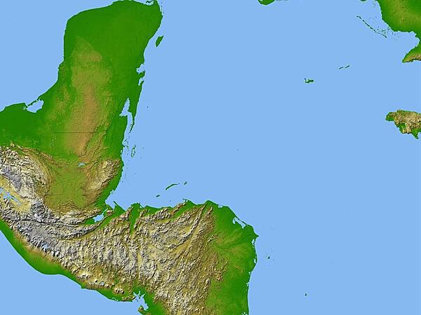
Satellite radar topography image of a portion of Central America. Due to persistent cloud cover, obtaining conventional high-altitude photos of this region is extrordinarily difficult. Radar's ability to penetrate clouds and make 3-D measurements allowed scientists to generate the first complete high-resolution topographic map of the entire region. All of Guatemala, Belize, El Salvador, and Honduras are visible on this image, as well as a considerable portion of southern Mexico (the Yucatan Peninsula). Image courtesy of NASA/JPL/NGA.
Satellite radar topography image of a portion of Central America. Due to persistent cloud cover, obtaining conventional high-altitude photos of this region is extrordinarily difficult. Radar's ability to penetrate clouds and make 3-D measurements allowed scientists to generate the first complete high-resolution topographic map of the entire region. All of Guatemala, Belize, El Salvador, and Honduras are visible on this image, as well as a considerable portion of southern Mexico (the Yucatan Peninsula). Image courtesy of NASA/JPL/NGA. • CIA World Factbook • 2020
CIA World Factbook • 2020
CIA World Factbook • 2020
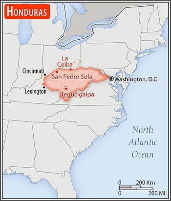
Area comparison map
Area comparison map • CIA World Factbook • 2020
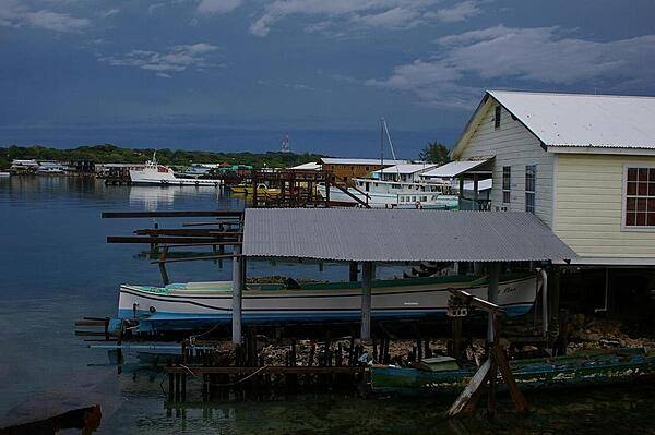
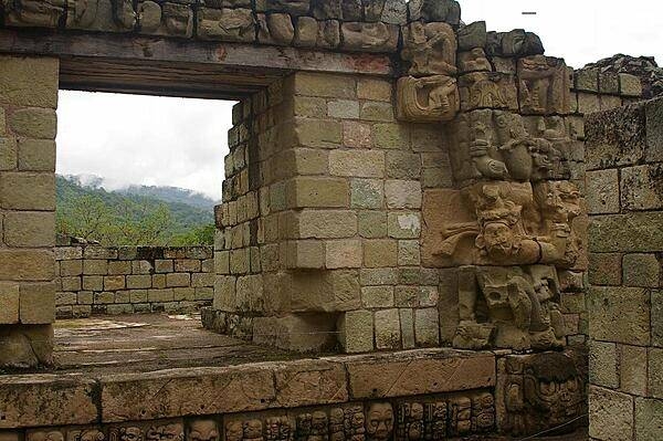
4 photos available
Data sources: World Bank, UN Data • Updated daily •Learn about our data