›››
Iceland — Media Gallery
45 items available (flags, maps, photos)
Photos
Descent down Hekla across the snowpack. Hekla is a stratovolcano located in the south of Iceland; it is one of the island's most active volcanoes, having erupted more than 20 times since the ninth century A.D.
Descent down Hekla across the snowpack. Hekla is a stratovolcano located in the south of Iceland; it is one of the island's most active volcanoes, having erupted more than 20 times since the ninth century A.D. • CIA World Factbook • 2020
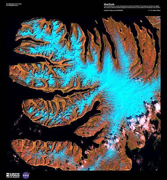
The West Fjords are a series of peninsulas in northwestern Iceland, shown in this false-color satellite image. They represent less than one-eighth the country's land area, but their jagged perimeter accounts for more than half of Iceland's total coastline. Black areas represent the sea; light blue snow and ice. Image courtesy of USGS.
The West Fjords are a series of peninsulas in northwestern Iceland, shown in this false-color satellite image. They represent less than one-eighth the country's land area, but their jagged perimeter accounts for more than half of Iceland's total coastline. Black areas represent the sea; light blue snow and ice. Image courtesy of USGS. • CIA World Factbook • 2020
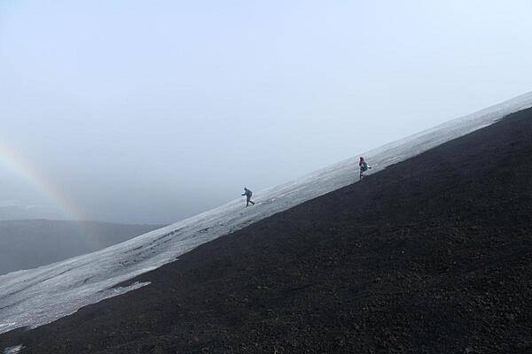
Descent down Hekla across the snowpack. Hekla is an active volcano located in the south of Iceland; it is 1,491 m (4,892 ft) high.
Descent down Hekla across the snowpack. Hekla is an active volcano located in the south of Iceland; it is 1,491 m (4,892 ft) high. • CIA World Factbook • 2020
CIA World Factbook • 2020
Menntaskolinn i Reykjavik (Reykjavik Junior College). Founded in 1096; building erected in 1846. Oldest school in full-time use in Iceland.
Menntaskolinn i Reykjavik (Reykjavik Junior College). Founded in 1096; building erected in 1846. Oldest school in full-time use in Iceland. • CIA World Factbook • 2020
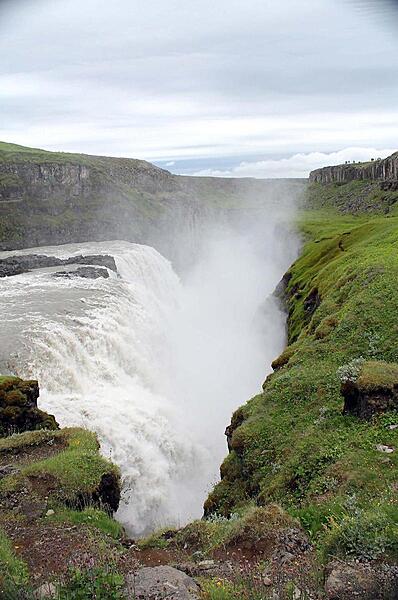
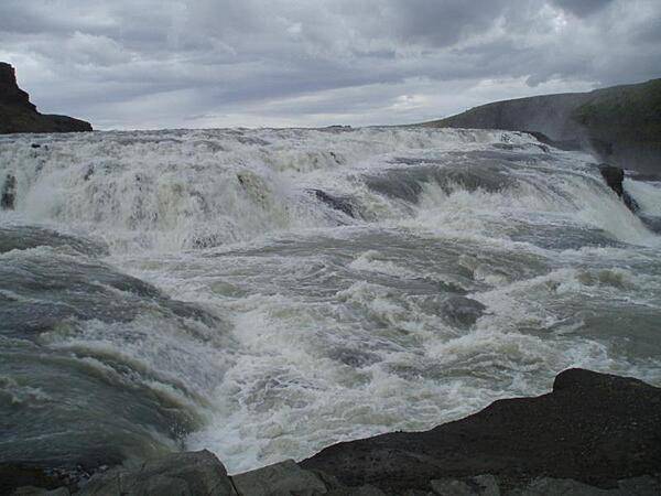
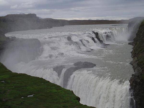
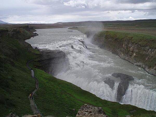
The thundering waters of the Gullfoss Waterfall.
The thundering waters of the Gullfoss Waterfall. • CIA World Factbook • 2020
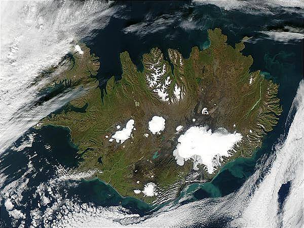
Summer is winding to a close on 9 September 2002, but even Iceland is still showing some summer color, its perimeter tinged with green, while its large permanent ice caps stand out brightly against the volcanic rock surrounding them. The largest ice cap, Vatnajokull, actually rests on top of three active volcanoes. The heat from these volcanoes causes the underside of the ice cap to melt, slowly filling the calderas. Eventually the caldera spills over and releases a torrent of water known as a glacial melt flood. This volcanic activity happens because a tectonic boundary runs roughly northeast-southwest through the island country, and the two plates are pulling away from each other, causing magma to well up from deep in the Earth. The brightly colored lakes and coastal waters are the result of very fine, and highly reflective sediment that is ground to bits by the immense weight of the glaciers and washed out with glacial runoff. Image courtesy of NASA.
Summer is winding to a close on 9 September 2002, but even Iceland is still showing some summer color, its perimeter tinged with green, while its large permanent ice caps stand out brightly against the volcanic rock surrounding them. The largest ice cap, Vatnajokull, actually rests on top of three active volcanoes. The heat from these volcanoes causes the underside of the ice cap to melt, slowly filling the calderas. Eventually the caldera spills over and releases a torrent of water known as a glacial melt flood. This volcanic activity happens because a tectonic boundary runs roughly northeast-southwest through the island country, and the two plates are pulling away from each other, causing magma to well up from deep in the Earth. The brightly colored lakes and coastal waters are the result of very fine, and highly reflective sediment that is ground to bits by the immense weight of the glaciers and washed out with glacial runoff. Image courtesy of NASA. • CIA World Factbook • 2020
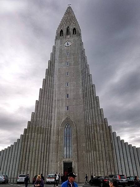
Hallsgrimskirkja is a Lutheran church in Reykjavik that was built between 1945 and 1986. Its spire of 74.5 m makes it is one of the tallest buildings in Iceland.
Hallsgrimskirkja is a Lutheran church in Reykjavik that was built between 1945 and 1986. Its spire of 74.5 m makes it is one of the tallest buildings in Iceland. • CIA World Factbook • 2020
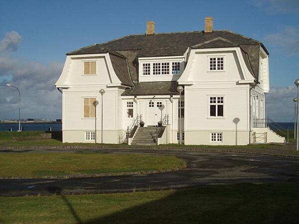
Hofthi House in Reykjavik, site of the summit between Ronald Reagan and Mikhail Gorbachev in 1986.
Hofthi House in Reykjavik, site of the summit between Ronald Reagan and Mikhail Gorbachev in 1986. • CIA World Factbook • 2020
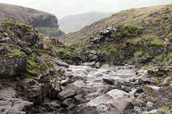
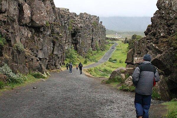
Downchannel from the volcanic dike in Thingvellir National Park.
Downchannel from the volcanic dike in Thingvellir National Park. • CIA World Factbook • 2020
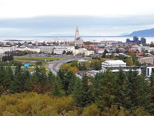
View of the skyline of Reykjavik; the distinctive Hallsgrimskirkja church stands out prominently in the upper center.
View of the skyline of Reykjavik; the distinctive Hallsgrimskirkja church stands out prominently in the upper center. • CIA World Factbook • 2020
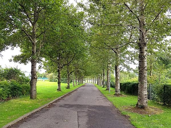
Large trees in the Arboretum in Reykjavik. This "forest" is unusual because Iceland is largely devoid of trees. The original forests were cut down by settlers, and abundant grazing animals consume any trees that attempt to grow and that do not perish in the cold and windy conditions on the island.
Large trees in the Arboretum in Reykjavik. This "forest" is unusual because Iceland is largely devoid of trees. The original forests were cut down by settlers, and abundant grazing animals consume any trees that attempt to grow and that do not perish in the cold and windy conditions on the island. • CIA World Factbook • 2020
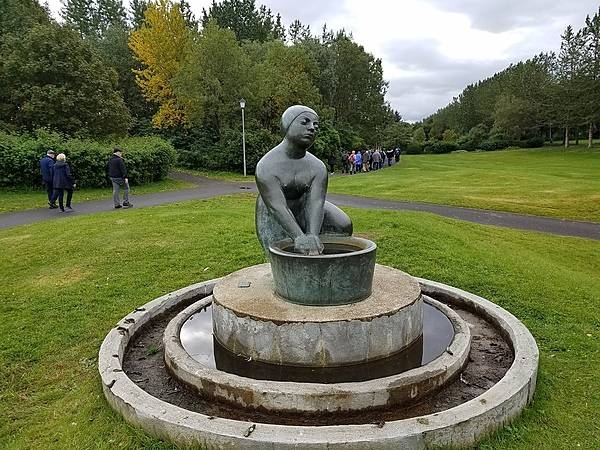
The Washerwoman statue in the Botanic Gardens in Reykjavik honors women who used to use the island's geothermal springs to clean clothes.
The Washerwoman statue in the Botanic Gardens in Reykjavik honors women who used to use the island's geothermal springs to clean clothes. • CIA World Factbook • 2020
View of the skyline of Reykjavik.
View of the skyline of Reykjavik. • CIA World Factbook • 2020
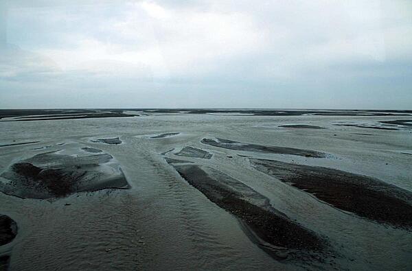
The many channels of a glacial river.
The many channels of a glacial river. • CIA World Factbook • 2020
CIA World Factbook • 2020
A hauntingly luminous view down the southwest flank of Hekla volcano.
A hauntingly luminous view down the southwest flank of Hekla volcano. • CIA World Factbook • 2020
A closeup of the churning Gullfoss Waterfall.
A closeup of the churning Gullfoss Waterfall. • CIA World Factbook • 2020
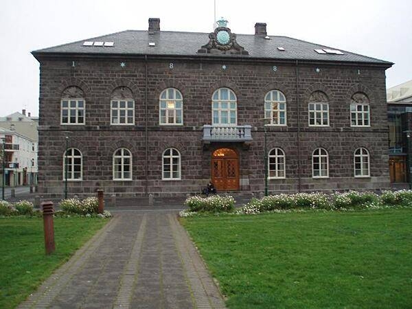
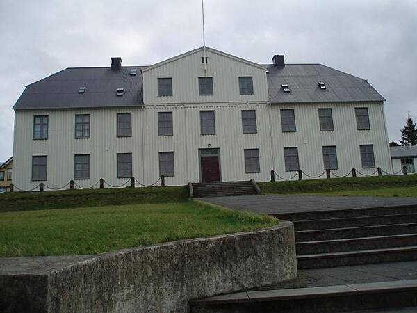
National Parliament (Althing) building in Reykjavik, erected in 1880-81.
National Parliament (Althing) building in Reykjavik, erected in 1880-81. • CIA World Factbook • 2020
Closeup of some of the stairsteps in the Gullfoss Waterfall.
Closeup of some of the stairsteps in the Gullfoss Waterfall. • CIA World Factbook • 2020
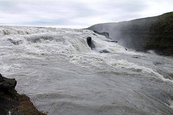
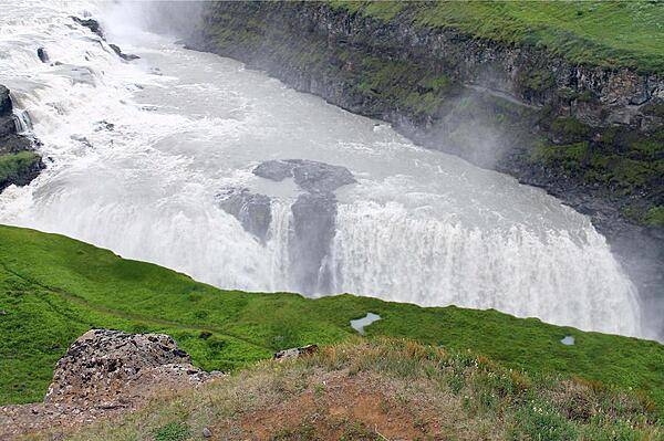
The Gullfoss (Golden Falls) Waterfall in southern Iceland.
The Gullfoss (Golden Falls) Waterfall in southern Iceland. • CIA World Factbook • 2020
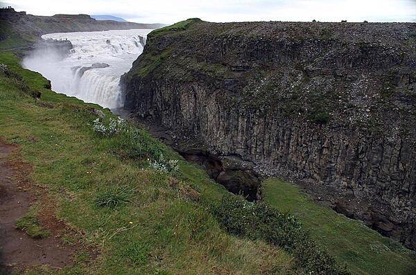
The Gullfoss Waterfall (Golden Falls) seen from a distance.
The Gullfoss Waterfall (Golden Falls) seen from a distance. • CIA World Factbook • 2020
A dike (volcanic feeder tube) merging into layered strata in Thingvellir National Park.
A dike (volcanic feeder tube) merging into layered strata in Thingvellir National Park. • CIA World Factbook • 2020
Channel downstream from the Gullfoss Waterfall.
Channel downstream from the Gullfoss Waterfall. • CIA World Factbook • 2020
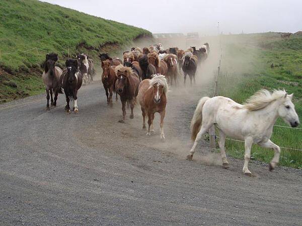
A roundup of Icelandic horses.
A roundup of Icelandic horses. • CIA World Factbook • 2020
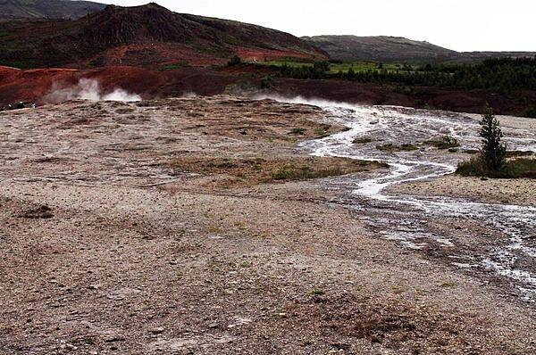
A geyser field and stream runoff.
A geyser field and stream runoff. • CIA World Factbook • 2020
Hardy Icelandic sheep exhibit a variety of wool colors: white, grays, browns, black, and spotted.
Hardy Icelandic sheep exhibit a variety of wool colors: white, grays, browns, black, and spotted. • CIA World Factbook • 2020
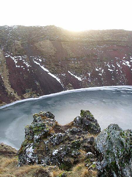
Sunset over a frozen lake-filled caldera.
Sunset over a frozen lake-filled caldera. • CIA World Factbook • 2020
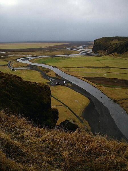
A river with volcanic black sand banks meanders to the sea through farm fields near the southern coast of Iceland.
A river with volcanic black sand banks meanders to the sea through farm fields near the southern coast of Iceland. • CIA World Factbook • 2020
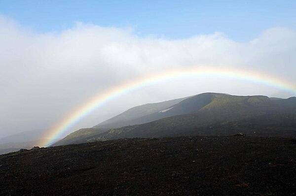
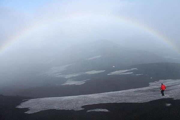
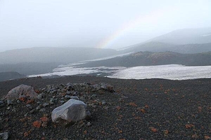
Rainbow envelopes the peak of Hekla volcano.
Rainbow envelopes the peak of Hekla volcano. • CIA World Factbook • 2020
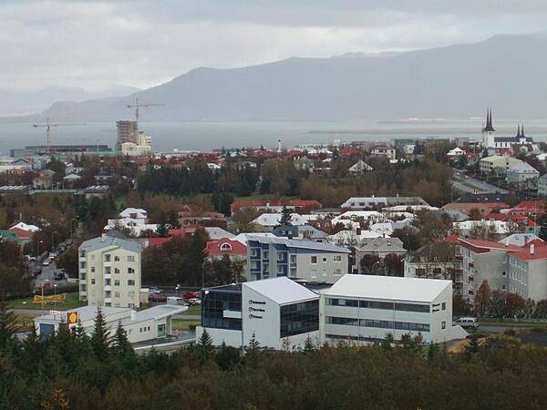
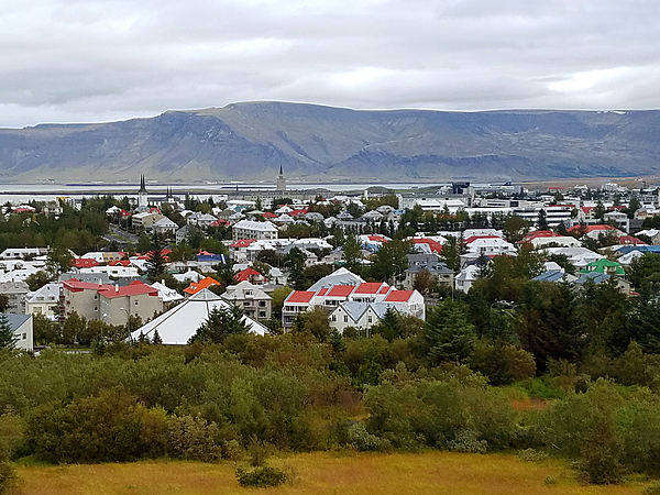
View of Reykjavik from Perlan Hill.
View of Reykjavik from Perlan Hill. • CIA World Factbook • 2020
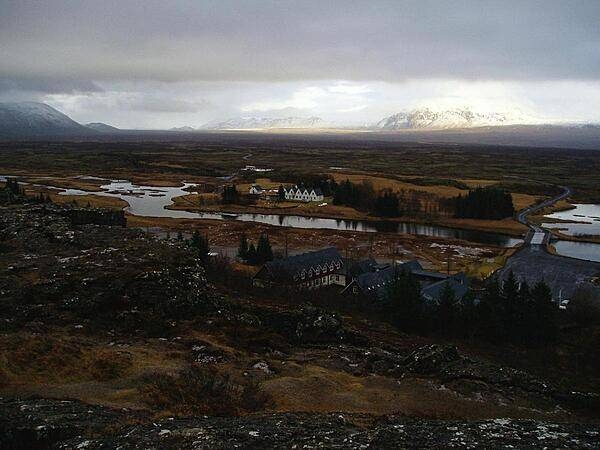
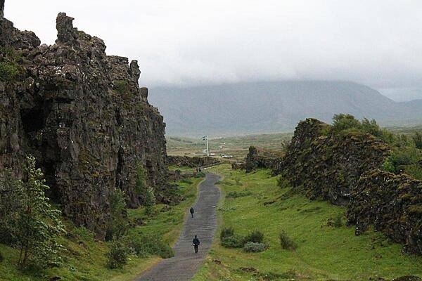
Photo taken from the Eurasian continental plate (foreground rock ledge) looking across to the North American plate and to the Thingvellir, the plains on which the Icelandic republic was founded in 930 and independence declared in 1944. The tabletop mountain on the horizon was formed by a volcanic eruption beneath a glacial ice sheet when Iceland was covered by ice.
Photo taken from the Eurasian continental plate (foreground rock ledge) looking across to the North American plate and to the Thingvellir, the plains on which the Icelandic republic was founded in 930 and independence declared in 1944. The tabletop mountain on the horizon was formed by a volcanic eruption beneath a glacial ice sheet when Iceland was covered by ice. • CIA World Factbook • 2020
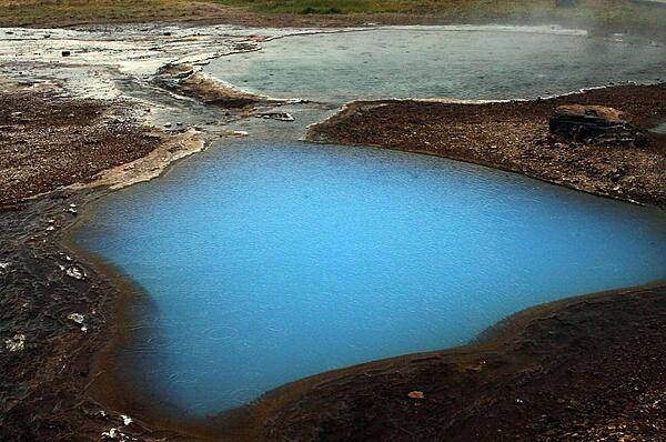
An azure blue hot pool.
An azure blue hot pool. • CIA World Factbook • 2020
The Gullfoss Waterfall has a distinctive stairstep configuration.
The Gullfoss Waterfall has a distinctive stairstep configuration. • CIA World Factbook • 2020
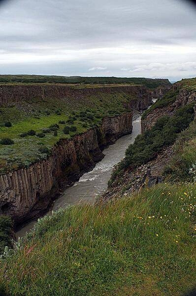
Almannagja, a large canyon-like fault in Thingvellir National Park, is actually the exposed eastern boundary of the North American geologic plate.
Almannagja, a large canyon-like fault in Thingvellir National Park, is actually the exposed eastern boundary of the North American geologic plate. • CIA World Factbook • 2020
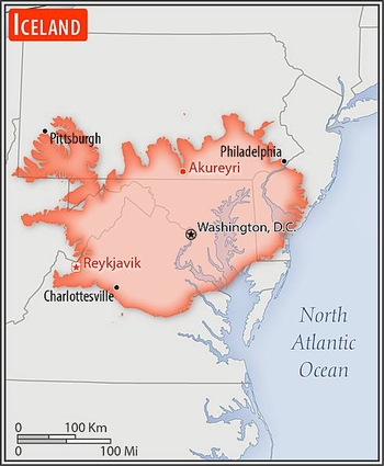
Area comparison map
Area comparison map • CIA World Factbook • 2020
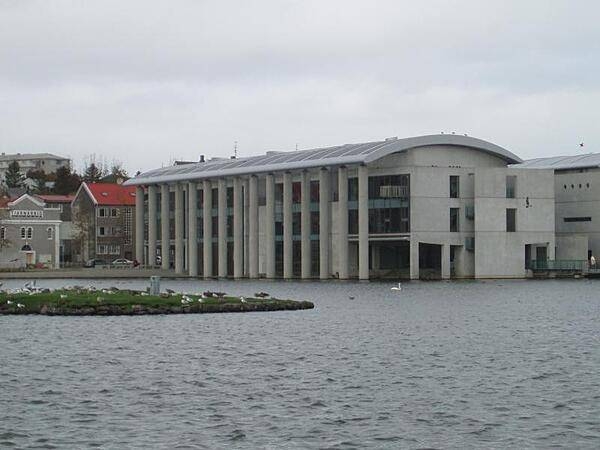
City Hall in Reykjavik.
City Hall in Reykjavik. • CIA World Factbook • 2020
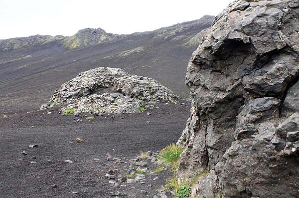
Pyroclastic rock bombs scattered about a crater in the Hekla Mountain Range.
Pyroclastic rock bombs scattered about a crater in the Hekla Mountain Range. • CIA World Factbook • 2020
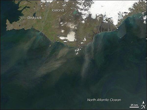
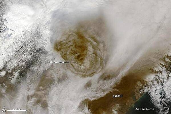
Plumes of dust blowing off the southern coast of Iceland in late June 2007. The dust appears as grayish blurs emanating from the coast southward over the North Atlantic Ocean. Blue-green algal blooms also fringe the coastline. Relatively light winter snow in 2006-07 followed by arid spring weather created the conditions for this dust storm. Photo courtesy of NASA.
Plumes of dust blowing off the southern coast of Iceland in late June 2007. The dust appears as grayish blurs emanating from the coast southward over the North Atlantic Ocean. Blue-green algal blooms also fringe the coastline. Relatively light winter snow in 2006-07 followed by arid spring weather created the conditions for this dust storm. Photo courtesy of NASA. • CIA World Factbook • 2020
Almannagja, the exposed eastern boundary of the North American geologic plate, Thingvellir National Park.
Almannagja, the exposed eastern boundary of the North American geologic plate, Thingvellir National Park. • CIA World Factbook • 2020
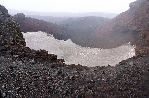
Snow-filled crater from the 2000 eruption of Hekla volcano.
Snow-filled crater from the 2000 eruption of Hekla volcano. • CIA World Factbook • 2020
Mist rises above the Gullfoss Waterfall.
Mist rises above the Gullfoss Waterfall. • CIA World Factbook • 2020
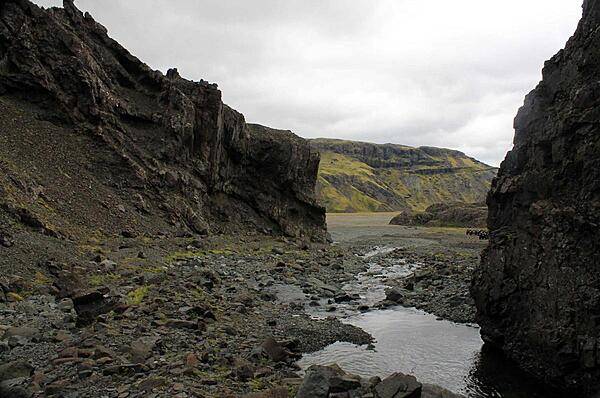
Mini stream between banks of eroding basalt in Thingvellir National Park.
Mini stream between banks of eroding basalt in Thingvellir National Park. • CIA World Factbook • 2020

View of Reykjavik from Perlan Hill. This photo dates from 2008-09 when the Hallsgrimskirkja church (left center) was undergoing restoration.
View of Reykjavik from Perlan Hill. This photo dates from 2008-09 when the Hallsgrimskirkja church (left center) was undergoing restoration. • CIA World Factbook • 2020
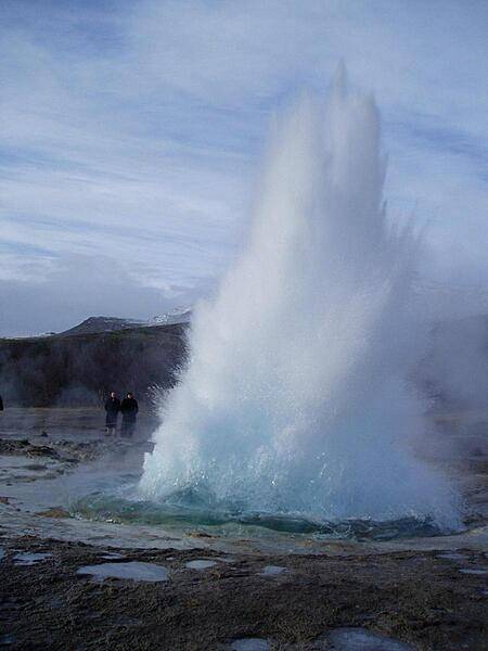
An eruption of the geyser Strokkur.
An eruption of the geyser Strokkur. • CIA World Factbook • 2020
Media source: CIA World Factbook (2020) — Public Domain