›››
Japan — Media Gallery
53 items available (flags, maps, photos)
Photos
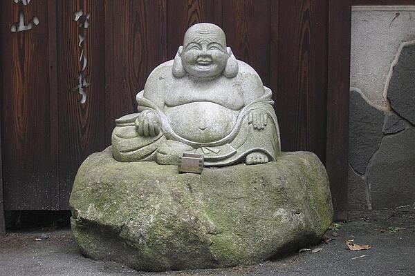
A Laughing Buddha in Narita.
A Laughing Buddha in Narita. • CIA World Factbook • 2020
CIA World Factbook • 2020
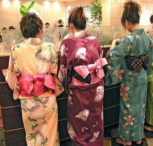
Colorful kimonos in a Tokyo coffee shop.
Colorful kimonos in a Tokyo coffee shop. • CIA World Factbook • 2020
CIA World Factbook • 2020
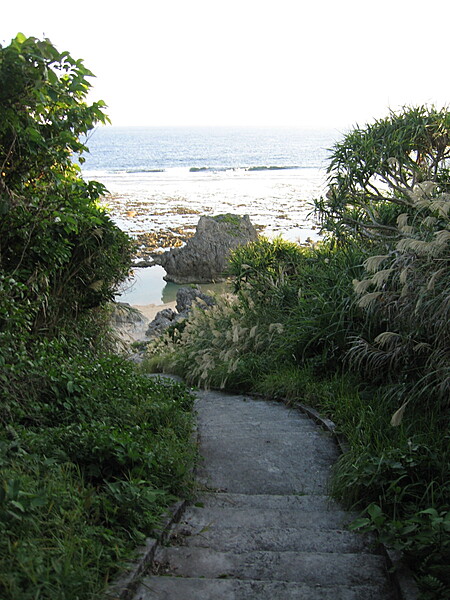
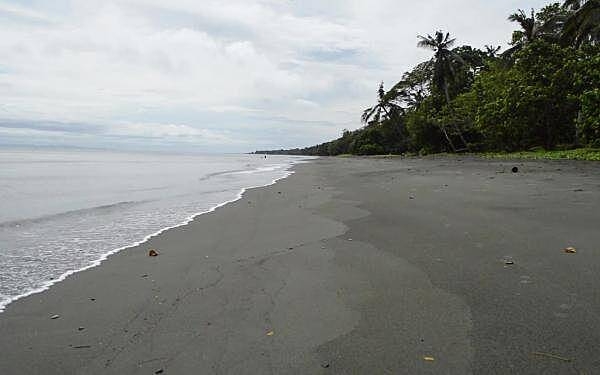
Pathway leading down to an Okinawan beach.
Pathway leading down to an Okinawan beach. • CIA World Factbook • 2020
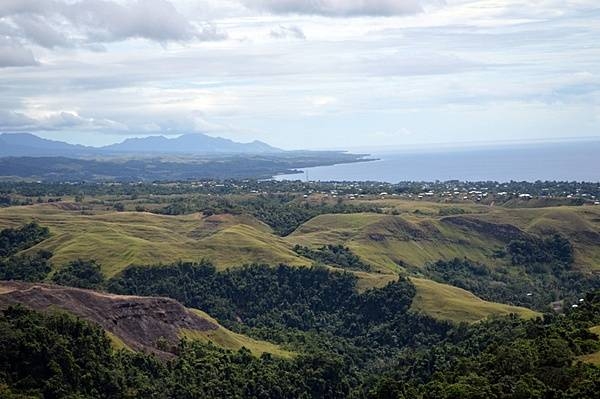
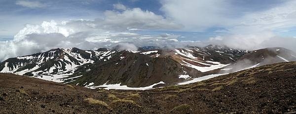
Rugged grassy ridges known as the Sea Horse and the Galloping Horse can be seen from the top of a hill known as the Gifu or Mount Austen on Guadalcanal. This area was the scene of intense fighting from December 1942 to January 1943 as US Army units fought entrenched Imperial Japanese Army forces in what was the last major land battle of the Guadalcanal Campaign. Photo courtesy of the US Army/ Staff Sgt. Armando R. Limon.
Rugged grassy ridges known as the Sea Horse and the Galloping Horse can be seen from the top of a hill known as the Gifu or Mount Austen on Guadalcanal. This area was the scene of intense fighting from December 1942 to January 1943 as US Army units fought entrenched Imperial Japanese Army forces in what was the last major land battle of the Guadalcanal Campaign. Photo courtesy of the US Army/ Staff Sgt. Armando R. Limon. • CIA World Factbook • 2020
View from Asan Bay Overlook toward the War in the Pacific National Historical Park. This photo illustrates the perspective of the Japanese defenders when US forces landed on 21 July 1944. Despite an intense pre-invasion bombardment, the 3rd Marine Division encountered significant opposition as they came ashore on the beaches of Asan Bay. Photo courtesy of the US National Park Service.
View from Asan Bay Overlook toward the War in the Pacific National Historical Park. This photo illustrates the perspective of the Japanese defenders when US forces landed on 21 July 1944. Despite an intense pre-invasion bombardment, the 3rd Marine Division encountered significant opposition as they came ashore on the beaches of Asan Bay. Photo courtesy of the US National Park Service. • CIA World Factbook • 2020
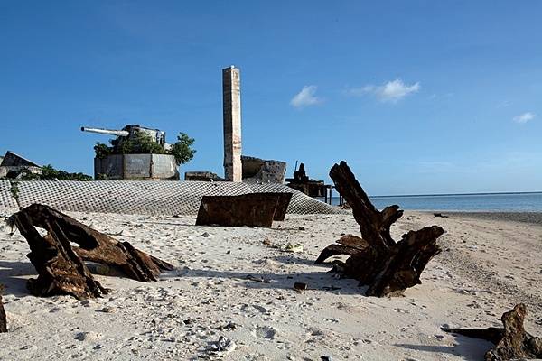
The remains of a Japanese 8-inch coastal defense gun mount sit on the point at Green Beach, Betio Island. Rising above the sand with its muzzle pointed inland, this was one of four 8-inch guns the Japanese emplaced on the island. Shrubs have overtaken the concrete and steel, and hundreds of red crabs race throughout the battlefield debris. Other than some graffiti and weathering, the area remains as it was following the Battle of Tarawa. Photo courtesy of the US Marine Corps/ Cpl. Aaron Hostutler.
The remains of a Japanese 8-inch coastal defense gun mount sit on the point at Green Beach, Betio Island. Rising above the sand with its muzzle pointed inland, this was one of four 8-inch guns the Japanese emplaced on the island. Shrubs have overtaken the concrete and steel, and hundreds of red crabs race throughout the battlefield debris. Other than some graffiti and weathering, the area remains as it was following the Battle of Tarawa. Photo courtesy of the US Marine Corps/ Cpl. Aaron Hostutler. • CIA World Factbook • 2020
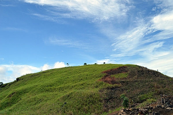
The peak of Mount Austen on Guadalcanal, named the Gifu by Japanese defenders, was the scene of intense fighting between Allied and Japanese forces from December 1942 to January 1943. US Army units fought entrenched Imperial Japanese Army forces in what was the last major land battle of the Guadalcanal Campaign. Photo courtesy of the US Army/ Staff Sgt. Armando R. Limon.
The peak of Mount Austen on Guadalcanal, named the Gifu by Japanese defenders, was the scene of intense fighting between Allied and Japanese forces from December 1942 to January 1943. US Army units fought entrenched Imperial Japanese Army forces in what was the last major land battle of the Guadalcanal Campaign. Photo courtesy of the US Army/ Staff Sgt. Armando R. Limon. • CIA World Factbook • 2020
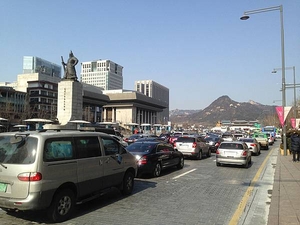
Statue of Admiral Yi Sun-Sin (1545–98) in Seoul. Yi was a Korean admiral and military general famed for his victories against the Japanese navy during the Imjin War (Japanese Invasions) from 1592-98. Yi became an exemplar of conduct for both the Koreans and Japanese. Incredibly, despite the fact that he had no prior naval training, Admiral Yi was never defeated at sea nor lost a single ship under his command to enemy action; military historians have placed him on par with Admiral Horatio Nelson as one of the greatest naval commanders in history.
Statue of Admiral Yi Sun-Sin (1545–98) in Seoul. Yi was a Korean admiral and military general famed for his victories against the Japanese navy during the Imjin War (Japanese Invasions) from 1592-98. Yi became an exemplar of conduct for both the Koreans and Japanese. Incredibly, despite the fact that he had no prior naval training, Admiral Yi was never defeated at sea nor lost a single ship under his command to enemy action; military historians have placed him on par with Admiral Horatio Nelson as one of the greatest naval commanders in history. • CIA World Factbook • 2020
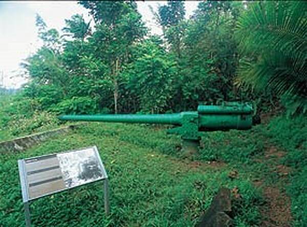
The Piti Guns unit of the War in the Pacific National Historical Park is the site of three Vickers type Model 3 140mm coastal defense guns. During the Japanese occupation of Guam from 1941-1944, the Chamorro population was forced to work in building up these defenses. Photo courtesy of the US National Park Service.
The Piti Guns unit of the War in the Pacific National Historical Park is the site of three Vickers type Model 3 140mm coastal defense guns. During the Japanese occupation of Guam from 1941-1944, the Chamorro population was forced to work in building up these defenses. Photo courtesy of the US National Park Service. • CIA World Factbook • 2020
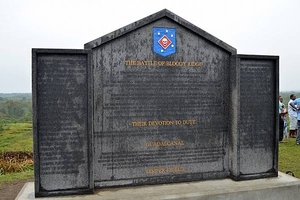
The US Marine Raiders Monument atop Edson’s Ridge, also known as Bloody Ridge and Raiders Ridge, on Guadalcanal. The Battle of Edson's Ridge, 12-14 September 1942, was the second of three separate major Japanese ground offensives during the Guadalcanal Campaign. The Marine 1st Raider Battalion held off repeated assaults by a 6,000-strong Japanese force. While the Marines suffered more than 250 casualties, the Japanese Army sustained a staggering 800 casualties during the two-day battle. Photo courtesy of the US Army photo/ Staff Sgt. Armando R. Limon.
The US Marine Raiders Monument atop Edson’s Ridge, also known as Bloody Ridge and Raiders Ridge, on Guadalcanal. The Battle of Edson's Ridge, 12-14 September 1942, was the second of three separate major Japanese ground offensives during the Guadalcanal Campaign. The Marine 1st Raider Battalion held off repeated assaults by a 6,000-strong Japanese force. While the Marines suffered more than 250 casualties, the Japanese Army sustained a staggering 800 casualties during the two-day battle. Photo courtesy of the US Army photo/ Staff Sgt. Armando R. Limon. • CIA World Factbook • 2020
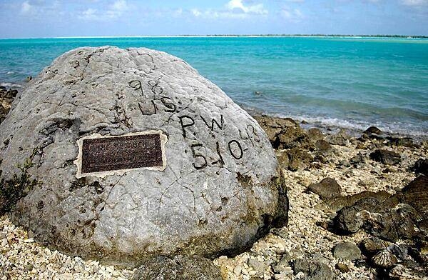
Wake Island memorial to 98 civilian contractors killed by Japanese soldiers during their occupation of the island in World War II. Photo courtesy of the US Air Force.
Wake Island memorial to 98 civilian contractors killed by Japanese soldiers during their occupation of the island in World War II. Photo courtesy of the US Air Force. • CIA World Factbook • 2020
Once a Japanese naval communications center, Fonte Plateau unit is located on Nimitz Hill, overlooking Asan Bay. Site of one of the more bitter battles between the US Marines and the Japanese, the high land of Fonte Plateau, later renamed Nimitz Hill, was once the CINCPAC headquarters for Admiral Chester Nimitz. Photo courtesy of the US National Park Service.
Once a Japanese naval communications center, Fonte Plateau unit is located on Nimitz Hill, overlooking Asan Bay. Site of one of the more bitter battles between the US Marines and the Japanese, the high land of Fonte Plateau, later renamed Nimitz Hill, was once the CINCPAC headquarters for Admiral Chester Nimitz. Photo courtesy of the US National Park Service. • CIA World Factbook • 2020
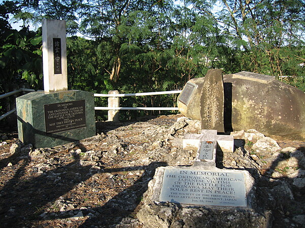
War memorial at the southern Okinawan site where Lt. Gen. Simon G. Buckner Jr. was killed (one of the markers is on the exact site). His death took place in the closing days of the campaign; he was watching an attack on Ibaru Ridge in the southern part of the island a few miles from the coast.
War memorial at the southern Okinawan site where Lt. Gen. Simon G. Buckner Jr. was killed (one of the markers is on the exact site). His death took place in the closing days of the campaign; he was watching an attack on Ibaru Ridge in the southern part of the island a few miles from the coast. • CIA World Factbook • 2020
Okinawan shoreline.
Okinawan shoreline. • CIA World Factbook • 2020
The Asan Bay Overlook Memorial Wall at the War in the Pacific National Historical Park. The Wall contains the names of 1,880 US servicemen who died in the 1941 defense of Guam against attacking Japanese armed forces and those who died retaking the island from Japan in 1944 along with the names of the 1,170 people of Guam who died and 14,721 who suffered atrocities of war from 1941-1944. Photo courtesy of the US National Park Service.
The Asan Bay Overlook Memorial Wall at the War in the Pacific National Historical Park. The Wall contains the names of 1,880 US servicemen who died in the 1941 defense of Guam against attacking Japanese armed forces and those who died retaking the island from Japan in 1944 along with the names of the 1,170 people of Guam who died and 14,721 who suffered atrocities of war from 1941-1944. Photo courtesy of the US National Park Service. • CIA World Factbook • 2020

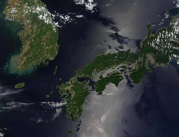
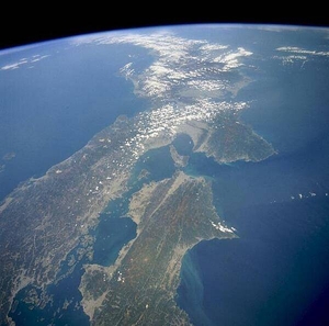
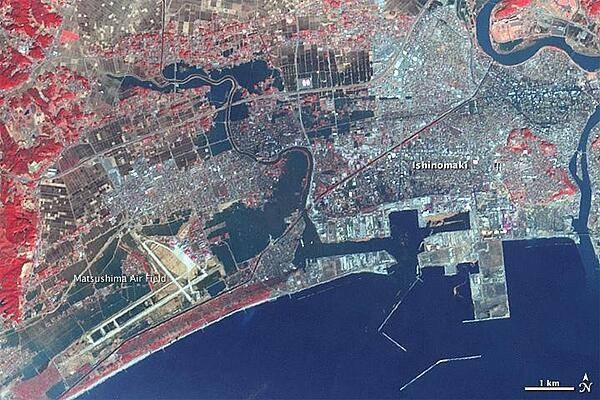
Satellite image shows North and South Korea (upper left) as well as the Japanese island of Shikoku, nestled between Kyushu to the southwest and Honshu to the north. Photo courtesy of NASA.
Satellite image shows North and South Korea (upper left) as well as the Japanese island of Shikoku, nestled between Kyushu to the southwest and Honshu to the north. Photo courtesy of NASA. • CIA World Factbook • 2020
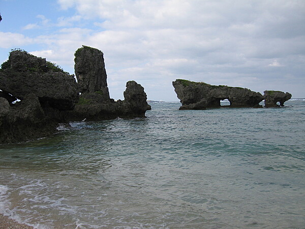
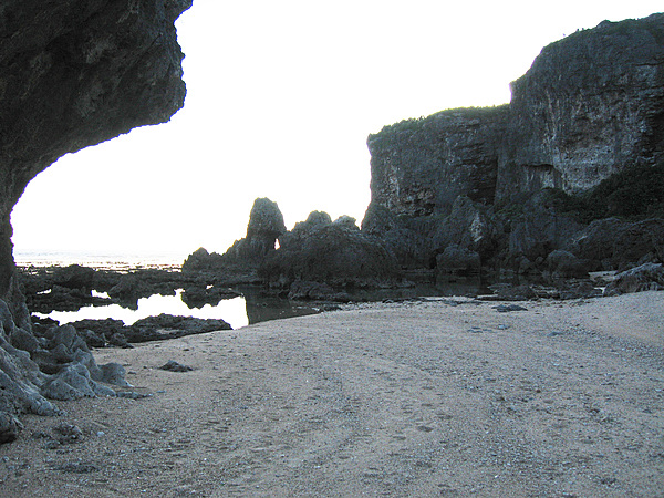
Sea stacks along an Okinawan shore.
Sea stacks along an Okinawan shore. • CIA World Factbook • 2020
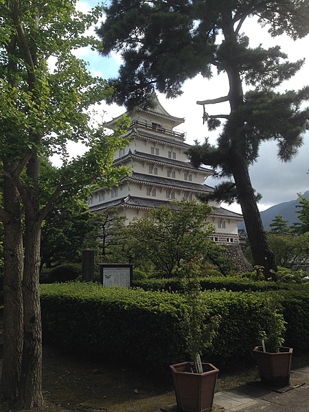
The distinctive, white, five-story Shimabara Castle keep in Shimabara, Hizen province (present day Nagasaki prefecture) dates to the 17th century.
The distinctive, white, five-story Shimabara Castle keep in Shimabara, Hizen province (present day Nagasaki prefecture) dates to the 17th century. • CIA World Factbook • 2020
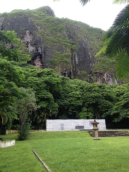
Japanese war memorial and garden on Saipan.
Japanese war memorial and garden on Saipan. • CIA World Factbook • 2020
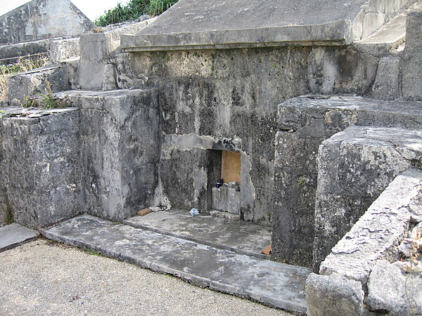
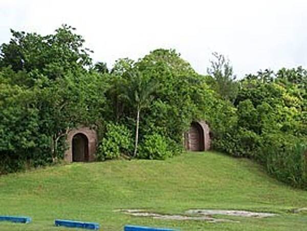
The burial tradition on the Ryukyu Islands (of which Okinawa is the largest) is the use of domed burial vaults termed turtleback tombs. The bones of many generations of a particular family could repose in one such tomb. During the Battle of Okinawa, many Okinawan civilians sought refuge from the naval bombardment of the island inside their ancestors' turtleback tombs. Later, many of these tombs were used by the Japanese defenders of the island.
The burial tradition on the Ryukyu Islands (of which Okinawa is the largest) is the use of domed burial vaults termed turtleback tombs. The bones of many generations of a particular family could repose in one such tomb. During the Battle of Okinawa, many Okinawan civilians sought refuge from the naval bombardment of the island inside their ancestors' turtleback tombs. Later, many of these tombs were used by the Japanese defenders of the island. • CIA World Factbook • 2020
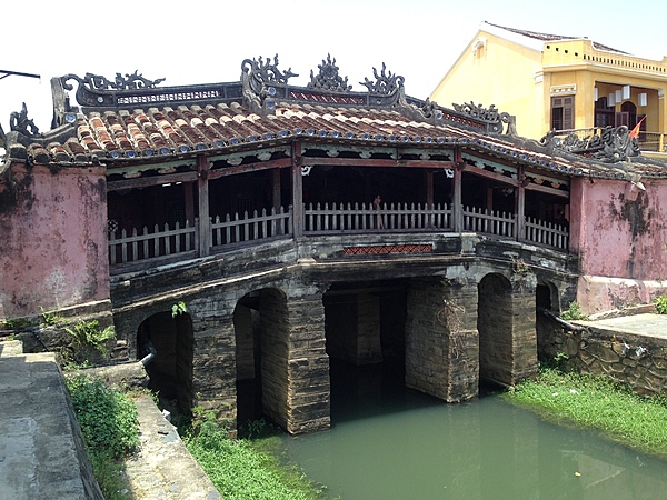
Old Town Hoi An, the city's historic district, is a UNESCO World Heritage Site. The Japanese Bridge in the Old Town is considered the symbol of the city.
Old Town Hoi An, the city's historic district, is a UNESCO World Heritage Site. The Japanese Bridge in the Old Town is considered the symbol of the city. • CIA World Factbook • 2020
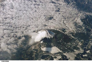
Mt. Fuji on the island of Honshu as seen from the space shuttle. The snow-capped inactive volcano, surrounded at lower levels by clouds in this image, lies several miles south of Tokyo. Image courtesy of NASA.
Mt. Fuji on the island of Honshu as seen from the space shuttle. The snow-capped inactive volcano, surrounded at lower levels by clouds in this image, lies several miles south of Tokyo. Image courtesy of NASA. • CIA World Factbook • 2020
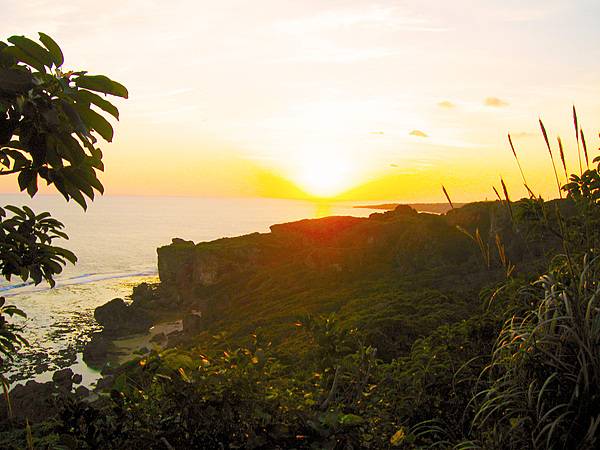
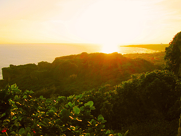
Sunrise over a verdant Okinawan shoreline.
Sunrise over a verdant Okinawan shoreline. • CIA World Factbook • 2020
Sunrise over a verdant Okinawan shoreline.
Sunrise over a verdant Okinawan shoreline. • CIA World Factbook • 2020
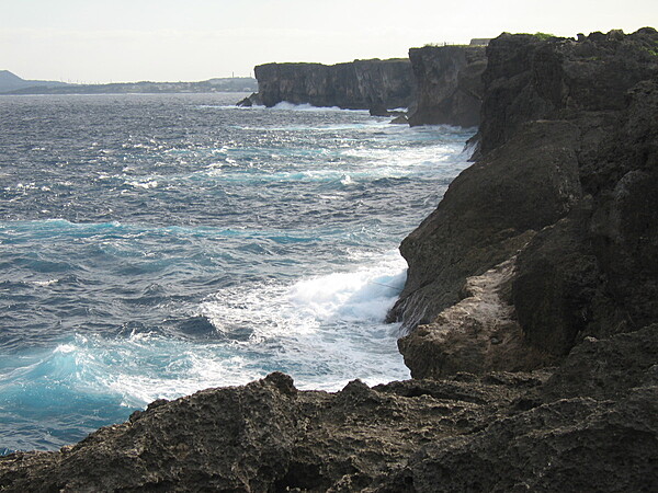
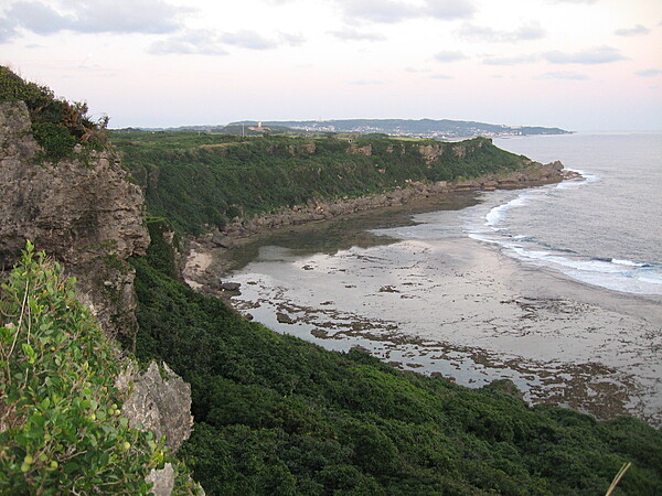
A rugged section of the Okinawa coastline.
A rugged section of the Okinawa coastline. • CIA World Factbook • 2020
Rocky beach and rugged cliffs along an Okinawan sea shore.
Rocky beach and rugged cliffs along an Okinawan sea shore. • CIA World Factbook • 2020
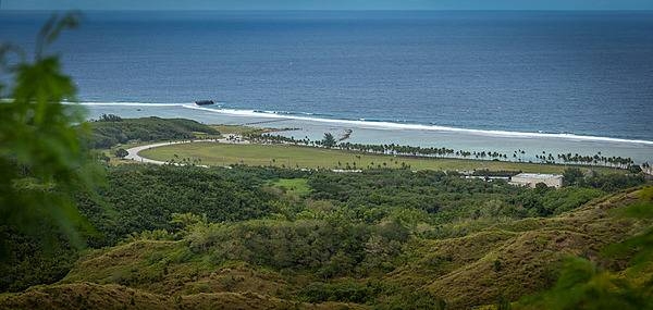
Red Beach was the original landing site of the 1st Marine Division at Guadalcanal on 7 August 1942; this was the Marines first offensive action against the Empire of Japan during World War II. The Marines seized a floatplane base and an airfield under construction. A monument at Red Beach marks the Division’s landing. Photo courtesy of the US Army/ Staff Sgt. Armando R. Limon.
Red Beach was the original landing site of the 1st Marine Division at Guadalcanal on 7 August 1942; this was the Marines first offensive action against the Empire of Japan during World War II. The Marines seized a floatplane base and an airfield under construction. A monument at Red Beach marks the Division’s landing. Photo courtesy of the US Army/ Staff Sgt. Armando R. Limon. • CIA World Factbook • 2020
CIA World Factbook • 2020
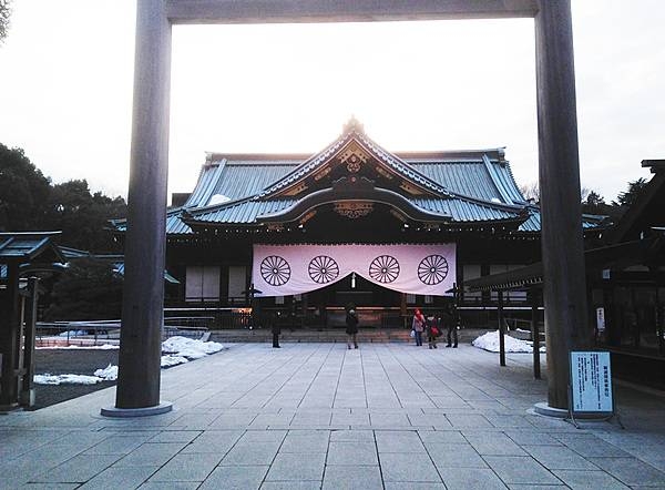
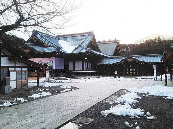
The haiden (hall of worship) at the Yasukuni Shrine in Chiyoda, Tokyo. The Shinto shrine was founded by Emperor Meiji in June 1869 and commemorates those who died in service of Japan in various wars.
The haiden (hall of worship) at the Yasukuni Shrine in Chiyoda, Tokyo. The Shinto shrine was founded by Emperor Meiji in June 1869 and commemorates those who died in service of Japan in various wars. • CIA World Factbook • 2020
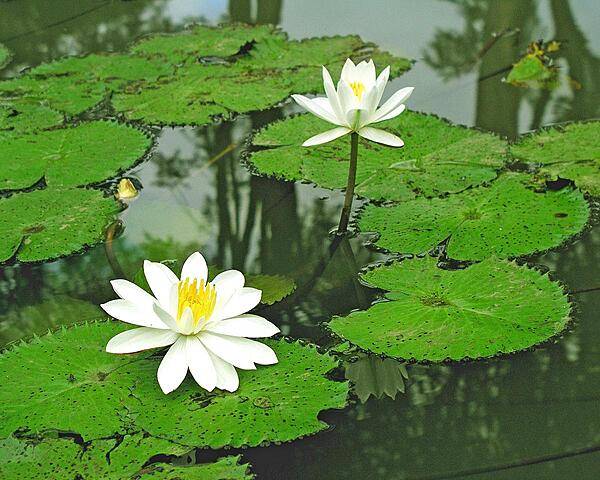
Lotus blossoms.
Lotus blossoms. • CIA World Factbook • 2020
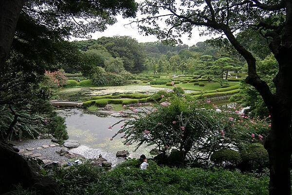
Layers of green foliage along the shoreline of a Japanese garden.
Layers of green foliage along the shoreline of a Japanese garden. • CIA World Factbook • 2020
CIA World Factbook • 2020
Satellite image shows North and South Korea (upper left) as well as the Japanese island of Shikoku, nestled between Kyushu to the southwest and Honshu to the north. Photo courtesy of NASA.
Satellite image shows North and South Korea (upper left) as well as the Japanese island of Shikoku, nestled between Kyushu to the southwest and Honshu to the north. Photo courtesy of NASA. • CIA World Factbook • 2020

CIA World Factbook • 2020
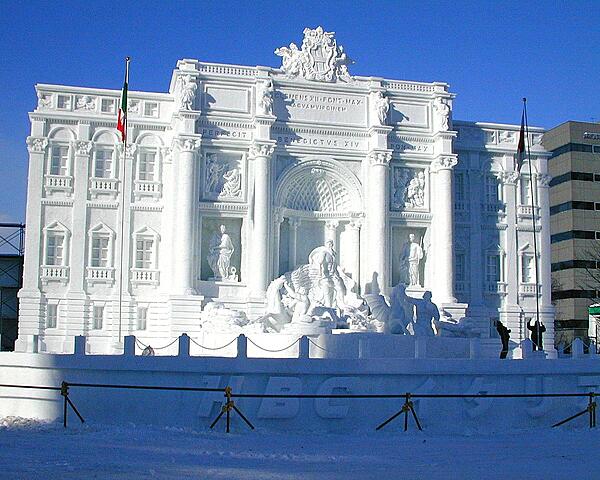
An ice sculpture at the Sapporo Snow Festival reproduces the Trevi Fountain in Rome.
An ice sculpture at the Sapporo Snow Festival reproduces the Trevi Fountain in Rome. • CIA World Factbook • 2020
CIA World Factbook • 2020
CIA World Factbook • 2020
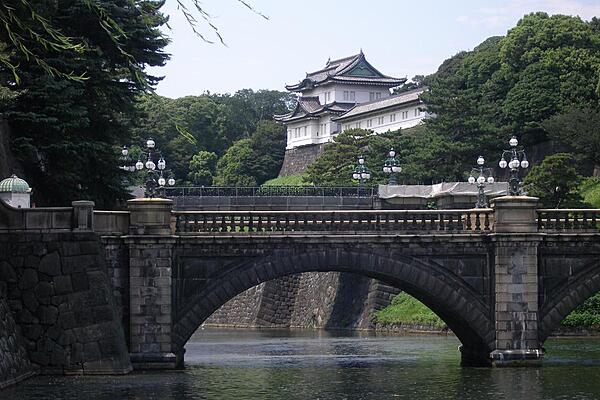
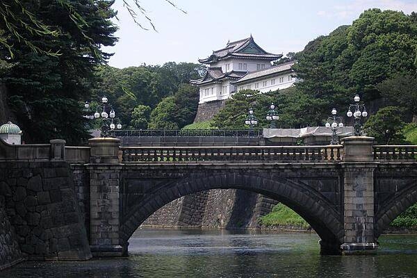
The Imperial Palace and Nijubashi Bridge in Tokyo.
The Imperial Palace and Nijubashi Bridge in Tokyo. • CIA World Factbook • 2020
This high-oblique, northeast-looking space shuttle photograph captures a portion of Southern Honshu Island and Shikoku Island of Japan. The darker areas show volcanic, mountainous terrain that comprises more than 80 percent of Japan; the lighter, more highly reflective areas of the coastal plains and valleys are urban and agricultural areas. Separated by the Seto Inland Sea are Shikoku Island to the south and the Osaka-Kobe industrial metroplex on Honshu Island to the north. Photo courtesy of NASA.
This high-oblique, northeast-looking space shuttle photograph captures a portion of Southern Honshu Island and Shikoku Island of Japan. The darker areas show volcanic, mountainous terrain that comprises more than 80 percent of Japan; the lighter, more highly reflective areas of the coastal plains and valleys are urban and agricultural areas. Separated by the Seto Inland Sea are Shikoku Island to the south and the Osaka-Kobe industrial metroplex on Honshu Island to the north. Photo courtesy of NASA. • CIA World Factbook • 2020
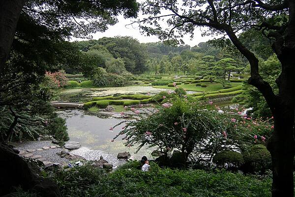
East Gardens of the Imperial Palace in Tokyo.
East Gardens of the Imperial Palace in Tokyo. • CIA World Factbook • 2020
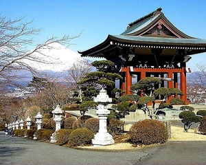
The temple gable mimics the shape of Mt. Fuji in the background.
The temple gable mimics the shape of Mt. Fuji in the background. • CIA World Factbook • 2020
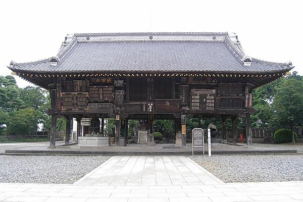
Shotoku-taishi-do Hall, Narita, Japan.
Shotoku-taishi-do Hall, Narita, Japan. • CIA World Factbook • 2020
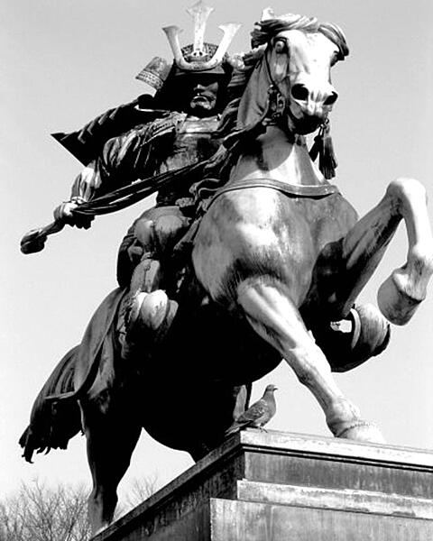
Equestrian statue of the famous samurai Kusunoki Masashige (1294-1336) outside of the Imperial Palace in Tokyo.
Equestrian statue of the famous samurai Kusunoki Masashige (1294-1336) outside of the Imperial Palace in Tokyo. • CIA World Factbook • 2020
CIA World Factbook • 2020
The haiden (hall of worship) at the Yasukuni Shrine in Chiyoda, Tokyo. The Shinto shrine was founded by Emperor Meiji in June 1869 and commemorates those who died in service of Japan in various wars.
The haiden (hall of worship) at the Yasukuni Shrine in Chiyoda, Tokyo. The Shinto shrine was founded by Emperor Meiji in June 1869 and commemorates those who died in service of Japan in various wars. • CIA World Factbook • 2020
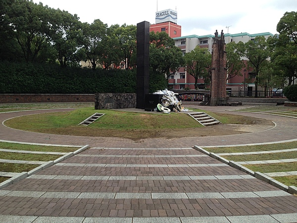
Monument at the atomic bomb hypocenter (ground zero) in Nagasaki.
Monument at the atomic bomb hypocenter (ground zero) in Nagasaki. • CIA World Factbook • 2020
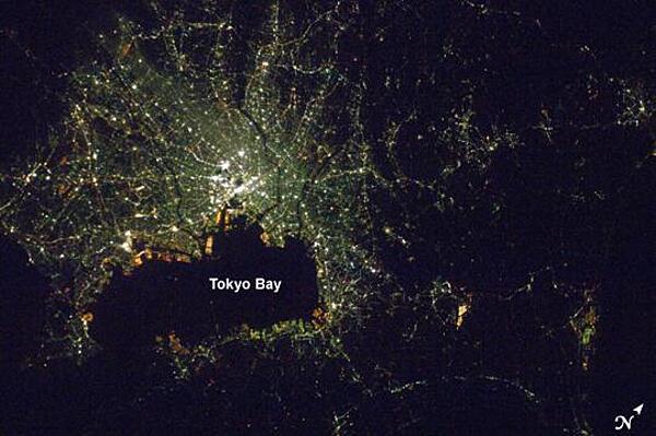
A nighttime view of Tokyo, Japan from the International Space Station. The heart of the city is brightest, with ribbons of lights radiating outward from the center along streets and railways. The regularly spaced bright spots along one of the ribbons heading almost due west out of the downtown area are train stations along a public transit route. The lights of Tokyo are a cooler blue-green color than in many other world cities. The color results from the more widespread use of mercury vapor lighting as opposed to sodium vapor lighting, which produces an orange-yellow light. Photo: NASA.
A nighttime view of Tokyo, Japan from the International Space Station. The heart of the city is brightest, with ribbons of lights radiating outward from the center along streets and railways. The regularly spaced bright spots along one of the ribbons heading almost due west out of the downtown area are train stations along a public transit route. The lights of Tokyo are a cooler blue-green color than in many other world cities. The color results from the more widespread use of mercury vapor lighting as opposed to sodium vapor lighting, which produces an orange-yellow light. Photo: NASA. • CIA World Factbook • 2020
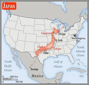
Area comparison map
Area comparison map • CIA World Factbook • 2020
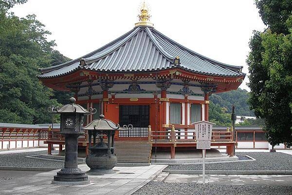
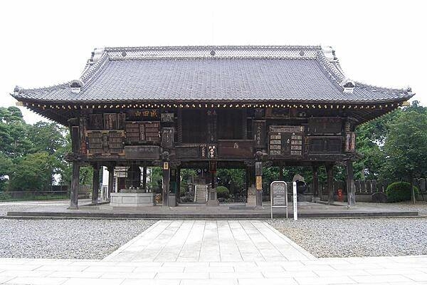
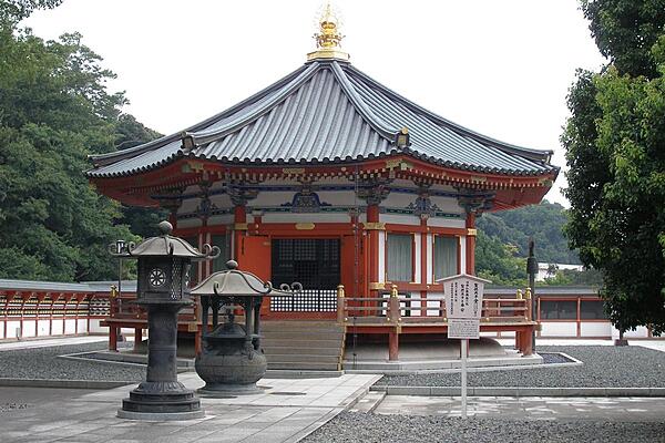
Gaku-do Hall in Narita.
Gaku-do Hall in Narita. • CIA World Factbook • 2020
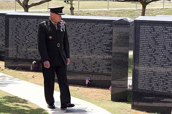
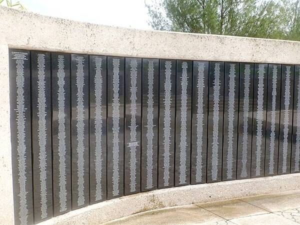
Lt. Gen. Kenneth J. Glueck Jr., commanding general of III Marine Expeditionary Force and commander of Marine Corps Bases Japan, reviews the names on the Cornerstone of Peace at Okinawa Peace Memorial Park in Itoman City, during the 2011 Okinawa Memorial Service for All War Dead June 23. Image courtesy of the US Marine Corps.
Lt. Gen. Kenneth J. Glueck Jr., commanding general of III Marine Expeditionary Force and commander of Marine Corps Bases Japan, reviews the names on the Cornerstone of Peace at Okinawa Peace Memorial Park in Itoman City, during the 2011 Okinawa Memorial Service for All War Dead June 23. Image courtesy of the US Marine Corps. • CIA World Factbook • 2020
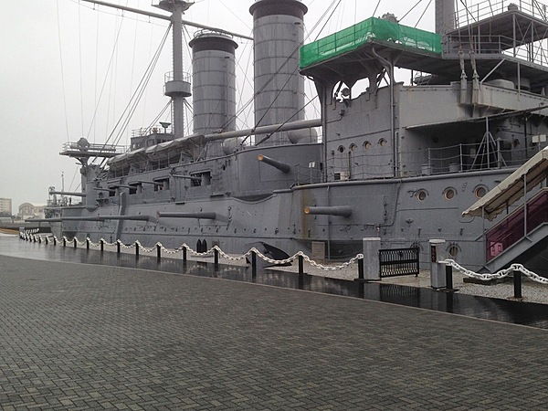
Starboard side view of the Mikasa pre-dreadnought battleship berthed at Mikasa Park in Yokosuka.
Starboard side view of the Mikasa pre-dreadnought battleship berthed at Mikasa Park in Yokosuka. • CIA World Factbook • 2020
Media source: CIA World Factbook (2020) — Public Domain