›››
Kiribati
Kiribati
Population
134.5K
Rank #187Source: World Bank
Capital
Tarawa
Source: REST Countries
Region
Oceania
East Asia & Pacific
Source: REST Countries
GDP (Nominal)
$307.86M
Rank #190Source: World Bank
Land Area
811 km²
Rank #180Source: REST Countries
Life Expectancy
66.473 yrs
Source: World Bank
Historical Trends
Population Trend (5-Year)
Source: World Bank
GDP Trend (5-Year, Nominal USD)
Source: World Bank
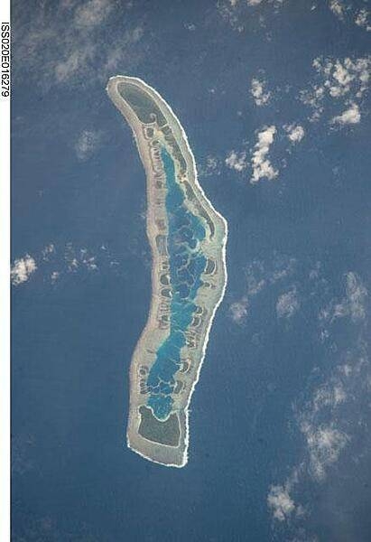
Geography
Area: 811 km²
Landlocked: No
Independent: Yes
Climate: tropical; marine, hot and humid, moderated by trade winds
Terrain: mostly low-lying coral atolls surrounded by extensive reefs
Elevation: mean elevation: 2 m lowest point: Pacific Ocean 0 m highest point: unnamed elevation on Banaba 81 m m
Natural Hazards: typhoons can occur any time, but usually November to March; occasional tornadoes; low level of some of the islands make them sensitive to changes in sea level
Environmental Issues: heavy pollution in lagoon of south Tarawa atoll due to overcrowding mixed with traditional practices such as lagoon latrines and open-pit dumping; ground water at risk; potential for water shortages,...
Land Use: agricultural land: 42% (2011 est.) forest: 15% (2011 est.) other: 43% (2011 est.)
Geography Note: 21 of the 33 islands are inhabited; Banaba (Ocean Island) in Kiribati is one of the three great phosphate rock islands in the Pacific Ocean - the others are Makatea in French Polynesia, and Nauru;...
Natural Resources
phosphate (production discontinued in 1979)coconuts (copra)fish
People & Society
Fertility Rate
3.15
Population
134.5K
Ethnic Groups
I-Kiribati (96.2%)I-Kiribati/mixed (1.8%)Tuvaluan (0.2%)other (1.8%)
Religions
Roman Catholic (57.3%)Kiribati Uniting Church (31.3%)Mormon (5.3%)Baha'i (2.1%)Seventh Day Adventist (1.9%)other (2.1%)
Economy
GDP per Capita
$2,288.635
GDP per Capita PPP
3,702.326
(2024)
(2024)
GNI per Capita
3,660
(2024)
(2024)
Gini Index
27.8
(2019)
(2019)
Unemployment
Not Available
Inflation
2.455%
(2024)
(2024)
Public Debt
Not Available
Energy
Electricity Access
95.9%
(2023)
(2023)
Renewable Energy
41.9%
(2022)
(2022)
CO₂ Emissions
0.08 Mt
(2024)
(2024)
Energy Intensity
6.82 MJ/$
(2022)
(2022)
Renewable Electricity
16.365%
(2021)
(2021)
Environment
Forest Coverage
1.457% of land
(2023)
(2023)
Protected Areas
20.2% of land
(2009)
(2009)
Communications
Internet Users
88%
(2023)
(2023)
Mobile Penetration
51.254%
(2023)
(2023)
Broadband Subscribers
0.04%
(2023)
(2023)
Transportation
Air Transport Freight
0.345 M ton-km
(2023)
(2023)
Container Port Traffic
52,099.86 TEU
(2019)
(2019)
Airports
4,427
Rail Lines
N/A
Roads Total
N/A
Military
Military Forces
no regular military forces (establishment prevented by the constitution); Police Force
Education
Pre-Primary Enrollment
88.812%
(2020)
(2020)
Primary Enrollment
95.269%
(2024)
(2024)
Secondary Enrollment
90.279%
(2024)
(2024)
Tertiary Enrollment
4.961%
(2024)
(2024)
Education Spending
16.391% of GDP
(2023)
(2023)
Adult Literacy Rate
98.632%
(2020)
(2020)
Pupil-Teacher Ratio
25.489:1
(2017)
(2017)
Health
Physicians per 1,000
0.193
(2013)
(2013)
Safe Water Access
79.068%
(2024)
(2024)
Safe Drinking Water
15.088%
(2024)
(2024)
Under-5 Mortality
55.1 per 1,000
(2023)
(2023)
Maternal Mortality (World Bank)
15.119 per 100,000
(2021)
(2021)
Hospital Beds per 1,000
57.777
(2021)
(2021)
UHC Coverage Index
51
(2023)
(2023)
Measles Immunization
94%
(2024)
(2024)
Social Indicators
Extreme Poverty Rate
6.1%
(2019)
(2019)
Food Insecurity
4.1%
(2023)
(2023)
Youth NEET Rate
7.657%
(2023)
(2023)
Governance
Women in Government
11.111%
(2024)
(2024)
Voice & Accountability
1.09
(Strong)
(2023)
(Strong)
(2023)
Political Stability
1.10
(Strong)
(2023)
(Strong)
(2023)
Government Effectiveness
-0.10
(Below Average)
(2023)
(Below Average)
(2023)
Regulatory Quality
-0.28
(Below Average)
(2023)
(Below Average)
(2023)
Rule of Law
0.59
(Above Average)
(2023)
(Above Average)
(2023)
Control of Corruption
0.41
(Above Average)
(2023)
(Above Average)
(2023)
Government
Government Type
presidential republic
Legal System
English common law supplemented by customary law
Executive Branch
chief of state: President Taneti MAAMAU (since 11 March 2016); Vice President Kourabi NENEM (since 17 March 2016); note - the president is both chief of state and head of government head of...
Legislative Branch
description: unicameral House of Assembly or Maneaba Ni Maungatabu (46 seats; 44 members directly elected in single- and multi-seat constituencies by absolute majority vote in two-rounds if needed; 1...
Judicial Branch
highest courts: High Court (consists of a chief justice and other judges as prescribed by the president); note - the High Court has jurisdiction on constitutional issues judge selection and term of...
National Symbols
Flag Description
the upper half is red with a yellow frigatebird flying over a yellow rising sun, and the lower half is blue with three horizontal wavy white stripes to represent the Pacific ocean; the white stripes...
National Symbols
frigatebird; national colors: red, white, blue, yellow
National Anthem
name: "Teirake kaini Kiribati" (Stand Up, Kiribati) lyrics/music: Urium Tamuera IOTEBA note: adopted 1979
Safety
Homicide Rate
7.125 per 100,000
(2012)
(2012)
Travel Information
Language(s): English, Gilbertese
Currency: AUD ($), KID ($)
Timezone(s): UTC +12:00 to +14:00
Landlocked: No
Independent: Yes
Driving Side: Left
Calling Code: +686
Car Sign: KIR
Week Starts: Monday
Data sources: World Bank, UN Data • Updated daily •Learn about our data