›››
Malta
Malta
Population
568.8K
Rank #170Source: World Bank
Capital
Valletta
Source: REST Countries
Region
Africa
Middle East, North Africa, Afghanistan & Pakistan
Source: REST Countries
GDP (Nominal)
$24.97B
Rank #119Source: World Bank
Land Area
316 km²
Rank #199Source: REST Countries
Life Expectancy
83.507 yrs
Source: World Bank
Historical Trends
Population Trend (5-Year)
Source: World Bank
GDP Trend (5-Year, Nominal USD)
Source: World Bank
Geography
Area: 316 km²
Landlocked: No
Independent: Yes
Climate: Mediterranean; mild, rainy winters; hot, dry summers
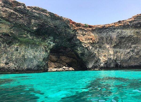
Terrain: mostly low, rocky, flat to dissected plains; many coastal cliffs
Elevation: lowest point: Mediterranean Sea 0 m highest point: Ta'Dmejrek on Dingli Cliffs 253 m
Natural Hazards: occasional droughts
Environmental Issues: limited natural freshwater resources; increasing reliance on desalination; deforestation; wildlife preservation
Land Use: agricultural land: 32.3% (2011 est.) forest: 0.9% (2011 est.) other: 66.8% (2011 est.)
Geography Note: the country comprises an archipelago, with only the three largest islands (Malta, Ghawdex or Gozo, and Kemmuna or Comino) inhabited; numerous bays provide good harbors; Malta and Tunisia are...
Natural Resources
limestonesaltarable land
People & Society
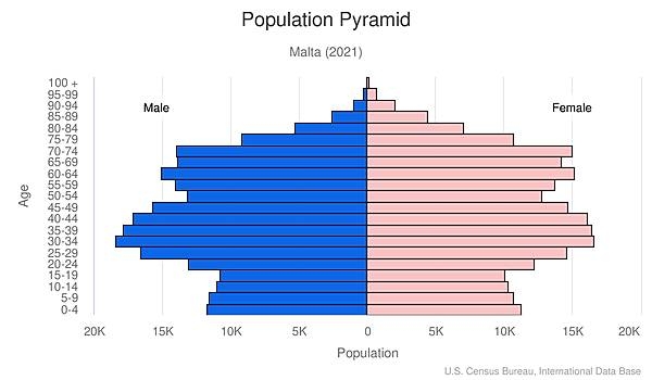
Fertility Rate
1.06
Population
568.8K
Religions
Roman Catholic (official) more than (90%)
Economy
GDP per Capita
$43,898.578
GDP per Capita PPP
71,017.774
(2024)
(2024)
GNI per Capita
36,730
(2024)
(2024)
Gini Index
34.6
(2022)
(2022)
Unemployment
3.1%
(2024)
(2024)
Inflation
1.651%
(2024)
(2024)
Public Debt
Not Available
Energy
Electricity Access
100%
(2023)
(2023)
Renewable Energy
8.6%
(2021)
(2021)
CO₂ Emissions
1.808 Mt
(2024)
(2024)
Energy Intensity
1.18 MJ/$
(2022)
(2022)
Renewable Electricity
11.89%
(2021)
(2021)
Environment
Forest Coverage
1.438% of land
(2023)
(2023)
Communications
Internet Users
92.073%
(2023)
(2023)
Mobile Penetration
140.594%
(2023)
(2023)
Broadband Subscribers
44.283%
(2023)
(2023)
Transportation
Air Transport Freight
3.356 M ton-km
(2023)
(2023)
Container Port Traffic
2,993,799 TEU
(2022)
(2022)
Airports
16,075
Rail Lines
N/A
Roads Total
2,841 km(©IRF)
Military
Military Forces
Armed Forces of Malta (AFM, includes land, maritime, and air elements, plus a Volunteer Reserve Force)
Personnel Strength
the Armed Forces of Malta have approximately 2,000 active duty personnel
Military Expenditure (USD)
$0.11B
Military Expenditure (% of GDP)
0.45%
Military Expenditure History
0.6% of GDP (2019) 0.5% of GDP (2018) 0.5% of GDP (2017) 0.5% of GDP (2016) 0.5% of GDP (2015)
Equipment & Inventories
the small inventory of the Armed Forces of Malta consists of equipment from a mix of European countries, particularly Italy, and the US; since 2010, Italy and the US are the only providers of...
Service Age & Obligation
18-30 years of age for voluntary military service; no conscription
Education
Pre-Primary Enrollment
112.487%
(2020)
(2020)
Primary Enrollment
97.708%
(2023)
(2023)
Secondary Enrollment
103.027%
(2023)
(2023)
Tertiary Enrollment
80.525%
(2023)
(2023)
Education Spending
4.72% of GDP
(2022)
(2022)
Adult Literacy Rate
93.31%
(2011)
(2011)
Pupil-Teacher Ratio
12.939:1
(2017)
(2017)
Health
Physicians per 1,000
4.513
(2022)
(2022)
Safe Water Access
100%
(2024)
(2024)
Safe Drinking Water
99.827%
(2024)
(2024)
Under-5 Mortality
5.5 per 1,000
(2023)
(2023)
Maternal Mortality (World Bank)
25.662 per 100,000
(2021)
(2021)
Hospital Beds per 1,000
81.812
(2021)
(2021)
UHC Coverage Index
82
(2023)
(2023)
Measles Immunization
97%
(2024)
(2024)
Social Indicators
Extreme Poverty Rate
0.1%
(2022)
(2022)
Food Insecurity
2.5%
(2023)
(2023)
Youth NEET Rate
9.1%
(2024)
(2024)
Governance
Women in Government
27.848%
(2024)
(2024)
Voice & Accountability
0.91
(Above Average)
(2023)
(Above Average)
(2023)
Political Stability
0.86
(Above Average)
(2023)
(Above Average)
(2023)
Government Effectiveness
0.40
(Above Average)
(2023)
(Above Average)
(2023)
Regulatory Quality
0.69
(Above Average)
(2023)
(Above Average)
(2023)
Rule of Law
0.70
(Above Average)
(2023)
(Above Average)
(2023)
Control of Corruption
0.11
(Above Average)
(2023)
(Above Average)
(2023)
Government
Government Type
parliamentary republic
Legal System
mixed legal system of English common law and civil law based on the Roman and Napoleonic civil codes; subject to European Union law
Executive Branch
chief of state: President George VELLA (since 4 April 2019) head of government: Prime Minister Robert ABELA (13 January 2020) cabinet: Cabinet appointed by the president on the advice of the prime...
Legislative Branch
description: unicameral House of Representatives or Il-Kamra Tad-Deputati, a component of the Parliament of Malta (normally 65 seats but can include at-large members; members directly elected in 5...
Judicial Branch
highest courts: Court of Appeal (consists of either 1 or 3 judges); Constitutional Court (consists of 3 judges); Court of Criminal Appeal (consists of either 1 or 3 judges) judge selection and term...
National Symbols
Flag Description
two equal vertical bands of white (hoist side) and red; in the upper hoist-side corner is a representation of the George Cross, edged in red; according to legend, the colors are taken from the red...
National Symbols
Maltese eight-pointed cross; national colors: red, white
National Anthem
name: "L-Innu Malti" (The Maltese Anthem) lyrics/music: Dun Karm PSAILA/Robert SAMMUT note: adopted 1945; written in the form of a prayer
Safety
Homicide Rate
0.563 per 100,000
(2023)
(2023)
Travel Information
Language(s): English, Maltese
Currency: EUR (€)
Timezone(s): UTC+01:00
Landlocked: No
Independent: Yes
Driving Side: Left
Calling Code: +356
Car Sign: M
Week Starts: Monday
Photos
CIA World Factbook • 2020
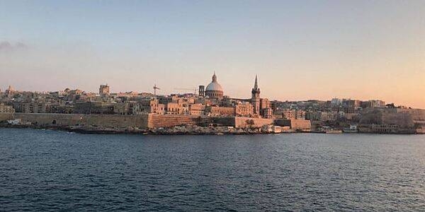
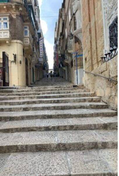
The old fortifications at the capital of Valletta date to the 16th century.
The old fortifications at the capital of Valletta date to the 16th century. • CIA World Factbook • 2020
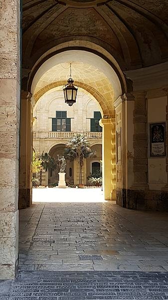
CIA World Factbook • 2020
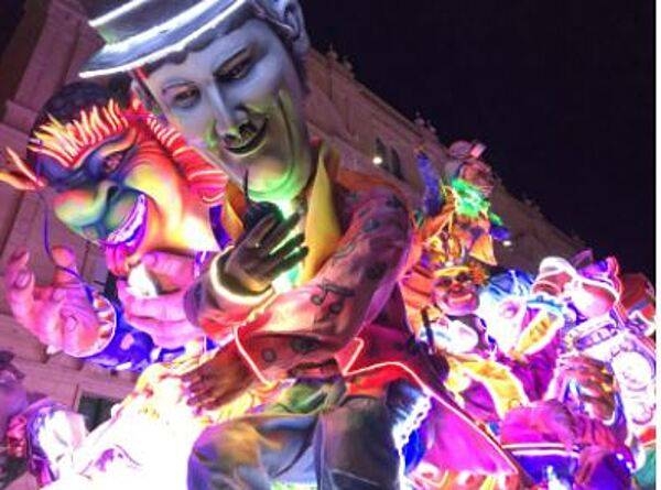
CIA World Factbook • 2020
CIA World Factbook • 2020
Although small in size (122 sq mi-316 sq km), the independent republic of Malta is strategically located midway between the Strait of Gibraltar and the Suez Canal in the Mediterranean Sea. The country is made up of three inhabited islands that are visible in this image: the island of Malta, the largest, Gozo, and Comino, the smallest (situated between the two larger islands). The capital and largest city, Valletta, is mainly built around a rocky peninsula, arrow-shaped peninsula extends northeast between two natural harbors (small, narrow, dark features). The geological faulting in this area has produced numerous fine natural harbors around the periphery of Malta. Although the islands are composed of sedimentary rocks, mainly limestone and clays, the alkaline soils provide fertile conditions for the well-established agricultural economy. Precipitation amounts can be a problem in that the islands average only about 32 cm (12 in) per year. Malta has few natural resources so the growth of tourism, especially since World War II, has gradually added to the Maltese economy. Photo courtesy of NASA.
Although small in size (122 sq mi-316 sq km), the independent republic of Malta is strategically located midway between the Strait of Gibraltar and the Suez Canal in the Mediterranean Sea. The country is made up of three inhabited islands that are visible in this image: the island of Malta, the largest, Gozo, and Comino, the smallest (situated between the two larger islands). The capital and largest city, Valletta, is mainly built around a rocky peninsula, arrow-shaped peninsula extends northeast between two natural harbors (small, narrow, dark features). The geological faulting in this area has produced numerous fine natural harbors around the periphery of Malta. Although the islands are composed of sedimentary rocks, mainly limestone and clays, the alkaline soils provide fertile conditions for the well-established agricultural economy. Precipitation amounts can be a problem in that the islands average only about 32 cm (12 in) per year. Malta has few natural resources so the growth of tourism, especially since World War II, has gradually added to the Maltese economy. Photo courtesy of NASA. • CIA World Factbook • 2020
9 photos available
View All Photos→Data sources: World Bank, UN Data • Updated daily •Learn about our data