›››
Maldives — Media Gallery
19 items available (flags, maps, photos)
Photos

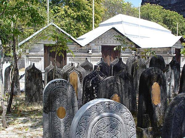
The Royal Graveyard in Male is near the Grand Friday Mosque and contains the tombs of the country's heroes and members of royalty.
The Royal Graveyard in Male is near the Grand Friday Mosque and contains the tombs of the country's heroes and members of royalty. • CIA World Factbook • 2020

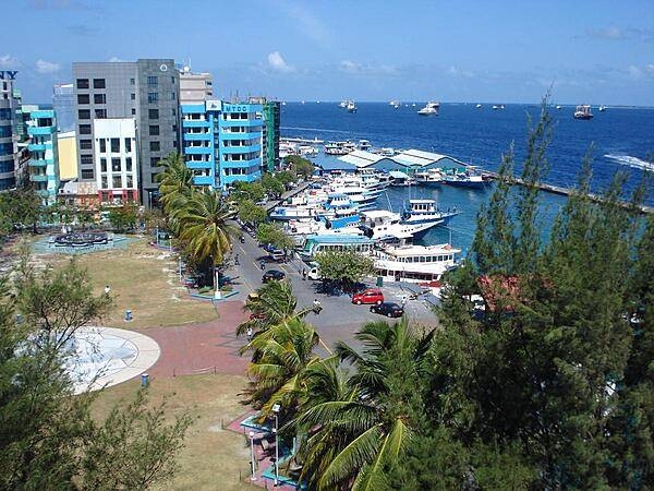
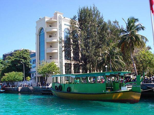
A view of the Male waterfront. The capital city's harbor is enclosed by an artificial coral stone breakwater.
A view of the Male waterfront. The capital city's harbor is enclosed by an artificial coral stone breakwater. • CIA World Factbook • 2020
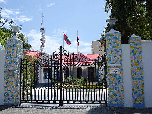
Mulee-Aage Palace in Male was built in 1906 by Sultan Shamsuddeen III as a home for his son. In 1936, the sultan was banished and the building became the new government's property. In 1986, the building was named the president's official residence. Today there is a new official residence and Mulee-Aage serves as the president's office. It is noted for its exquisite white carvings.
Mulee-Aage Palace in Male was built in 1906 by Sultan Shamsuddeen III as a home for his son. In 1936, the sultan was banished and the building became the new government's property. In 1986, the building was named the president's official residence. Today there is a new official residence and Mulee-Aage serves as the president's office. It is noted for its exquisite white carvings. • CIA World Factbook • 2020
Area comparison map
Area comparison map • CIA World Factbook • 2020
CIA World Factbook • 2020
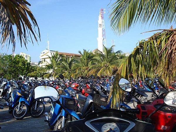
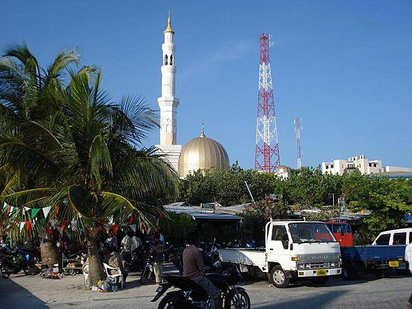
Male bike park with minaret in the background.
Male bike park with minaret in the background. • CIA World Factbook • 2020
CIA World Factbook • 2020
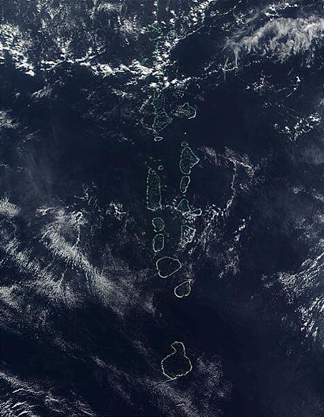
All but the southernmost of the Maldives many atolls, Addu Atoll, is visible in this 2006 space-based image. Photo courtesy of NASA.
All but the southernmost of the Maldives many atolls, Addu Atoll, is visible in this 2006 space-based image. Photo courtesy of NASA. • CIA World Factbook • 2020
CIA World Factbook • 2020
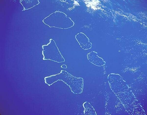
This south-looking, low-oblique photograph shows (from north to south) the Ari, Male, Felidu, Nilande, Mulaku, and Kolumadulu Atolls of the Maldives. The 26 atolls of the Maldives are composed of 1,190 small coral islands. The island chain extends north-south for approximately 880 km (550 mi). The Maldives are the exposed top of a long, narrow submarine ridge whose average height is 1 to 2 m (3 to 6 ft) above sea level. Most of the atolls have spacious, deep-water lagoons suitable for ship anchorage. Image courtesy of NASA.
This south-looking, low-oblique photograph shows (from north to south) the Ari, Male, Felidu, Nilande, Mulaku, and Kolumadulu Atolls of the Maldives. The 26 atolls of the Maldives are composed of 1,190 small coral islands. The island chain extends north-south for approximately 880 km (550 mi). The Maldives are the exposed top of a long, narrow submarine ridge whose average height is 1 to 2 m (3 to 6 ft) above sea level. Most of the atolls have spacious, deep-water lagoons suitable for ship anchorage. Image courtesy of NASA. • CIA World Factbook • 2020
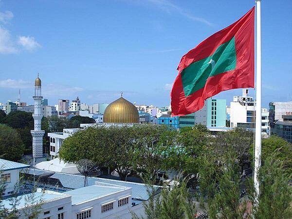
A mosque with its minaret in Male.
A mosque with its minaret in Male. • CIA World Factbook • 2020

CIA World Factbook • 2020

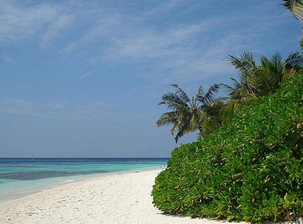
Looking out onto lagoon waters from a palm-shaded beach.
Looking out onto lagoon waters from a palm-shaded beach. • CIA World Factbook • 2020
CIA World Factbook • 2020
CIA World Factbook • 2020
CIA World Factbook • 2020
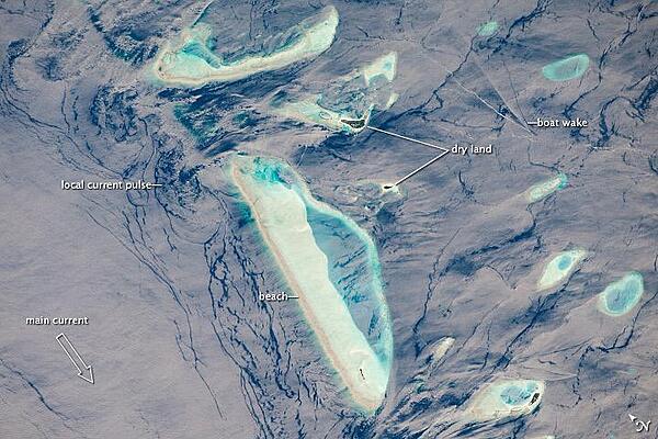
This photograph features one of the numerous atolls in the Maldive Islands chain. The Maldives are an island nation comprised of twenty-six atolls that stretch in a north-south chain for almost 900 km (560 mi) southwest of India. The silvery, almost pink sheen on the normally blue water of the equatorial Indian Ocean in the image is the result of sunglint, which is sunlight reflecting off of water surface directly back towards the observer. The largest island (image center) is 6 km (4 mi) long, and it is part of the 70-km-(40-mi-) long oval-shaped Male Atoll. Shores facing deeper water have well-defined beaches. Numerous small, elliptical coral reef islets are protected within the ring of shallow water to the northeast (image right). These islets are mostly awash at high tide. Image courtesy of NASA.
This photograph features one of the numerous atolls in the Maldive Islands chain. The Maldives are an island nation comprised of twenty-six atolls that stretch in a north-south chain for almost 900 km (560 mi) southwest of India. The silvery, almost pink sheen on the normally blue water of the equatorial Indian Ocean in the image is the result of sunglint, which is sunlight reflecting off of water surface directly back towards the observer. The largest island (image center) is 6 km (4 mi) long, and it is part of the 70-km-(40-mi-) long oval-shaped Male Atoll. Shores facing deeper water have well-defined beaches. Numerous small, elliptical coral reef islets are protected within the ring of shallow water to the northeast (image right). These islets are mostly awash at high tide. Image courtesy of NASA. • CIA World Factbook • 2020
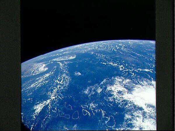
A view over the Indian Ocean as seen from the space shuttle. The bottom portion of the photo shows the complete chain of the atolls that form the Maldive Islands. Off to the left are the southern portion of India, the Palk Strait, and the island of Sri Lanka. Image courtesy of NASA.
A view over the Indian Ocean as seen from the space shuttle. The bottom portion of the photo shows the complete chain of the atolls that form the Maldive Islands. Off to the left are the southern portion of India, the Palk Strait, and the island of Sri Lanka. Image courtesy of NASA. • CIA World Factbook • 2020

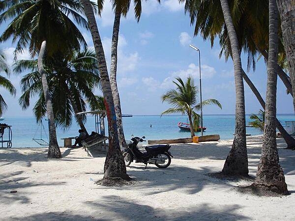
An inviting beach at a resort near Male.
An inviting beach at a resort near Male. • CIA World Factbook • 2020
Media source: CIA World Factbook (2020) — Public Domain