›››
West Bank and Gaza
West Bank and Gaza
Population
5.3M
Rank #122Source: World Bank
Capital
Source: REST Countries
Region
Africa
Middle East, North Africa, Afghanistan & Pakistan
Source: REST Countries
GDP (Nominal)
$13.71B
Rank #142Source: World Bank
Land Area
6.2K km²
Rank #167Source: REST Countries
Life Expectancy
65.17 yrs
Source: World Bank
Historical Trends
Population Trend (5-Year)
Source: World Bank
GDP Trend (5-Year, Nominal USD)
Source: World Bank
Geography
Area: 6,220 km²
Landlocked: No
Independent: No
Climate: temperate, mild winters, dry and warm to hot summers
Terrain: flat to rolling, sand- and dune-covered coastal plain
Elevation: lowest point: Mediterranean Sea 0 m highest point: Abu 'Awdah (Joz Abu 'Awdah) 105 m
Natural Hazards: droughts
Environmental Issues: soil degradation; desertification; water pollution from chemicals and pesticides; salination of fresh water; improper sewage treatment; water-borne disease; depletion and contamination of underground...
Land Use: agricultural land: 43.3% (2011 est.) forest: 1.5% (2011 est.) other: 55.2% (2011 est.) note: includes Gaza Strip
Geography Note: strategic strip of land along Mideast-North African trade routes has experienced an incredibly turbulent history; the town of Gaza itself has been besieged countless times in its history; there are...
Natural Resources
arable landnatural gas
People & Society
Fertility Rate
3.31
Population
5.3M
Religions
Muslim 98.0 - (99%)
Economy
GDP per Capita
$2,592.306
GDP per Capita PPP
4,371.111
(2024)
(2024)
GNI per Capita
2,710
(2024)
(2024)
Gini Index
36.4
(2023)
(2023)
Unemployment
24.42%
(2022)
(2022)
Inflation
53.669%
(2024)
(2024)
Public Debt
Not Available
Energy
Electricity Access
100%
(2023)
(2023)
Renewable Energy
15.4%
(2022)
(2022)
CO₂ Emissions
Not Available
Energy Intensity
3.1 MJ/$
(2022)
(2022)
Renewable Electricity
24.463%
(2021)
(2021)
Environment
Forest Coverage
1.683% of land
(2023)
(2023)
Communications
Internet Users
86.638%
(2023)
(2023)
Mobile Penetration
76.692%
(2023)
(2023)
Broadband Subscribers
8.371%
(2023)
(2023)
Military
Military Forces
HAMAS does not have a conventional military in the Gaza Strip but maintains security forces in addition to its military wing, the 'Izz al-Din al-Qassam Brigades; the military wing reports to the...
Personnel Strength
the military wing of HAMAS, the Izz al-Din al-Qassam Brigades, has an estimated 15-25,000 fighters
Equipment & Inventories
the military wing of HAMAS is armed with light weapons, including an inventory of improvised rocket, anti-tank missile, and mortar capabilities; HAMAS acquires its weapons through smuggling or local...
Education
Pre-Primary Enrollment
49.476%
(2021)
(2021)
Primary Enrollment
91.442%
(2023)
(2023)
Secondary Enrollment
89.121%
(2023)
(2023)
Tertiary Enrollment
44.49%
(2023)
(2023)
Education Spending
5.434% of GDP
(2021)
(2021)
Adult Literacy Rate
97.945%
(2024)
(2024)
Pupil-Teacher Ratio
24.453:1
(2018)
(2018)
Health
Physicians per 1,000
2.168
(2018)
(2018)
Safe Water Access
98.772%
(2024)
(2024)
Safe Drinking Water
80.642%
(2024)
(2024)
Under-5 Mortality
26.3 per 1,000
(2023)
(2023)
Maternal Mortality (World Bank)
16.807 per 100,000
(2021)
(2021)
Hospital Beds per 1,000
71.141
(2021)
(2021)
UHC Coverage Index
65
(2023)
(2023)
Measles Immunization
88%
(2024)
(2024)
Social Indicators
Extreme Poverty Rate
2.1%
(2023)
(2023)
Food Insecurity
Not Available
Youth NEET Rate
42.952%
(2024)
(2024)
Governance
Women in Government
Not Available
Voice & Accountability
-1.12
(Weak)
(2023)
(Weak)
(2023)
Political Stability
-1.86
(Weak)
(2023)
(Weak)
(2023)
Government Effectiveness
-1.21
(Weak)
(2023)
(Weak)
(2023)
Regulatory Quality
-0.28
(Below Average)
(2023)
(Below Average)
(2023)
Rule of Law
-0.68
(Below Average)
(2023)
(Below Average)
(2023)
Control of Corruption
-0.68
(Below Average)
(2023)
(Below Average)
(2023)
Government
National Symbols
Safety
Homicide Rate
0.622 per 100,000
(2022)
(2022)
Travel Information
Language(s): Arabic
Currency: EGP (E£), ILS (₪), JOD (JD)
Timezone(s): UTC+02:00
Landlocked: No
Independent: No
Driving Side: Right
Calling Code: +970
Car Sign: PS
Week Starts: Sunday
Photos
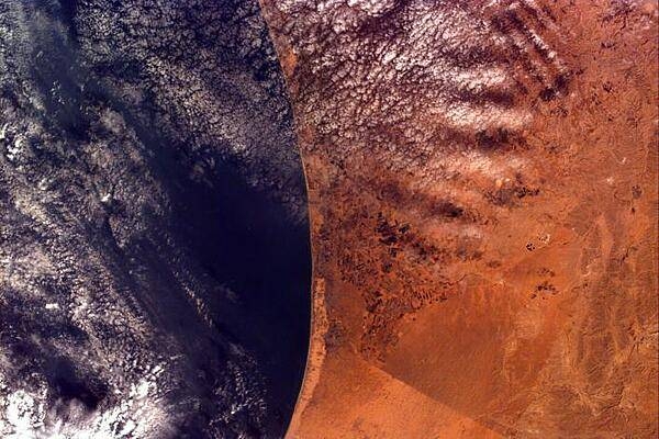
This image covers an area roughly 100x150 km; due to shuttle orientation, north is located at approximately eleven o'clock in this image. Shown are the Gaza Strip (roughly the center third of the coastal strip) and the Mediterranean Sea. The straight-line Egypt-Israel border is apparent in the lower center because of a difference in vegetation patterns, the Egyptian side (south) being less vegetated perhaps due to heavy use of the land for grazing. Photo courtesy of NASA.
This image covers an area roughly 100x150 km; due to shuttle orientation, north is located at approximately eleven o'clock in this image. Shown are the Gaza Strip (roughly the center third of the coastal strip) and the Mediterranean Sea. The straight-line Egypt-Israel border is apparent in the lower center because of a difference in vegetation patterns, the Egyptian side (south) being less vegetated perhaps due to heavy use of the land for grazing. Photo courtesy of NASA. • CIA World Factbook • 2020
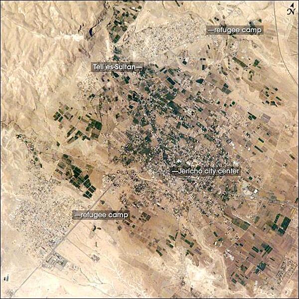
Commonly known as "the oldest city in the world," Jericho is an important historical, cultural, and political center located northwest of the Dead Sea. The city is perhaps best known from the Biblical story of a great victory over its Canaanite citizens by the Israelite leader Joshua. In the story, the walls of the heavily fortified city were destroyed with divine assistance (ca. 1400 B.C.). The site of ancient Jericho, known today as Tell es-Sultan, has been the focus of several archaeological excavations to investigate the Biblical story. The original settlement was built on a hill, or "tell." The results of these excavations suggest that the walls of Tell es-Sultan have been built and rebuilt many times, due mainly to collapse caused by earthquakes, which are common in the region. One of these events may be the basis for the story of Joshua. Modern-day Jericho is a popular tourist destination due to its pleasant climate, historical sites, and religious significance. This photograph shows the city center and the original settlement mound of Tell es-Sultan. Total distance across the image is approximately 8 km (5 mi). Two large refugee camps are located to the northwest and south of the city center. The high building density of the refugee camps contrasts sharply with the more open city center and irrigated fields (green polygonal patches) of Jericho, and illustrates one of the physical consequences of the ongoing Israeli-Palestinian conflict in the region. Photo courtesy of NASA.
Commonly known as "the oldest city in the world," Jericho is an important historical, cultural, and political center located northwest of the Dead Sea. The city is perhaps best known from the Biblical story of a great victory over its Canaanite citizens by the Israelite leader Joshua. In the story, the walls of the heavily fortified city were destroyed with divine assistance (ca. 1400 B.C.). The site of ancient Jericho, known today as Tell es-Sultan, has been the focus of several archaeological excavations to investigate the Biblical story. The original settlement was built on a hill, or "tell." The results of these excavations suggest that the walls of Tell es-Sultan have been built and rebuilt many times, due mainly to collapse caused by earthquakes, which are common in the region. One of these events may be the basis for the story of Joshua. Modern-day Jericho is a popular tourist destination due to its pleasant climate, historical sites, and religious significance. This photograph shows the city center and the original settlement mound of Tell es-Sultan. Total distance across the image is approximately 8 km (5 mi). Two large refugee camps are located to the northwest and south of the city center. The high building density of the refugee camps contrasts sharply with the more open city center and irrigated fields (green polygonal patches) of Jericho, and illustrates one of the physical consequences of the ongoing Israeli-Palestinian conflict in the region. Photo courtesy of NASA. • CIA World Factbook • 2020
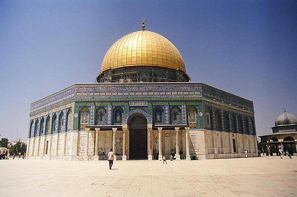
The Dome of the Rock, located on Haram al-Sharif (also known as the Temple Mount), in Israeli-occupied East Jerusalem.
The Dome of the Rock, located on Haram al-Sharif (also known as the Temple Mount), in Israeli-occupied East Jerusalem. • CIA World Factbook • 2020
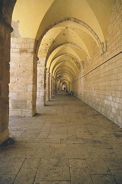
The hallway leading to the Dome of the Rock in Israeli-occupied East Jerusalem.
The hallway leading to the Dome of the Rock in Israeli-occupied East Jerusalem. • CIA World Factbook • 2020
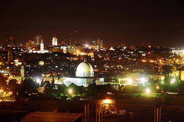
A nighttime view of Jerusalem and Israeli-occupied East Jerusalem, taken from the Mount of Olives.
A nighttime view of Jerusalem and Israeli-occupied East Jerusalem, taken from the Mount of Olives. • CIA World Factbook • 2020
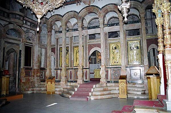
Inside the Church of the Holy Sepulchre, built over the site traditionally identified as the tomb of Christ, in Israeli-occupied East Jerusalem.
Inside the Church of the Holy Sepulchre, built over the site traditionally identified as the tomb of Christ, in Israeli-occupied East Jerusalem. • CIA World Factbook • 2020
10 photos available
View All Photos→Data sources: World Bank, UN Data • Updated daily •Learn about our data