›››
Sweden — Media Gallery
11 items available (flags, maps, photos)
Photos
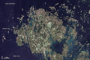
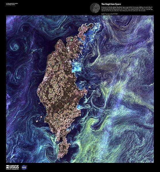
The Åland Islands (pronounced O-lahnd) lie at the southern end of the Gulf of Bothnia, between Sweden and Finland. The archipelago consists of several large islands and roughly 6,500 small isles, many of them too small for human habitation. Åland vegetation is a combination of pine and deciduous forest, meadows, and farmed fields. Image courtesy of NASA/Jesse Allen & Robert Simmon, using USGS Landsat data.
The Åland Islands (pronounced O-lahnd) lie at the southern end of the Gulf of Bothnia, between Sweden and Finland. The archipelago consists of several large islands and roughly 6,500 small isles, many of them too small for human habitation.
Åland vegetation is a combination of pine and deciduous forest, meadows, and farmed fields.
Image courtesy of NASA/Jesse Allen & Robert Simmon, using USGS Landsat data. • CIA World Factbook • 2020
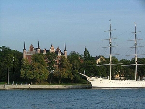
Admiralty House (built 1647-50) on the islet of Skeppsholmen in central Stockholm. Formerly occupied by the Royal Swedish Navy, it today houses the Swedish Tourist Association. The steel, full-rigged ship is the "af Chapman." Built in the UK in 1888, it served as a training ship and made several trips around the world. No longer in active service, it presently is a youth hostel.
Admiralty House (built 1647-50) on the islet of Skeppsholmen in central Stockholm. Formerly occupied by the Royal Swedish Navy, it today houses the Swedish Tourist Association. The steel, full-rigged ship is the "af Chapman." Built in the UK in 1888, it served as a training ship and made several trips around the world. No longer in active service, it presently is a youth hostel. • CIA World Factbook • 2020
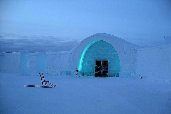
Ice hotel (2005).
Ice hotel (2005). • CIA World Factbook • 2020
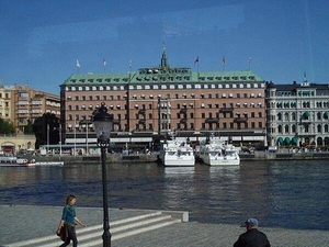
The Grand Hotel in Stockholm. Since 1901, Nobel Prize laureates and their families have all been guests of the hotel.
The Grand Hotel in Stockholm. Since 1901, Nobel Prize laureates and their families have all been guests of the hotel. • CIA World Factbook • 2020
The Wrangel and Stenbock Palaces and the Riddarholmen Church in central Stockholm. The church serves as the burial place for Swedish monarchs and is one of the oldest buildings in Stockholm, with sections dating to the late 13th century.
The Wrangel and Stenbock Palaces and the Riddarholmen Church in central Stockholm. The church serves as the burial place for Swedish monarchs and is one of the oldest buildings in Stockholm, with sections dating to the late 13th century. • CIA World Factbook • 2020
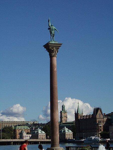
A pillar near Stockholm City Hall bears the figure of Englbrekt Engelbrektson, leader of a 1434 rebellion for Swedish independence from Denmark.
A pillar near Stockholm City Hall bears the figure of Englbrekt Engelbrektson, leader of a 1434 rebellion for Swedish independence from Denmark. • CIA World Factbook • 2020
CIA World Factbook • 2020
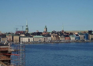
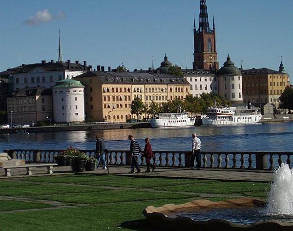
A view of the Stockholm harbor shoreline.
A view of the Stockholm harbor shoreline. • CIA World Factbook • 2020
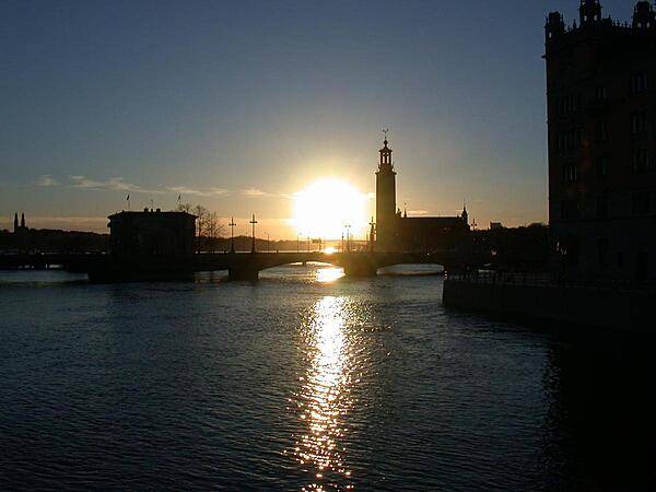
A Stockholm sunset outlines the distinctive City Hall (Stadshuset) on Lake Malaren.
A Stockholm sunset outlines the distinctive City Hall (Stadshuset) on Lake Malaren. • CIA World Factbook • 2020
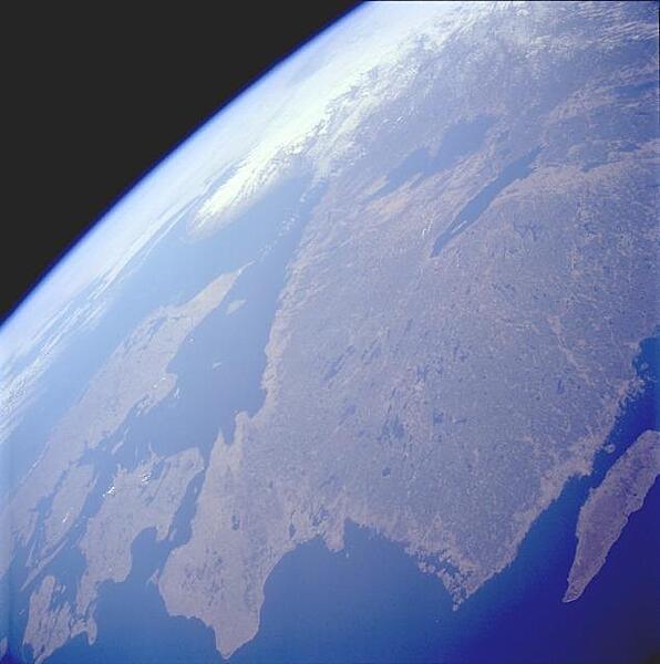
Southern Sweden, with its plethora of lakes, is visible in this west-looking, high-oblique photograph. The lakes were created when the continental glaciers scoured this area and then receded, allowing the countless depressions to fill with water. In addition to numerous smaller lakes that are generally aligned in a north-south orientation, two large lakes - larger Lake Vanern and Lake Vattern - can be seen toward the northern edge of the photograph. The dark green area inland from the coast is forested lands. Image courtesy of NASA.
Southern Sweden, with its plethora of lakes, is visible in this west-looking, high-oblique photograph. The lakes were created when the continental glaciers scoured this area and then receded, allowing the countless depressions to fill with water. In addition to numerous smaller lakes that are generally aligned in a north-south orientation, two large lakes - larger Lake Vanern and Lake Vattern - can be seen toward the northern edge of the photograph. The dark green area inland from the coast is forested lands. Image courtesy of NASA. • CIA World Factbook • 2020
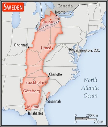
Area comparison map
Area comparison map • CIA World Factbook • 2020
Media source: CIA World Factbook (2020) — Public Domain