›››
South Africa
South Africa
Population
64.0M
Rank #24Source: World Bank
Capital
Pretoria
Source: REST Countries
Region
Africa
Sub-Saharan Africa
Source: REST Countries
GDP (Nominal)
$401.14B
Rank #40Source: World Bank
Land Area
1.2M km²
Rank #25Source: REST Countries
Life Expectancy
66.139 yrs
Source: World Bank
Historical Trends
Population Trend (5-Year)
Source: World Bank
GDP Trend (5-Year, Nominal USD)
Source: World Bank
Geography
Area: 1,221,037 km²
Landlocked: No
Independent: Yes
Climate: mostly semiarid; subtropical along east coast; sunny days, cool nights
Terrain: vast interior plateau rimmed by rugged hills and narrow coastal plain
Elevation: mean elevation: 1,034 m lowest point: Atlantic Ocean 0 m highest point: Njesuthi 3,408 m
Natural Hazards: prolonged droughtsvolcanism: the volcano forming Marion Island in the Prince Edward Islands, which last erupted in 2004, is South Africa's only active volcano
Environmental Issues: lack of important arterial rivers or lakes requires extensive water conservation and control measures; growth in water usage outpacing supply; pollution of rivers from agricultural runoff and urban...
Land Use: agricultural land: 79.4% (2011 est.) forest: 7.6% (2011 est.) other: 13% (2011 est.)
Geography Note: South Africa completely surrounds Lesotho and almost completely surrounds Eswatini
Natural Resources
goldchromiumantimonycoaliron oremanganesenickelphosphatestinrare earth elements
People & Society
Fertility Rate
2.22
Population
64.0M
Ethnic Groups
black African (80.9%)colored (8.8%)white (7.8%)Indian/Asian (2.5%)
Religions
Christian (86%)or other traditional African religions (5.4%)Muslim (1.9%)other (1.5%)nothing in particular (5.2%)
Economy
GDP per Capita
$6,267.187
GDP per Capita PPP
15,456.199
(2024)
(2024)
GNI per Capita
6,110
(2024)
(2024)
Gini Index
63
(2014)
(2014)
Unemployment
32.279%
(2024)
(2024)
Inflation
4.361%
(2024)
(2024)
Public Debt
79.447%
(2023)
(2023)
Energy
Electricity Access
87.7%
(2023)
(2023)
Renewable Energy
9.7%
(2021)
(2021)
CO₂ Emissions
440.168 Mt
(2024)
(2024)
Energy Intensity
6.57 MJ/$
(2021)
(2021)
Renewable Electricity
6.448%
(2021)
(2021)
Environment
Forest Coverage
13.965% of land
(2023)
(2023)
Communications
Internet Users
75.659%
(2023)
(2023)
Mobile Penetration
171.509%
(2023)
(2023)
Broadband Subscribers
3.406%
(2023)
(2023)
Transportation
Air Transport Freight
59.665 M ton-km
(2023)
(2023)
Container Port Traffic
4,053,350 TEU
(2022)
(2022)
Airports
169,154
Rail Lines
20,953 km
Roads Total
767,608 km(©IRF)
Military
Military Forces
South African National Defence Force (SANDF): South African Army (includes Reserve Force), South African Navy (SAN), South African Air Force (SAAF), South African Military Health Services
Personnel Strength
the South African National Defence Force (SANDF) is comprised of approximately 75,000 personnel (40,000 Army; 7,000 Navy; 10,000 Air Force; 8,000 Military Health Service; 10,000 other)
Military Expenditure (USD)
$2.84B
Military Expenditure (% of GDP)
0.70%
Military Expenditure History
1% of GDP (2019) 1% of GDP (2018) 1% of GDP (2017) 1.1% of GDP (2016) 1.1% of GDP (2015)
Deployments
1,050 Democratic Republic of the Congo (MONUSCO) (2020)
Equipment & Inventories
the SANDF's inventory consists of a mix of domestically-produced and foreign-supplied equipment; South Africa's domestic defense industry produced most of the Army's major weapons systems (some were...
Service Age & Obligation
18-26 years of age for voluntary military service; women are eligible to serve in noncombat roles; 2-year service obligation
Education
Pre-Primary Enrollment
17.546%
(2020)
(2020)
Primary Enrollment
101.772%
(2023)
(2023)
Secondary Enrollment
104.133%
(2023)
(2023)
Tertiary Enrollment
23.494%
(2023)
(2023)
Education Spending
6.021% of GDP
(2024)
(2024)
Adult Literacy Rate
91.15%
(2024)
(2024)
Pupil-Teacher Ratio
30.332:1
(2015)
(2015)
Health
Physicians per 1,000
0.794
(2022)
(2022)
Safe Water Access
90.192%
(2024)
(2024)
Safe Drinking Water
68.008%
(2024)
(2024)
Under-5 Mortality
34.7 per 1,000
(2023)
(2023)
Maternal Mortality (World Bank)
15.271 per 100,000
(2021)
(2021)
Hospital Beds per 1,000
61.499
(2021)
(2021)
UHC Coverage Index
74
(2023)
(2023)
Measles Immunization
74%
(2024)
(2024)
Social Indicators
Extreme Poverty Rate
31.2%
(2014)
(2014)
Food Insecurity
10%
(2023)
(2023)
Youth NEET Rate
60.111%
(2024)
(2024)
Governance
Women in Government
44.703%
(2024)
(2024)
Voice & Accountability
0.74
(Above Average)
(2023)
(Above Average)
(2023)
Political Stability
-0.67
(Below Average)
(2023)
(Below Average)
(2023)
Government Effectiveness
-0.26
(Below Average)
(2023)
(Below Average)
(2023)
Regulatory Quality
-0.22
(Below Average)
(2023)
(Below Average)
(2023)
Rule of Law
0.09
(Above Average)
(2023)
(Above Average)
(2023)
Control of Corruption
-0.28
(Below Average)
(2023)
(Below Average)
(2023)
Government
Government Type
parliamentary republic
Legal System
mixed legal system of Roman-Dutch civil law, English common law, and customary law
Executive Branch
chief of state: President Matamela Cyril RAMAPHOSA (since 15 February 2018); Deputy President David MABUZA (26 February 2018); note - the president is both chief of state and head of government;...
Legislative Branch
description: bicameral Parliament consists of:National Council of Provinces (90 seats; 10-member delegations appointed by each of the 9 provincial legislatures to serve 5-year terms; note - the...
Judicial Branch
highest courts: Supreme Court of Appeals (consists of the court president, deputy president, and 21 judges); Constitutional Court (consists of the chief and deputy chief justices and 9 judges) judge...
National Symbols
Flag Description
two equal width horizontal bands of red (top) and blue separated by a central green band that splits into a horizontal Y, the arms of which end at the corners of the hoist side; the Y embraces a...
National Symbols
springbok (antelope), king protea flower; national colors: red, green, blue, yellow, black, white
National Anthem
name: National Anthem of South Africa lyrics/music: Enoch SONTONGA and Cornelius Jacob LANGENHOVEN/Enoch SONTONGA and Marthinus LOURENS de Villiers note: adopted 1994; a combination of "N'kosi...
Safety
Homicide Rate
43.72 per 100,000
(2022)
(2022)
Travel Information
Language(s): Afrikaans, English, Southern Ndebele, +8 more
Currency: ZAR (R)
Timezone(s): UTC+02:00
Landlocked: No
Independent: Yes
Driving Side: Left
Calling Code: +27
Car Sign: ZA
Week Starts: Monday
Photos
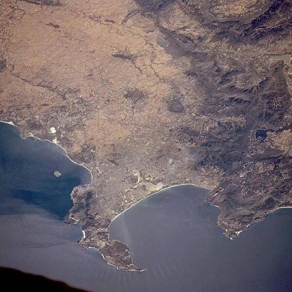
Cape Town is considered to be one of the great scenic cities of the world. Situated in the southwestern part of Cape Province, it lies at the foot of Table Mountain (1,088 m; 3,567 feet in altitude) on the shore of Table Bay, in which lies Robben Island. Because the mountains obstruct inland expansion, the city has developed along the coast. The Cape of Good Hope appears at the southern tip of the Cape Peninsula. Photo courtesy of NASA.
Cape Town is considered to be one of the great scenic cities of the world. Situated in the southwestern part of Cape Province, it lies at the foot of Table Mountain (1,088 m; 3,567 feet in altitude) on the shore of Table Bay, in which lies Robben Island. Because the mountains obstruct inland expansion, the city has developed along the coast. The Cape of Good Hope appears at the southern tip of the Cape Peninsula. Photo courtesy of NASA. • CIA World Factbook • 2020
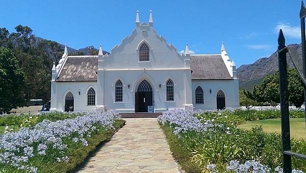
Franschhoek (Afrikaans for "French Corner") is a small town in Western Cape Province and one of the oldest towns in the Republic of South Africa. Settlement by French Huguenot refugees began in 1688 and many of their original farms are today renowned wineries. The town, at the very heart of the South African wine industry, still retains much of its historic Dutch Cape-style architecture, including this much photographed Dutch Reformed Church.
Franschhoek (Afrikaans for "French Corner") is a small town in Western Cape Province and one of the oldest towns in the Republic of South Africa. Settlement by French Huguenot refugees began in 1688 and many of their original farms are today renowned wineries. The town, at the very heart of the South African wine industry, still retains much of its historic Dutch Cape-style architecture, including this much photographed Dutch Reformed Church. • CIA World Factbook • 2020
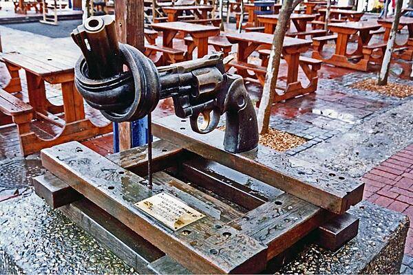
Sculpture at a Cape Town shopping mall.
Sculpture at a Cape Town shopping mall. • CIA World Factbook • 2020
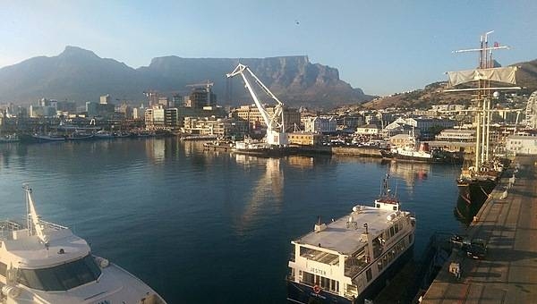
Cape Town waterfront. Pleasure boats, ferries, and cranes fill the harbor.
Cape Town waterfront. Pleasure boats, ferries, and cranes fill the harbor. • CIA World Factbook • 2020
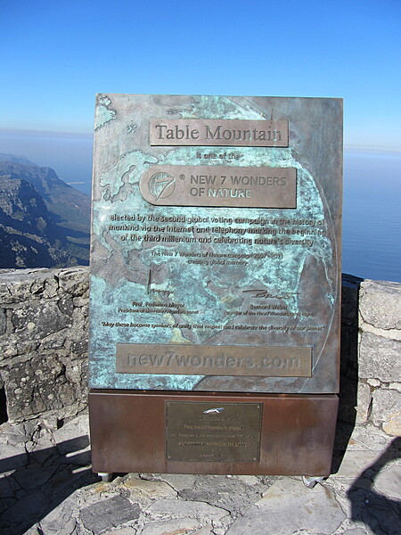
Monument marking Table Mountain as one of the New 7 Wonders of Nature.
Monument marking Table Mountain as one of the New 7 Wonders of Nature. • CIA World Factbook • 2020
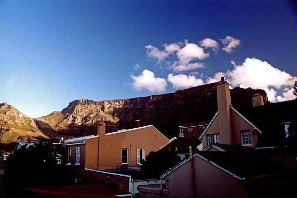
Table Mountain - a level plataeu about 3 km (2 mi) from side to side - overlooking some homes in Cape Town.
Table Mountain - a level plataeu about 3 km (2 mi) from side to side - overlooking some homes in Cape Town. • CIA World Factbook • 2020
31 photos available
View All Photos→Data sources: World Bank, UN Data • Updated daily •Learn about our data