›››
Canada — Media Gallery
51 items available (flags, maps, photos)
Photos
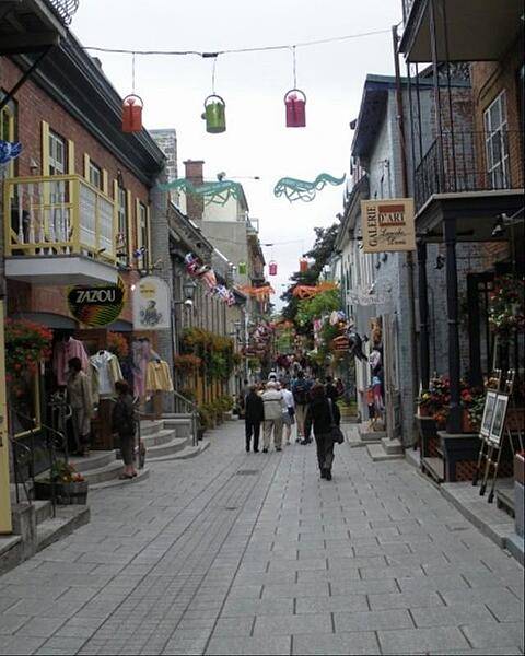
Shopping along one of Quebec City's narrow streets.
Shopping along one of Quebec City's narrow streets. • CIA World Factbook • 2020
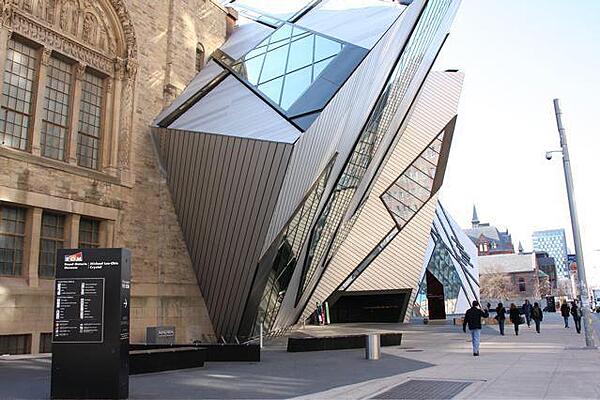
"The Crystal," the new entrance to the Royal Ontario Museum in Toronto. The ROM is Canada's largest repository of world culture and natural history.
"The Crystal," the new entrance to the Royal Ontario Museum in Toronto. The ROM is Canada's largest repository of world culture and natural history. • CIA World Factbook • 2020
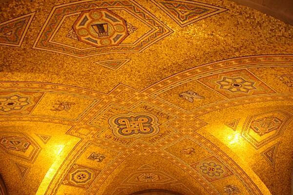
The mosaic ceiling in the rotunda of the Royal Ontario Museum in Toronto. The inscription in the middle of the dome reads: "That all men may know His work."
The mosaic ceiling in the rotunda of the Royal Ontario Museum in Toronto. The inscription in the middle of the dome reads: "That all men may know His work." • CIA World Factbook • 2020
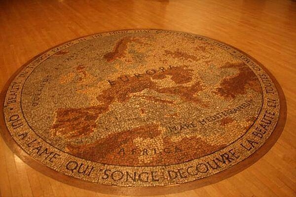
An "Old World" floor mosaic of Europe in the Royal Ontario Museum in Toronto.
An "Old World" floor mosaic of Europe in the Royal Ontario Museum in Toronto. • CIA World Factbook • 2020
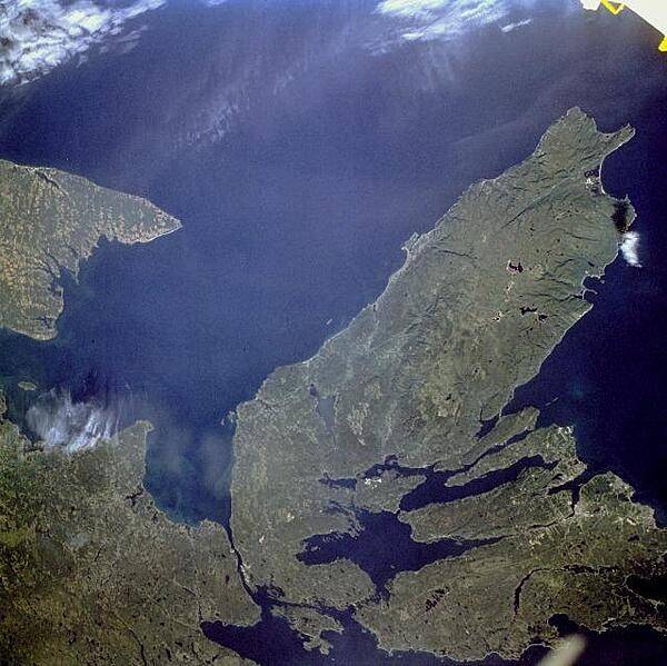
The Canadian maritime province of Nova Scotia can be divided into two separate regions - Cape Breton Island (on the right) and much larger, peninsular mainland Nova Scotia (lower left). Cape Breton Island is joined to the mainland by a causeway and a railroad spanning the narrow Strait of Canso. St. George's Bay is the small bay west of the causeway, and the Northumberland Strait separates Cape Breton Island from the eastern end of Prince Edward Island, another maritime province of Canada (visible along the west margin of the photograph). Photo courtesy of NASA.
The Canadian maritime province of Nova Scotia can be divided into two separate regions - Cape Breton Island (on the right) and much larger, peninsular mainland Nova Scotia (lower left). Cape Breton Island is joined to the mainland by a causeway and a railroad spanning the narrow Strait of Canso. St. George's Bay is the small bay west of the causeway, and the Northumberland Strait separates Cape Breton Island from the eastern end of Prince Edward Island, another maritime province of Canada (visible along the west margin of the photograph). Photo courtesy of NASA. • CIA World Factbook • 2020
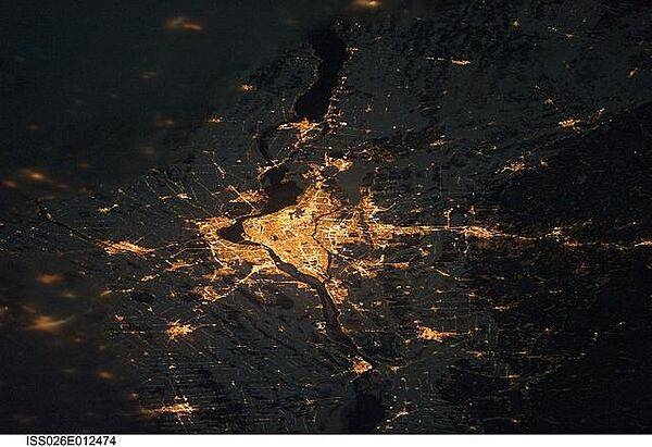
A night view of the Montreal metropolitan area is featured in this image from the International Space Station. This photo of the Montreal, Quebec metropolitan area (center) illustrates the extent of urbanization made clearly visible by city lights at night. Major roadways and industrial areas are traced by bright white lighting, while the adjacent residential and commercial land uses are characterized by more diffuse yellow-gold lighting. Rivers and other water bodies appear black, while the surrounding rural countryside is faintly illuminated by moonlight. Blurry areas at top and bottom left are caused by cloud cover. Montreal is the largest city in the dominantly French-speaking province of Quebec, and the second-largest in Canada, after Toronto. While the city of Montreal proper is located on - and almost completely covers - the Island of Montreal at the confluence of the St. Lawrence (center) and Ottawa Rivers (not visible), the city takes its name from Mont Royal located at the city's center. Image courtesy of NASA.
A night view of the Montreal metropolitan area is featured in this image from the International Space Station. This photo of the Montreal, Quebec metropolitan area (center) illustrates the extent of urbanization made clearly visible by city lights at night. Major roadways and industrial areas are traced by bright white lighting, while the adjacent residential and commercial land uses are characterized by more diffuse yellow-gold lighting. Rivers and other water bodies appear black, while the surrounding rural countryside is faintly illuminated by moonlight. Blurry areas at top and bottom left are caused by cloud cover. Montreal is the largest city in the dominantly French-speaking province of Quebec, and the second-largest in Canada, after Toronto. While the city of Montreal proper is located on - and almost completely covers - the Island of Montreal at the confluence of the St. Lawrence (center) and Ottawa Rivers (not visible), the city takes its name from Mont Royal located at the city's center. Image courtesy of NASA. • CIA World Factbook • 2020

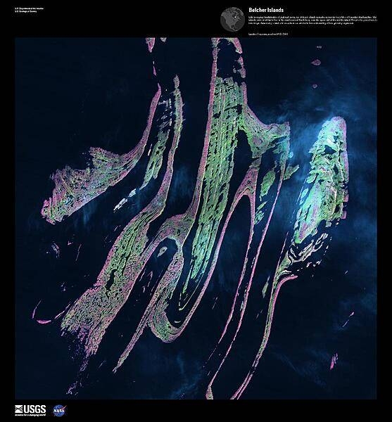
Like sweeping brushstrokes of pink and green, the Belcher Islands meander across the deep blue of the James Bay portion of the Hudson Bay. The islands shown in this enhanced satellite image are part of the Belcher archipelago, which is comprised of approximately 1,500 islands and covers an area of 3,000 sq km (1,160 sq mi). The islands' only inhabitants live in the small town of Sanikiluaq, near the upper end of the middle island. Despite the green hues in this image, these rocky islands are too cold - and the soil is too thin - to sustain more than a smattering of low-growing vegetation. Image courtesy of USGS.
Like sweeping brushstrokes of pink and green, the Belcher Islands meander across the deep blue of the James Bay portion of the Hudson Bay. The islands shown in this enhanced satellite image are part of the Belcher archipelago, which is comprised of approximately 1,500 islands and covers an area of 3,000 sq km (1,160 sq mi). The islands' only inhabitants live in the small town of Sanikiluaq, near the upper end of the middle island. Despite the green hues in this image, these rocky islands are too cold - and the soil is too thin - to sustain more than a smattering of low-growing vegetation. Image courtesy of USGS. • CIA World Factbook • 2020
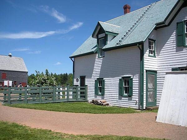
Green Gables farmhouse, Cavendish, Prince Edward Island. The farm and its environs served as the setting for the popular Anne of Green Gables novels by Lucy Maud Montgomery.
Green Gables farmhouse, Cavendish, Prince Edward Island. The farm and its environs served as the setting for the popular Anne of Green Gables novels by Lucy Maud Montgomery. • CIA World Factbook • 2020
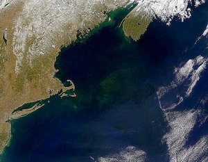
A view of Georges Bank, a large elevated area of the sea floor that separates the Gulf of Maine from the Atlantic Ocean. The Bank is situated east of Cape Cod, Massachusetts (US; on the left) and southwest of Cape Sable Island, Nova Scotia (Canada; upper right). Photo courtesy of NASA.
A view of Georges Bank, a large elevated area of the sea floor that separates the Gulf of Maine from the Atlantic Ocean. The Bank is situated east of Cape Cod, Massachusetts (US; on the left) and southwest of Cape Sable Island, Nova Scotia (Canada; upper right). Photo courtesy of NASA. • CIA World Factbook • 2020
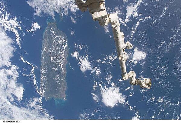
The Space Station Remote Manipulator System (SSRMS) or Canadarm2 appears against the Caribbean Sea in this view taken from the International Space Station. Puerto Rico is the large island on the left side of the frame. Image courtesy of NASA.
The Space Station Remote Manipulator System (SSRMS) or Canadarm2 appears against the Caribbean Sea in this view taken from the International Space Station. Puerto Rico is the large island on the left side of the frame. Image courtesy of NASA. • CIA World Factbook • 2020
Waterfall near the a replica Wendat (Huron) village.
Waterfall near the a replica Wendat (Huron) village. • CIA World Factbook • 2020
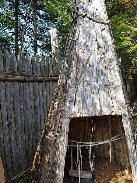
A smoke house at the replica Wendat (Huron) village.
A smoke house at the replica Wendat (Huron) village. • CIA World Factbook • 2020
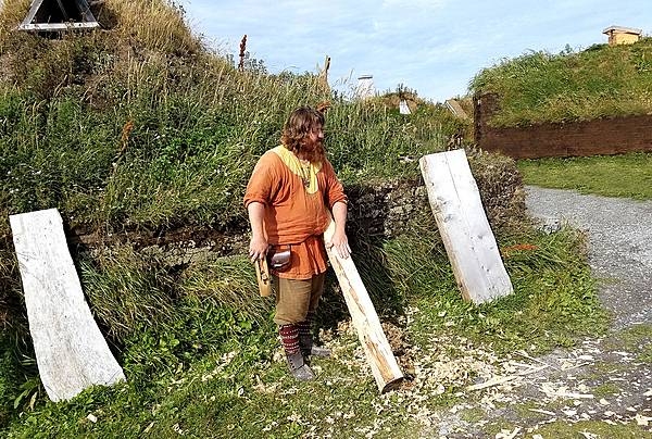
A Norse-period interpreter at L’Anse Aux Meadows planing logs.
A Norse-period interpreter at L’Anse Aux Meadows planing logs. • CIA World Factbook • 2020
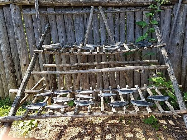
Rack for drying fish at the replica Wendat (Huron) settlement.
Rack for drying fish at the replica Wendat (Huron) settlement. • CIA World Factbook • 2020

Replica storage building at L’Anse Aux Meadows.
Replica storage building at L’Anse Aux Meadows. • CIA World Factbook • 2020
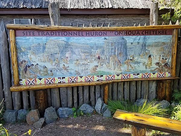
Sign at Wendake, a 300-year-old community established by the Wendat (Huron) people northwest of Quebec City. The reserve includes a replica Wendat village.
Sign at Wendake, a 300-year-old community established by the Wendat (Huron) people northwest of Quebec City. The reserve includes a replica Wendat village. • CIA World Factbook • 2020
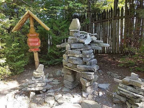
Inukshuks or structures of rough stones stacked in the form of human figures traditionally used by Inuit people as a landmark or a commemorative sign - at the replica Wendat (Huron) village outside Quebec City.
Inukshuks or structures of rough stones stacked in the form of human figures traditionally used by Inuit people as a landmark or a commemorative sign - at the replica Wendat (Huron) village outside Quebec City. • CIA World Factbook • 2020
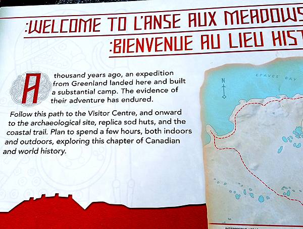
Welcoming sign at L’Anse Aux Meadows in Newfoundland. The archeological site dates from about 1000 A.D. It is thought to be the first Norse holding in North America - predating Columbus' arrival by five centuries. The site probably was ship repair station, serving Norse ships from Greenland, rather than a settlement. At the time, it was closer to the water and surrounded by trees. The site may only have been in use for about a century before being abandoned.
Welcoming sign at L’Anse Aux Meadows in Newfoundland. The archeological site dates from about 1000 A.D. It is thought to be the first Norse holding in North America - predating Columbus' arrival by five centuries. The site probably was ship repair station, serving Norse ships from Greenland, rather than a settlement. At the time, it was closer to the water and surrounded by trees. The site may only have been in use for about a century before being abandoned. • CIA World Factbook • 2020
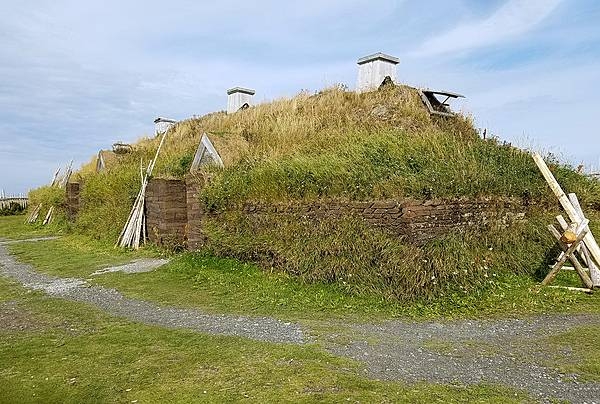
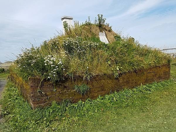
Replica Norse sod longhouse, north of the archaeological site at L’Anse Aux Meadows.
Replica Norse sod longhouse, north of the archaeological site at L’Anse Aux Meadows. • CIA World Factbook • 2020
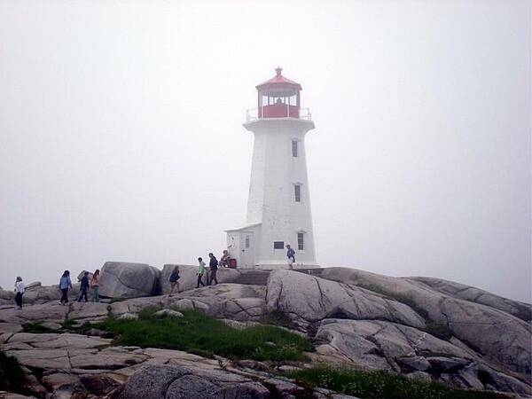
Peggys Point Lighthouse in Peggys Cove, Nova Scotia is a very popular tourist site operated by the Canadian Coast Guard. The lighthouse, the second one on this site, was built in 1914 and is 15 m (50 ft) tall.
Peggys Point Lighthouse in Peggys Cove, Nova Scotia is a very popular tourist site operated by the Canadian Coast Guard. The lighthouse, the second one on this site, was built in 1914 and is 15 m (50 ft) tall. • CIA World Factbook • 2020
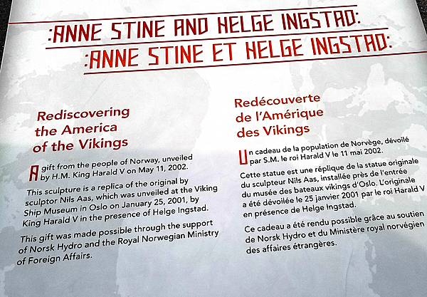
Sign describing the statue of Anne Stine and Helge Ingstad, the co-discoverers of L’Anse Aux Meadows archeological site.
Sign describing the statue of Anne Stine and Helge Ingstad, the co-discoverers of L’Anse Aux Meadows archeological site. • CIA World Factbook • 2020
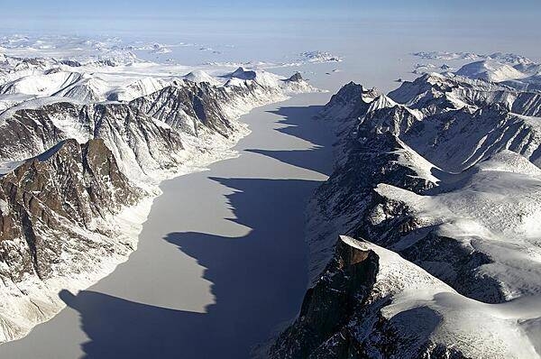
The image captures an ice covered fjord on Baffin Island with Davis Strait in the background. Image Credit: NASA/Michael Studinger.
The image captures an ice covered fjord on Baffin Island with Davis Strait in the background. Image Credit: NASA/Michael Studinger. • CIA World Factbook • 2020
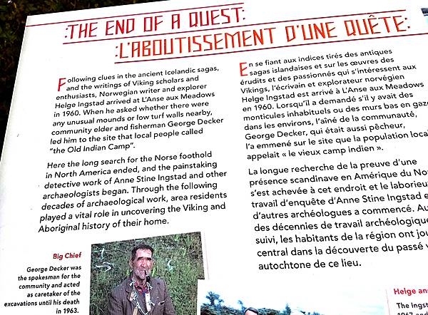
Information of the discovery of the Norse camp at L’Anse Aux Meadows by Helge Ingstad in 1960. The site was first studied by his wife, the archaeologist Anne Stine.
Information of the discovery of the Norse camp at L’Anse Aux Meadows by Helge Ingstad in 1960. The site was first studied by his wife, the archaeologist Anne Stine. • CIA World Factbook • 2020
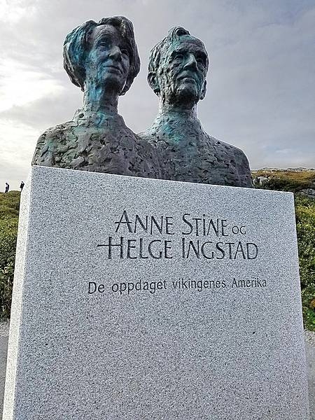
Statue of Anne Stine and Helge Ingstad, the co-discoverers of the archeological site, dedicated by the king of Norway at L’Anse Aux Meadows in 2002.
Statue of Anne Stine and Helge Ingstad, the co-discoverers of the archeological site, dedicated by the king of Norway at L’Anse Aux Meadows in 2002. • CIA World Factbook • 2020
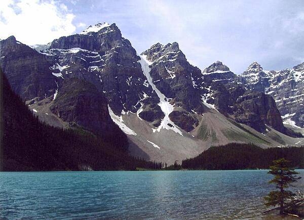
Moraine Lake in Banff National Park, Alberta. The intense blue waters of the lake come from the run-off of nearby glaciers.
Moraine Lake in Banff National Park, Alberta. The intense blue waters of the lake come from the run-off of nearby glaciers. • CIA World Factbook • 2020
Another view of a replica Norse sod longhouse, north of the archaeological site at L’Anse Aux Meadows.
Another view of a replica Norse sod longhouse, north of the archaeological site at L’Anse Aux Meadows. • CIA World Factbook • 2020
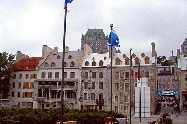
Residential apartment buildings in Quebec City echo the shape of Chateau Frontenac.
Residential apartment buildings in Quebec City echo the shape of Chateau Frontenac. • CIA World Factbook • 2020
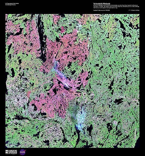
Extensive wetlands lie near the town of Yellowknife, just north of Great Slave Lake in the Northwest Territories. The hundreds of shallow lakes, shown as black in this false-color satellite image, have formed in grooves in the landscape that were carved by glaciers during the last Ice Age. The red in this image could represent grass or marshland, while the green is taller vegetation, such as shrubs and trees. Image courtesy of USGS.
Extensive wetlands lie near the town of Yellowknife, just north of Great Slave Lake in the Northwest Territories. The hundreds of shallow lakes, shown as black in this false-color satellite image, have formed in grooves in the landscape that were carved by glaciers during the last Ice Age. The red in this image could represent grass or marshland, while the green is taller vegetation, such as shrubs and trees. Image courtesy of USGS. • CIA World Factbook • 2020

The Ontario Legislative Building in Toronto houses the viceregal suite of the Lieutenant Governor of Ontario, the Legislative Assembly of Ontario, and the offices for members of the provincial parliament.
The Ontario Legislative Building in Toronto houses the viceregal suite of the Lieutenant Governor of Ontario, the Legislative Assembly of Ontario, and the offices for members of the provincial parliament. • CIA World Factbook • 2020

CIA World Factbook • 2020
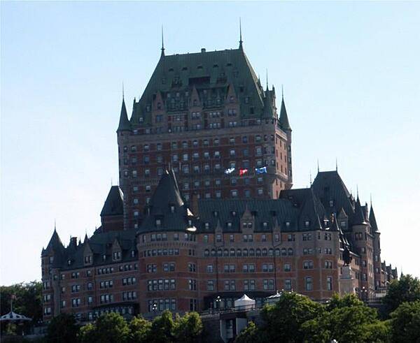
The grand hotel Chateau Frontenac is a popular tourist attraction in Quebec City.
The grand hotel Chateau Frontenac is a popular tourist attraction in Quebec City. • CIA World Factbook • 2020
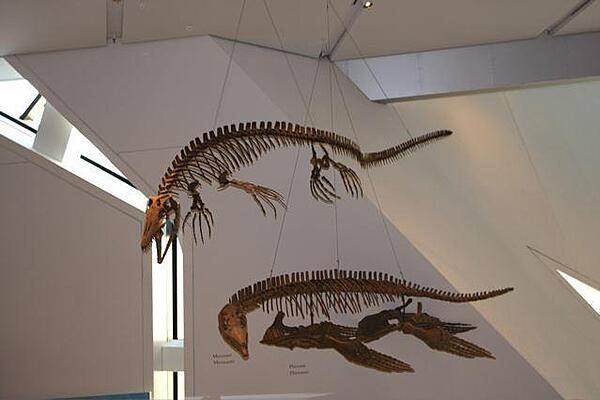
Fossil reptiles on display at the Royal Ontario Museum in Toronto.
Fossil reptiles on display at the Royal Ontario Museum in Toronto. • CIA World Factbook • 2020
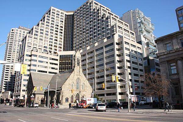
The historic Church of the Redeemer on the northeast corner of Bloor St. and Avenue Rd. in Toronto was completed in 1879. It is dwarfed by the massive Four Seasons Renaissance Centre.
The historic Church of the Redeemer on the northeast corner of Bloor St. and Avenue Rd. in Toronto was completed in 1879. It is dwarfed by the massive Four Seasons Renaissance Centre. • CIA World Factbook • 2020
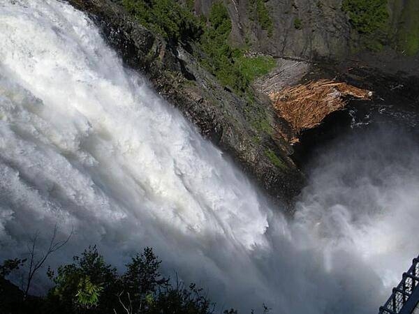
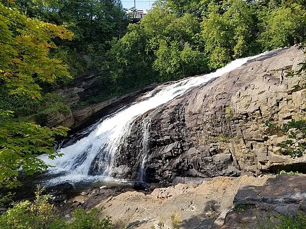
At 84 m (275 ft) Montmorency Falls in Quebec are 30 m higher than Niagara Falls.
At 84 m (275 ft) Montmorency Falls in Quebec are 30 m higher than Niagara Falls. • CIA World Factbook • 2020

Temple Anshe Sholom in Hamilton, Ontario is the first Reform synagogue in Canada.
Temple Anshe Sholom in Hamilton, Ontario is the first Reform synagogue in Canada. • CIA World Factbook • 2020
CIA World Factbook • 2020
Cavendish Beach, Prince Edward Island.
Cavendish Beach, Prince Edward Island. • CIA World Factbook • 2020
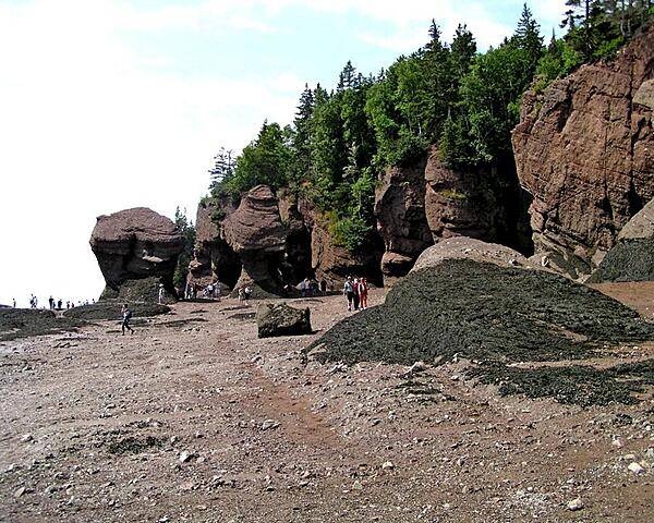
The Bay of Fundy, between the provinces of New Brunswick and Nova Scotia, has one of the highest tidal ranges in the world - on average about 17 m (56 ft). At low tide, one can literally walk on the bottom of the ocean.
The Bay of Fundy, between the provinces of New Brunswick and Nova Scotia, has one of the highest tidal ranges in the world - on average about 17 m (56 ft). At low tide, one can literally walk on the bottom of the ocean. • CIA World Factbook • 2020
CIA World Factbook • 2020
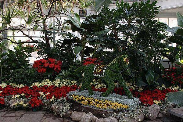
Inside one of the six conservatories at Allan Gardens, a park and indoor botanical garden in Toronto. Opened in 1860, Allan Gardens is one of the oldest parks in Toronto; it is named after a former mayor and senator who donated the land to the city.
Inside one of the six conservatories at Allan Gardens, a park and indoor botanical garden in Toronto. Opened in 1860, Allan Gardens is one of the oldest parks in Toronto; it is named after a former mayor and senator who donated the land to the city. • CIA World Factbook • 2020
A view of Georges Bank, a large elevated area of the sea floor that separates the Gulf of Maine from the Atlantic Ocean. The Bank is situated east of Cape Cod, Massachusetts (US; on the left) and southwest of Cape Sable Island, Nova Scotia (Canada; upper right). Photo courtesy of NASA.
A view of Georges Bank, a large elevated area of the sea floor that separates the Gulf of Maine from the Atlantic Ocean. The Bank is situated east of Cape Cod, Massachusetts (US; on the left) and southwest of Cape Sable Island, Nova Scotia (Canada; upper right). Photo courtesy of NASA. • CIA World Factbook • 2020
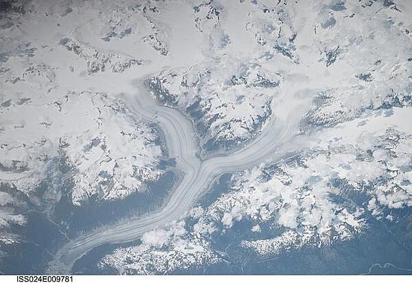
The snow-covered Coastal Mountains of British Columbia are featured in this image taken from the International Space Station. The long smooth areas are glaciers. Photo courtesy of NASA.
The snow-covered Coastal Mountains of British Columbia are featured in this image taken from the International Space Station. The long smooth areas are glaciers. Photo courtesy of NASA. • CIA World Factbook • 2020
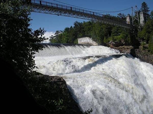
The Montmorency Falls form at the mouth of the Montmorency River as it drops over a cliff shore into the St. Lawrence River. The falls are the highest in the province of Quebec.
The Montmorency Falls form at the mouth of the Montmorency River as it drops over a cliff shore into the St. Lawrence River. The falls are the highest in the province of Quebec. • CIA World Factbook • 2020
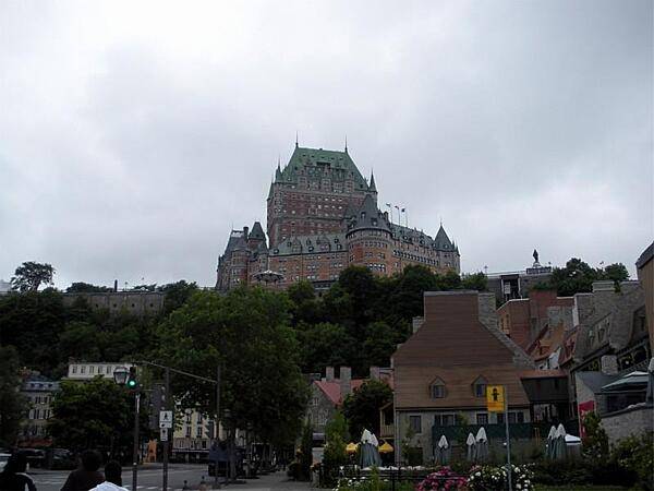
Chateau Frontenac towers over the houses of Quebec City.
Chateau Frontenac towers over the houses of Quebec City. • CIA World Factbook • 2020
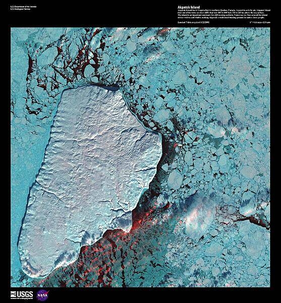
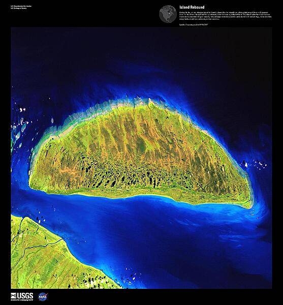
Akpatok Island, the largest island in Ungava Bay in northern Quebec, dominates this enhanced satellite image. Accessible only by air, Akpatok Island rises out of the water, sheer cliffs soar 150 to 245 m (500 to 800 ft) above the sea surface. The island is uninhabited, except for a Dorset (paleo-Eskimo) settlement that was abandoned by 1900 and a defunct exploratory oil drill, built in 1971. The island is an important sanctuary for cliff-nesting seabirds including its namesake the Akpat or the Thick-billed Murre, which nests in the pock-marked cliffs on the northern and southern ends of the island. Numerous ice floes around the island attract walrus and whales, making Akpatok a traditional hunting ground for native Inuit people. Image courtesy of USGS.
Akpatok Island, the largest island in Ungava Bay in northern Quebec, dominates this enhanced satellite image. Accessible only by air, Akpatok Island rises out of the water, sheer cliffs soar 150 to 245 m (500 to 800 ft) above the sea surface. The island is uninhabited, except for a Dorset (paleo-Eskimo) settlement that was abandoned by 1900 and a defunct exploratory oil drill, built in 1971. The island is an important sanctuary for cliff-nesting seabirds including its namesake the Akpat or the Thick-billed Murre, which nests in the pock-marked cliffs on the northern and southern ends of the island. Numerous ice floes around the island attract walrus and whales, making Akpatok a traditional hunting ground for native Inuit people. Image courtesy of USGS. • CIA World Factbook • 2020
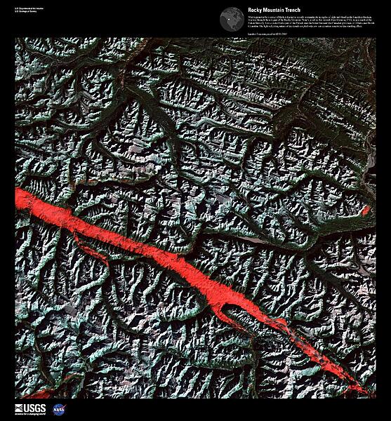
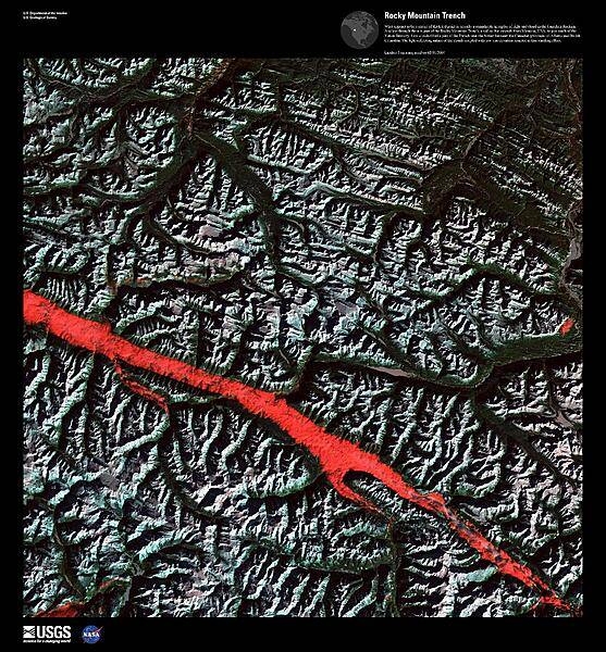
What appears to be a stroke of thick red paint in this false-color satellite image is actually a remarkable interplay of light and cloud in the Canadian Rockies. Angling through the mountains is part of the Rocky Mountain Trench, a valley that extends from Montana in the US, to just south of the Yukon Territory in Canada. Low clouds filled a part of the Trench near the border between the provinces of Alberta and British Columbia. The light-reflecting nature of the clouds coupled with low sun elevation resulted in this startling effect. Image courtesy of USGS.
What appears to be a stroke of thick red paint in this false-color satellite image is actually a remarkable interplay of light and cloud in the Canadian Rockies. Angling through the mountains is part of the Rocky Mountain Trench, a valley that extends from Montana in the US, to just south of the Yukon Territory in Canada. Low clouds filled a part of the Trench near the border between the provinces of Alberta and British Columbia. The light-reflecting nature of the clouds coupled with low sun elevation resulted in this startling effect. Image courtesy of USGS. • CIA World Factbook • 2020
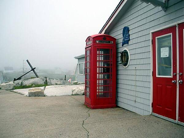
In the fishing community of Peggys Cove, Nova Scotia.
In the fishing community of Peggys Cove, Nova Scotia. • CIA World Factbook • 2020
CIA World Factbook • 2020
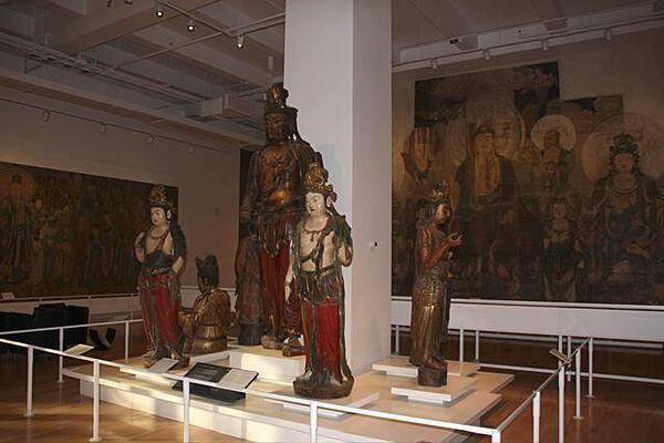
An Oriental exhibit at the Royal Ontario Museum in Toronto.
An Oriental exhibit at the Royal Ontario Museum in Toronto. • CIA World Factbook • 2020
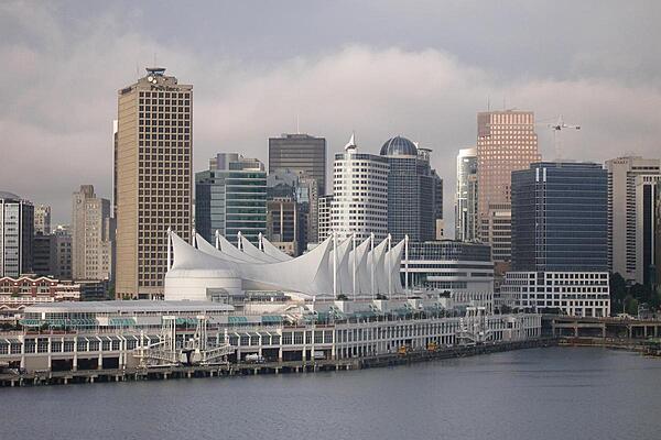
The white sails of Canada Place in downtown Vancouver. The site serves as a hotel, exhibition, and convention center, as well as a cruise ship terminal.
The white sails of Canada Place in downtown Vancouver. The site serves as a hotel, exhibition, and convention center, as well as a cruise ship terminal. • CIA World Factbook • 2020
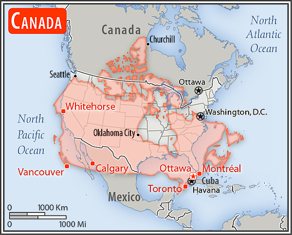
Area comparison map
Area comparison map • CIA World Factbook • 2020
Media source: CIA World Factbook (2020) — Public Domain