›››
Costa Rica — Media Gallery
14 items available (flags, maps, photos)
Photos
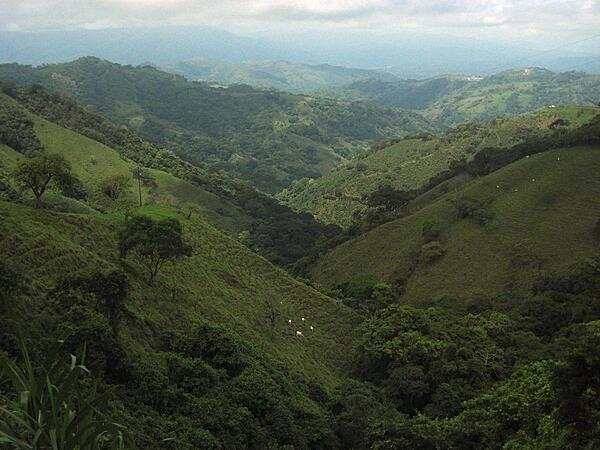
Mountainous countryside along the road to the capital of San Jose.
Mountainous countryside along the road to the capital of San Jose. • CIA World Factbook • 2020
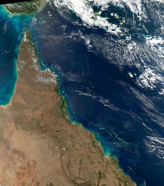
This view of the Queensland coast of northeast Australia taken by the Aqua satellite vividly shows the many offshore reefs that together form the Great Barrier Reef. The various white specks in the deeper blue waters of the Coral Sea to the east are some of the reefs, cays, and islets that make up the Coral Sea Islands. Image courtesy of NASA.
This view of the Queensland coast of northeast Australia taken by the Aqua satellite vividly shows the many offshore reefs that together form the Great Barrier Reef. The various white specks in the deeper blue waters of the Coral Sea to the east are some of the reefs, cays, and islets that make up the Coral Sea Islands. Image courtesy of NASA. • CIA World Factbook • 2020
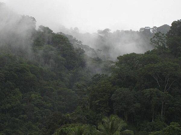
Mist rising over the rainforest near Gulfito on the Pacific coast near the border of Panama. This region is one of the wettest spots in the world.
Mist rising over the rainforest near Gulfito on the Pacific coast near the border of Panama. This region is one of the wettest spots in the world. • CIA World Factbook • 2020
CIA World Factbook • 2020
CIA World Factbook • 2020
CIA World Factbook • 2020

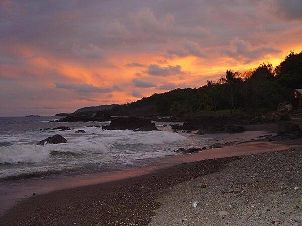
Fiery clouds hover over a darkened jungle coastline at sunset.
Fiery clouds hover over a darkened jungle coastline at sunset. • CIA World Factbook • 2020
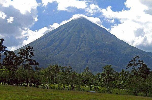
Located in the north central part of the country, Arenal Volcano is one of Costa Rica's scenic wonders. The volcano was dormant for hundreds of years until it suddenly erupted in 1968. It remained active, off and on, for decades, but has been relatively quiescent since 2010, with only occasional rumbles.
Located in the north central part of the country, Arenal Volcano is one of Costa Rica's scenic wonders. The volcano was dormant for hundreds of years until it suddenly erupted in 1968. It remained active, off and on, for decades, but has been relatively quiescent since 2010, with only occasional rumbles. • CIA World Factbook • 2020
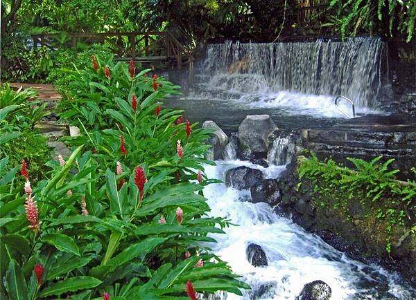
The waters of the Tabacon Hot Springs that flow through the jungle are naturally heated by the nearby Arenal Volcano.
The waters of the Tabacon Hot Springs that flow through the jungle are naturally heated by the nearby Arenal Volcano. • CIA World Factbook • 2020
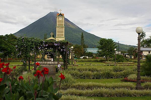
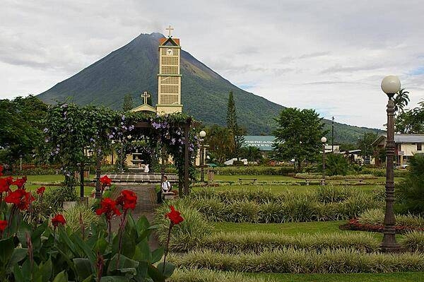
Volcano Arenal, seen here from the town of La Fortuna, was dormant for hundreds of years until it suddenly erupted in 1968. It remained active, off and on, for decades, but has been relatively quiescent since 2010, with only occasional rumbles.
Volcano Arenal, seen here from the town of La Fortuna, was dormant for hundreds of years until it suddenly erupted in 1968. It remained active, off and on, for decades, but has been relatively quiescent since 2010, with only occasional rumbles. • CIA World Factbook • 2020
CIA World Factbook • 2020
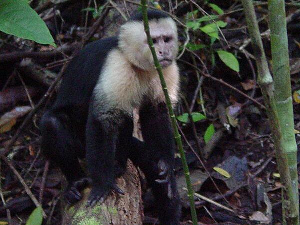
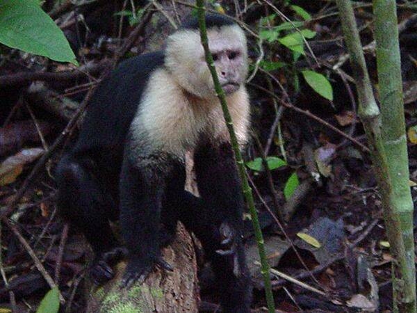
A monkey in Manuel Antonio National Park.
A monkey in Manuel Antonio National Park. • CIA World Factbook • 2020

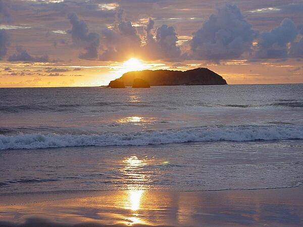
A sunset and its reflection create a golden sheen along a Costa Rican shoreline.
A sunset and its reflection create a golden sheen along a Costa Rican shoreline. • CIA World Factbook • 2020
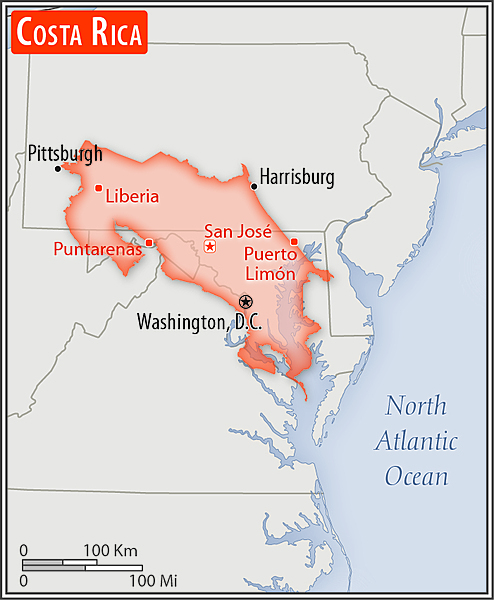
Area comparison map
Area comparison map • CIA World Factbook • 2020
Media source: CIA World Factbook (2020) — Public Domain