›››
Micronesia, Fed. Sts. — Media Gallery
9 items available (flags, maps, photos)
Photos
CIA World Factbook • 2020
CIA World Factbook • 2020
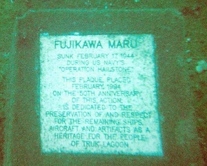
Underwater plaque in Chuuk (Truk) Lagoon.
Underwater plaque in Chuuk (Truk) Lagoon. • CIA World Factbook • 2020

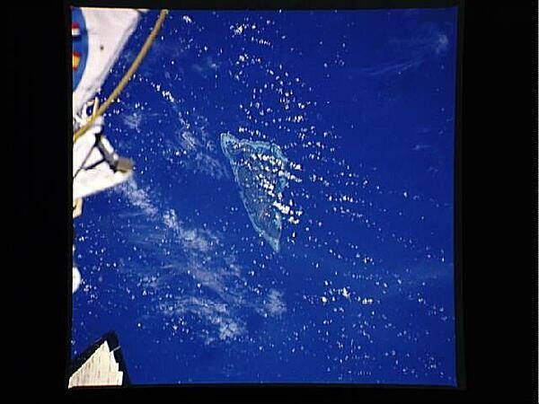
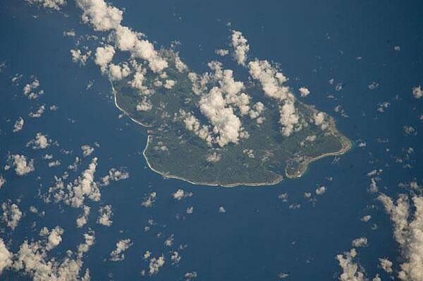
The State of Kosrae is the easternmost of the four states that make up the Federated States of Micronesia; it includes the main island of Kosrae and about a dozen nearby islands and islets. The island is located approximately 600 Km (370 mi) north of the equator, between Guam and the Hawaiian Islands. Its land area is approximately 110 sq km (42 sq mi). Image courtesy of NASA.
The State of Kosrae is the easternmost of the four states that make up the Federated States of Micronesia; it includes the main island of Kosrae and about a dozen nearby islands and islets. The island is located approximately 600 Km (370 mi) north of the equator, between Guam and the Hawaiian Islands. Its land area is approximately 110 sq km (42 sq mi). Image courtesy of NASA. • CIA World Factbook • 2020
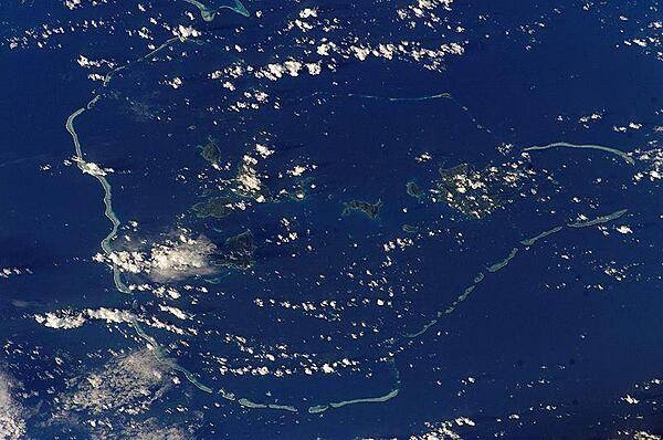
Classically shaped Nukuoro Atoll is one of 607 islands that make up the Federated States of Micronesia. It is also a municipality of the state of Pohnpei, Federated States of Micronesia. The atoll has a population of only several hundred people. The total area, including the lagoon, is 40 sq km, with a land area of only 1.7 sq km, which is divided among more than 40 islets that lie on the northern, eastern, and southern sides of the lagoon. By far the largest islet is Nukuoro islet in the southeast, which is the center of population and the capital of the municipality. Vegetation is most prominent on the northeast and east portions of the atoll that face the dominant Easterly winds. Swells driven by these winds can be seen approaching from the east-southeast (right) and wrapping around the atoll to produce an interference pattern on the downwind side. Water in the lagoon is calm in comparison. A coral head appears dead center of the photo. Image courtesy of NASA.
Classically shaped Nukuoro Atoll is one of 607 islands that make up the Federated States of Micronesia. It is also a municipality of the state of Pohnpei, Federated States of Micronesia. The atoll has a population of only several hundred people. The total area, including the lagoon, is 40 sq km, with a land area of only 1.7 sq km, which is divided among more than 40 islets that lie on the northern, eastern, and southern sides of the lagoon. By far the largest islet is Nukuoro islet in the southeast, which is the center of population and the capital of the municipality. Vegetation is most prominent on the northeast and east portions of the atoll that face the dominant Easterly winds. Swells driven by these winds can be seen approaching from the east-southeast (right) and wrapping around the atoll to produce an interference pattern on the downwind side. Water in the lagoon is calm in comparison. A coral head appears dead center of the photo. Image courtesy of NASA. • CIA World Factbook • 2020

Pohnpei (on the right) is the largest, highest, most populous, and most developed single island in the Federated States of Micronesia. The islanders of Pohnpei have a reputation as being the most welcoming of outsiders among residents of the island group. Pohnpei also contains a wealth of biodiversity and is one of the wettest places on earth with annual recorded rainfall exceeding 7.6 m (25 ft) each year in certain mountainous locations. Image courtesy of NASA.
Pohnpei (on the right) is the largest, highest, most populous, and most developed single island in the Federated States of Micronesia. The islanders of Pohnpei have a reputation as being the most welcoming of outsiders among residents of the island group. Pohnpei also contains a wealth of biodiversity and is one of the wettest places on earth with annual recorded rainfall exceeding 7.6 m (25 ft) each year in certain mountainous locations. Image courtesy of NASA. • CIA World Factbook • 2020
CIA World Factbook • 2020
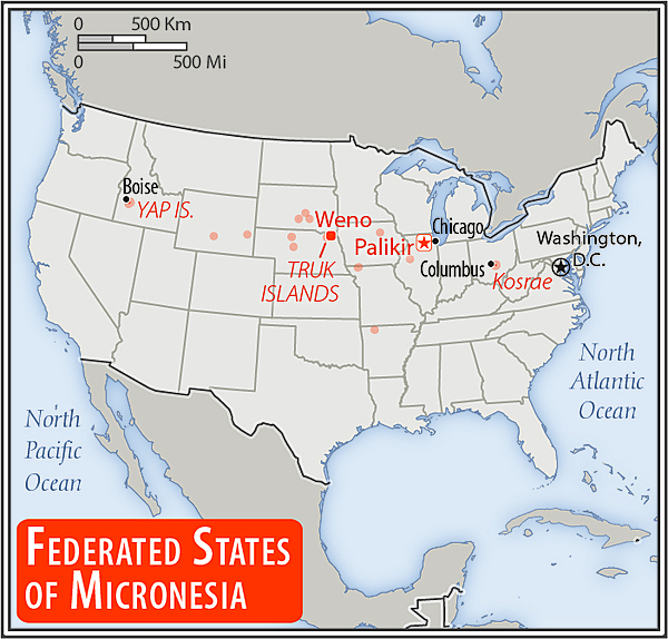
Area comparison map
Area comparison map • CIA World Factbook • 2020

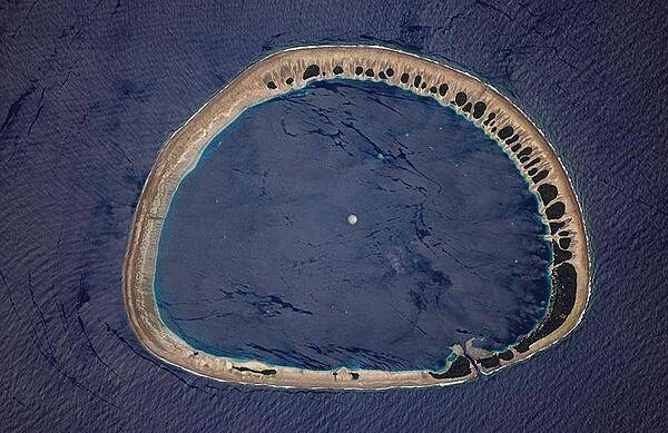
Chuuk Lagoon (formerly Truk Lagoon) is a sheltered body of water in the central Pacific, about 1,800 km north-east of New Guinea. It is part of Chuuk State within the Federated States of Micronesia. The atoll enclosing the lagoon consists of a protective reef, 225 km (140 mi) around, forming a natural harbor 79 by 50 km (49 by 30 mi), with an area of 2,130 sq km (820 sq mi). It has a land area of some 127 square km (49 sq mi). Image courtesy of NASA.
Chuuk Lagoon (formerly Truk Lagoon) is a sheltered body of water in the central Pacific, about 1,800 km north-east of New Guinea. It is part of Chuuk State within the Federated States of Micronesia. The atoll enclosing the lagoon consists of a protective reef, 225 km (140 mi) around, forming a natural harbor 79 by 50 km (49 by 30 mi), with an area of 2,130 sq km (820 sq mi). It has a land area of some 127 square km (49 sq mi). Image courtesy of NASA. • CIA World Factbook • 2020
Media source: CIA World Factbook (2020) — Public Domain