›››
Greece — Media Gallery
78 items available (flags, maps, photos)
Photos
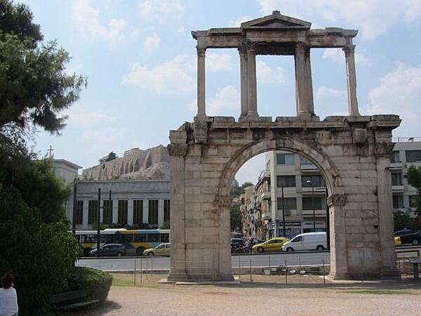
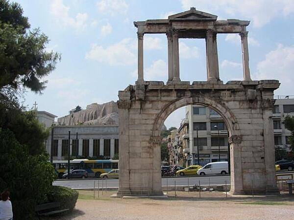
Hadrian's Arch in downtown Athens was built in A.D. 131 or 132 to honor the Roman Emperor Hadrian, possibly for restoring much of the city and completing the nearby Temple of Olympian Zeus. The Parthenon and Acropolis can be seen in the left background.
Hadrian's Arch in downtown Athens was built in A.D. 131 or 132 to honor the Roman Emperor Hadrian, possibly for restoring much of the city and completing the nearby Temple of Olympian Zeus. The Parthenon and Acropolis can be seen in the left background. • CIA World Factbook • 2020
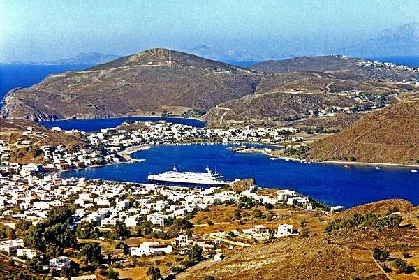
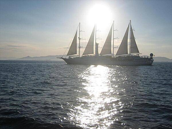
Harbor and ship on the island of Patmos, as seen from the shrine of St. John the Evangelist. According to tradition, it was here that the saint, living in exile from Ephesus, wrote the Biblical "Book of Revelations."
Harbor and ship on the island of Patmos, as seen from the shrine of St. John the Evangelist. According to tradition, it was here that the saint, living in exile from Ephesus, wrote the Biblical "Book of Revelations." • CIA World Factbook • 2020
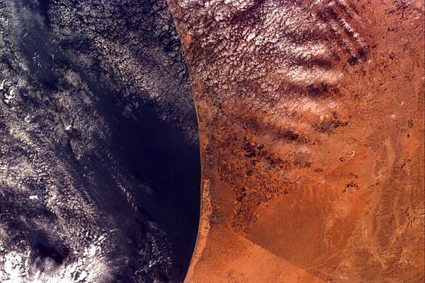
This image covers an area roughly 100x150 km; due to shuttle orientation, north is located at approximately eleven o'clock in this image. Shown are the Gaza Strip (roughly the center third of the coastal strip) and the Mediterranean Sea. The straight-line Egypt-Israel border is apparent in the lower center because of a difference in vegetation patterns, the Egyptian side (south) being less vegetated perhaps due to heavy use of the land for grazing. Photo courtesy of NASA.
This image covers an area roughly 100x150 km; due to shuttle orientation, north is located at approximately eleven o'clock in this image. Shown are the Gaza Strip (roughly the center third of the coastal strip) and the Mediterranean Sea. The straight-line Egypt-Israel border is apparent in the lower center because of a difference in vegetation patterns, the Egyptian side (south) being less vegetated perhaps due to heavy use of the land for grazing. Photo courtesy of NASA. • CIA World Factbook • 2020
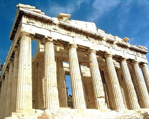
Close up of the front of the Parthenon - the temple to ancient Athens' patron deity, Athena.
Close up of the front of the Parthenon - the temple to ancient Athens' patron deity, Athena. • CIA World Factbook • 2020
CIA World Factbook • 2020
View of the 400 m (1300 ft)-deep volcanic caldera off the coast of Santorini/Thera Island. In the foreground is the island of Nea Kameni. In the background is the island of Therasia. Santorini, Nea Kameni, and Therasia were separated by a volcanic eruption termed the Minoan Eruption in about 1630 B.C.
View of the 400 m (1300 ft)-deep volcanic caldera off the coast of Santorini/Thera Island. In the foreground is the island of Nea Kameni. In the background is the island of Therasia. Santorini, Nea Kameni, and Therasia were separated by a volcanic eruption termed the Minoan Eruption in about 1630 B.C. • CIA World Factbook • 2020
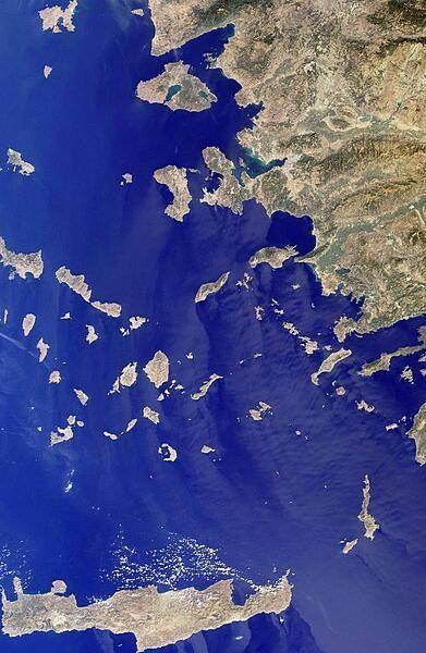
This image includes many of the islands of the East Aegean as well as part of mainland Turkey. The largest modern city in the Aegean coast is Izmir, Turkey, situated about one quarter of the image length from the top. The city is the bright coastal area near the greenish waters of Izmir Bay and southeast of the roughly triangular-shaped island of Lesvos. The lengthy island at the bottom of the photo is Crete. North of Crete, the small broken ring of islands are the remnants of the collapsed caldera of Santorini Volcano. Image courtesy of NASA.
This image includes many of the islands of the East Aegean as well as part of mainland Turkey. The largest modern city in the Aegean coast is Izmir, Turkey, situated about one quarter of the image length from the top. The city is the bright coastal area near the greenish waters of Izmir Bay and southeast of the roughly triangular-shaped island of Lesvos. The lengthy island at the bottom of the photo is Crete. North of Crete, the small broken ring of islands are the remnants of the collapsed caldera of Santorini Volcano. Image courtesy of NASA. • CIA World Factbook • 2020
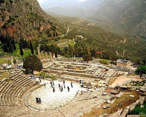
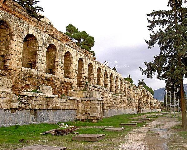
A view of the theater at Delphi and the remains of the Temple of Apollo. Delphi was the site of the most famous oracle in the classical Greek world.
A view of the theater at Delphi and the remains of the Temple of Apollo. Delphi was the site of the most famous oracle in the classical Greek world. • CIA World Factbook • 2020

CIA World Factbook • 2020
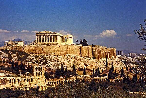
The Parthenon crowns the Acropolis in Athens. The Acropolis is a citadel on a flat, high, rocky outcrop 150 m (490 ft) above sea level and is the highest point in Athens. It preserves a number of ancient structures.
The Parthenon crowns the Acropolis in Athens. The Acropolis is a citadel on a flat, high, rocky outcrop 150 m (490 ft) above sea level and is the highest point in Athens. It preserves a number of ancient structures. • CIA World Factbook • 2020
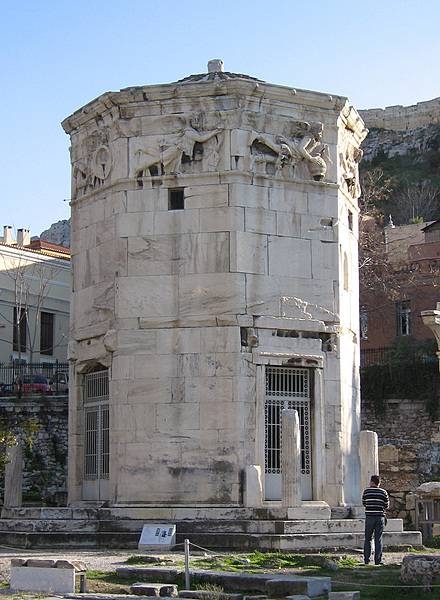
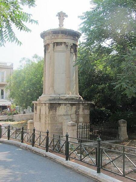
The Tower of the Winds is an octagonal marble clock tower in the Roman Agora in Athens that functioned as a horologion or "timepiece." It is considered the world's first meteorological station. The structure features a combination of sundials, a water clock, and a wind vane. The frieze on the Tower of the Winds shows the wind gods Boreas (north wind, on the left) and Skiron (northwesterly wind, on the right).
The Tower of the Winds is an octagonal marble clock tower in the Roman Agora in Athens that functioned as a horologion or "timepiece." It is considered the world's first meteorological station. The structure features a combination of sundials, a water clock, and a wind vane. The frieze on the Tower of the Winds shows the wind gods Boreas (north wind, on the left) and Skiron (northwesterly wind, on the right). • CIA World Factbook • 2020
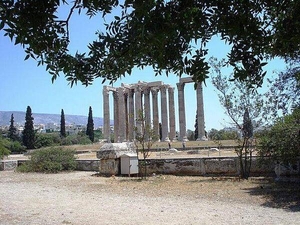
The remains of the Temple of Olympian Zeus (Olympieion) in Athens.
The remains of the Temple of Olympian Zeus (Olympieion) in Athens. • CIA World Factbook • 2020
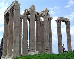
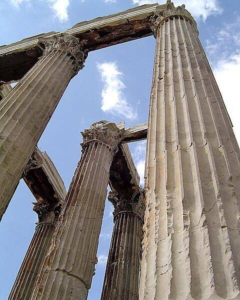
Thirteen of the columns of the Temple of Olympian Zeus (Olympieion) in Athens. Originally, 104 columns supported this massive structure, which was begun in 520 B.C. but not fully completed until A.D. 132!
Thirteen of the columns of the Temple of Olympian Zeus (Olympieion) in Athens. Originally, 104 columns supported this massive structure, which was begun in 520 B.C. but not fully completed until A.D. 132! • CIA World Factbook • 2020

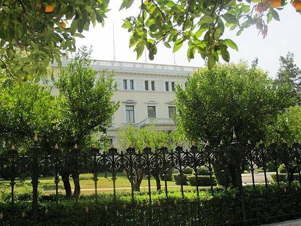
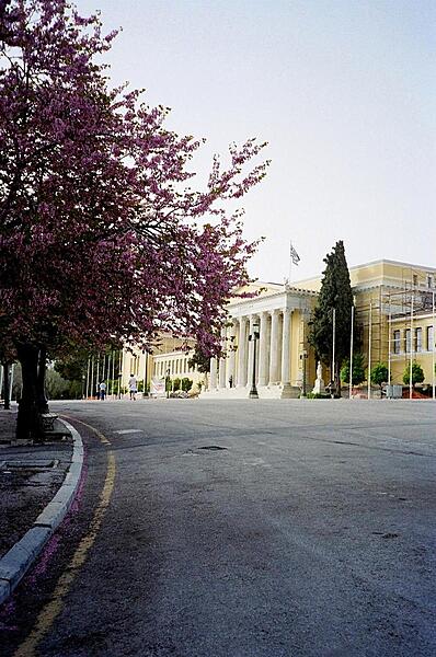
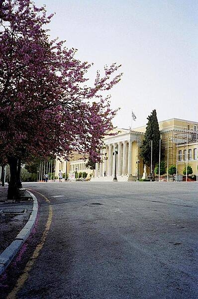
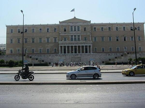
The Parliament Building in Athens was originally constructed as the Royal Palace in 1843. It is still on occasion referred to as the Old Royal Palace. It has served as the home of the Greek parliament since 1934.
The Parliament Building in Athens was originally constructed as the Royal Palace in 1843. It is still on occasion referred to as the Old Royal Palace. It has served as the home of the Greek parliament since 1934. • CIA World Factbook • 2020
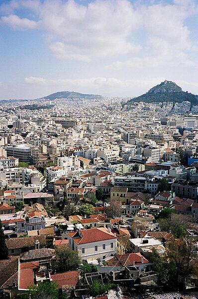
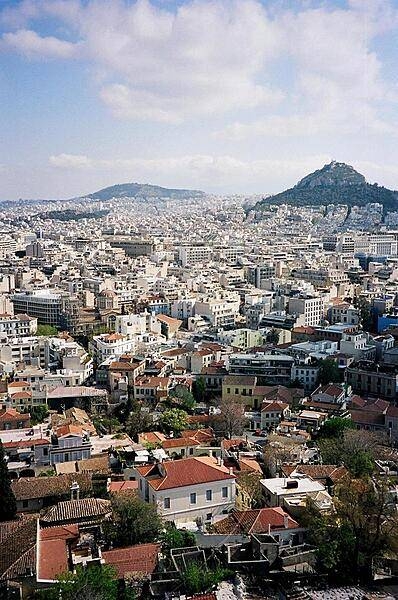
A view of the city of Athens from the Acropolis.
A view of the city of Athens from the Acropolis. • CIA World Factbook • 2020
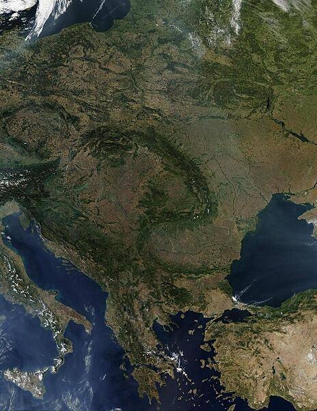
A virtually cloud-free view of Central Europe vividly displays the fishhook-shaped Carpathian Mountains that snake through the middle of the continent. Encompassed in this satellite view are all of Poland, the Czech Republic, Slovakia, Hungary, Romania, Slovenia, Greece, and all of the Balkan countries. Large parts of Lithuania, Belarus, Ukraine, Turkey, and Italy are also visible. Scattered fires are visible as red dots. Image courtesy of NASA.
A virtually cloud-free view of Central Europe vividly displays the fishhook-shaped Carpathian Mountains that snake through the middle of the continent. Encompassed in this satellite view are all of Poland, the Czech Republic, Slovakia, Hungary, Romania, Slovenia, Greece, and all of the Balkan countries. Large parts of Lithuania, Belarus, Ukraine, Turkey, and Italy are also visible. Scattered fires are visible as red dots. Image courtesy of NASA. • CIA World Factbook • 2020

CIA World Factbook • 2020

CIA World Factbook • 2020
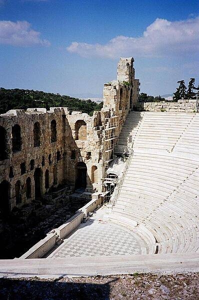
A view of the exterior of the Odeon of Herodes Atticus in Athens, constructed A.D. 161.
A view of the exterior of the Odeon of Herodes Atticus in Athens, constructed A.D. 161. • CIA World Factbook • 2020
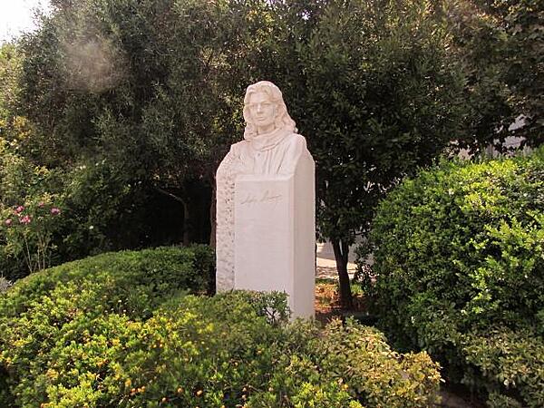
A statue of Melina Mercouri in downtown Athens. Mercouri was a world-famous actress who was active in the resistance movement against the military regime in the late 1960s and early 1970s. Later, during the 1980s and 1990s, she served as Minister of Culture. She was born in Athens and was sometimes referred to as the last Greek goddess.
A statue of Melina Mercouri in downtown Athens. Mercouri was a world-famous actress who was active in the resistance movement against the military regime in the late 1960s and early 1970s. Later, during the 1980s and 1990s, she served as Minister of Culture. She was born in Athens and was sometimes referred to as the last Greek goddess. • CIA World Factbook • 2020
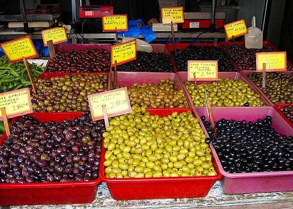
Olives from across Greece on display at an Athens market.
Olives from across Greece on display at an Athens market. • CIA World Factbook • 2020
CIA World Factbook • 2020
CIA World Factbook • 2020
CIA World Factbook • 2020
CIA World Factbook • 2020
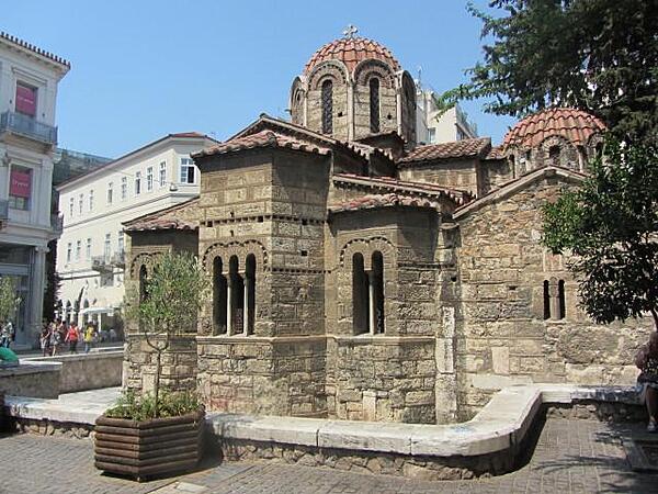
The Orthodox Church of Panaghia Kapnikarea in downtown Athens is dedicated to Saint Mary. It was built over a pagan temple in about A.D. 1050 making it one of the oldest churches in Athens.
The Orthodox Church of Panaghia Kapnikarea in downtown Athens is dedicated to Saint Mary. It was built over a pagan temple in about A.D. 1050 making it one of the oldest churches in Athens. • CIA World Factbook • 2020
CIA World Factbook • 2020
CIA World Factbook • 2020
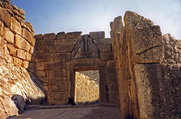
The Lion Gate at the Late Bronze Age site of Mycenae. The archeological site is located 90 km (55 mi) southwest of Athens on the Peloponnesian Peninsula. Agamemnon, Clytemnestra, and Orestes all reputedly lived in the royal palace of the fortified city.
The Lion Gate at the Late Bronze Age site of Mycenae. The archeological site is located 90 km (55 mi) southwest of Athens on the Peloponnesian Peninsula. Agamemnon, Clytemnestra, and Orestes all reputedly lived in the royal palace of the fortified city. • CIA World Factbook • 2020
CIA World Factbook • 2020
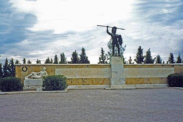
The monument to Leonidas and the Spartans at Thermopylae, 200 km (125 mi) north of Athens. The memorial structure celebrates a 480 B.C. battle in which a small army of Greeks, led by King Leonidas, held at bay for three days a vastly superior invading Persian force, thus allowing the main part of the Greek army to escape.
The monument to Leonidas and the Spartans at Thermopylae, 200 km (125 mi) north of Athens. The memorial structure celebrates a 480 B.C. battle in which a small army of Greeks, led by King Leonidas, held at bay for three days a vastly superior invading Persian force, thus allowing the main part of the Greek army to escape. • CIA World Factbook • 2020
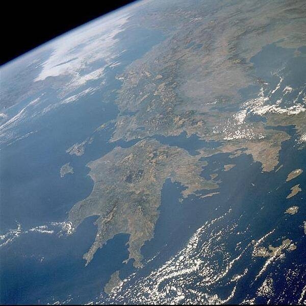
This northwest-looking photo displays the rugged, mountainous landscape of Greece. Two major landform regions are captured in the photo - the northwest-southeast-trending Pindus Mtns. in central Greece north of the Gulf of Corinth and the Peloponnese Peninsula south of the Gulf (center of the photo). This rugged terrain caused the Greeks to become a seafaring people, second only to the Norwegians in Europe. The capital of Athens (lighter area) is barely discernible along the southern edge of the broad peninsula near the eastern edge of the photograph. Image courtesy of NASA.
This northwest-looking photo displays the rugged, mountainous landscape of Greece. Two major landform regions are captured in the photo - the northwest-southeast-trending Pindus Mtns. in central Greece north of the Gulf of Corinth and the Peloponnese Peninsula south of the Gulf (center of the photo). This rugged terrain caused the Greeks to become a seafaring people, second only to the Norwegians in Europe. The capital of Athens (lighter area) is barely discernible along the southern edge of the broad peninsula near the eastern edge of the photograph. Image courtesy of NASA. • CIA World Factbook • 2020
Close up of some of the Corinthian columns of the Temple of Olympian Zeus (Olympieion) in Athens.
Close up of some of the Corinthian columns of the Temple of Olympian Zeus (Olympieion) in Athens. • CIA World Factbook • 2020
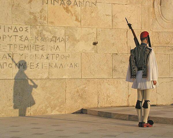
An Evzone (member of the Presidential Guard) at the Tomb of the Unknown Soldier in Syntagma Square, Athens.
An Evzone (member of the Presidential Guard) at the Tomb of the Unknown Soldier in Syntagma Square, Athens. • CIA World Factbook • 2020
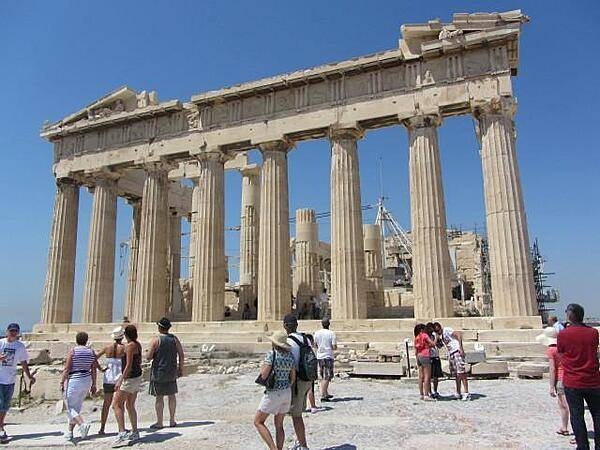
Another view of the Parthenon on the Acropolis in Athens. Built in the 5th century B.C., it is the most important surviving building of Classical Greece.
Another view of the Parthenon on the Acropolis in Athens. Built in the 5th century B.C., it is the most important surviving building of Classical Greece. • CIA World Factbook • 2020
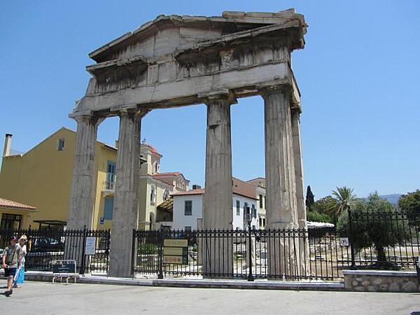
Entrance arch into the Roman Forum and Tower of the Wind in Athens. This area was used as the principal marketplace and agora by the Romans beginning in the 1st century A.D. It was a commercial and administrative center of the city until the 19th century.
Entrance arch into the Roman Forum and Tower of the Wind in Athens. This area was used as the principal marketplace and agora by the Romans beginning in the 1st century A.D. It was a commercial and administrative center of the city until the 19th century. • CIA World Factbook • 2020
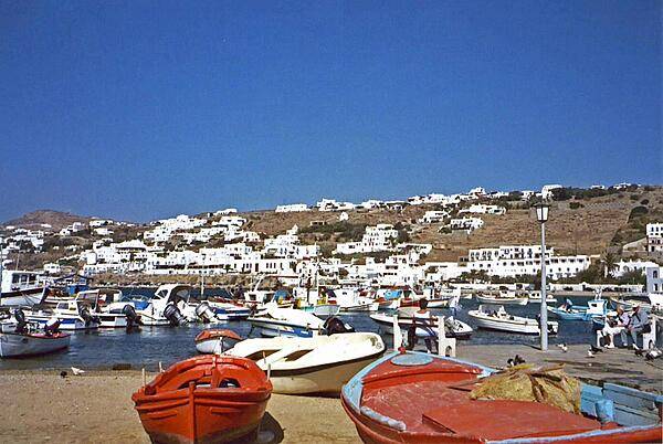
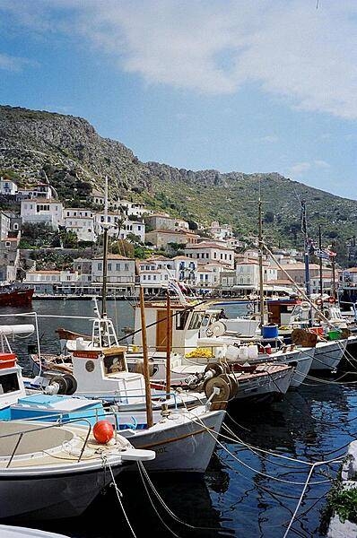
Boats in the harbor at Mykonos.
Boats in the harbor at Mykonos. • CIA World Factbook • 2020
CIA World Factbook • 2020
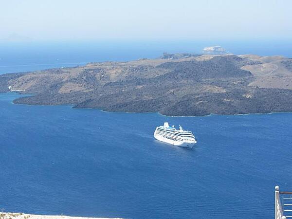
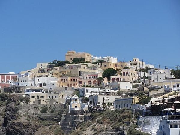
Picturesque view of Santorini Bay.
Picturesque view of Santorini Bay. • CIA World Factbook • 2020
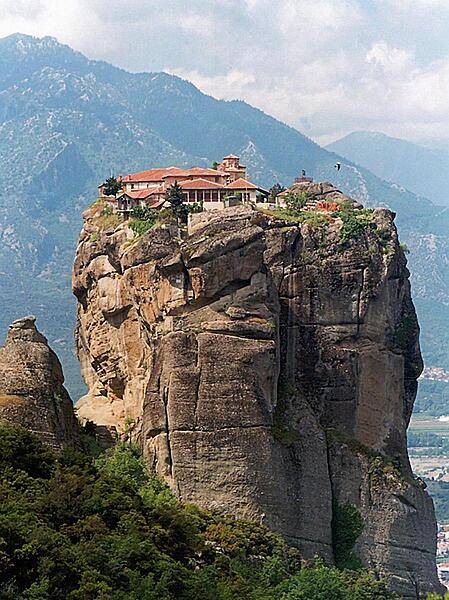
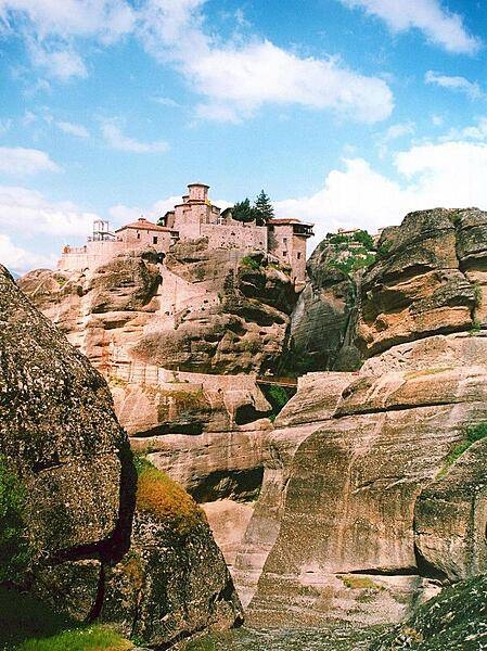
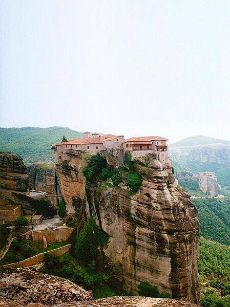
Agio Triada Monastery is one of six remaining monasteries in the Meteora region that are listed as UNESCO World Heritage sites. Each of these monasteries is built on a natural sandstone pillar.
Agio Triada Monastery is one of six remaining monasteries in the Meteora region that are listed as UNESCO World Heritage sites. Each of these monasteries is built on a natural sandstone pillar. • CIA World Factbook • 2020
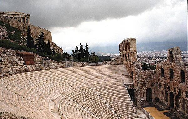
The Odeon of Herodes Atticus in Athens lies on the south slope of the Acropolis. Built in A.D. 161, the structure still serves as a venue for concert performances.
The Odeon of Herodes Atticus in Athens lies on the south slope of the Acropolis. Built in A.D. 161, the structure still serves as a venue for concert performances. • CIA World Factbook • 2020
CIA World Factbook • 2020
CIA World Factbook • 2020
CIA World Factbook • 2020
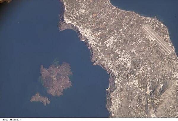
This view illustrates the center of Santorini Volcano, located approximately 120 km (75 mi) north of Crete in the Aegean Sea. One of the largest volcanic eruptions in the past 10,000 years occurred approximately 1630 B.C. on this island. The cataclysm created the present-day islands and caldera bay of Santorini Volcano. The caldera rim is clearly visible in this image as a steep cliff forming the western shoreline of the island of Thera, the largest of the remnant islands. The white rooftops of cities and towns also help trace the caldera rim. Image courtesy of NASA.
This view illustrates the center of Santorini Volcano, located approximately 120 km (75 mi) north of Crete in the Aegean Sea. One of the largest volcanic eruptions in the past 10,000 years occurred approximately 1630 B.C. on this island. The cataclysm created the present-day islands and caldera bay of Santorini Volcano. The caldera rim is clearly visible in this image as a steep cliff forming the western shoreline of the island of Thera, the largest of the remnant islands. The white rooftops of cities and towns also help trace the caldera rim. Image courtesy of NASA. • CIA World Factbook • 2020
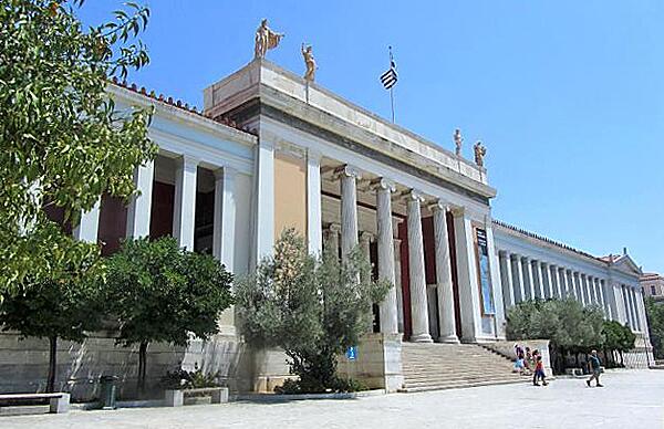
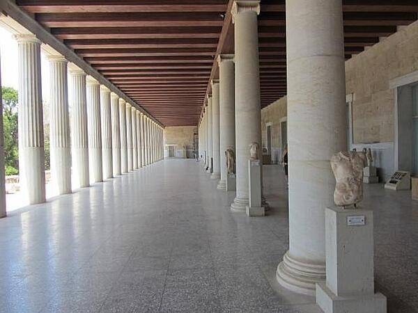
The National Archaeological Museum in Athens was established in 1829; the current museum building was completed in 1889. The museum has the richest collection in the world of Greek artifacts from antiquity.
The National Archaeological Museum in Athens was established in 1829; the current museum building was completed in 1889. The museum has the richest collection in the world of Greek artifacts from antiquity. • CIA World Factbook • 2020
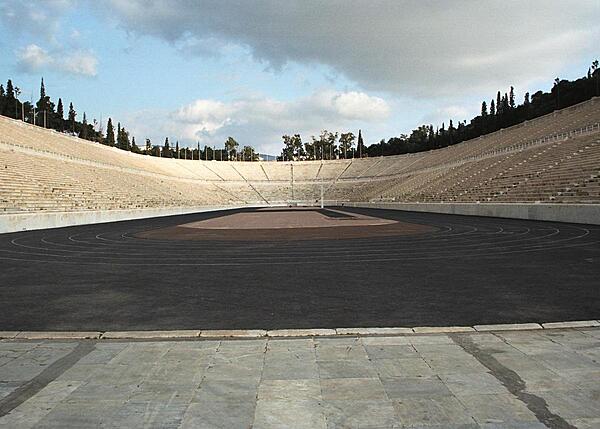
Interior view of Panathiniako Stadium, constructed for the 1896 Olympic Games in Athens.
Interior view of Panathiniako Stadium, constructed for the 1896 Olympic Games in Athens. • CIA World Factbook • 2020
Varlaam Monastery at the Meteora complex is one of six remaining 14th-century monasteries built on natural sandstone pillars.
Varlaam Monastery at the Meteora complex is one of six remaining 14th-century monasteries built on natural sandstone pillars. • CIA World Factbook • 2020
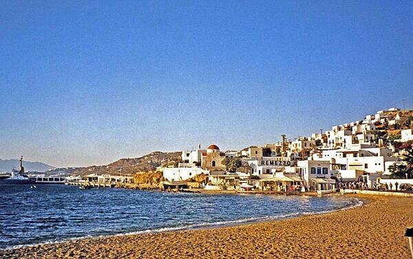
The town of Mykonos on the eponymous island in the Aegean Sea. A tourist destination of sandy beaches and diverse night life, Mykonos is well known for its many windmills.
The town of Mykonos on the eponymous island in the Aegean Sea. A tourist destination of sandy beaches and diverse night life, Mykonos is well known for its many windmills. • CIA World Factbook • 2020
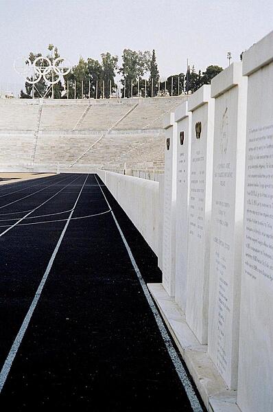
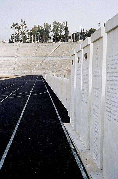
Panathinaiko Stadium in Athens was the site of the 1896 Olympic Games. The tablets on the right list the Olympic winners.
Panathinaiko Stadium in Athens was the site of the 1896 Olympic Games. The tablets on the right list the Olympic winners. • CIA World Factbook • 2020
CIA World Factbook • 2020

CIA World Factbook • 2020
The Zappeion in Athens is used as a conference and exhibition center.
The Zappeion in Athens is used as a conference and exhibition center. • CIA World Factbook • 2020
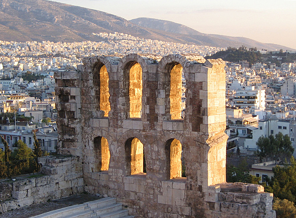
Arches forming part of the facade of the Odeon of Herodes Atticus (also called the Herodeion or Herodion), a stone Roman theater structure located on the southwest slope of the Acropolis of Athens. The building was completed in A.D. 161 and then renovated in the 20th century.
Arches forming part of the facade of the Odeon of Herodes Atticus (also called the Herodeion or Herodion), a stone Roman theater structure located on the southwest slope of the Acropolis of Athens. The building was completed in A.D. 161 and then renovated in the 20th century. • CIA World Factbook • 2020
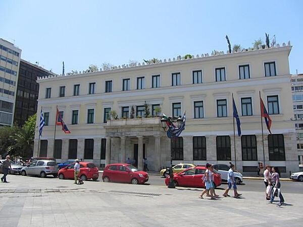
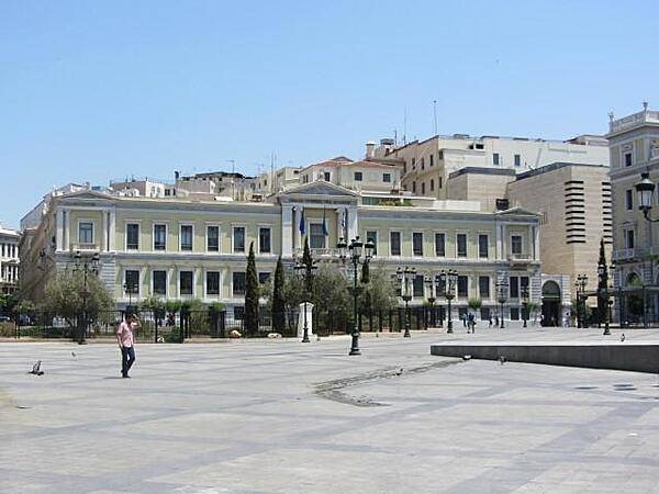
The marble City Hall building in Athens was constructed between 1870 and 1874.
The marble City Hall building in Athens was constructed between 1870 and 1874. • CIA World Factbook • 2020
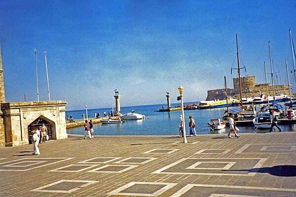
Mandraki Harbor at Rhodes, the site of a third century B.C. statue to the Greek sun god, Helios. Standing some 30 m (100 ft) high, it became known as the Colossus of Rhodes, and was considered one of the Seven Wonders of the Ancient World.
Mandraki Harbor at Rhodes, the site of a third century B.C. statue to the Greek sun god, Helios. Standing some 30 m (100 ft) high, it became known as the Colossus of Rhodes, and was considered one of the Seven Wonders of the Ancient World. • CIA World Factbook • 2020
Grand Meteora Monastery, one of six remaining 14th-century monasteries all located near the town of Kalmbaka in the Meteora region.
Grand Meteora Monastery, one of six remaining 14th-century monasteries all located near the town of Kalmbaka in the Meteora region. • CIA World Factbook • 2020
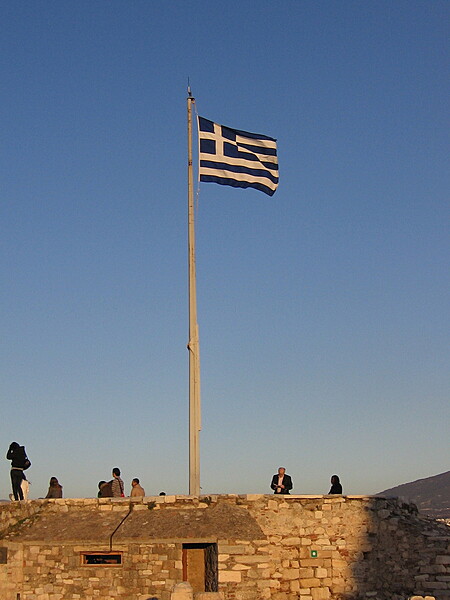
The Greek flag flies over the Acropolis.
The Greek flag flies over the Acropolis. • CIA World Factbook • 2020
CIA World Factbook • 2020
CIA World Factbook • 2020
CIA World Factbook • 2020
CIA World Factbook • 2020
CIA World Factbook • 2020
CIA World Factbook • 2020
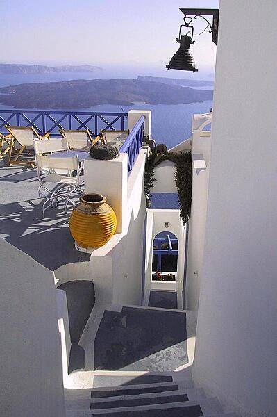
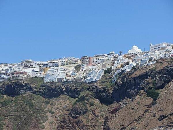
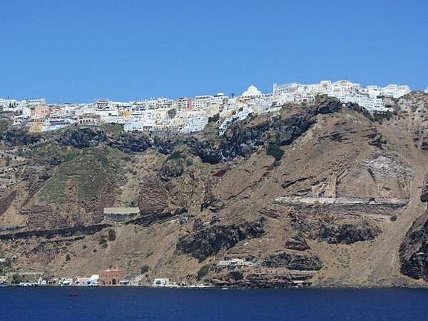
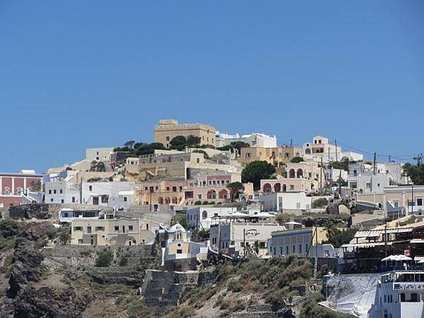
Houses in the city of Fira on the island of Santorini/Thera, Greece.
Houses in the city of Fira on the island of Santorini/Thera, Greece. • CIA World Factbook • 2020
CIA World Factbook • 2020
CIA World Factbook • 2020
CIA World Factbook • 2020

The Odeon of Herodes Atticus in Athens.
The Odeon of Herodes Atticus in Athens. • CIA World Factbook • 2020
CIA World Factbook • 2020
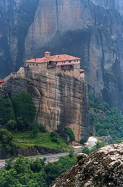
Rousanou Monastery in the Meteora region was one of 20 monasteries built on natural sandstone pillars in the 14th century by monks taking refuge from the advancing Turks. The only ingress was by ladder or rope and net.
Rousanou Monastery in the Meteora region was one of 20 monasteries built on natural sandstone pillars in the 14th century by monks taking refuge from the advancing Turks. The only ingress was by ladder or rope and net. • CIA World Factbook • 2020
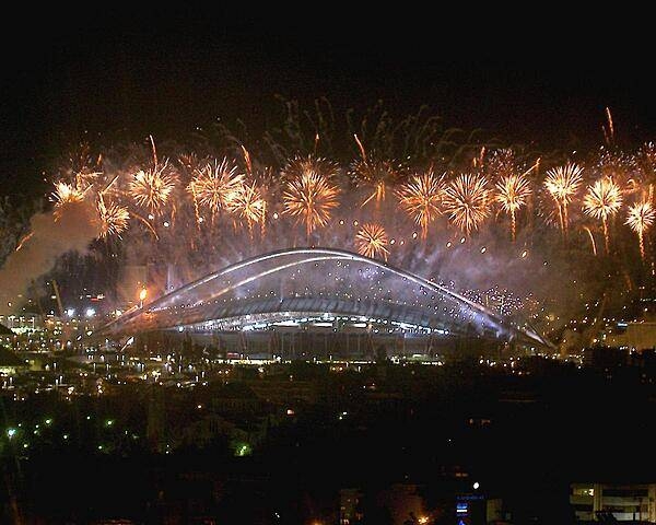
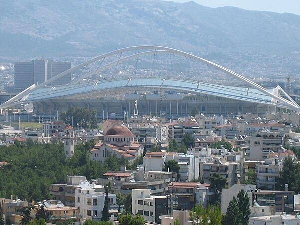
The Olympic Stadium in Athens during the 2004 Olympic celebrations.
The Olympic Stadium in Athens during the 2004 Olympic celebrations. • CIA World Factbook • 2020

CIA World Factbook • 2020

CIA World Factbook • 2020
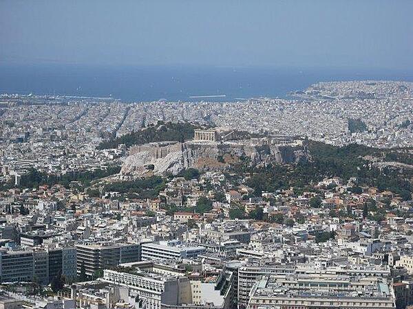
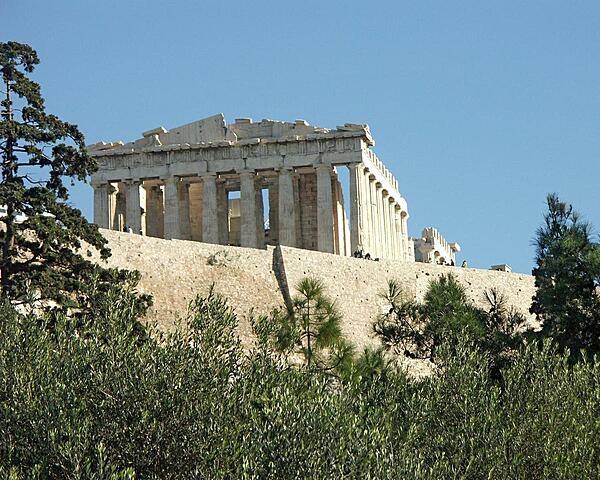
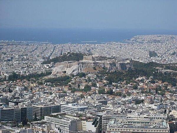
The Acropolis, a flat-topped rock about five hectares in area, overlooks the sprawling city of Athens. Various famous ruins, including the Parthenon (a temple to the goddess Athena), crown its heights.
The Acropolis, a flat-topped rock about five hectares in area, overlooks the sprawling city of Athens. Various famous ruins, including the Parthenon (a temple to the goddess Athena), crown its heights. • CIA World Factbook • 2020
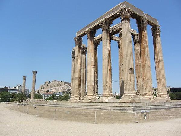
The Temple of Olympian Zeus (Olympieion) in Athens. Construction began in 520 B.C. but was not completed until A.D. 132 in the reign of Roman Emperor Hadrian. Sixteen of the original Corinthian 104 columns survive (15 standing, one fallen). The Acropolis can be seen in the distance.
The Temple of Olympian Zeus (Olympieion) in Athens. Construction began in 520 B.C. but was not completed until A.D. 132 in the reign of Roman Emperor Hadrian. Sixteen of the original Corinthian 104 columns survive (15 standing, one fallen). The Acropolis can be seen in the distance. • CIA World Factbook • 2020

View of the rear of the Parthenon on the Acropolis in Athens. The temple, dedicated to the goddess Athena, was built between 447 and 438 B.C. The Acropolis is a citadel on a flat, high, rocky outcrop 150 m (490 ft)above sea level and is the highest point in Athens. It preserves a number of ancient structures.
View of the rear of the Parthenon on the Acropolis in Athens. The temple, dedicated to the goddess Athena, was built between 447 and 438 B.C. The Acropolis is a citadel on a flat, high, rocky outcrop 150 m (490 ft)above sea level and is the highest point in Athens. It preserves a number of ancient structures. • CIA World Factbook • 2020

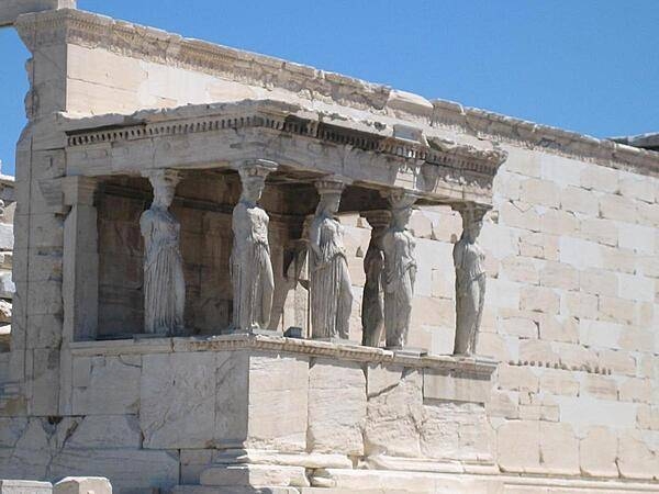
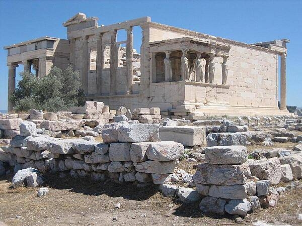
A close up of the Porch of the Caryatids (also known as the Porch of the Maidens) on the southern side of the Erechtheum temple on the Acropolis in Athens.
A close up of the Porch of the Caryatids (also known as the Porch of the Maidens) on the southern side of the Erechtheum temple on the Acropolis in Athens. • CIA World Factbook • 2020
Media source: CIA World Factbook (2020) — Public Domain