›››
Israel — Media Gallery
14 items available (flags, maps, photos)
Photos
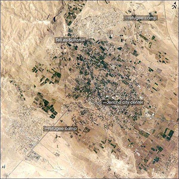
Commonly known as "the oldest city in the world," Jericho is an important historical, cultural, and political center located northwest of the Dead Sea. The city is perhaps best known from the Biblical story of a great victory over its Canaanite citizens by the Israelite leader Joshua. In the story, the walls of the heavily fortified city were destroyed with divine assistance (ca. 1400 B.C.). The site of ancient Jericho, known today as Tell es-Sultan, has been the focus of several archaeological excavations to investigate the Biblical story. The original settlement was built on a hill, or "tell." The results of these excavations suggest that the walls of Tell es-Sultan have been built and rebuilt many times, due mainly to collapse caused by earthquakes, which are common in the region. One of these events may be the basis for the story of Joshua. Modern-day Jericho is a popular tourist destination due to its pleasant climate, historical sites, and religious significance. This photograph shows the city center and the original settlement mound of Tell es-Sultan. Total distance across the image is approximately 8 km (5 mi). Two large refugee camps are located to the northwest and south of the city center. The high building density of the refugee camps contrasts sharply with the more open city center and irrigated fields (green polygonal patches) of Jericho, and illustrates one of the physical consequences of the ongoing Israeli-Palestinian conflict in the region. Photo courtesy of NASA.
Commonly known as "the oldest city in the world," Jericho is an important historical, cultural, and political center located northwest of the Dead Sea. The city is perhaps best known from the Biblical story of a great victory over its Canaanite citizens by the Israelite leader Joshua. In the story, the walls of the heavily fortified city were destroyed with divine assistance (ca. 1400 B.C.). The site of ancient Jericho, known today as Tell es-Sultan, has been the focus of several archaeological excavations to investigate the Biblical story. The original settlement was built on a hill, or "tell." The results of these excavations suggest that the walls of Tell es-Sultan have been built and rebuilt many times, due mainly to collapse caused by earthquakes, which are common in the region. One of these events may be the basis for the story of Joshua. Modern-day Jericho is a popular tourist destination due to its pleasant climate, historical sites, and religious significance. This photograph shows the city center and the original settlement mound of Tell es-Sultan. Total distance across the image is approximately 8 km (5 mi). Two large refugee camps are located to the northwest and south of the city center. The high building density of the refugee camps contrasts sharply with the more open city center and irrigated fields (green polygonal patches) of Jericho, and illustrates one of the physical consequences of the ongoing Israeli-Palestinian conflict in the region. Photo courtesy of NASA. • CIA World Factbook • 2020
This image covers an area roughly 100x150 km; due to shuttle orientation, north is located at approximately eleven o'clock in this image. Shown are the Gaza Strip (roughly the center third of the coastal strip) and the Mediterranean Sea. The straight-line Egypt-Israel border is apparent in the lower center because of a difference in vegetation patterns, the Egyptian side (south) being less vegetated perhaps due to heavy use of the land for grazing. Photo courtesy of NASA.
This image covers an area roughly 100x150 km; due to shuttle orientation, north is located at approximately eleven o'clock in this image. Shown are the Gaza Strip (roughly the center third of the coastal strip) and the Mediterranean Sea. The straight-line Egypt-Israel border is apparent in the lower center because of a difference in vegetation patterns, the Egyptian side (south) being less vegetated perhaps due to heavy use of the land for grazing. Photo courtesy of NASA. • CIA World Factbook • 2020
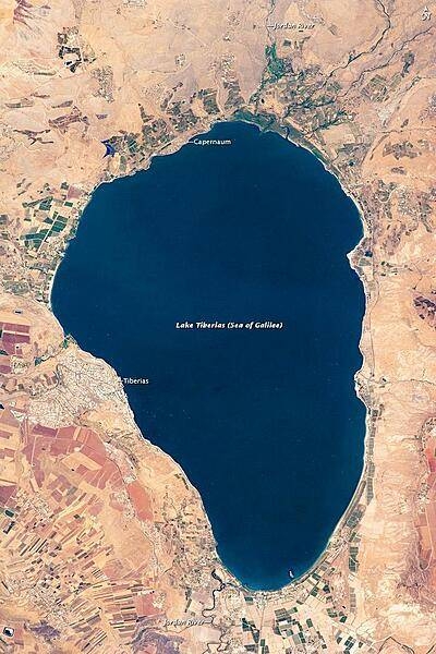
Israel's largest freshwater lake, Lake Tiberias, is also known as the Sea of Galilee. The lake measures just over 21 km (13 mi) north-south, and it is only 43 m (141 ft) deep. The lake is fed partly by underground springs related to the Jordan sector of the Great Rift Valley, but most of its water comes from the Jordan River, which enters from the north. The river's winding course can be seen draining the south end of the lake at image bottom. Angular green and brown field patterns clothe most hillsides in this arid landscape. Bright roof tops are the hallmark of several villages in the area. Much of the area to the east of the lake is part of the Israeli-occupied Golan Heights. Image courtesy of NASA.
Israel's largest freshwater lake, Lake Tiberias, is also known as the Sea of Galilee. The lake measures just over 21 km (13 mi) north-south, and it is only 43 m (141 ft) deep. The lake is fed partly by underground springs related to the Jordan sector of the Great Rift Valley, but most of its water comes from the Jordan River, which enters from the north. The river's winding course can be seen draining the south end of the lake at image bottom. Angular green and brown field patterns clothe most hillsides in this arid landscape. Bright roof tops are the hallmark of several villages in the area. Much of the area to the east of the lake is part of the Israeli-occupied Golan Heights. Image courtesy of NASA. • CIA World Factbook • 2020
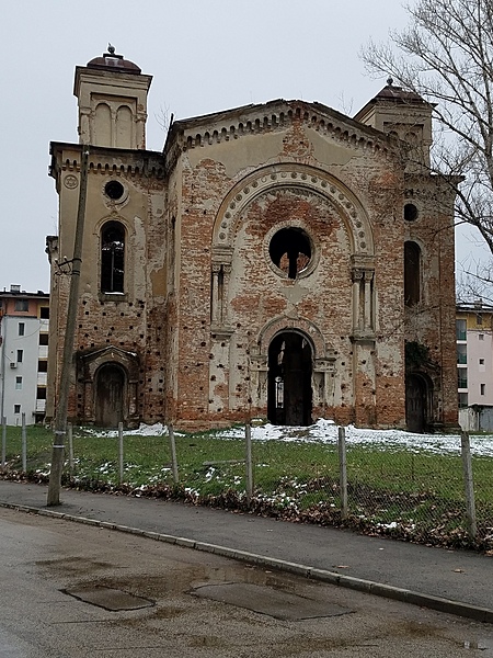
Vidin Synagogue, completed in 1894, was the second largest synagogue in Bulgaria. Most of its congregation emigrated to Israel following World War II. Seized by the state in 1950, the synagogue is now in ruins, but there are plans to restore it as a museum.
Vidin Synagogue, completed in 1894, was the second largest synagogue in Bulgaria. Most of its congregation emigrated to Israel following World War II. Seized by the state in 1950, the synagogue is now in ruins, but there are plans to restore it as a museum. • CIA World Factbook • 2020
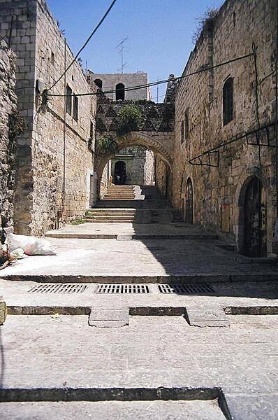
A scene from the Old City in Israeli-occupied East Jerusalem.
A scene from the Old City in Israeli-occupied East Jerusalem. • CIA World Factbook • 2020
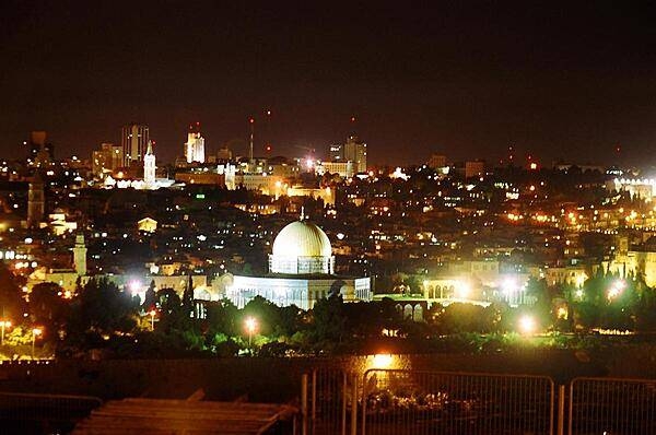
A nighttime view of Jerusalem and Israeli-occupied East Jerusalem, taken from the Mount of Olives.
A nighttime view of Jerusalem and Israeli-occupied East Jerusalem, taken from the Mount of Olives. • CIA World Factbook • 2020
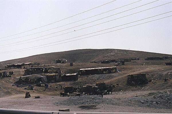
A Bedouin encampment on the road to Jericho from Jerusalem. Bedouins are constantly on the move to feed and water their herds.
A Bedouin encampment on the road to Jericho from Jerusalem. Bedouins are constantly on the move to feed and water their herds. • CIA World Factbook • 2020
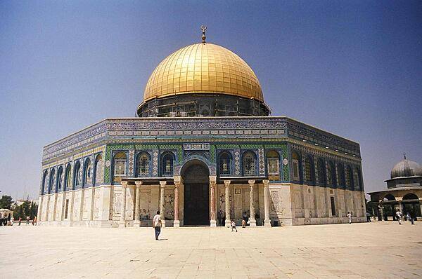
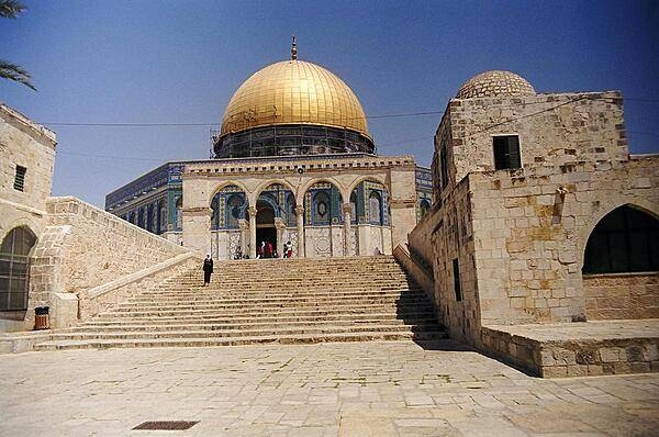
The Dome of the Rock, located on Haram al-Sharif (also known as the Temple Mount), in Israeli-occupied East Jerusalem.
The Dome of the Rock, located on Haram al-Sharif (also known as the Temple Mount), in Israeli-occupied East Jerusalem. • CIA World Factbook • 2020
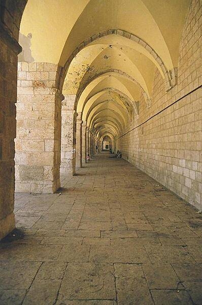
The hallway leading to the Dome of the Rock in Israeli-occupied East Jerusalem.
The hallway leading to the Dome of the Rock in Israeli-occupied East Jerusalem. • CIA World Factbook • 2020
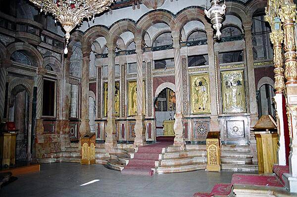
Inside the Church of the Holy Sepulchre, built over the site traditionally identified as the tomb of Christ, in Israeli-occupied East Jerusalem.
Inside the Church of the Holy Sepulchre, built over the site traditionally identified as the tomb of Christ, in Israeli-occupied East Jerusalem. • CIA World Factbook • 2020
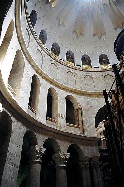
The dome of the Church of the Holy Sepulchre in Israeli-occupied East Jerusalem.
The dome of the Church of the Holy Sepulchre in Israeli-occupied East Jerusalem. • CIA World Factbook • 2020
The Dome of the Rock, located on Haram al-Sharif (also known as the Temple Mount), in Israeli-occupied East Jerusalem.
The Dome of the Rock, located on Haram al-Sharif (also known as the Temple Mount), in Israeli-occupied East Jerusalem. • CIA World Factbook • 2020

A nighttime view of Jerusalem and Israeli-occupied East Jerusalem, taken from the Mount of Olives.
A nighttime view of Jerusalem and Israeli-occupied East Jerusalem, taken from the Mount of Olives. • CIA World Factbook • 2020
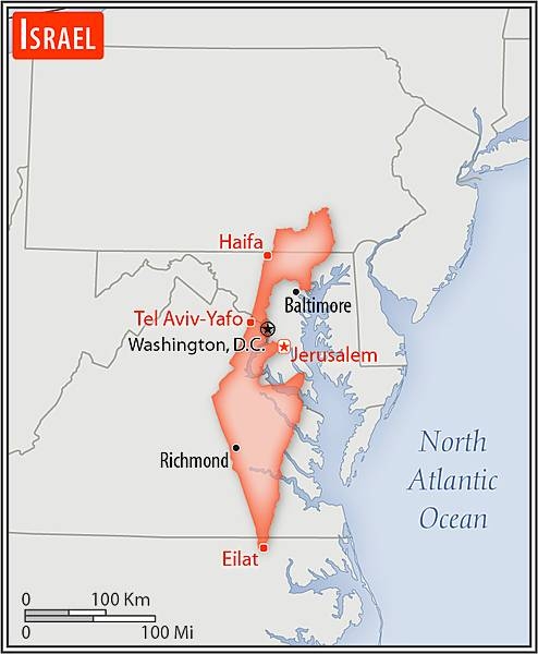
Area comparison map
Area comparison map • CIA World Factbook • 2020
Media source: CIA World Factbook (2020) — Public Domain