›››
India — Media Gallery
55 items available (flags, maps, photos)
Photos
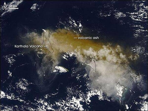
On 24 November 2005, some 2,000 people fled their homes hoping to escape the latest eruption of the Karthala Volcano. The volcano covered nearby villages in ash and locals had little means of protecting their lungs beyond covering their faces with scarves. Karthala is one of two volcanoes that make up Grande Comore (or N'gazidja) Island in the Comoros archipelago. These islands lie in the Indian Ocean, between Africa and Madagascar. In this image of 25 November 2005, Grande Comore appears only in outline as material from the eruption completely obscures the satellite's view of the land surface. The volcanic ash ranges in color from tan to beige; it has spread out around the volcano in all directions, but moves primarily eastward. With an altitude of 2,361 m (7,746 ft), Karthala is a shield volcano, with smooth slopes built from hardened lava. Comprising the southern portion of Grande Comore Island, Karthala is a regular troublemaker in its neighborhood. The volcano has erupted about 20 times in the last century. Photo courtesy of NASA.
On 24 November 2005, some 2,000 people fled their homes hoping to escape the latest eruption of the Karthala Volcano. The volcano covered nearby villages in ash and locals had little means of protecting their lungs beyond covering their faces with scarves.
Karthala is one of two volcanoes that make up Grande Comore (or N'gazidja) Island in the Comoros archipelago. These islands lie in the Indian Ocean, between Africa and Madagascar. In this image of 25 November 2005, Grande Comore appears only in outline as material from the eruption completely obscures the satellite's view of the land surface. The volcanic ash ranges in color from tan to beige; it has spread out around the volcano in all directions, but moves primarily eastward.
With an altitude of 2,361 m (7,746 ft), Karthala is a shield volcano, with smooth slopes built from hardened lava. Comprising the southern portion of Grande Comore Island, Karthala is a regular troublemaker in its neighborhood. The volcano has erupted about 20 times in the last century. Photo courtesy of NASA. • CIA World Factbook • 2020

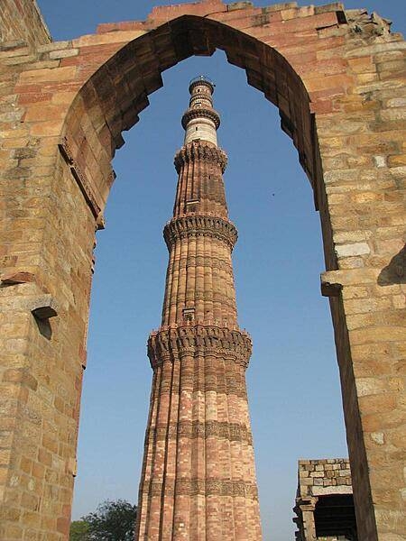
Qutab Minar, a tower in Delhi, is the world's tallest free standing brick and stone minaret. The structure is 72.5 m (238 ft) high with 379 steps leading to the top.
Qutab Minar, a tower in Delhi, is the world's tallest free standing brick and stone minaret. The structure is 72.5 m (238 ft) high with 379 steps leading to the top. • CIA World Factbook • 2020
This mound-like structure called the Dhamek Stupa is 143 feet high and 92 feet wide. Located in Sarnath, in the state of Uttar Pradesh, it is believed to be the location of Buddha's first sermon to his five disciples after attaining enlightenment.
This mound-like structure called the Dhamek Stupa is 143 feet high and 92 feet wide. Located in Sarnath, in the state of Uttar Pradesh, it is believed to be the location of Buddha's first sermon to his five disciples after attaining enlightenment. • CIA World Factbook • 2020
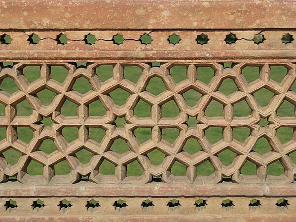
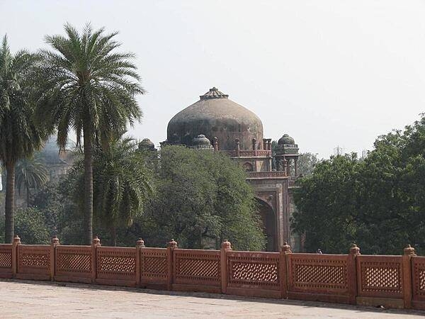
Complex carvings on the grounds of Humayun's Tomb.
Complex carvings on the grounds of Humayun's Tomb. • CIA World Factbook • 2020
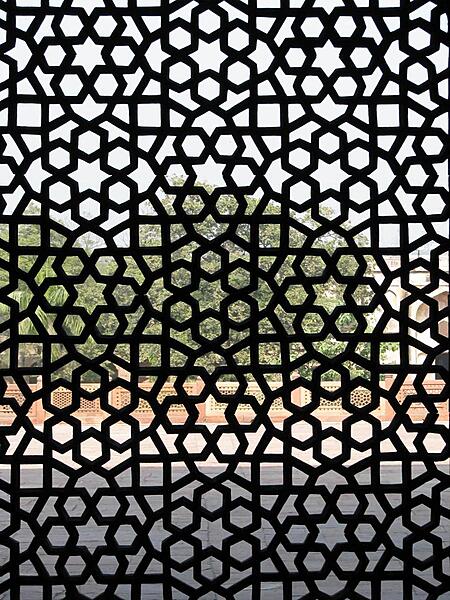
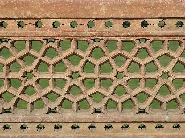
Elaborate latticework on the grounds of Humayun's Tomb.
Elaborate latticework on the grounds of Humayun's Tomb. • CIA World Factbook • 2020
Area comparison map
Area comparison map • CIA World Factbook • 2020

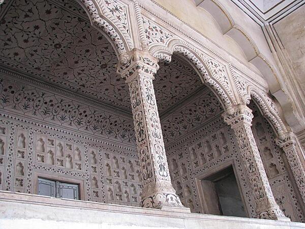
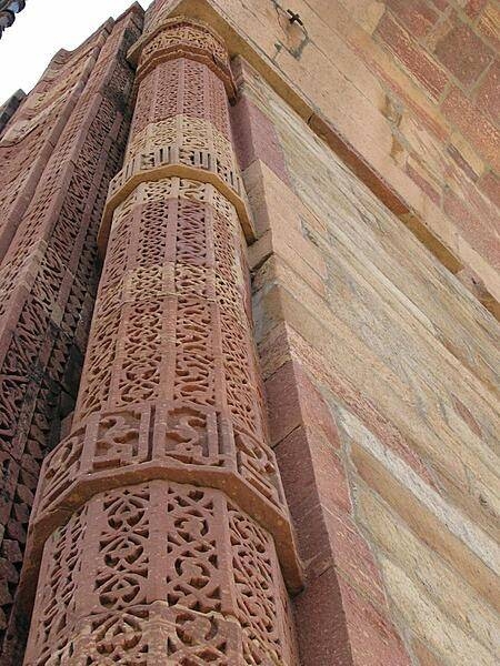
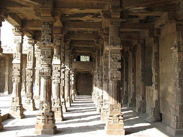
Pillars in the Quwwat ul-Islam Mosque reused from a Jain temple, Qutab complex, Delhi.
Pillars in the Quwwat ul-Islam Mosque reused from a Jain temple, Qutab complex, Delhi. • CIA World Factbook • 2020
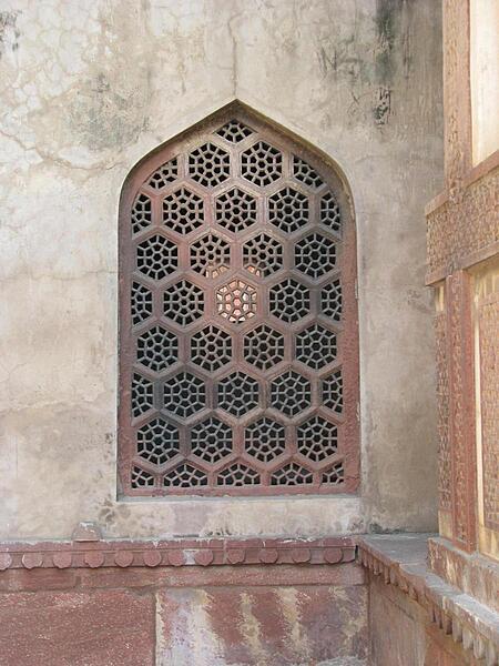
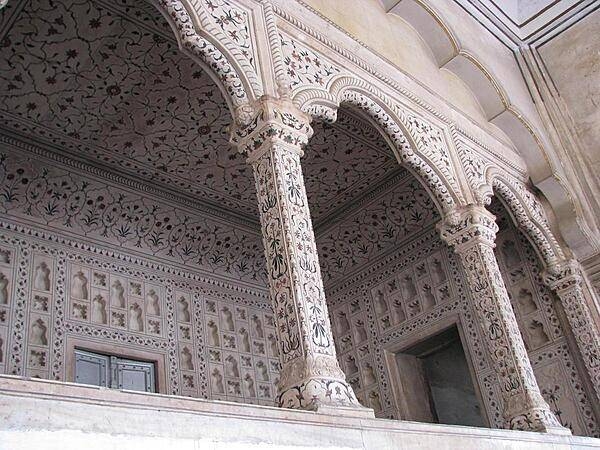
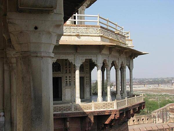
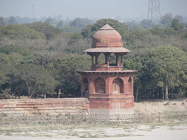
Window at Agra Fort.
Window at Agra Fort. • CIA World Factbook • 2020
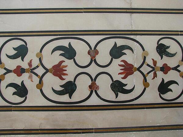
A floral marble design at the Taj Mahal.
A floral marble design at the Taj Mahal. • CIA World Factbook • 2020

CIA World Factbook • 2020

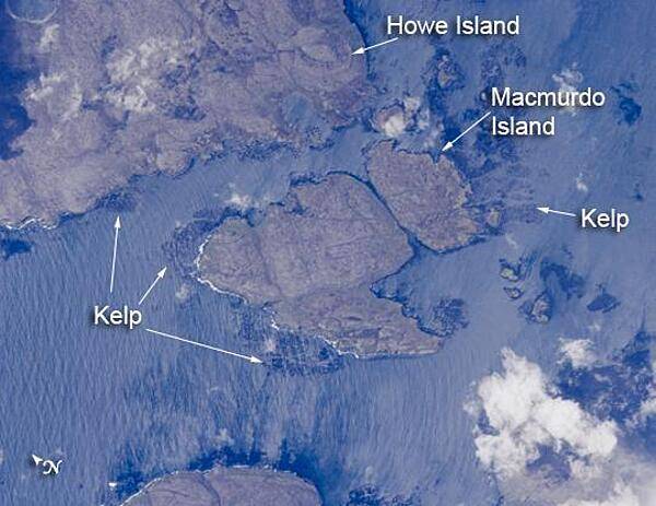
Mac Murdo and Howe Islands are two of the 300 islands of the remote Kerguelen Archipelago, located in the southern Indian Ocean. The coastlines of many of these islands are occupied by giant kelp beds. The surface wave pattern that travels southeastward along the gray-blue ocean surface and through the kelp beds is visible due to sunglint, the mirror-like reflection of sunlight off the water. The sunglint also improves the identification of the kelp beds by creating a different water texture between the dark vegetation and the reflective ocean surface. Image courtesy of NASA.
Mac Murdo and Howe Islands are two of the 300 islands of the remote Kerguelen Archipelago, located in the southern Indian Ocean. The coastlines of many of these islands are occupied by giant kelp beds. The surface wave pattern that travels southeastward along the gray-blue ocean surface and through the kelp beds is visible due to sunglint, the mirror-like reflection of sunlight off the water. The sunglint also improves the identification of the kelp beds by creating a different water texture between the dark vegetation and the reflective ocean surface. Image courtesy of NASA. • CIA World Factbook • 2020
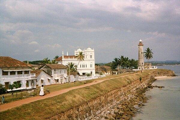
The Galle lighthouse is the oldest lighthouse in Sri Lanka, first built in 1848; it lies at the entrance to Galle harbor on southwestern coast of Sri Lanka, about 120 km south of Colombo. The lighthouse is situated within Galle Fort, first fortified by the Portuguese in 1588 and then extensively improved upon by the Dutch in the 17th and 18th centuries. The current lighthouse is 26.5 m tall and was built in 1939 after the original lighthouse was destroyed by fire in 1934. Galle was a historically important port of call in the Indian Ocean trade being visited by the Islamic explorer Ibn Batuta, the Chinese admiral Zheng He, and where the Portuguese first landed in 1502. Today, the lighthouse and surrounding fort have been designated as a World Heritage Center.
The Galle lighthouse is the oldest lighthouse in Sri Lanka, first built in 1848; it lies at the entrance to Galle harbor on southwestern coast of Sri Lanka, about 120 km south of Colombo. The lighthouse is situated within Galle Fort, first fortified by the Portuguese in 1588 and then extensively improved upon by the Dutch in the 17th and 18th centuries. The current lighthouse is 26.5 m tall and was built in 1939 after the original lighthouse was destroyed by fire in 1934. Galle was a historically important port of call in the Indian Ocean trade being visited by the Islamic explorer Ibn Batuta, the Chinese admiral Zheng He, and where the Portuguese first landed in 1502. Today, the lighthouse and surrounding fort have been designated as a World Heritage Center. • CIA World Factbook • 2020
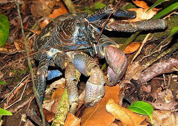
The coconut crab is a species of terrestrial hermit crab that also goes by the name of robber crab or palm thief. It is the largest land-living arthropod in the world and can weigh up to 4.1 kg (9 lb) and grow to up to 1 m in length from each tip to tip of the leg; it is found on islands across the Indian Ocean and parts of the Pacific Ocean. And, yes, omnivorous coconut crabs can break open and feed on coconuts, although they prefer softer foods such as fruits, nuts, seeds, and the pith of fallen trees. Photo courtesy of the US National Park Service.
The coconut crab is a species of terrestrial hermit crab that also goes by the name of robber crab or palm thief. It is the largest land-living arthropod in the world and can weigh up to 4.1 kg (9 lb) and grow to up to 1 m in length from each tip to tip of the leg; it is found on islands across the Indian Ocean and parts of the Pacific Ocean. And, yes, omnivorous coconut crabs can break open and feed on coconuts, although they prefer softer foods such as fruits, nuts, seeds, and the pith of fallen trees. Photo courtesy of the US National Park Service. • CIA World Factbook • 2020
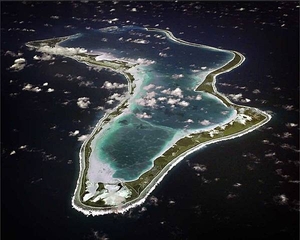
An aerial view of the island of Diego Garcia in the British Indian Ocean Territory. Diego Garcia is the location of an important UK and US air and naval base supporting operations throughout the Indian Ocean basin. The lagoon provides an excellent sheltered deep water anchorage. Photo courtesy of US Navy.
An aerial view of the island of Diego Garcia in the British Indian Ocean Territory. Diego Garcia is the location of an important UK and US air and naval base supporting operations throughout the Indian Ocean basin. The lagoon provides an excellent sheltered deep water anchorage. Photo courtesy of US Navy. • CIA World Factbook • 2020
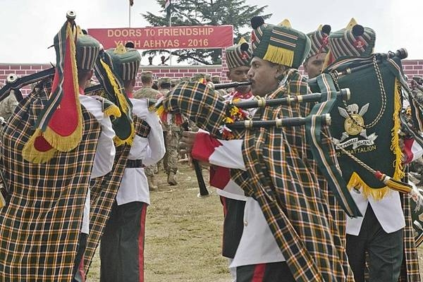
The Pipes and Drums of the Madras Regiment perform during the Yudh Abhyas 2016 closing ceremony on 27 September 2016, at Chaubattia Military Station, India. The Madras Regiment is one of the oldest regiments in the Indian Army whose establishment dates to 1758. The insignia of the Madras Regiment, visible in this photograph, consists of a pair of crossed swords behind a circular shield surmounted by an Assaye Elephant above a scroll reading “Madras Regiment.” The Assaye Elephant crest is in recognition of the regiment’s valor in the Battle of Assaye (1803). In addition, the distinctive black pom-pom worn by the regiment is visible on the turbans of the band members. Yudh Abhyas, Hindi for “training for war,” is a bilateral training exercise geared toward enhancing cooperation and coordination between the US and Indian armies through training and cultural exchanges. Photo courtesy of the US Army/ Staff Sgt. Samuel Northrup.
The Pipes and Drums of the Madras Regiment perform during the Yudh Abhyas 2016 closing ceremony on 27 September 2016, at Chaubattia Military Station, India. The Madras Regiment is one of the oldest regiments in the Indian Army whose establishment dates to 1758. The insignia of the Madras Regiment, visible in this photograph, consists of a pair of crossed swords behind a circular shield surmounted by an Assaye Elephant above a scroll reading “Madras Regiment.” The Assaye Elephant crest is in recognition of the regiment’s valor in the Battle of Assaye (1803). In addition, the distinctive black pom-pom worn by the regiment is visible on the turbans of the band members. Yudh Abhyas, Hindi for “training for war,” is a bilateral training exercise geared toward enhancing cooperation and coordination between the US and Indian armies through training and cultural exchanges. Photo courtesy of the US Army/ Staff Sgt. Samuel Northrup. • CIA World Factbook • 2020
Elegant design work at Agra Fort.
Elegant design work at Agra Fort. • CIA World Factbook • 2020
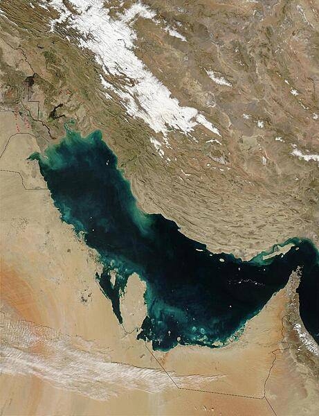
Much of the sediment clouding the water in this image of the Persian Gulf is from the Shatt al Arab River, which enters the Gulf in the north along the Iran-Iraq border. The river drains the combined waters of the Euphrates and Tigris Rivers of Iraq, and the Karun River of Iran. Though other rivers empty into the Persian Gulf, most of its fresh water comes from the Shatt al Arab. On the right edge of the image is the narrow Strait of Hormuz, which connects the Persian Gulf to the Arabian Sea, part of the northern Indian Ocean. The Persian Gulf is flanked to the west by wedge-shaped Kuwait and by Saudi Arabia with its vast tan-, pink-, and white-sand deserts; to the south by Qatar, the United Arab Emirates, and Oman; and to the east by the dry mountains of Iran. The wetlands and rivers of Mesopotamia border the Gulf on the north. The red dots mark gas flares in oil fields of Iran and Iraq. Image courtesy of NASA.
Much of the sediment clouding the water in this image of the Persian Gulf is from the Shatt al Arab River, which enters the Gulf in the north along the Iran-Iraq border. The river drains the combined waters of the Euphrates and Tigris Rivers of Iraq, and the Karun River of Iran. Though other rivers empty into the Persian Gulf, most of its fresh water comes from the Shatt al Arab. On the right edge of the image is the narrow Strait of Hormuz, which connects the Persian Gulf to the Arabian Sea, part of the northern Indian Ocean. The Persian Gulf is flanked to the west by wedge-shaped Kuwait and by Saudi Arabia with its vast tan-, pink-, and white-sand deserts; to the south by Qatar, the United Arab Emirates, and Oman; and to the east by the dry mountains of Iran. The wetlands and rivers of Mesopotamia border the Gulf on the north. The red dots mark gas flares in oil fields of Iran and Iraq. Image courtesy of NASA. • CIA World Factbook • 2020
CIA World Factbook • 2020
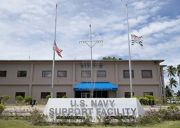
The main administration building for US Navy Support Facility (NSF) Diego Garcia. The US and British Indian Ocean Territory flags are flown at half-mast on 11 September to mark an anniversary of the terrorist attacks on the US. NSF Diego Garcia provides logistic, service, recreational, and administrative support to US and Allied Forces forward deployed to the Indian Ocean and Arabian Gulf. Photo courtesy of US Navy/ Mass Communication Specialist 2nd Class Charlotte C. Oliver.
The main administration building for US Navy Support Facility (NSF) Diego Garcia. The US and British Indian Ocean Territory flags are flown at half-mast on 11 September to mark an anniversary of the terrorist attacks on the US. NSF Diego Garcia provides logistic, service, recreational, and administrative support to US and Allied Forces forward deployed to the Indian Ocean and Arabian Gulf. Photo courtesy of US Navy/ Mass Communication Specialist 2nd Class Charlotte C. Oliver. • CIA World Factbook • 2020
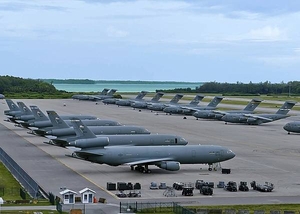
US Air Force KC-10A Extender aerial refueling aircraft, left, and C-17 Globemaster III cargo aircraft are parked on the ramp at Naval Support Facility Diego Garcia. This photo illustrates the surge capacity for staging strategic forces into the Indian Ocean basin. The joint UK and US base on Diego Garcia provides logistics support to overseas contingency operations. Photo courtesy of the US Navy/ Mass Communication Specialist 3rd Class Caine Storino.
US Air Force KC-10A Extender aerial refueling aircraft, left, and C-17 Globemaster III cargo aircraft are parked on the ramp at Naval Support Facility Diego Garcia. This photo illustrates the surge capacity for staging strategic forces into the Indian Ocean basin. The joint UK and US base on Diego Garcia provides logistics support to overseas contingency operations. Photo courtesy of the US Navy/ Mass Communication Specialist 3rd Class Caine Storino. • CIA World Factbook • 2020
Mac Murdo and Howe Islands are two of the 300 islands of the remote Kerguelen Archipelago, located in the southern Indian Ocean. The coastlines of many of these islands are occupied by giant kelp beds. The surface wave pattern that travels southeastward along the gray-blue ocean surface and through the kelp beds is visible due to sunglint, the mirror-like reflection of sunlight off the water. The sunglint also improves the identification of the kelp beds by creating a different water texture between the dark vegetation and the reflective ocean surface. Image courtesy of NASA.
Mac Murdo and Howe Islands are two of the 300 islands of the remote Kerguelen Archipelago, located in the southern Indian Ocean. The coastlines of many of these islands are occupied by giant kelp beds. The surface wave pattern that travels southeastward along the gray-blue ocean surface and through the kelp beds is visible due to sunglint, the mirror-like reflection of sunlight off the water. The sunglint also improves the identification of the kelp beds by creating a different water texture between the dark vegetation and the reflective ocean surface. Image courtesy of NASA. • CIA World Factbook • 2020

CIA World Factbook • 2020
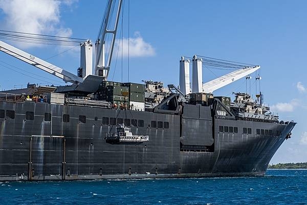
The USNS Seay (T-AKR 302), a Military Sealift Command roll-on roll-off vehicle cargo ship, at anchor in the lagoon at Diego Garcia. The photo shows sailors lowering a maritime prepositioning force utility boat from the USNS Seay using a crane during a ship-to-shore logistics training exercise. Diego Garcia provides critical logistical infrastructure support to US and Allied Forces forward deployed to the Indian Ocean and Arabian Gulf. Photo courtesy of the US Navy/ Mass Communication Specialist 1st Class Nathan Carpenter.
The USNS Seay (T-AKR 302), a Military Sealift Command roll-on roll-off vehicle cargo ship, at anchor in the lagoon at Diego Garcia. The photo shows sailors lowering a maritime prepositioning force utility boat from the USNS Seay using a crane during a ship-to-shore logistics training exercise. Diego Garcia provides critical logistical infrastructure support to US and Allied Forces forward deployed to the Indian Ocean and Arabian Gulf. Photo courtesy of the US Navy/ Mass Communication Specialist 1st Class Nathan Carpenter. • CIA World Factbook • 2020
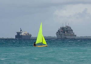
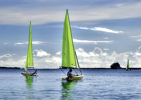
A relaxing sail on the lagoon of Diego Garcia. The island is a strategic joint UK and US air and naval base in the Indian Ocean. The lagoon provides a sheltered anchorage for forward deployed naval assets. Diego Garcia provides critical logistical infrastructure support to US and Allied Forces forward deployed to the Indian Ocean and Arabian Gulf. Photo courtesy of the US Navy.
A relaxing sail on the lagoon of Diego Garcia. The island is a strategic joint UK and US air and naval base in the Indian Ocean. The lagoon provides a sheltered anchorage for forward deployed naval assets. Diego Garcia provides critical logistical infrastructure support to US and Allied Forces forward deployed to the Indian Ocean and Arabian Gulf. Photo courtesy of the US Navy. • CIA World Factbook • 2020
CIA World Factbook • 2020
CIA World Factbook • 2020

CIA World Factbook • 2020
Personnel assigned to US Naval Support Facility Diego Garcia, British Indian Ocean Territory, participate in a basic sailing class in the Diego Garcia lagoon. The base Morale, Welfare, and Recreation Department sponsored the class. Photo courtesy of the US Navy/ Mass Communication Specialist 3rd Class Caine Storino.
Personnel assigned to US Naval Support Facility Diego Garcia, British Indian Ocean Territory, participate in a basic sailing class in the Diego Garcia lagoon. The base Morale, Welfare, and Recreation Department sponsored the class. Photo courtesy of the US Navy/ Mass Communication Specialist 3rd Class Caine Storino. • CIA World Factbook • 2020
A B-2 Spirit Stealth Bomber arrives at Naval Support Facility Diego Garcia, 12 August 2020. Three B-2s deployed to the Indian Ocean as part of a training exercise. Photo courtesy of the US Air Force/ 1st Lt. Michael Hardy.
A B-2 Spirit Stealth Bomber arrives at Naval Support Facility Diego Garcia, 12 August 2020. Three B-2s deployed to the Indian Ocean as part of a training exercise. Photo courtesy of the US Air Force/ 1st Lt. Michael Hardy. • CIA World Factbook • 2020
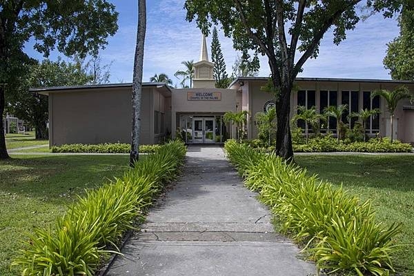
The Chapel in the Palms on Diego Garcia, part of the US Naval Support Facility (NSF) community. NSF Diego Garcia provides logistic, service, recreational, and administrative support to US and Allied Forces forward deployed to the Indian Ocean and Arabian Gulf. Photo courtesy of the US Navy/Seaman Apprentice Michael Porterfield.
The Chapel in the Palms on Diego Garcia, part of the US Naval Support Facility (NSF) community. NSF Diego Garcia provides logistic, service, recreational, and administrative support to US and Allied Forces forward deployed to the Indian Ocean and Arabian Gulf. Photo courtesy of the US Navy/Seaman Apprentice Michael Porterfield. • CIA World Factbook • 2020
The Republic of Seychelles is an island country spanning an archipelago of 155 islands in the Indian Ocean. It is about 1,500 km (930 mi) east of the African continent, and spreads out over a vast area of ocean north of Madagascar. Independent from the UK since 1976, the country nevertheless is far more French after years of early French settlement and influence. Since independence, tourism has grown dramatically to become the primary industry of Seychelles, overtaking plantation agriculture. This 2010 image of some of the northern Seychelles islands covers an area of 54 x 66 km (34 x 41 mi). Photo courtesy of NASA.
The Republic of Seychelles is an island country spanning an archipelago of 155 islands in the Indian Ocean. It is about 1,500 km (930 mi) east of the African continent, and spreads out over a vast area of ocean north of Madagascar. Independent from the UK since 1976, the country nevertheless is far more French after years of early French settlement and influence. Since independence, tourism has grown dramatically to become the primary industry of Seychelles, overtaking plantation agriculture. This 2010 image of some of the northern Seychelles islands covers an area of 54 x 66 km (34 x 41 mi). Photo courtesy of NASA. • CIA World Factbook • 2020
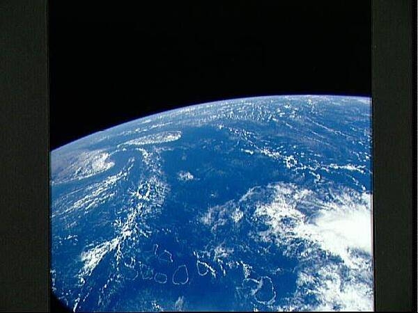
A view over the Indian Ocean as seen from the space shuttle. The bottom portion of the photo shows the complete chain of the atolls that form the Maldive Islands. Off to the left are the southern portion of India, the Palk Strait, and the island of Sri Lanka. Image courtesy of NASA.
A view over the Indian Ocean as seen from the space shuttle. The bottom portion of the photo shows the complete chain of the atolls that form the Maldive Islands. Off to the left are the southern portion of India, the Palk Strait, and the island of Sri Lanka. Image courtesy of NASA. • CIA World Factbook • 2020
CIA World Factbook • 2020
CIA World Factbook • 2020
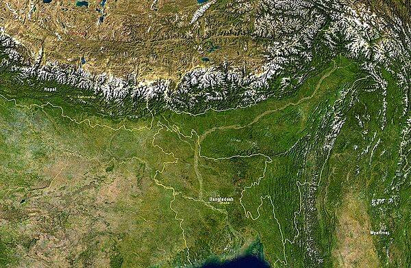
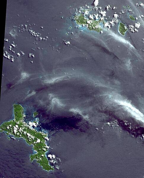
Satellite image showing Bangladesh and nearby countries. Bangladesh itself is bordered by India on its east, north, and west sides, and by Burma on the southeast. The snow-covered mountain chain is the Himalayas; to their north lies the Tibetan Plateau. Image courtesy of NASA.
Satellite image showing Bangladesh and nearby countries. Bangladesh itself is bordered by India on its east, north, and west sides, and by Burma on the southeast. The snow-covered mountain chain is the Himalayas; to their north lies the Tibetan Plateau. Image courtesy of NASA. • CIA World Factbook • 2020

A pavilion on the grounds of the Taj Mahal.
A pavilion on the grounds of the Taj Mahal. • CIA World Factbook • 2020
CIA World Factbook • 2020
CIA World Factbook • 2020
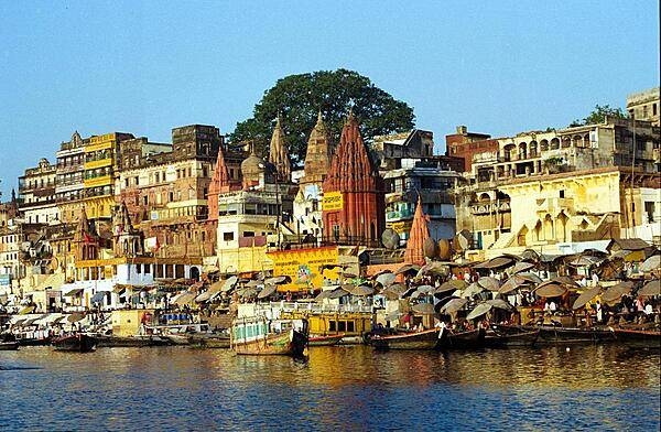
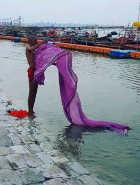
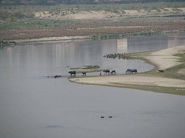
Varanasi, located on the west bank of the River Ganges in the state of Uttar Pradesh, is one of the oldest continuously inhabited cities in the world and is often referred to as the religious capital of India. Pilgrims journey to Varanasi to cleanse their spirits in the river.
Varanasi, located on the west bank of the River Ganges in the state of Uttar Pradesh, is one of the oldest continuously inhabited cities in the world and is often referred to as the religious capital of India. Pilgrims journey to Varanasi to cleanse their spirits in the river. • CIA World Factbook • 2020
CIA World Factbook • 2020
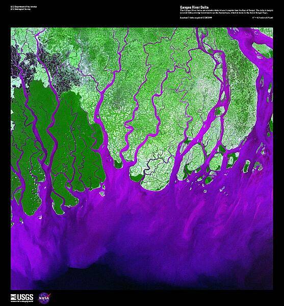
The Ganges River forms the largest tide-dominated delta in the world where it empties into the Bay of Bengal. This false-color satellite image vividly displays the large amount of sediment (violet), carried from as far away as the Himalayas, that precipitates when it abruptly encounters the sea. The delta is largely covered with a swamp forest known as the Sunderbans, which is home to the Royal Bengal Tiger. Image courtesy of USGS.
The Ganges River forms the largest tide-dominated delta in the world where it empties into the Bay of Bengal. This false-color satellite image vividly displays the large amount of sediment (violet), carried from as far away as the Himalayas, that precipitates when it abruptly encounters the sea. The delta is largely covered with a swamp forest known as the Sunderbans, which is home to the Royal Bengal Tiger. Image courtesy of USGS. • CIA World Factbook • 2020
CIA World Factbook • 2020
CIA World Factbook • 2020
CIA World Factbook • 2020
CIA World Factbook • 2020
CIA World Factbook • 2020
CIA World Factbook • 2020
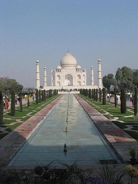
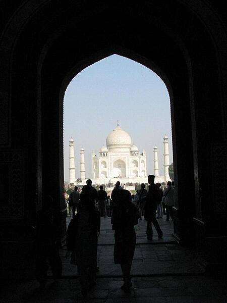
The Taj Mahal was built by Emperor Shah Jahan between 1632 and 1653 to honor the memory of his favorite wife. Located 125 miles from New Delhi in Agra, it took nearly 22 years, 22,000 workers, and 1,000 elephants to complete the white marble mausoleum.
The Taj Mahal was built by Emperor Shah Jahan between 1632 and 1653 to honor the memory of his favorite wife. Located 125 miles from New Delhi in Agra, it took nearly 22 years, 22,000 workers, and 1,000 elephants to complete the white marble mausoleum. • CIA World Factbook • 2020

On the road from Delhi to Agra.
On the road from Delhi to Agra. • CIA World Factbook • 2020
CIA World Factbook • 2020
CIA World Factbook • 2020
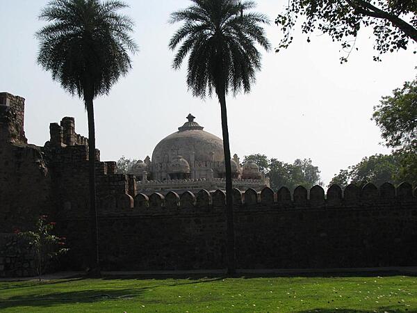
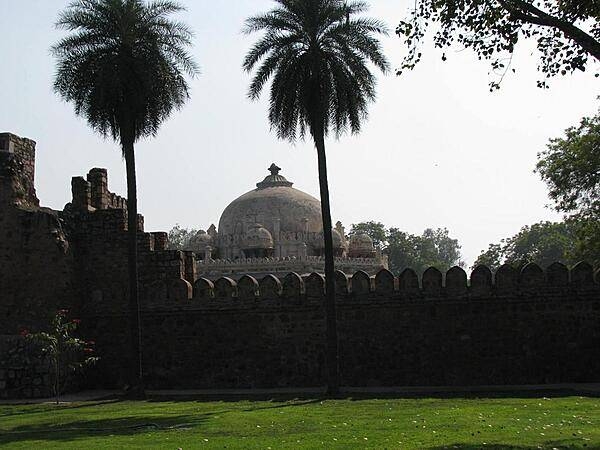
A view of the Humayun Tomb complex in Nizamuddin East, Delhi.
A view of the Humayun Tomb complex in Nizamuddin East, Delhi. • CIA World Factbook • 2020
CIA World Factbook • 2020
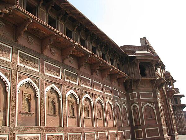
The Jahangiri Mahal, the most prominent building at Agra Fort.
The Jahangiri Mahal, the most prominent building at Agra Fort. • CIA World Factbook • 2020

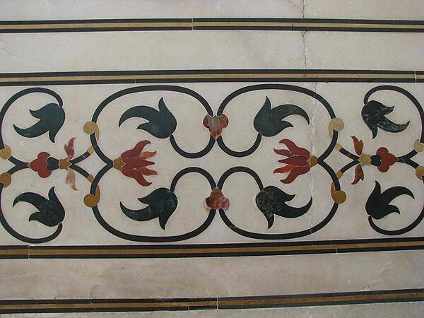
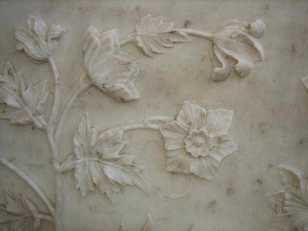
Realistic bas-relief floral design in marble at the Taj Mahal.
Realistic bas-relief floral design in marble at the Taj Mahal. • CIA World Factbook • 2020
Media source: CIA World Factbook (2020) — Public Domain