›››
Libya — Media Gallery
18 items available (flags, maps, photos)
Photos
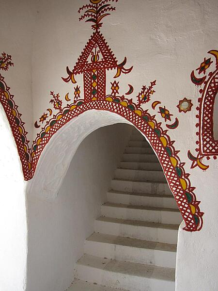
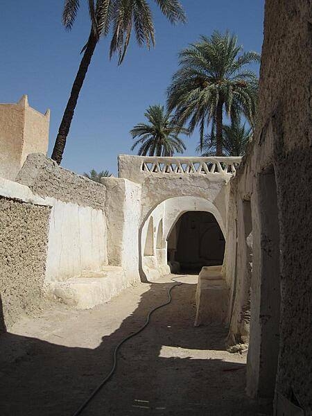
The traditionally decorated mud brick architecture of Ghadames' Old City is designed for natural cooling. Buildings are built directly adjacent to each other, which insulates the streets and living spaces below from the beating sun.
The traditionally decorated mud brick architecture of Ghadames' Old City is designed for natural cooling. Buildings are built directly adjacent to each other, which insulates the streets and living spaces below from the beating sun. • CIA World Factbook • 2020
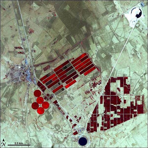
In the 1950s, oil exploration in Libya revealed that the country also had huge aquifers lurking underneath its scorching sands. Libyans weighed the costs of bringing water up from the aquifers against transporting water from Europe or the desalination of salt water, and chose the aquifers as the most cost-effective option. This false-color satellite image shows part of Libya's massive water project, known as the Grand Omar Mukhtar, near the city of Suluq. Libyans plan to make the Grand Omar Mukhtar the country's largest man-made reservoir. Water residing in reservoirs appears twice in this image, in the upper right and at the bottom. In both cases, the water appears dark blue. In this image, vegetation appears red, and the brighter the red, the more robust the vegetation. In this arid place, the vegetation results from irrigated agriculture, so the areas of red appear in the crisp geometric shapes of carefully planned fields. The circular spots of red are the result of result of center-pivot irrigation. Image courtesy of NASA.
In the 1950s, oil exploration in Libya revealed that the country also had huge aquifers lurking underneath its scorching sands. Libyans weighed the costs of bringing water up from the aquifers against transporting water from Europe or the desalination of salt water, and chose the aquifers as the most cost-effective option. This false-color satellite image shows part of Libya's massive water project, known as the Grand Omar Mukhtar, near the city of Suluq. Libyans plan to make the Grand Omar Mukhtar the country's largest man-made reservoir. Water residing in reservoirs appears twice in this image, in the upper right and at the bottom. In both cases, the water appears dark blue. In this image, vegetation appears red, and the brighter the red, the more robust the vegetation. In this arid place, the vegetation results from irrigated agriculture, so the areas of red appear in the crisp geometric shapes of carefully planned fields. The circular spots of red are the result of result of center-pivot irrigation. Image courtesy of NASA. • CIA World Factbook • 2020
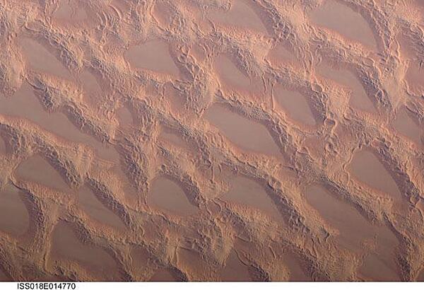
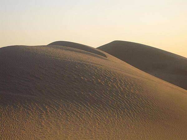
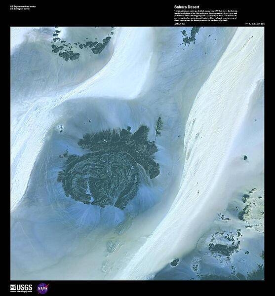
Photo shows classic large and small sand masses of the central Sahara Desert, where wind is a more powerful land-shaping agent than water. "Draa" dunes (from the Arabic for "arm") are very large masses of sand, and they appear here as the broad network of yellow-orange sand masses, with smooth-floored, almost sand-free basins between them. These sand masses lie in the western part of Libya's vast Marzuq Sand Sea. Geologists think that the draa of the Marzuq were probably formed by winds different from the prevailing north-northeast winds of today. Numerous smaller dunes have developed on the backs of the draa. Three distinct dune types are visible: longitudinal dunes, which are more or less parallel with the north winds; transverse dunes, which are usually more curved and formed at right angles to the wind; and star dunes, in which several linear arms converge towards a single peak. Image courtesy of NASA.
Photo shows classic large and small sand masses of the central Sahara Desert, where wind is a more powerful land-shaping agent than water. "Draa" dunes (from the Arabic for "arm") are very large masses of sand, and they appear here as the broad network of yellow-orange sand masses, with smooth-floored, almost sand-free basins between them. These sand masses lie in the western part of Libya's vast Marzuq Sand Sea. Geologists think that the draa of the Marzuq were probably formed by winds different from the prevailing north-northeast winds of today. Numerous smaller dunes have developed on the backs of the draa. Three distinct dune types are visible: longitudinal dunes, which are more or less parallel with the north winds; transverse dunes, which are usually more curved and formed at right angles to the wind; and star dunes, in which several linear arms converge towards a single peak. Image courtesy of NASA. • CIA World Factbook • 2020
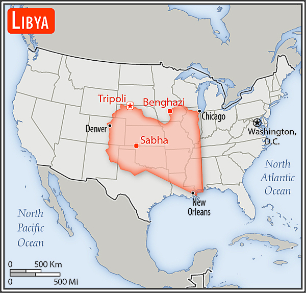
Area comparison map
Area comparison map • CIA World Factbook • 2020

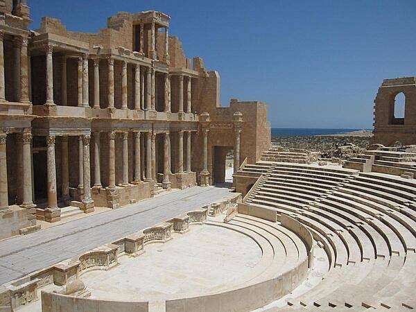
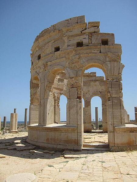
Leptis Magna, about 100 km (60 mi) east of Tripoli, is recognized as one of the most complete and best-preserved Roman ruins in the Mediterranean area.
Leptis Magna, about 100 km (60 mi) east of Tripoli, is recognized as one of the most complete and best-preserved Roman ruins in the Mediterranean area. • CIA World Factbook • 2020
CIA World Factbook • 2020
CIA World Factbook • 2020
CIA World Factbook • 2020
CIA World Factbook • 2020
CIA World Factbook • 2020
CIA World Factbook • 2020
CIA World Factbook • 2020
CIA World Factbook • 2020

CIA World Factbook • 2020
CIA World Factbook • 2020
The mountainous outcrops of Jebel Ouenat (Auenat) rise 1,830 m (6,000 ft) above the barren, uninhabited plains of the Libyan Desert. One of the wadis on the western side is the site of a permanent oasis where prehistoric petroglyphs may be found. The frontiers of Libya, Egypt, and Sudan meet amidst the mountains, which are remnants of an ancient granitic dome. Rivers of sand meander around them, swept across the desert pavement by northeasterly winds. False-color satellite image courtesy of USGS.
The mountainous outcrops of Jebel Ouenat (Auenat) rise 1,830 m (6,000 ft) above the barren, uninhabited plains of the Libyan Desert. One of the wadis on the western side is the site of a permanent oasis where prehistoric petroglyphs may be found. The frontiers of Libya, Egypt, and Sudan meet amidst the mountains, which are remnants of an ancient granitic dome. Rivers of sand meander around them, swept across the desert pavement by northeasterly winds. False-color satellite image courtesy of USGS. • CIA World Factbook • 2020
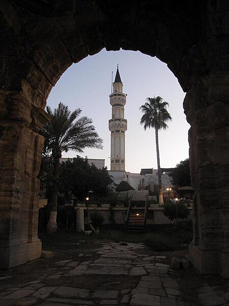
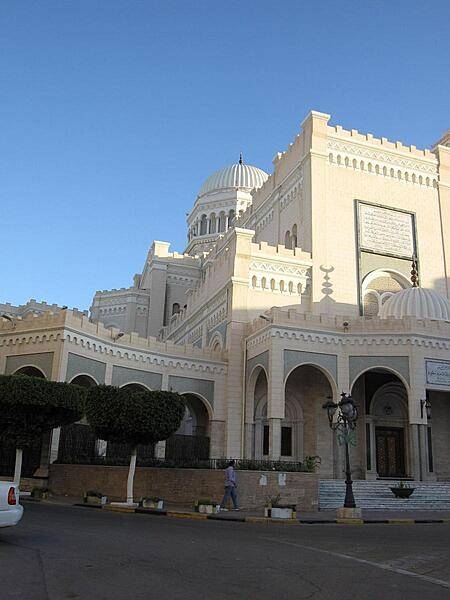
The Arch of Marcus Aurelius is the largest remaining Roman relic in Tripoli. Here seen framing a local minaret, the monument dates to the second half of the second century A.D.
The Arch of Marcus Aurelius is the largest remaining Roman relic in Tripoli. Here seen framing a local minaret, the monument dates to the second half of the second century A.D. • CIA World Factbook • 2020

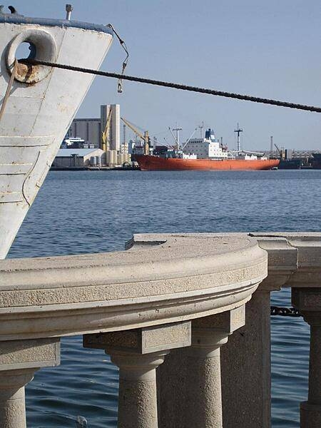
Tripoli Harbor is a study in contrasts, with significant industrial shipping taking place adjacent to a broad recreational riverwalk, popular with Tripoli residents of all ages.
Tripoli Harbor is a study in contrasts, with significant industrial shipping taking place adjacent to a broad recreational riverwalk, popular with Tripoli residents of all ages. • CIA World Factbook • 2020
Media source: CIA World Factbook (2020) — Public Domain