›››
Mexico — Media Gallery
15 items available (flags, maps, photos)
Photos
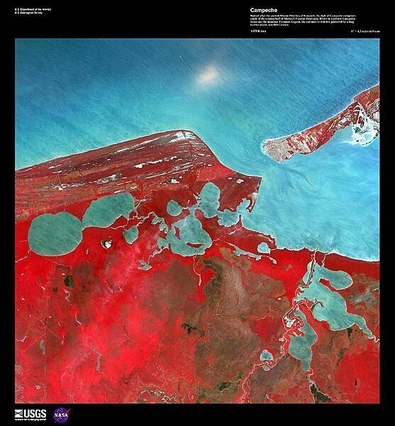
Named after the ancient Mayan Province of Kimpech, the state of Campeche comprises much of the western half of Mexico's Yucatan Peninsula. Rivers in southern Campeche drain into the immense Terminos Lagoon, the entrance to which is protected by a long barrier island, Isla Del Carmen (upper right). In this false-color satellite image the green jungle canopy shows up as bright red. Image courtesy of USGS.
Named after the ancient Mayan Province of Kimpech, the state of Campeche comprises much of the western half of Mexico's Yucatan Peninsula. Rivers in southern Campeche drain into the immense Terminos Lagoon, the entrance to which is protected by a long barrier island, Isla Del Carmen (upper right). In this false-color satellite image the green jungle canopy shows up as bright red. Image courtesy of USGS. • CIA World Factbook • 2020
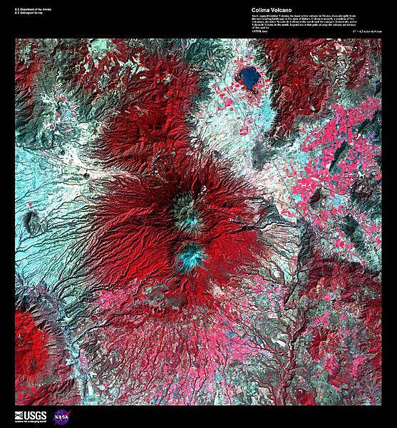
Snow-capped Colima Volcano, the most active volcano in Mexico, rises abruptly from the surrounding landscape in the state of Jalisco in the center of this false-color satellite image. Part of the trans-Mexican volcanic belt, Colima is actually a melding of two volcanoes, the older Nevado de Colima to the north and the younger, historically active Volcan de Colima to the south. Approximately 300,000 people live within 40 km (25 mi) of the volcano earning it designation as a Decade Volcano by the International Association of Volcanology and Chemistry of the Earth's Interior. Legend has it that gods sit atop the volcano on thrones of fire and ice. For other active volcanoes in Mexico, see the Natural hazards-volcanism subfield in the Geography section. Image courtesy of USGS.
Snow-capped Colima Volcano, the most active volcano in Mexico, rises abruptly from the surrounding landscape in the state of Jalisco in the center of this false-color satellite image. Part of the trans-Mexican volcanic belt, Colima is actually a melding of two volcanoes, the older Nevado de Colima to the north and the younger, historically active Volcan de Colima to the south. Approximately 300,000 people live within 40 km (25 mi) of the volcano earning it designation as a Decade Volcano by the International Association of Volcanology and Chemistry of the Earth's Interior. Legend has it that gods sit atop the volcano on thrones of fire and ice. For other active volcanoes in Mexico, see the Natural hazards-volcanism subfield in the Geography section. Image courtesy of USGS. • CIA World Factbook • 2020

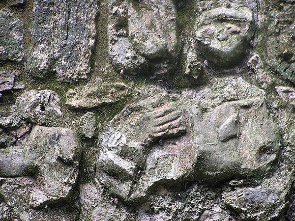
Traces of red paint still visible on Maya carving at Chacchoben.
Traces of red paint still visible on Maya carving at Chacchoben. • CIA World Factbook • 2020

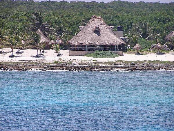
Beach resort of Costa Maya at Quintana Roo.
Beach resort of Costa Maya at Quintana Roo. • CIA World Factbook • 2020
CIA World Factbook • 2020

CIA World Factbook • 2020
CIA World Factbook • 2020
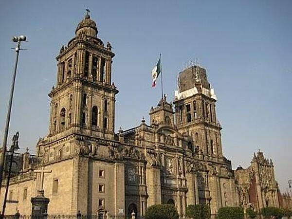
The Catedral Metropolitana de la Asuncion de Maria (Metropolitan Cathedral of the Assumption of Mary) on the Zocalo (main square) in Mexico City.
The Catedral Metropolitana de la Asuncion de Maria (Metropolitan Cathedral of the Assumption of Mary) on the Zocalo (main square) in Mexico City. • CIA World Factbook • 2020
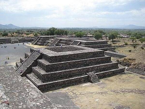
One of the smaller step pyramids at the massive archaeological site of Teotihuacan (approximately 40km or 25mi northeast of Mexico City).
One of the smaller step pyramids at the massive archaeological site of Teotihuacan (approximately 40km or 25mi northeast of Mexico City). • CIA World Factbook • 2020
CIA World Factbook • 2020
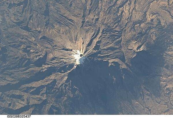
The snow and ice-clad peak of Pico de Orizaba (also known as Citlaltepetl) boasts a summit elevation of 5,675 m (18,619 ft) above sea level, making it the highest peak in Mexico and North America?s highest volcano. It is also one of three volcanic peaks in Mexico - together with Popocatepetl and Iztaccihuatl - that retain summit glaciers. Pico de Orizaba is part of the Trans-Mexican Volcanic Belt that extends roughly east-west across Mexico. The last recorded eruption took place in 1846; while the volcano is considered dormant at present, geologists continue to investigate the potential hazards associated with a renewal of activity. Shadows accentuate several features of the Pico de Orizaba stratovolcano visible in this photograph from the International Space Station. The 300-meter-deep summit crater is clearly visible against surrounding ice and snow cover at center. Several lava flows extend down the flanks of the volcano, made readily visible by prominent cooling ridges along their sides known as flow levees. One of the most clearly visible examples is located on the southwest flank of the cone. The extinct Sierra Negra volcano to the southwest has a summit elevation of 4,640 m (15,223 ft) above sea level; while not as lofty as Pico de Orizaba, it is also one of Mexico?s highest peaks. Image courtesy of NASA.
The snow and ice-clad peak of Pico de Orizaba (also known as Citlaltepetl) boasts a summit elevation of 5,675 m (18,619 ft) above sea level, making it the highest peak in Mexico and North America?s highest volcano. It is also one of three volcanic peaks in Mexico - together with Popocatepetl and Iztaccihuatl - that retain summit glaciers. Pico de Orizaba is part of the Trans-Mexican Volcanic Belt that extends roughly east-west across Mexico. The last recorded eruption took place in 1846; while the volcano is considered dormant at present, geologists continue to investigate the potential hazards associated with a renewal of activity. Shadows accentuate several features of the Pico de Orizaba stratovolcano visible in this photograph from the International Space Station. The 300-meter-deep summit crater is clearly visible against surrounding ice and snow cover at center. Several lava flows extend down the flanks of the volcano, made readily visible by prominent cooling ridges along their sides known as flow levees. One of the most clearly visible examples is located on the southwest flank of the cone. The extinct Sierra Negra volcano to the southwest has a summit elevation of 4,640 m (15,223 ft) above sea level; while not as lofty as Pico de Orizaba, it is also one of Mexico?s highest peaks. Image courtesy of NASA. • CIA World Factbook • 2020
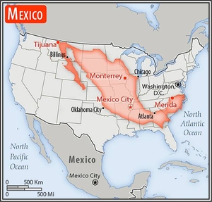
Area comparison map
Area comparison map • CIA World Factbook • 2020
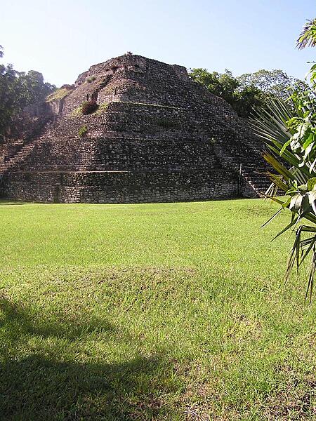
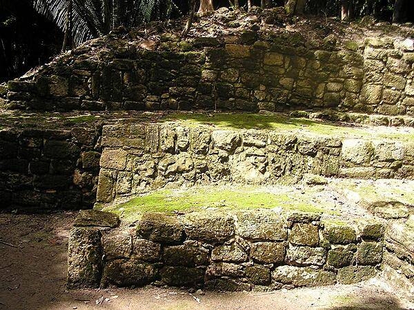
The Chacchoben Maya temple pyramid dates to about AD 700; it was originally painted red and yellow.
The Chacchoben Maya temple pyramid dates to about AD 700; it was originally painted red and yellow. • CIA World Factbook • 2020
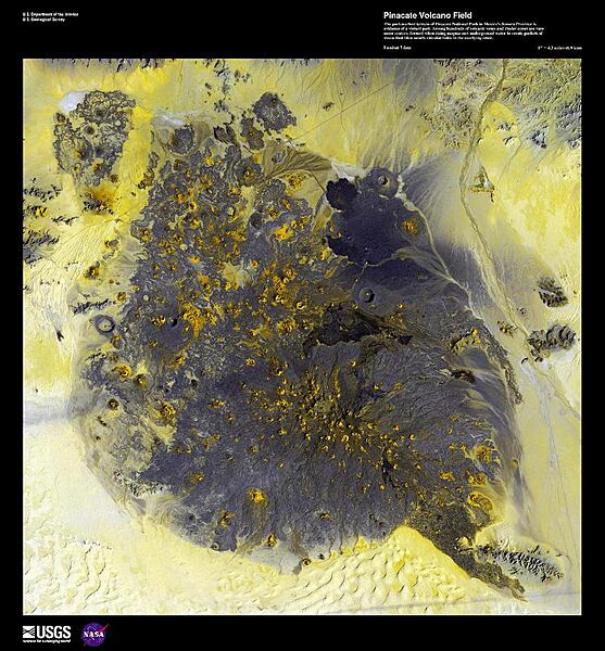
The pockmarked terrain of Pinacate National Park in Sonora province, shown in this enhanced satellite image, provides evidence of a violent geologic past. Among hundreds of volcanic vents and cinder cones are rare maar craters, formed when rising magma met underground water to create pockets of steam that blew nearly circular holes in the overlying crust. American astronauts used this area in 1965-70 to train for lunar excursions; surrounding the region are the vast sand dune fields of Gran Desierto de Altar. Image courtesy of USGS.
The pockmarked terrain of Pinacate National Park in Sonora province, shown in this enhanced satellite image, provides evidence of a violent geologic past. Among hundreds of volcanic vents and cinder cones are rare maar craters, formed when rising magma met underground water to create pockets of steam that blew nearly circular holes in the overlying crust. American astronauts used this area in 1965-70 to train for lunar excursions; surrounding the region are the vast sand dune fields of Gran Desierto de Altar. Image courtesy of USGS. • CIA World Factbook • 2020
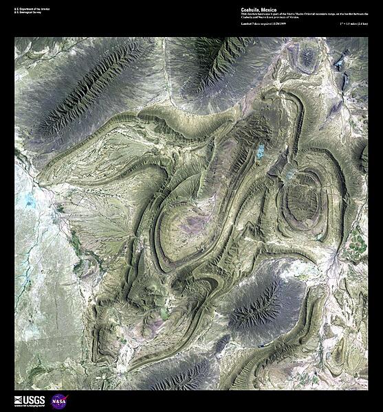
This high-resolution satellite image shows part of the Sierra Madre Oriental mountain range, on the border between the Coahuila and Nuevo Leon provinces of eastern Mexico. This range is part of the Sierra Madre Mountains that divide Mexico, and which also include the Sierra Madre Occidental on the West coast and the Sierra Madre del Sur in southern Mexico. In the area shown, ancient sedimentary rocks were folded as a result of a tectonic collision that some geologists consider related to the Appalachian folding of eastern North America. This mountain range is drier than the rainforest areas to the south. Image courtesy of USGS.
This high-resolution satellite image shows part of the Sierra Madre Oriental mountain range, on the border between the Coahuila and Nuevo Leon provinces of eastern Mexico. This range is part of the Sierra Madre Mountains that divide Mexico, and which also include the Sierra Madre Occidental on the West coast and the Sierra Madre del Sur in southern Mexico. In the area shown, ancient sedimentary rocks were folded as a result of a tectonic collision that some geologists consider related to the Appalachian folding of eastern North America. This mountain range is drier than the rainforest areas to the south. Image courtesy of USGS. • CIA World Factbook • 2020
Media source: CIA World Factbook (2020) — Public Domain