›››
Netherlands — Media Gallery
19 items available (flags, maps, photos)
Photos
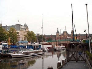
The Amsterdam Centraal railway station overlooks the city's harbor.
The Amsterdam Centraal railway station overlooks the city's harbor. • CIA World Factbook • 2020
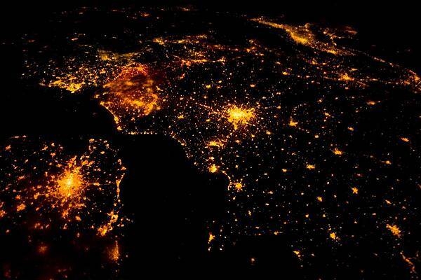
Several of the oldest cities of northwestern Europe are highlighted in this astronaut photo of 10 August 2011. While the landscape is dotted with clusters of lights from individual urban areas, the metropolitan areas of London (lower left), Paris (center), Brussels, and Amsterdam (upper left) stand out due to their large light "footprints." The metropolitan area of Milan is also visible at image upper right. While each of these cities is, or has been, the capital of a kingdom, republic, or empire - Paris and London have been all three - Brussels is also the capital city of the European Union. To give a sense of scale, the centers of the London and Paris metropolitan areas are approximately 340 km (210 mi) from each other. The image is also oblique making the distance between Paris and Milan (640 km, or 400 mi) appear less than that of Paris to London. In contrast to the land surface defined by the city lights, the English Channel presents a uniform dark appearance. Similarly, the Alps near Milan are also largely devoid of lights. While much of the atmosphere was clear at the time the image was taken, the lights of Brussels are dimmed by thin cloud cover. Image courtesy of NASA.
Several of the oldest cities of northwestern Europe are highlighted in this astronaut photo of 10 August 2011. While the landscape is dotted with clusters of lights from individual urban areas, the metropolitan areas of London (lower left), Paris (center), Brussels, and Amsterdam (upper left) stand out due to their large light "footprints." The metropolitan area of Milan is also visible at image upper right. While each of these cities is, or has been, the capital of a kingdom, republic, or empire - Paris and London have been all three - Brussels is also the capital city of the European Union. To give a sense of scale, the centers of the London and Paris metropolitan areas are approximately 340 km (210 mi) from each other. The image is also oblique making the distance between Paris and Milan (640 km, or 400 mi) appear less than that of Paris to London. In contrast to the land surface defined by the city lights, the English Channel presents a uniform dark appearance. Similarly, the Alps near Milan are also largely devoid of lights. While much of the atmosphere was clear at the time the image was taken, the lights of Brussels are dimmed by thin cloud cover. Image courtesy of NASA. • CIA World Factbook • 2020
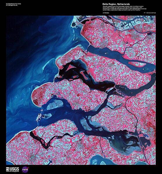
Along the southern coast of the Netherlands, sediment-laden rivers have created a massive delta of islands and waterways in the gaps between coastal dunes. The area in this false-color satellite image is extensively farmed, giving the photo its patchwork look. The Dutch have built an elaborate system of dikes, canals, dams, bridges, and locks to hold back the North Sea because of rising sea levels and devastating historic floods. The Dutch coastline has changed significantly over time due to these floods, such as the 1134 storm that formed the Zeeland archipelago when water covered massive swaths of land. Other major floods include St. Lucia's Day flood in 1287, St. Elizabeth's Day flood in 1421, and a massive flood in 1953 that sparked the building of the Delta works system in place today. The Delta works will be under stress in coming years as sea levels continue to rise. Image courtesy of USGS.
Along the southern coast of the Netherlands, sediment-laden rivers have created a massive delta of islands and waterways in the gaps between coastal dunes. The area in this false-color satellite image is extensively farmed, giving the photo its patchwork look. The Dutch have built an elaborate system of dikes, canals, dams, bridges, and locks to hold back the North Sea because of rising sea levels and devastating historic floods. The Dutch coastline has changed significantly over time due to these floods, such as the 1134 storm that formed the Zeeland archipelago when water covered massive swaths of land. Other major floods include St. Lucia's Day flood in 1287, St. Elizabeth's Day flood in 1421, and a massive flood in 1953 that sparked the building of the Delta works system in place today. The Delta works will be under stress in coming years as sea levels continue to rise. Image courtesy of USGS. • CIA World Factbook • 2020
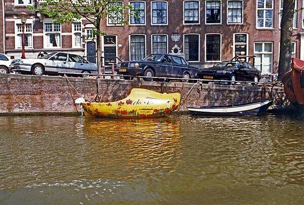
A wooden shoe-shaped boat on an Amsterdam canal. Most of the city's canals were built in the 17th century. The old city center of Amsterdam is the focal point for architectural styles prior the end of the 19th century; outlying areas display more recent architectural styles.
A wooden shoe-shaped boat on an Amsterdam canal. Most of the city's canals were built in the 17th century. The old city center of Amsterdam is the focal point for architectural styles prior the end of the 19th century; outlying areas display more recent architectural styles. • CIA World Factbook • 2020
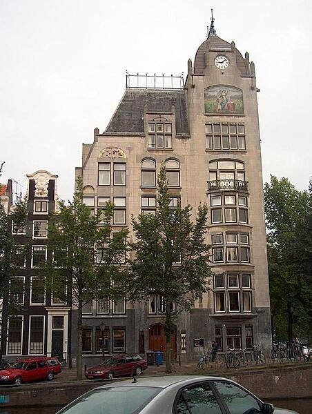
The Astoria building in Amsterdam, built 1904-05, is indicative of a more reserved style of Art-Nouveau (Jugendstil) that came to be known as "New Art" (Nieuwe Kunst). Though difficult to distinguish, typical Art-Nouveau engravings appear in the gray stone around the doorway.
The Astoria building in Amsterdam, built 1904-05, is indicative of a more reserved style of Art-Nouveau (Jugendstil) that came to be known as "New Art" (Nieuwe Kunst). Though difficult to distinguish, typical Art-Nouveau engravings appear in the gray stone around the doorway. • CIA World Factbook • 2020
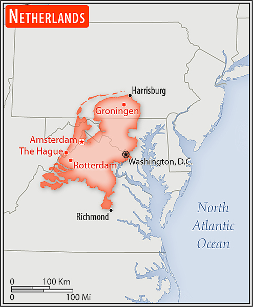
Area comparison map
Area comparison map • CIA World Factbook • 2020
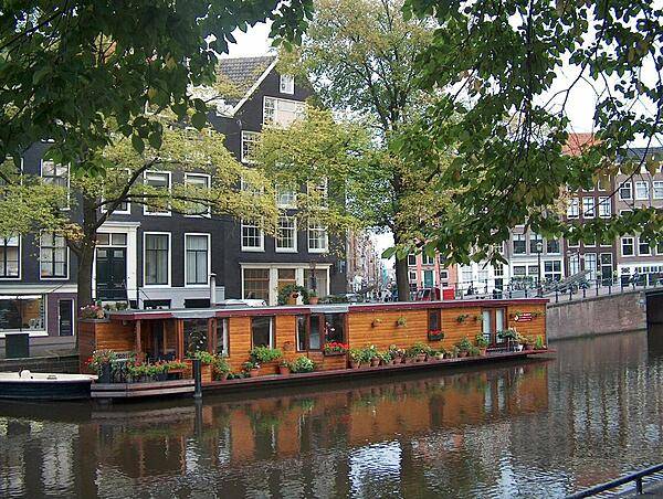
The floating Tulip Museum in Amsterdam.
The floating Tulip Museum in Amsterdam. • CIA World Factbook • 2020
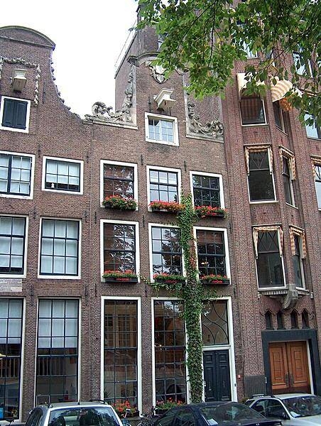
Modernized facades on older buildings in Amsterdam.
Modernized facades on older buildings in Amsterdam. • CIA World Factbook • 2020
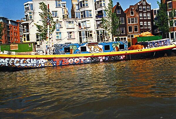
Colorful coffee shop barge moored on an Amsterdam canal.
Colorful coffee shop barge moored on an Amsterdam canal. • CIA World Factbook • 2020
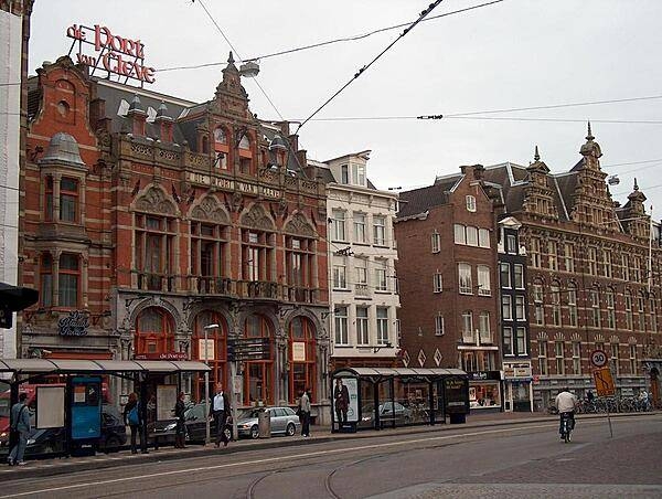
Distinctive architecture along an Amsterdam street.
Distinctive architecture along an Amsterdam street. • CIA World Factbook • 2020
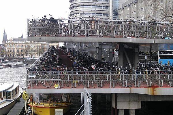
Bicycles are a ubiquitous form of transport in Amsterdam.
Bicycles are a ubiquitous form of transport in Amsterdam. • CIA World Factbook • 2020
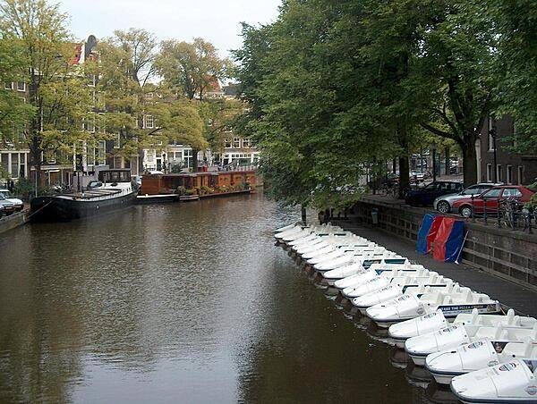
Lined up tourist boats on an Amsterdam canal resemble a row of shoes. The floating Tulip Museum is in the background.
Lined up tourist boats on an Amsterdam canal resemble a row of shoes. The floating Tulip Museum is in the background. • CIA World Factbook • 2020
CIA World Factbook • 2020
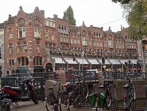
View along Nieuwezijds Voorburgwal, a street (formerly a canal) in the heart of Amsterdam.
View along Nieuwezijds Voorburgwal, a street (formerly a canal) in the heart of Amsterdam. • CIA World Factbook • 2020
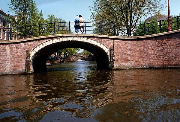
A series of similar-looking bridges spanning an Amsterdam canal.
A series of similar-looking bridges spanning an Amsterdam canal. • CIA World Factbook • 2020
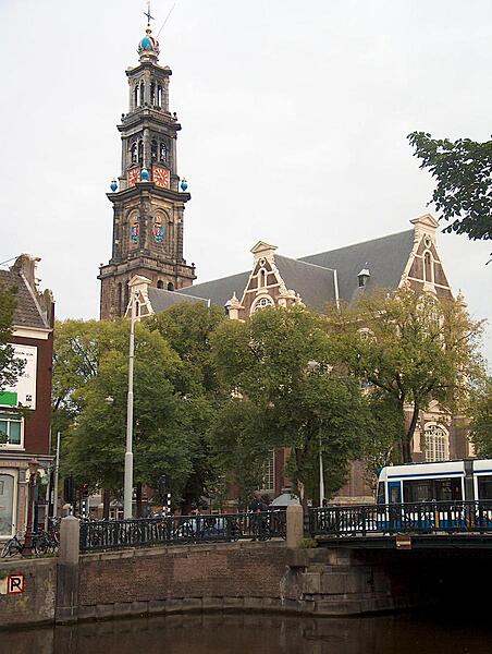
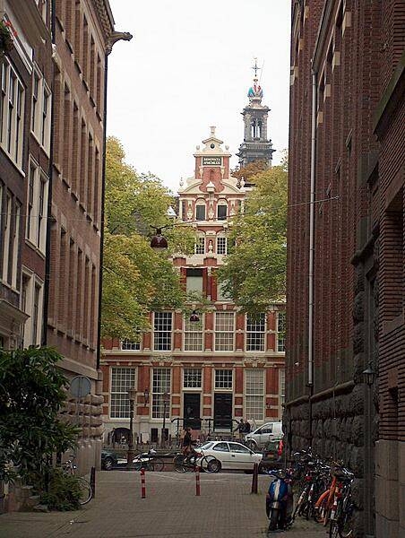
The spire of the Westerkerk (85 m) is the highest church tower in Amsterdam. The edifice was completed in 1638.
The spire of the Westerkerk (85 m) is the highest church tower in Amsterdam. The edifice was completed in 1638. • CIA World Factbook • 2020

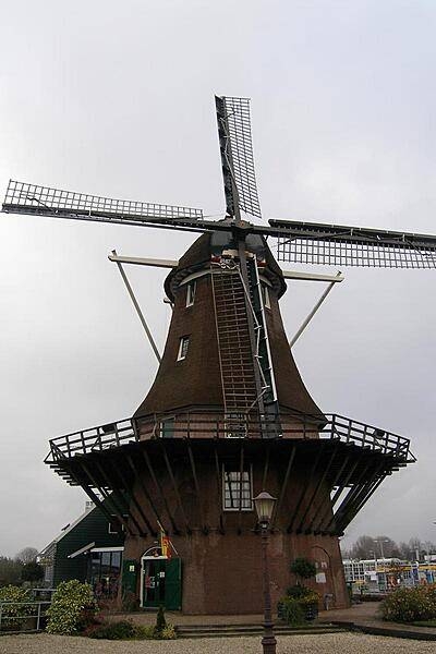
Molen van Sloten (the Sloten Windmill), on the outskirts of Amsterdam, is a still-functioning polder-draining mill. Dating from 1847, the mill can pump 60,000 liters of water per minute from the polder.
Molen van Sloten (the Sloten Windmill), on the outskirts of Amsterdam, is a still-functioning polder-draining mill. Dating from 1847, the mill can pump 60,000 liters of water per minute from the polder. • CIA World Factbook • 2020
CIA World Factbook • 2020
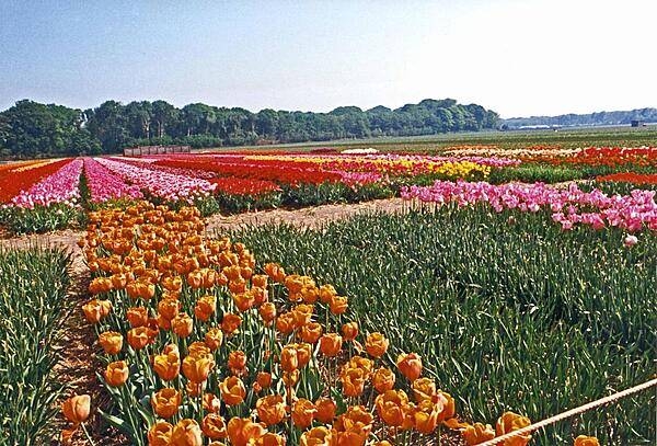
Tulip fields brighten an already sunny day. The tulip is today the symbol of the Netherlands, having arrived from the Ottoman Empire in the 16th century.
Tulip fields brighten an already sunny day. The tulip is today the symbol of the Netherlands, having arrived from the Ottoman Empire in the 16th century. • CIA World Factbook • 2020
Media source: CIA World Factbook (2020) — Public Domain