›››
Peru — Media Gallery
76 items available (flags, maps, photos)
Photos
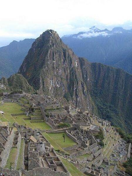
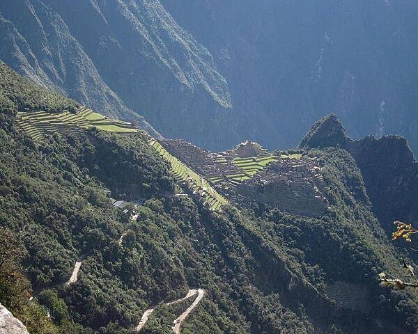
Machu Picchu has been declared a World Heritage Site and was named one of the "New" Seven Wonders of the World.
Machu Picchu has been declared a World Heritage Site and was named one of the "New" Seven Wonders of the World. • CIA World Factbook • 2020
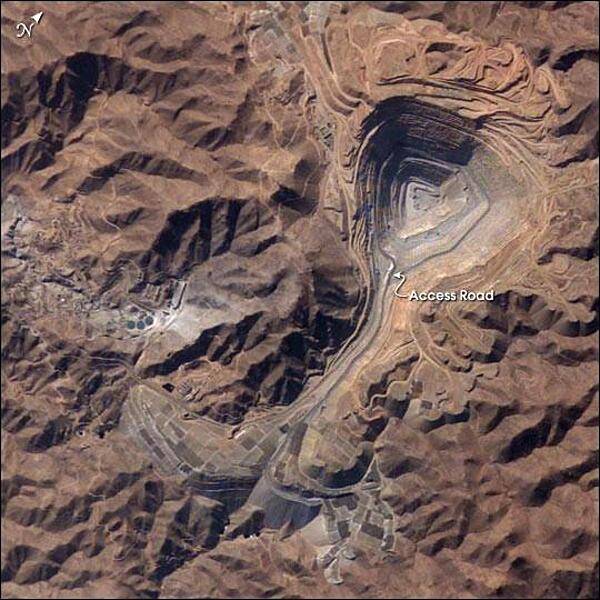
The rugged, mineral-rich Andes support some of the world's biggest mines (gold, silver, copper, and more). This image looks down the bull's-eye of Peru's Toquepala copper mine, a steep sided and stepped open-pit mine. Mid-afternoon sunlight on the arid slopes of the central Andes mountains provides an accent to the mine contours. At the surface, the open pit is 2.5 km (1.5 mi) across, and it descends more than 700 m (2,300 ft) into the earth. A dark line on the wall of the pit is the main access road to the bottom. Spoil dumps of material mined from the pit are arranged in tiers along the northwest lip of the pit. Numerous angular leaching fields appear lower right, and the railroad to the coast is a line that exits the image center left. The railroad was built to export Toquepala's copper and connects the coastal port of Ilo, 95 km (60 mi) to the southwest. Photo courtesy of NASA.
The rugged, mineral-rich Andes support some of the world's biggest mines (gold, silver, copper, and more). This image looks down the bull's-eye of Peru's Toquepala copper mine, a steep sided and stepped open-pit mine. Mid-afternoon sunlight on the arid slopes of the central Andes mountains provides an accent to the mine contours. At the surface, the open pit is 2.5 km (1.5 mi) across, and it descends more than 700 m (2,300 ft) into the earth. A dark line on the wall of the pit is the main access road to the bottom. Spoil dumps of material mined from the pit are arranged in tiers along the northwest lip of the pit. Numerous angular leaching fields appear lower right, and the railroad to the coast is a line that exits the image center left. The railroad was built to export Toquepala's copper and connects the coastal port of Ilo, 95 km (60 mi) to the southwest. Photo courtesy of NASA. • CIA World Factbook • 2020
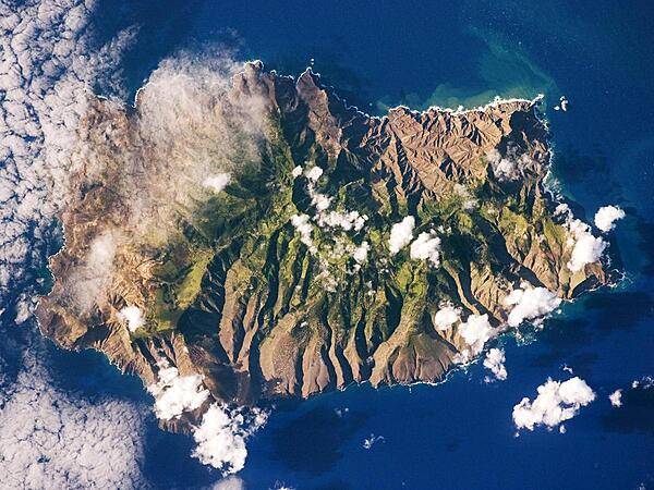
Saint Helena's rugged topography of sharp peaks and deep ravines - evident in this photograph from the International Space Station - is the result of erosion of the volcanic rocks that make up the island. A climatic gradient related to elevation is also evident - the higher, wetter central portion of the island is covered with green vegetation, whereas the lower coastal areas are drier and hotter with little vegetation cover. Image courtesy of NASA.
Saint Helena's rugged topography of sharp peaks and deep ravines - evident in this photograph from the International Space Station - is the result of erosion of the volcanic rocks that make up the island. A climatic gradient related to elevation is also evident - the higher, wetter central portion of the island is covered with green vegetation, whereas the lower coastal areas are drier and hotter with little vegetation cover. Image courtesy of NASA. • CIA World Factbook • 2020
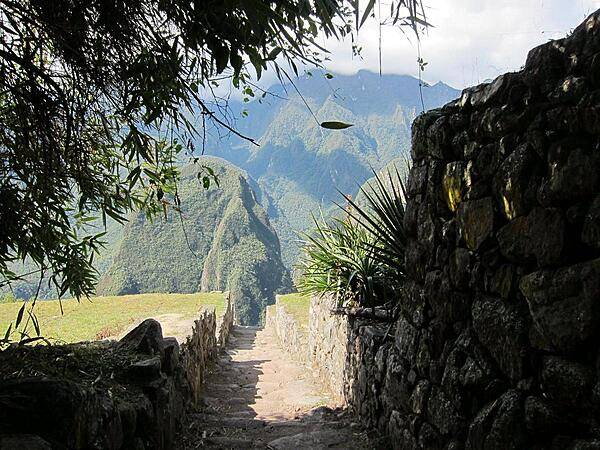
A section of the Inca Trail near the Machu Picchu ruins. The Trail between Cusco, the Inca's ancient capital, and the ruins is approximately 80 km (50 mi).
A section of the Inca Trail near the Machu Picchu ruins. The Trail between Cusco, the Inca's ancient capital, and the ruins is approximately 80 km (50 mi). • CIA World Factbook • 2020
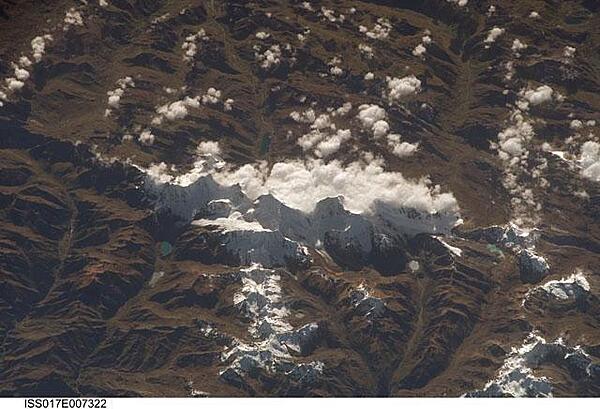
This view of the Peruvian Andes was taken looking east from the international space station flying off the Peruvian coast and shows Cordillera Huayhuash (pronounced Why-wash). Here clouds are banked up on the east side, snow covers all higher slopes and mountain peaks, and glaciers occupy lower slopes. This prominent but short mountain range (25 km or 15 mi in length) boasts twenty peaks of remarkable steepness and ridge sharpness. Although only 100 km (60 mi) from the coastline, six of the peaks reach above 6,000 m (more than 19,500 ft), the highest of which is Nevado Yerupaja, Peru's second highest peak, variously estimated as 6,617 and 6,635 m high. Generally considered the most spectacular peak in South America, Yerupaja is so steep that it has seldom been climbed. Photo courtesy of NASA.
This view of the Peruvian Andes was taken looking east from the international space station flying off the Peruvian coast and shows Cordillera Huayhuash (pronounced Why-wash). Here clouds are banked up on the east side, snow covers all higher slopes and mountain peaks, and glaciers occupy lower slopes. This prominent but short mountain range (25 km or 15 mi in length) boasts twenty peaks of remarkable steepness and ridge sharpness. Although only 100 km (60 mi) from the coastline, six of the peaks reach above 6,000 m (more than 19,500 ft), the highest of which is Nevado Yerupaja, Peru's second highest peak, variously estimated as 6,617 and 6,635 m high. Generally considered the most spectacular peak in South America, Yerupaja is so steep that it has seldom been climbed. Photo courtesy of NASA. • CIA World Factbook • 2020
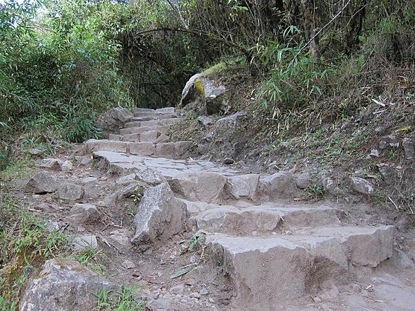
Steep rock steps on the Inca Trail are common. The majority of the trail's stones date back to the Inca Empire.
Steep rock steps on the Inca Trail are common. The majority of the trail's stones date back to the Inca Empire. • CIA World Factbook • 2020
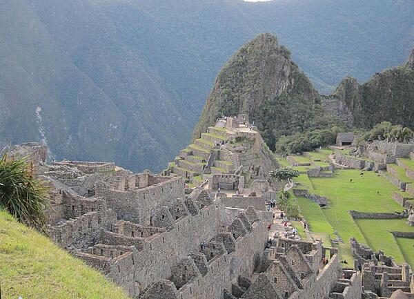
A section of housing is seen in front of Machu Picchu's Sacred Plaza, with the Intiwatana (Hitching Post of the Sun) above the plaza and the Western Urban Section to its right, where llamas roam.
A section of housing is seen in front of Machu Picchu's Sacred Plaza, with the Intiwatana (Hitching Post of the Sun) above the plaza and the Western Urban Section to its right, where llamas roam. • CIA World Factbook • 2020
The Urubamba River bends around Huayna Picchu's base.
The Urubamba River bends around Huayna Picchu's base. • CIA World Factbook • 2020
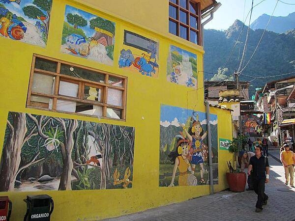
Murals reflecting an area's history or other subjects of interest to the locals are a common sight in Peru. This mural is in Aguas Calientes.
Murals reflecting an area's history or other subjects of interest to the locals are a common sight in Peru. This mural is in Aguas Calientes. • CIA World Factbook • 2020
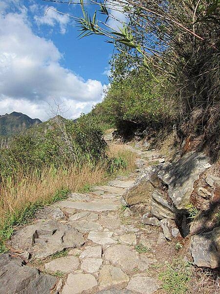
The Inca Trail is typically narrow with a steep incline on one side and steep decline on the other side.
The Inca Trail is typically narrow with a steep incline on one side and steep decline on the other side. • CIA World Factbook • 2020
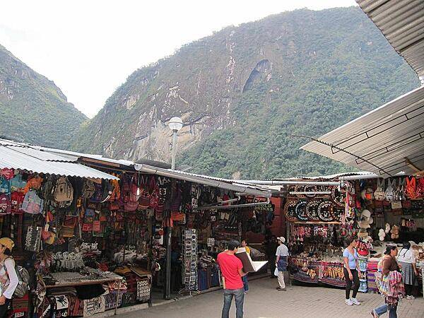
One of numerous markets in Aguas Calientes.
One of numerous markets in Aguas Calientes. • CIA World Factbook • 2020
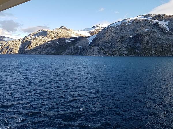
Mountains along ship channel through southeast Greenland.
Mountains along ship channel through southeast Greenland. • CIA World Factbook • 2020
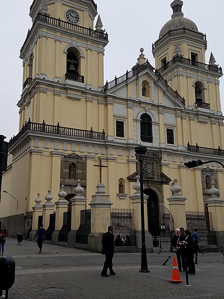
The Basilica Cathedral of Lima located on the Plaza Mayor in downtown Lima. Construction on the cathedral, which is dedicated to the apostle Saint John the Evangelist, began in 1535; the structure has undergone many expansions and transformations over the ensuing centuries.
The Basilica Cathedral of Lima located on the Plaza Mayor in downtown Lima. Construction on the cathedral, which is dedicated to the apostle Saint John the Evangelist, began in 1535; the structure has undergone many expansions and transformations over the ensuing centuries. • CIA World Factbook • 2020
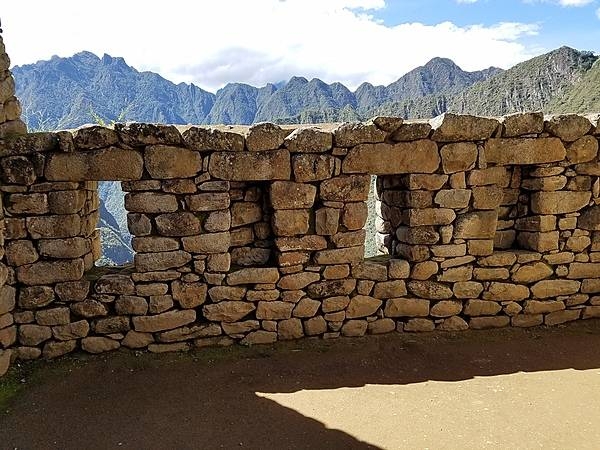
Wall with trapezoidal windows in Machu Picchu.
Wall with trapezoidal windows in Machu Picchu. • CIA World Factbook • 2020

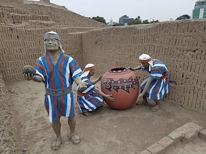
Huaca Pucllana is a great adobe and clay pyramid preserved in central Lima. Built from seven staggered platforms, it served as an important ceremonial and administrative center for the Lima Culture, a society that developed along the Peruvian central coast between the years A.D. 200-700. A display at the Huaca recreates a ritual offering vessel.
Huaca Pucllana is a great adobe and clay pyramid preserved in central Lima. Built from seven staggered platforms, it served as an important ceremonial and administrative center for the Lima Culture, a society that developed along the Peruvian central coast between the years A.D. 200-700. A display at the Huaca recreates a ritual offering vessel. • CIA World Factbook • 2020
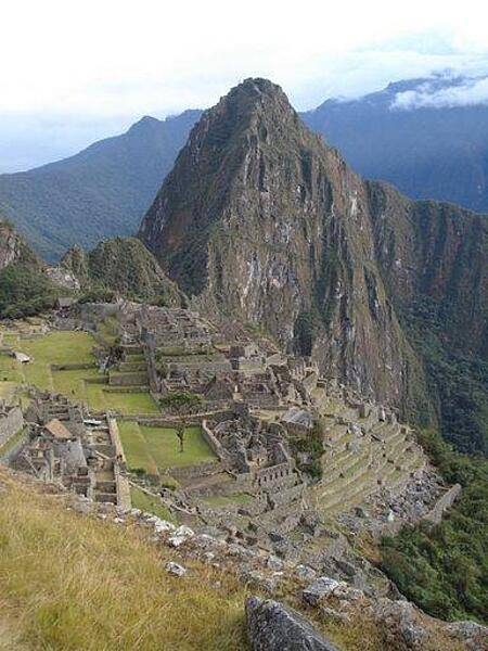
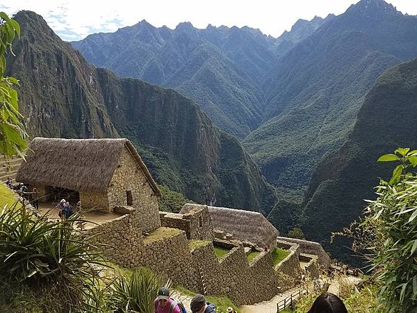
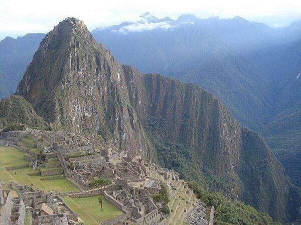
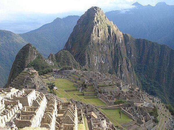
Located high in the Andes, and not rediscovered until the early part of the 20th century, the spectacular Inca ruins of Machu Picchu are one of the showpieces of South America.
Located high in the Andes, and not rediscovered until the early part of the 20th century, the spectacular Inca ruins of Machu Picchu are one of the showpieces of South America. • CIA World Factbook • 2020
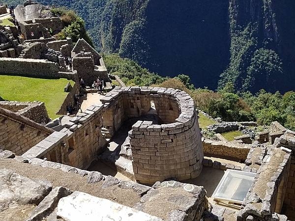
The Temple of the Sun or Torreon at Machu Picchu.
The Temple of the Sun or Torreon at Machu Picchu. • CIA World Factbook • 2020
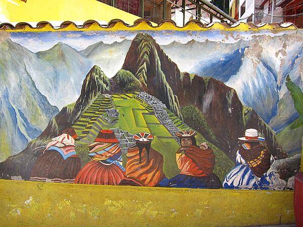
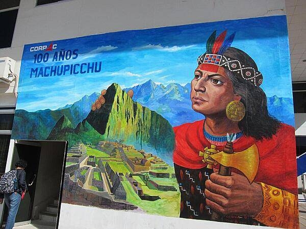
The mural of Machu Picchu in Aguas Calientes honors the Incas.
The mural of Machu Picchu in Aguas Calientes honors the Incas. • CIA World Factbook • 2020
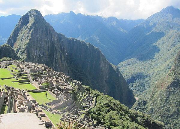
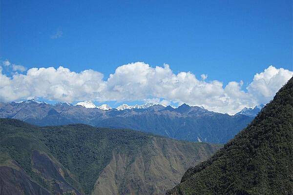
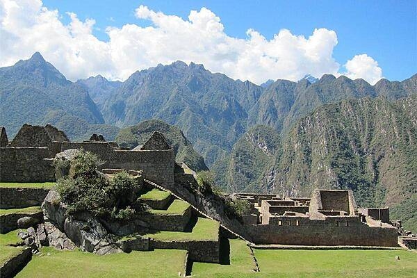
This view of the Andes from Machu Picchu gives some idea of just how high up the Inca citadel is situated.
This view of the Andes from Machu Picchu gives some idea of just how high up the Inca citadel is situated. • CIA World Factbook • 2020
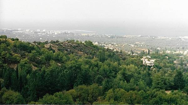
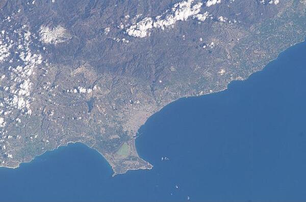
Landscape view looking towards the city of Limassol.
Landscape view looking towards the city of Limassol. • CIA World Factbook • 2020
CIA World Factbook • 2020
The Sovereign Base Area of Akrotiri juts into the Mediterranean Sea in this astronaut photo from 2003. The salt lake appears green in this image; the gray area further north is the Cypriot city of Limassol. Image courtesy of NASA.
The Sovereign Base Area of Akrotiri juts into the Mediterranean Sea in this astronaut photo from 2003. The salt lake appears green in this image; the gray area further north is the Cypriot city of Limassol. Image courtesy of NASA. • CIA World Factbook • 2020
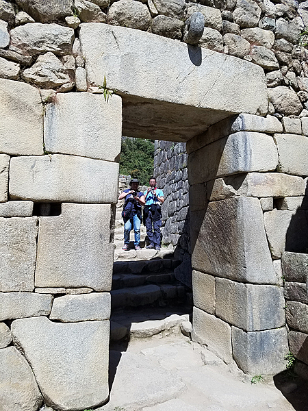
Impressive archway in Machu Picchu. The Incas constructed their windows and doors in a trapezoidal form (wider at the base and narrower at the top) because this shape provided greater stability during earthquakes.
Impressive archway in Machu Picchu. The Incas constructed their windows and doors in a trapezoidal form (wider at the base and narrower at the top) because this shape provided greater stability during earthquakes. • CIA World Factbook • 2020
Andes vista viewed from Intipunku (Sun Gate) at Machu Picchu.
Andes vista viewed from Intipunku (Sun Gate) at Machu Picchu. • CIA World Factbook • 2020
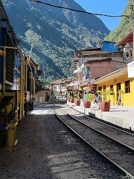
A train passing through the center of Aguas Calientes.
A train passing through the center of Aguas Calientes. • CIA World Factbook • 2020
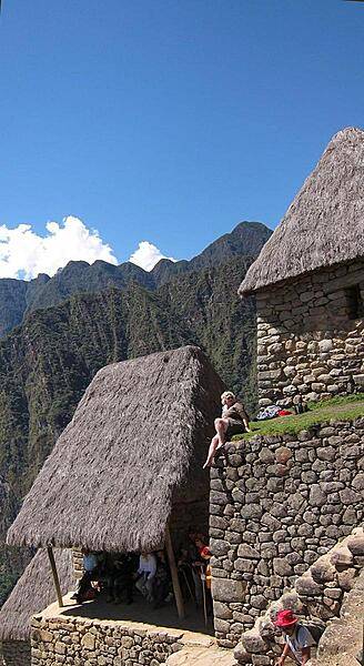
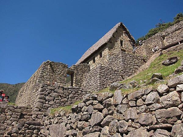
Thatched roofs have been restored on some of the buildings at Machu Picchu.
Thatched roofs have been restored on some of the buildings at Machu Picchu. • CIA World Factbook • 2020
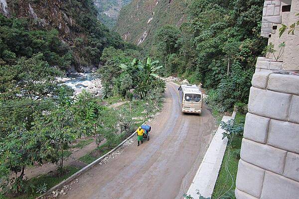
A bus taking tourists to the sacred Incan city of Machu Picchu passes a shopkeeper wheeling his wares to Aguas Calientes (Hot Waters), the nearest access point to the mountaintop city.
A bus taking tourists to the sacred Incan city of Machu Picchu passes a shopkeeper wheeling his wares to Aguas Calientes (Hot Waters), the nearest access point to the mountaintop city. • CIA World Factbook • 2020

At the Presidential Palace in Lima. The military band at the Palace performs at noon daily.
At the Presidential Palace in Lima. The military band at the Palace performs at noon daily. • CIA World Factbook • 2020
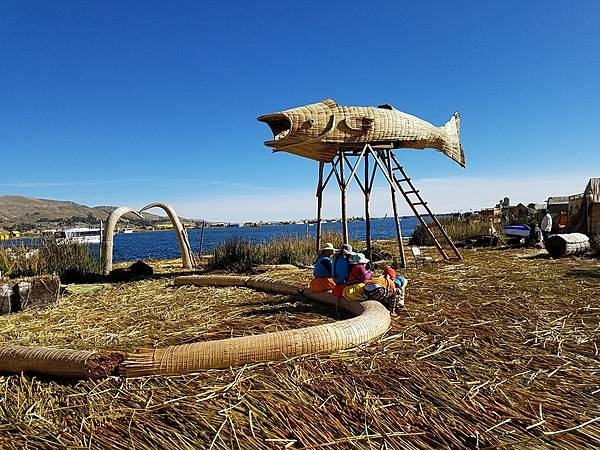
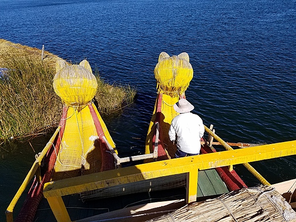
There are many floating islands on the lake. The residents construct figures made of reeds to attract visitors.
There are many floating islands on the lake. The residents construct figures made of reeds to attract visitors. • CIA World Factbook • 2020
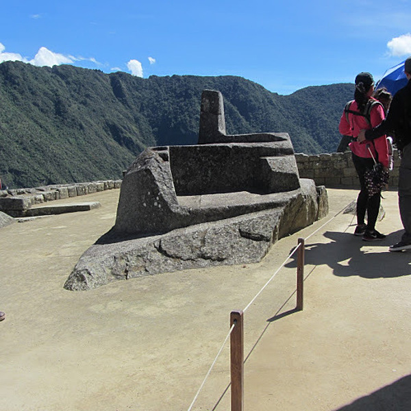
The Intiwatana at Machu Picchu is a notable ritual stone that has been described as an astronomic clock, a type of sundial, or a calendar of the Inca. The Inca believed the stone held the sun in its place along its annual path in the sky. The stone aligns with the sun's position during the winter solstice (June 21), casting its longest shadow on its southern side . At midday on the equinoxes the sun stands almost above the pillar, casting no shadow at all. In Quechua, "inti" is the name of "the sun" and "wata-" is a verb root meaning "to tie or hitch (up)." The "-na" suffix indicates a tool or place. Hence inti-wata-na is literally an instrument or place to "tie up the sun," often colorfully conveyed as "The Hitching Post of the Sun."
The Intiwatana at Machu Picchu is a notable ritual stone that has been described as an astronomic clock, a type of sundial, or a calendar of the Inca. The Inca believed the stone held the sun in its place along its annual path in the sky. The stone aligns with the sun's position during the winter solstice (June 21), casting its longest shadow on its southern side . At midday on the equinoxes the sun stands almost above the pillar, casting no shadow at all.
In Quechua, "inti" is the name of "the sun" and "wata-" is a verb root meaning "to tie or hitch (up)." The "-na" suffix indicates a tool or place. Hence inti-wata-na is literally an instrument or place to "tie up the sun," often colorfully conveyed as "The Hitching Post of the Sun." • CIA World Factbook • 2020
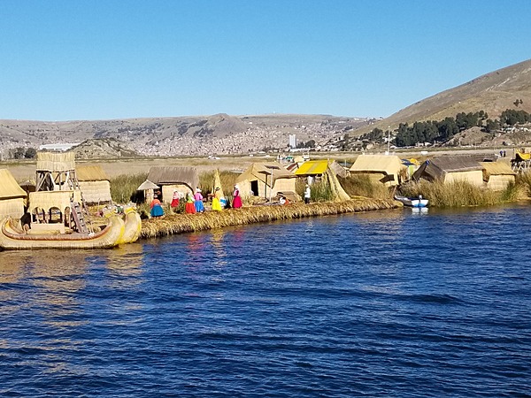
Lake Titicaca on the Peru-Bolivia border is the highest navigable lake in the world at 3,805 m. The lake has floating islands made from totora reed layers that are replenished constantly.
Lake Titicaca on the Peru-Bolivia border is the highest navigable lake in the world at 3,805 m. The lake has floating islands made from totora reed layers that are replenished constantly. • CIA World Factbook • 2020
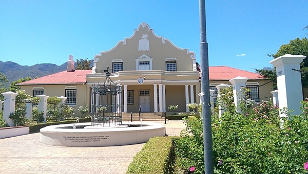
Building in Stellenbosch in the West Cape displays the Dutch Cape style. The town, founded in 1679, lies in the center of wine country.
Building in Stellenbosch in the West Cape displays the Dutch Cape style. The town, founded in 1679, lies in the center of wine country. • CIA World Factbook • 2020
The Incas built temples and terrances at the top of Huayna Picchu, approximately 2,720 m (8,920 ft) above sea level.
The Incas built temples and terrances at the top of Huayna Picchu, approximately 2,720 m (8,920 ft) above sea level. • CIA World Factbook • 2020
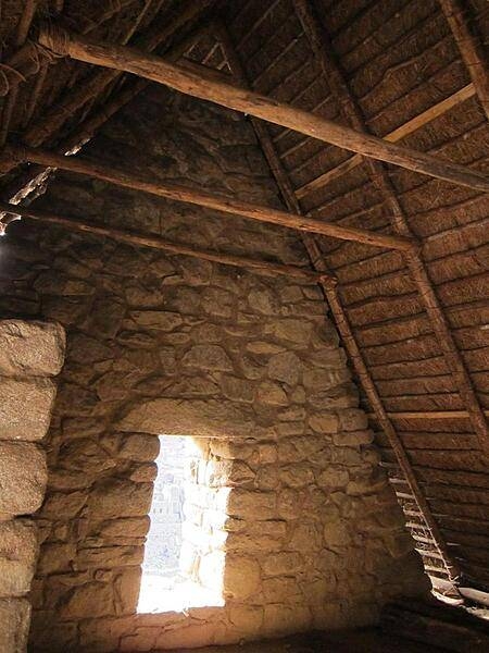
The inside of a Machu Picchu house with a thatched roof showing the traditional shape of Inca windows.
The inside of a Machu Picchu house with a thatched roof showing the traditional shape of Inca windows. • CIA World Factbook • 2020
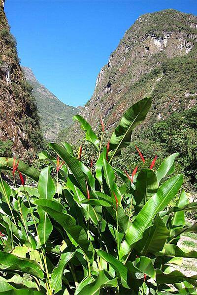
Bird of Paradise plants in Aguas Calientes (Hot Waters), the closest modern-day town to the ancient mountaintop city of Machu Picchu.
Bird of Paradise plants in Aguas Calientes (Hot Waters), the closest modern-day town to the ancient mountaintop city of Machu Picchu. • CIA World Factbook • 2020
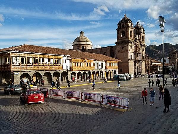
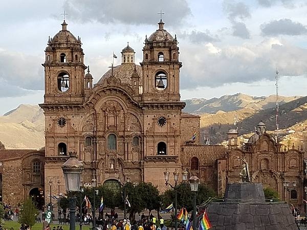
A colonial building and the Iglesia de la Compania de Jesus (Church of the Society of Jesus) on the Plaza de Armas (Parade Square) in Cusco.
A colonial building and the Iglesia de la Compania de Jesus (Church of the Society of Jesus) on the Plaza de Armas (Parade Square) in Cusco. • CIA World Factbook • 2020
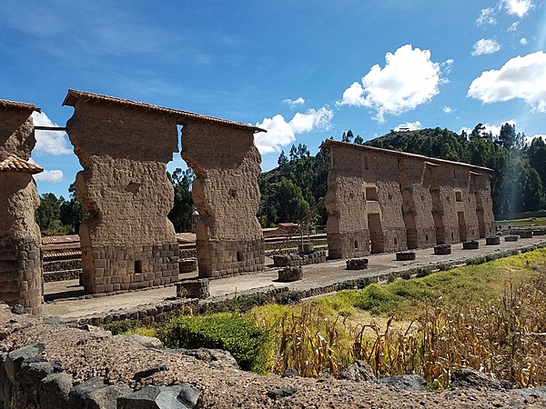
Central wall of the huge two-story Inca Temple of Viracocha at Raqchi; the remains are some 100 m long and 14 m high. The original building consisted of a central adobe wall some 18 to 20 meters in height with a cut stone foundation base. Windows and doors allowed passage from one side to the other. The central wall was flanked on either side by a row of eleven columns. The foundations for both the wall and the columns were constructed of classic high Inca stonework with the remaining height built of adobe. (The 4 m height of the wall foundation survives, but most of the column heights have been reduced.) Prior to its destruction by the Spaniards, the temple had what was likely the largest single gable roof in the Incan Empire, with its peak at the central wall and stretching out over the columns on each side. The site is at 3,480 m above sea level and 110 km from Cusco.
Central wall of the huge two-story Inca Temple of Viracocha at Raqchi; the remains are some 100 m long and 14 m high. The original building consisted of a central adobe wall some 18 to 20 meters in height with a cut stone foundation base. Windows and doors allowed passage from one side to the other. The central wall was flanked on either side by a row of eleven columns. The foundations for both the wall and the columns were constructed of classic high Inca stonework with the remaining height built of adobe. (The 4 m height of the wall foundation survives, but most of the column heights have been reduced.) Prior to its destruction by the Spaniards, the temple had what was likely the largest single gable roof in the Incan Empire, with its peak at the central wall and stretching out over the columns on each side. The site is at 3,480 m above sea level and 110 km from Cusco. • CIA World Factbook • 2020
CIA World Factbook • 2020
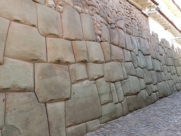
Close up of a typical Inca wall in Cusco - constructed without mortar and with no spaces between the enormous blocks of stone.
Close up of a typical Inca wall in Cusco - constructed without mortar and with no spaces between the enormous blocks of stone. • CIA World Factbook • 2020
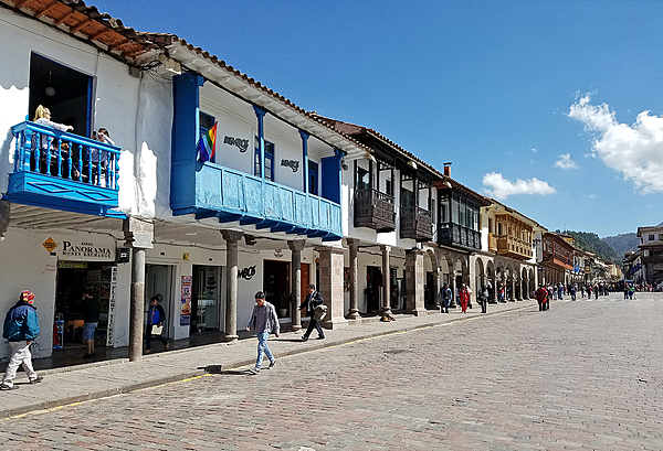
Buildings off the main square in Cusco.
Buildings off the main square in Cusco. • CIA World Factbook • 2020
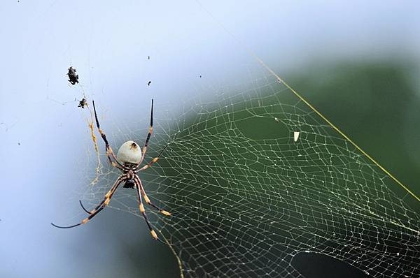
A Golden Orb Weaver Spider basks on the island of Vava'u, Tonga. This arachnid is found In warm climates and can vary in color. The spider takes its name from the gold color of the silk in its web. Its venomous bite is painful but rarely deadly to humans. Photo courtesy of the US Army National Guard/ Sgt. Walter H. Lowell.
A Golden Orb Weaver Spider basks on the island of Vava'u, Tonga. This arachnid is found In warm climates and can vary in color. The spider takes its name from the gold color of the silk in its web. Its venomous bite is painful but rarely deadly to humans. Photo courtesy of the US Army National Guard/ Sgt. Walter H. Lowell. • CIA World Factbook • 2020
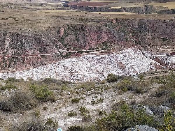
Salineras de Maras in the Sacred Valley is the site of ancient salt pans, first developed by the Wari culture and subsequently by the Inca. Today, there are more than 5,000 salt pans near Maras, almost all less than 4 sq m (43 sq ft) in size and no more than about 30 cm (1 ft) deep. Each pan is owned and mined by a local family of the Salineras community. The salt is collected and sold in local shops or in nearby towns. Although the salt pans are man-made, the water that is channeled through them comes from a subterranean natural brine spring that bubbles up near the small town.
Salineras de Maras in the Sacred Valley is the site of ancient salt pans, first developed by the Wari culture and subsequently by the Inca. Today, there are more than 5,000 salt pans near Maras, almost all less than 4 sq m (43 sq ft) in size and no more than about 30 cm (1 ft) deep. Each pan is owned and mined by a local family of the Salineras community. The salt is collected and sold in local shops or in nearby towns.
Although the salt pans are man-made, the water that is channeled through them comes from a subterranean natural brine spring that bubbles up near the small town. • CIA World Factbook • 2020
This site at La Raya is the highest point on the road from Cusco to Puno at 4,325 m. The snow-covered high Andes may be seen in the distance.
This site at La Raya is the highest point on the road from Cusco to Puno at 4,325 m. The snow-covered high Andes may be seen in the distance. • CIA World Factbook • 2020
CIA World Factbook • 2020
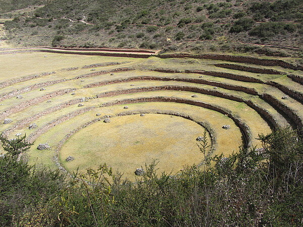
This huge series of concentric terraces in Moray (just west of the salt pans of Maras) served as an ancient agricultural research station. The distance from the highest to lowest ring is 150 m (490 ft), which allowed the Wari and later the Inca peoples to experiment with growing crops at different altitudes and exposure to the sun. The circular bottom is so well drained that it never completely floods, no matter how hard the rain.
This huge series of concentric terraces in Moray (just west of the salt pans of Maras) served as an ancient agricultural research station. The distance from the highest to lowest ring is 150 m (490 ft), which allowed the Wari and later the Inca peoples to experiment with growing crops at different altitudes and exposure to the sun. The circular bottom is so well drained that it never completely floods, no matter how hard the rain. • CIA World Factbook • 2020
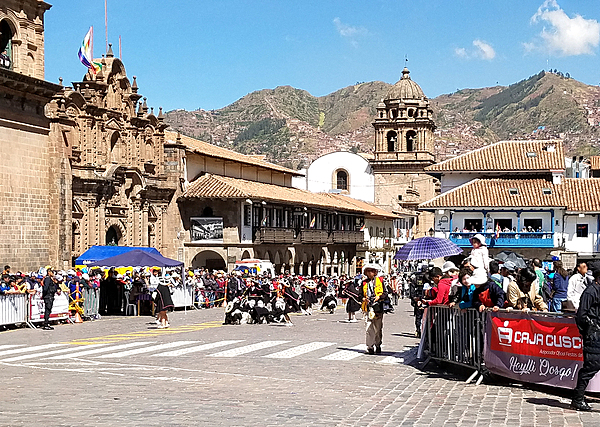
A festival in Cusco. The city served as the capital of the Inca Empire from the 13th until the 16th-century Spanish conquest.
A festival in Cusco. The city served as the capital of the Inca Empire from the 13th until the 16th-century Spanish conquest. • CIA World Factbook • 2020

A festival in Cusco. The city served as the capital of the Inca Empire from the 13th until the 16th-century Spanish conquest.
A festival in Cusco. The city served as the capital of the Inca Empire from the 13th until the 16th-century Spanish conquest. • CIA World Factbook • 2020
Colorful reed boats with viewing platforms take visitors on tours of Lake Titicaca.
Colorful reed boats with viewing platforms take visitors on tours of Lake Titicaca. • CIA World Factbook • 2020
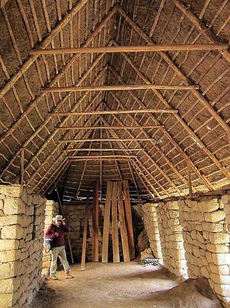
The inside of a large Machu Picchu structure with a thatched roof.
The inside of a large Machu Picchu structure with a thatched roof. • CIA World Factbook • 2020
CIA World Factbook • 2020
CIA World Factbook • 2020
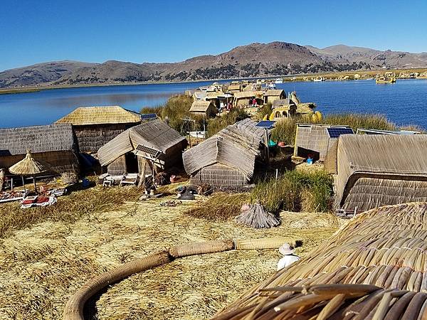
Small community on a floating island on Lake Titicaca.
Small community on a floating island on Lake Titicaca. • CIA World Factbook • 2020
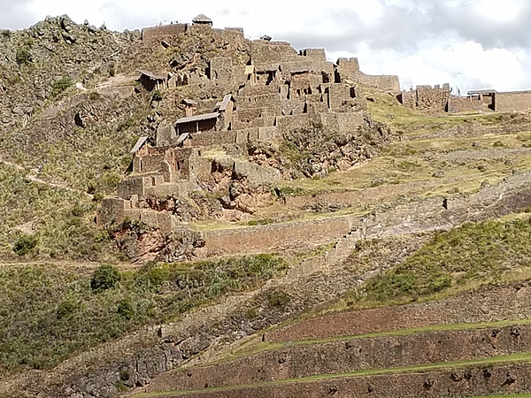
Cliff dwellings in the Sacred Valley.
Cliff dwellings in the Sacred Valley. • CIA World Factbook • 2020
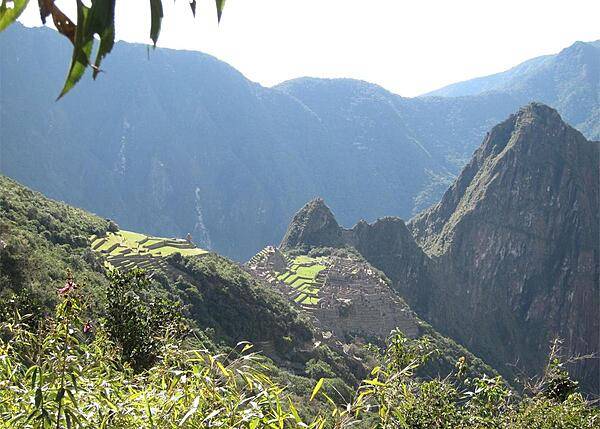
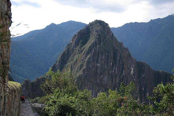
Machu Picchu (Old Mountain) in the foreground and Huayna Picchu (Young Mountain) on the right as viewed from the Inca Trail.
Machu Picchu (Old Mountain) in the foreground and Huayna Picchu (Young Mountain) on the right as viewed from the Inca Trail. • CIA World Factbook • 2020
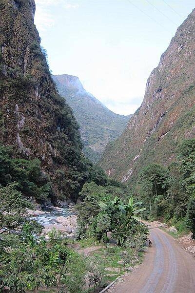
Urubamba River alongside Aguas Calientes, 3.5 miles (6 km) from Machu Picchu.
Urubamba River alongside Aguas Calientes, 3.5 miles (6 km) from Machu Picchu. • CIA World Factbook • 2020
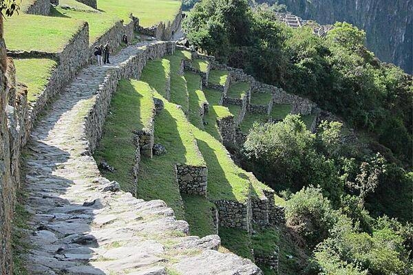
The Incas built terraces to stabilize the mountainsides and to grow crops.
The Incas built terraces to stabilize the mountainsides and to grow crops. • CIA World Factbook • 2020
Machu Picchu is situated roughly 2,430 m (7,970 ft) above sea level.
Machu Picchu is situated roughly 2,430 m (7,970 ft) above sea level. • CIA World Factbook • 2020
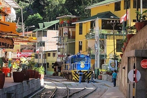
Trains bring tourists and supplies to Aguas Calientes (Hot Waters), also known by the name of Machupicchu Pueblo.
Trains bring tourists and supplies to Aguas Calientes (Hot Waters), also known by the name of Machupicchu Pueblo. • CIA World Factbook • 2020
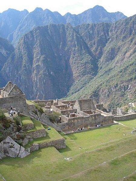
Many of the former housing units of the city of Machu Picchu are visible in the foreground of this image.
Many of the former housing units of the city of Machu Picchu are visible in the foreground of this image. • CIA World Factbook • 2020
CIA World Factbook • 2020
Cave mouths of all sizes are a common feature in the Andes Mountains. This sight is along the Inca Trail between the Machu Picchu ruins and the Sun Gate (Intipunko).
Cave mouths of all sizes are a common feature in the Andes Mountains. This sight is along the Inca Trail between the Machu Picchu ruins and the Sun Gate (Intipunko). • CIA World Factbook • 2020
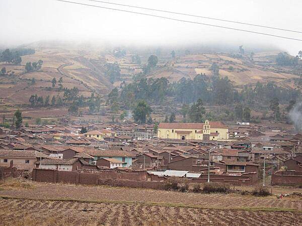
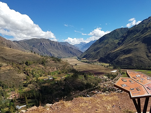
A typical large town in the Sacred Valley (Urumbamba Valley) between Cusco and Machu Picchu.
A typical large town in the Sacred Valley (Urumbamba Valley) between Cusco and Machu Picchu. • CIA World Factbook • 2020
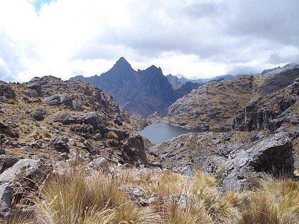
Small mountain lake in the Andes.
Small mountain lake in the Andes. • CIA World Factbook • 2020
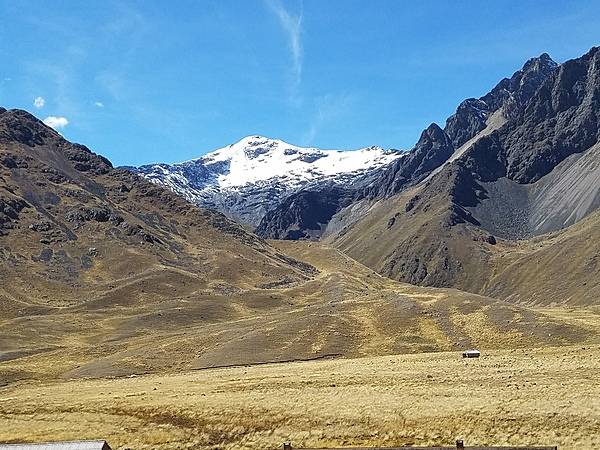
Aerial view contrasting snow and semi-arid terrain in the Andes.
Aerial view contrasting snow and semi-arid terrain in the Andes. • CIA World Factbook • 2020
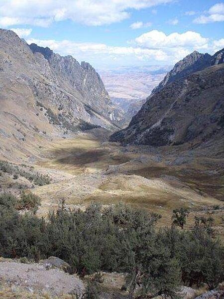
Valley in the Andes Mountains.
Valley in the Andes Mountains. • CIA World Factbook • 2020
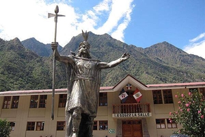
Archaeologists think Machu Picchu was built as an estate for Inca Emperor Pachacuti, who reigned from 1438 to 1472. His statue dominates a square in Aguas Calientes.
Archaeologists think Machu Picchu was built as an estate for Inca Emperor Pachacuti, who reigned from 1438 to 1472. His statue dominates a square in Aguas Calientes. • CIA World Factbook • 2020
Excavation at some of the housing units at Machu Picchu.
Excavation at some of the housing units at Machu Picchu. • CIA World Factbook • 2020
A house at the Machu Picchu ruins with a new thatched roof, modeled after the Inca roof design.
A house at the Machu Picchu ruins with a new thatched roof, modeled after the Inca roof design. • CIA World Factbook • 2020
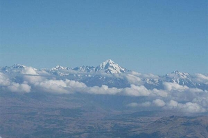
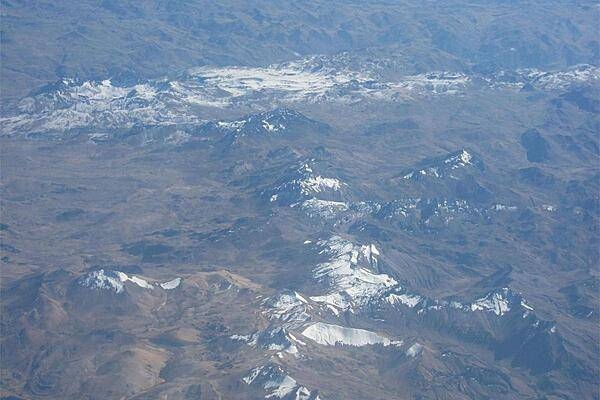
Aerial shot of snow-capped Andes Mountains between Lima and Cusco.
Aerial shot of snow-capped Andes Mountains between Lima and Cusco. • CIA World Factbook • 2020
Houses near the Sacred Plaza of Machu Picchu, approximately 2,430 m (7,970 ft) above sea level.
Houses near the Sacred Plaza of Machu Picchu, approximately 2,430 m (7,970 ft) above sea level. • CIA World Factbook • 2020
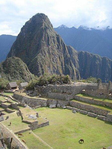
Llamas in a plaza at Machu Picchu.
Llamas in a plaza at Machu Picchu. • CIA World Factbook • 2020
This panaramic view highlights the steep hills that buses and hikers traverse to reach the ruins.
This panaramic view highlights the steep hills that buses and hikers traverse to reach the ruins. • CIA World Factbook • 2020
Area comparison map
Area comparison map • CIA World Factbook • 2020
CIA World Factbook • 2020
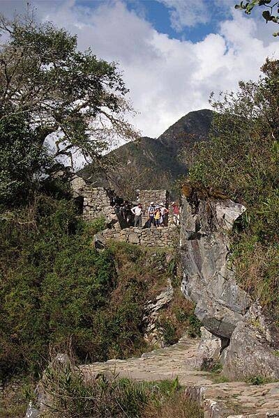
The Inca Trail ends at Intipunku (Sun Gate).
The Inca Trail ends at Intipunku (Sun Gate). • CIA World Factbook • 2020

The quipu is a system of knotted cords the Incas and their predecessors in the Andean region used for accounting and storing massive amounts of data important to their civilizations.
The quipu is a system of knotted cords the Incas and their predecessors in the Andean region used for accounting and storing massive amounts of data important to their civilizations. • CIA World Factbook • 2020
Media source: CIA World Factbook (2020) — Public Domain