›››
Portugal — Media Gallery
24 items available (flags, maps, photos)
Photos
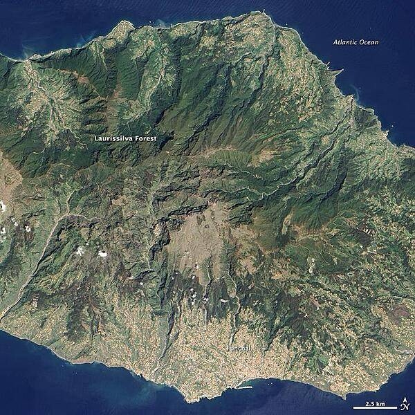
Located in the Atlantic Ocean about 700 km off the coast of North Africa, Madeira Island is the top of a giant shield volcano that rises 6 km from the ocean floor to reach an altitude of 1,862 m above sea level. When Portuguese explorers arrived there in the early 1400s, they were so impressed with the thick forest covering the steep, mountainous island that they called it Ilhe de Madeira, Island of Wood. The forest of Madeira is known as Laurissilva, a forest that is similar to high-altitude tropical rain forests ("cloud forests"). Laurissilva is a relic of the forest that once thrived across southern Europe and North Africa, but which disappeared as the last ice age ended and the regional climate became hotter and drier. Madeira's mild, subtropical climate and isolation preserved the laurel forest as it became extinct elsewhere. The surviving Laurissilva is both a natural reserve and a World Heritage Site. The remaining forest covers about 15,000 ha, making it the largest Laurissilva forest in the world. About 90% of the forest is believed to be old growth, primary forest, according to the UN. The Laurissilva includes a wide diversity of flora, including a number of rare ferns and flowering plants. Image courtesy of NASA.
Located in the Atlantic Ocean about 700 km off the coast of North Africa, Madeira Island is the top of a giant shield volcano that rises 6 km from the ocean floor to reach an altitude of 1,862 m above sea level. When Portuguese explorers arrived there in the early 1400s, they were so impressed with the thick forest covering the steep, mountainous island that they called it Ilhe de Madeira, Island of Wood.
The forest of Madeira is known as Laurissilva, a forest that is similar to high-altitude tropical rain forests ("cloud forests"). Laurissilva is a relic of the forest that once thrived across southern Europe and North Africa, but which disappeared as the last ice age ended and the regional climate became hotter and drier. Madeira's mild, subtropical climate and isolation preserved the laurel forest as it became extinct elsewhere.
The surviving Laurissilva is both a natural reserve and a World Heritage Site. The remaining forest covers about 15,000 ha, making it the largest Laurissilva forest in the world. About 90% of the forest is believed to be old growth, primary forest, according to the UN. The Laurissilva includes a wide diversity of flora, including a number of rare ferns and flowering plants. Image courtesy of NASA. • CIA World Factbook • 2020
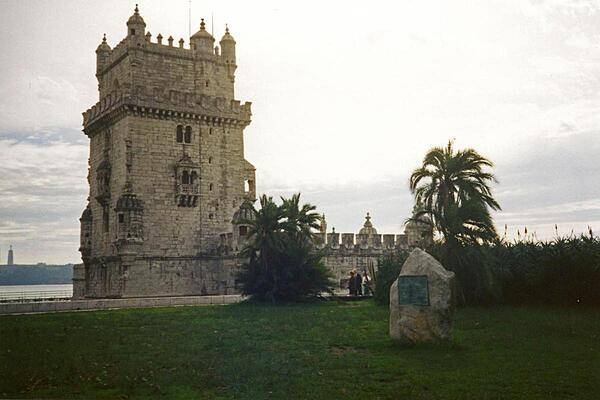
The Torre de Belem (Belem Tower) was built in the early 16th century to commemorate Vasco de Gama's voyages of discovery to India (1497-1524).
The Torre de Belem (Belem Tower) was built in the early 16th century to commemorate Vasco de Gama's voyages of discovery to India (1497-1524). • CIA World Factbook • 2020
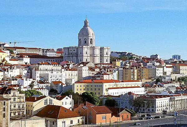
Lisbon, Portugal's capital and largest city, is often called the “White City." The center of this scene shows the Church of Santa Engracia, a 17th-century monument. Originally a church, it was converted in the 20th century into a National Pantheon in which important Portuguese personalities are buried.
Lisbon, Portugal's capital and largest city, is often called the “White City." The center of this scene shows the Church of Santa Engracia, a 17th-century monument. Originally a church, it was converted in the 20th century into a National Pantheon in which important Portuguese personalities are buried. • CIA World Factbook • 2020
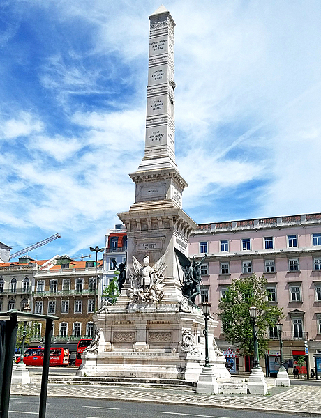
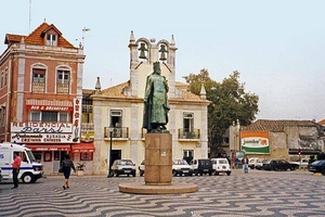
The Monument to the Restorers in Lisbon was erected in 1886 to celebrate the restoration of Portuguese independence from Spain in 1640.
The Monument to the Restorers in Lisbon was erected in 1886 to celebrate the restoration of Portuguese independence from Spain in 1640. • CIA World Factbook • 2020
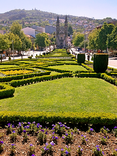
The medieval section of Guimaraes opens onto the “Largo Republica do Brasil (Republic Square of Brazil)” with its formal flower gardens. One end of the square features the slim Nossa Senhora da Consolacao e dos Santos Passos (Church of Our Lady of Consolation and the Holy Steps), one of the loveliest examples of Portuguese Baroque architecture.
The medieval section of Guimaraes opens onto the “Largo Republica do Brasil (Republic Square of Brazil)” with its formal flower gardens. One end of the square features the slim Nossa Senhora da Consolacao e dos Santos Passos (Church of Our Lady of Consolation and the Holy Steps), one of the loveliest examples of Portuguese Baroque architecture. • CIA World Factbook • 2020
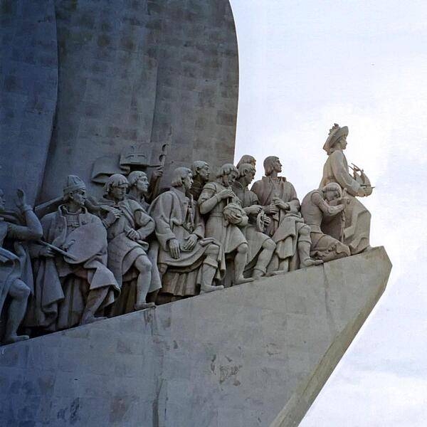
Closeup of the figures on the west side of the Padrao dos descobrimentos (Monument to the Discoveries) in Lisbon, which honors monarchs, explorers, navigators, cartographers, scientists, and missionaries from the Age of Discovery (15th and 16th centuries). The main statue of Henry the Navigator (1394-1460), holding a model of a carrack, leads a procession of 32 figures (16 on either side ramp) on the monument.
Closeup of the figures on the west side of the Padrao dos descobrimentos (Monument to the Discoveries) in Lisbon, which honors monarchs, explorers, navigators, cartographers, scientists, and missionaries from the Age of Discovery (15th and 16th centuries). The main statue of Henry the Navigator (1394-1460), holding a model of a carrack, leads a procession of 32 figures (16 on either side ramp) on the monument. • CIA World Factbook • 2020
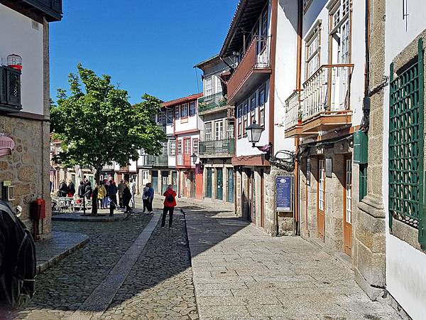
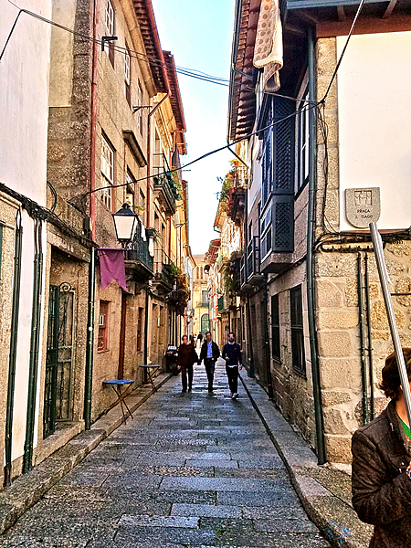
A medieval street in the historic town center of Guimaraes.
A medieval street in the historic town center of Guimaraes. • CIA World Factbook • 2020
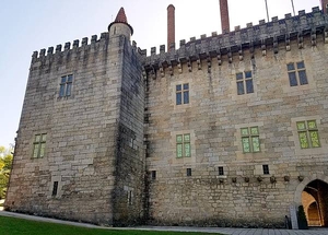
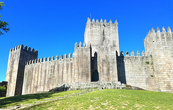
A rear view of Guimaraes Castle.
A rear view of Guimaraes Castle. • CIA World Factbook • 2020
The brickwork in the main square of the coastal town of Cascais - some 30 km west of Lisbon - displays a distinctive wavy pattern.
The brickwork in the main square of the coastal town of Cascais - some 30 km west of Lisbon - displays a distinctive wavy pattern. • CIA World Factbook • 2020
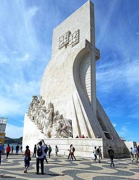
The Padrao dos descobrimentos (Monument to the Discoveries) in Lisbon honors monarchs, explorers, navigators, cartographers, scientists, and missionaries from the Age of Discovery (15th and 16th centuries). The main statue of Henry the Navigator (1394-1460), holding a model of a carrack, leads a procession of 32 figures (16 on either side ramp) on the monument. This view is of the east side.
The Padrao dos descobrimentos (Monument to the Discoveries) in Lisbon honors monarchs, explorers, navigators, cartographers, scientists, and missionaries from the Age of Discovery (15th and 16th centuries). The main statue of Henry the Navigator (1394-1460), holding a model of a carrack, leads a procession of 32 figures (16 on either side ramp) on the monument. This view is of the east side. • CIA World Factbook • 2020
Decorative tiles commemorating Portuguese explorers and navigators in Lisbon.
Decorative tiles commemorating Portuguese explorers and navigators in Lisbon. • CIA World Factbook • 2020
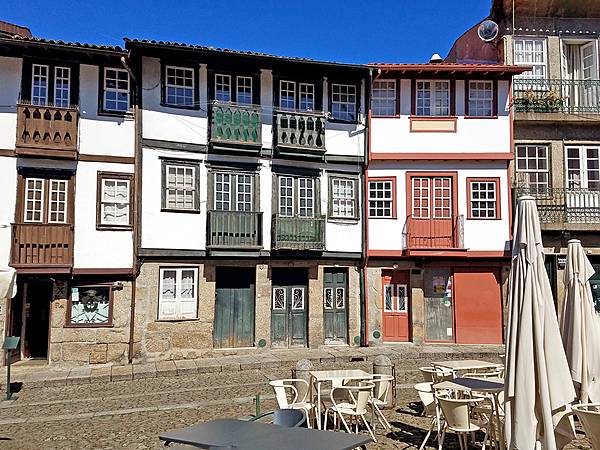
The castle in Guimaraes was built in the 10th century to protect a nearby monastery from Moors and Norsemen. As the first capital of the nation and birthplace of its first king, Guimaraes it is one of Portugal's most historic cities and one of the most attractive places to visit in the country. Its historic town center is listed as a World Heritage Site in recognition of its being an "exceptionally well-preserved and authentic example of the evolution of a medieval settlement into a modern town" in Europe.
The castle in Guimaraes was built in the 10th century to protect a nearby monastery from Moors and Norsemen. As the first capital of the nation and birthplace of its first king, Guimaraes it is one of Portugal's most historic cities and one of the most attractive places to visit in the country. Its historic town center is listed as a World Heritage Site in recognition of its being an "exceptionally well-preserved and authentic example of the evolution of a medieval settlement into a modern town" in Europe. • CIA World Factbook • 2020
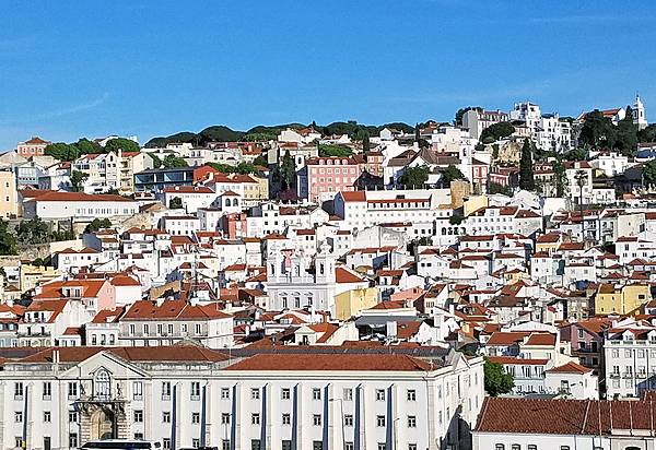
View of Lisbon, Portugal's largest city and capital, which often goes by the moniker of the “White City.”
View of Lisbon, Portugal's largest city and capital, which often goes by the moniker of the “White City.” • CIA World Factbook • 2020
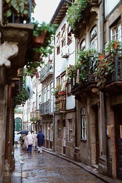
Along a medieval street in the historic town center of Guimaraes.
Along a medieval street in the historic town center of Guimaraes. • CIA World Factbook • 2020
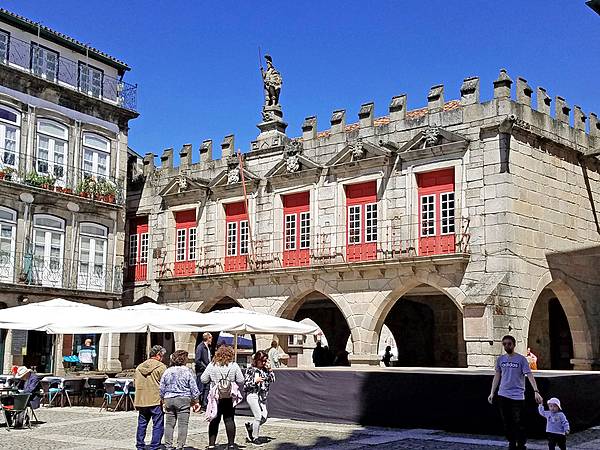
The Old Palace Council Chambers in the Largo da Oliveira (Square of the Olive Tree) in Guimaraes.
The Old Palace Council Chambers in the Largo da Oliveira (Square of the Olive Tree) in Guimaraes. • CIA World Factbook • 2020
A medieval street in the historic town center of Guimaraes.
A medieval street in the historic town center of Guimaraes. • CIA World Factbook • 2020
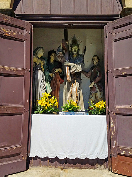
Street shrines are maintained by Guimaraes residents in each neighborhood of the city.
Street shrines are maintained by Guimaraes residents in each neighborhood of the city. • CIA World Factbook • 2020
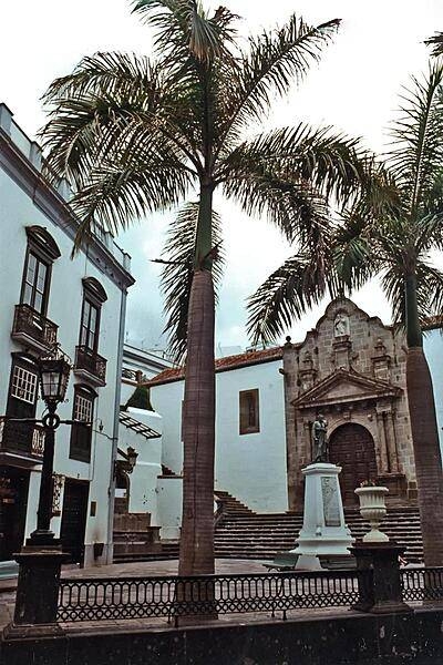
A peaceful plaza in front of a church in Madeira.
A peaceful plaza in front of a church in Madeira. • CIA World Factbook • 2020
Narrow streets with their window boxes and wrought iron balconies in Madeira.
Narrow streets with their window boxes and wrought iron balconies in Madeira. • CIA World Factbook • 2020
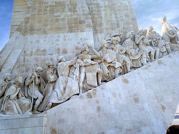
A detail from the Padrao dos descobrimentos (Monument to the Discoveries) in Lisbon, which celebrates the contributions of the Portuguese in the Age of Discovery during the 15th and 16th centuries. The main statue of Henry the Navigator (1394-1460), holding a model of a carrack, leads a procession of 32 figures (16 on either side ramp) on the monument. This view is of the west side.
A detail from the Padrao dos descobrimentos (Monument to the Discoveries) in Lisbon, which celebrates the contributions of the Portuguese in the Age of Discovery during the 15th and 16th centuries. The main statue of Henry the Navigator (1394-1460), holding a model of a carrack, leads a procession of 32 figures (16 on either side ramp) on the monument. This view is of the west side. • CIA World Factbook • 2020
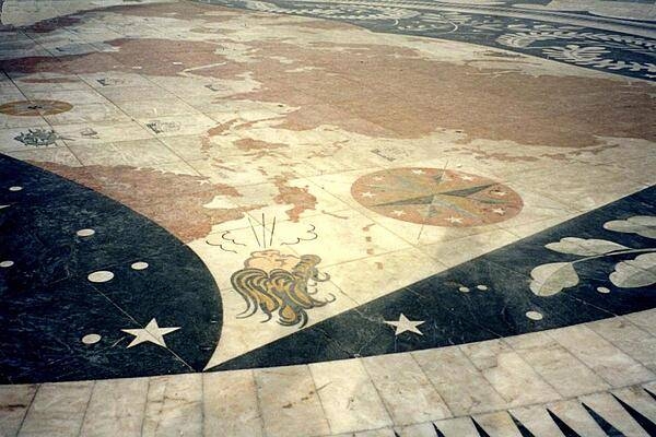
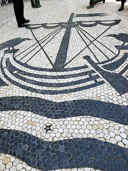
A mosaic at the base of the Monument to the Discoveries in Lisbon shows a world map with routes of the various Portuguese explorers.
A mosaic at the base of the Monument to the Discoveries in Lisbon shows a world map with routes of the various Portuguese explorers. • CIA World Factbook • 2020
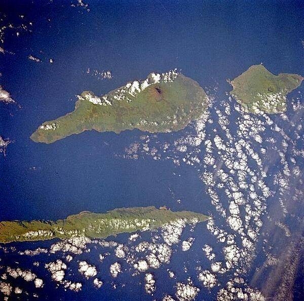
Three islands of the central Azores - spear-shaped Sao Jorge Island, Pico Island with its large volcano, and circular volcanic Faial Island - are visible in this low-oblique, southwest-looking, space shuttle photograph. Image courtesy of NASA.
Three islands of the central Azores - spear-shaped Sao Jorge Island, Pico Island with its large volcano, and circular volcanic Faial Island - are visible in this low-oblique, southwest-looking, space shuttle photograph. Image courtesy of NASA. • CIA World Factbook • 2020
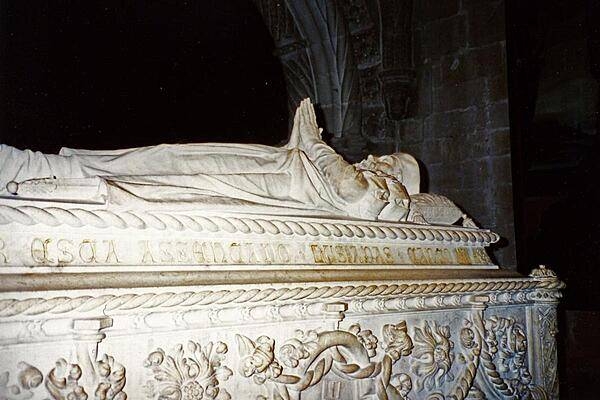
The tomb of Vasco de Gama in the Jeronimos Monastery in Belem, a parish (district) in southwestern Lisbon.
The tomb of Vasco de Gama in the Jeronimos Monastery in Belem, a parish (district) in southwestern Lisbon. • CIA World Factbook • 2020
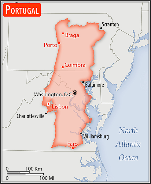
Area comparison map
Area comparison map • CIA World Factbook • 2020
Media source: CIA World Factbook (2020) — Public Domain