›››
Turkiye — Media Gallery
60 items available (flags, maps, photos)
Photos
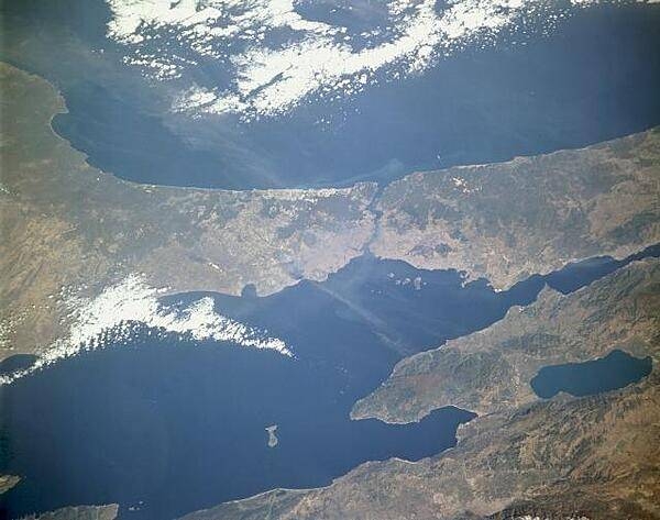
The Bosporus (near the center of the photograph), a strait that connects the Black Sea to the north with the Sea of Marmara to the south, stands out in this low-oblique, north-looking photograph. One of the world's most strategic waterways, the strait separates European Turkey to the west with Asiatic Turkey to the east. Istanbul (formerly Constantinople), one of the great historic cities of the world, sits near the Bosporus entrance to the Sea of Marmara. Photo courtesy of NASA.
The Bosporus (near the center of the photograph), a strait that connects the Black Sea to the north with the Sea of Marmara to the south, stands out in this low-oblique, north-looking photograph. One of the world's most strategic waterways, the strait separates European Turkey to the west with Asiatic Turkey to the east. Istanbul (formerly Constantinople), one of the great historic cities of the world, sits near the Bosporus entrance to the Sea of Marmara. Photo courtesy of NASA. • CIA World Factbook • 2020
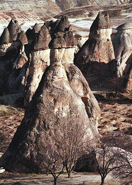
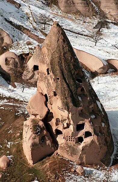
"Fairy chimneys" create a surreal landscape in the Cappadocia region of Turkey. Created by volcanic eruptions and shaped by centuries of wind and rain erosion, each of these structures consists of a soft cone topped by a layer of harder rock. They reach heights of up to 40 m (130 ft).
"Fairy chimneys" create a surreal landscape in the Cappadocia region of Turkey. Created by volcanic eruptions and shaped by centuries of wind and rain erosion, each of these structures consists of a soft cone topped by a layer of harder rock. They reach heights of up to 40 m (130 ft). • CIA World Factbook • 2020
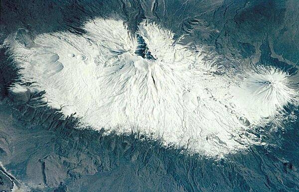
Mount Ararat (5,166 m, 16,949 ft) is the largest volcano in Turkey, but is not currently active. It is located in extreme northeastern Turkey, near the borders with Iran and Armenia. Southwest of the main peak lies Lesser Ararat (3,896 m, 12,877 ft). Ahora Gorge is a northeast-trending chasm dropping from the top of the mountain. Claims by different explorers to have found remnants of Noah's Ark on Mount Ararat have led to continuing expeditions to the mountain, many focusing their searches on the gorge area. Photo courtesy of NASA.
Mount Ararat (5,166 m, 16,949 ft) is the largest volcano in Turkey, but is not currently active. It is located in extreme northeastern Turkey, near the borders with Iran and Armenia. Southwest of the main peak lies Lesser Ararat (3,896 m, 12,877 ft). Ahora Gorge is a northeast-trending chasm dropping from the top of the mountain. Claims by different explorers to have found remnants of Noah's Ark on Mount Ararat have led to continuing expeditions to the mountain, many focusing their searches on the gorge area. Photo courtesy of NASA. • CIA World Factbook • 2020
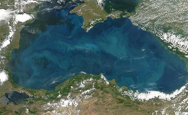
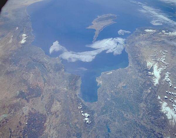
Swirls of color ranging from deep olive green to bright turquoise were created by a massive phytoplankton bloom that covered the entire surface of the Black Sea on this image taken 20 June 2006. Many of Europe's largest rivers, including the Danube, the Dnister, and the Dnipro (Dnieper) dump fresh water into the sea. The sea's only source of salty water is the narrow Bosporus Strait (in the southwest), which connects it to the Mediterranean Sea through the Sea of Marmara. Northern Turkey makes up the southern shore of the sea. The diamond-shaped landmass that projects into the sea from the north is Ukraine's Crimean peninsula. Photo courtesy of NASA.
Swirls of color ranging from deep olive green to bright turquoise were created by a massive phytoplankton bloom that covered the entire surface of the Black Sea on this image taken 20 June 2006. Many of Europe's largest rivers, including the Danube, the Dnister, and the Dnipro (Dnieper) dump fresh water into the sea. The sea's only source of salty water is the narrow Bosporus Strait (in the southwest), which connects it to the Mediterranean Sea through the Sea of Marmara. Northern Turkey makes up the southern shore of the sea. The diamond-shaped landmass that projects into the sea from the north is Ukraine's Crimean peninsula. Photo courtesy of NASA. • CIA World Factbook • 2020
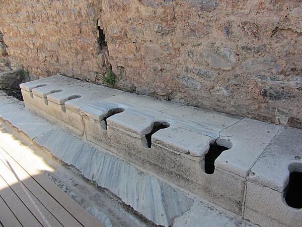
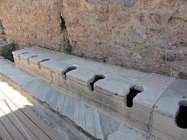
The public toilets in Ephesus were located in the public baths and had running water. Servants were often employed as seat warmers before the patrons used the cold stone seats. An inscription on a wall reads: "Close your eyes, count slowly to 10, and it will come."
The public toilets in Ephesus were located in the public baths and had running water. Servants were often employed as seat warmers before the patrons used the cold stone seats. An inscription on a wall reads: "Close your eyes, count slowly to 10, and it will come." • CIA World Factbook • 2020

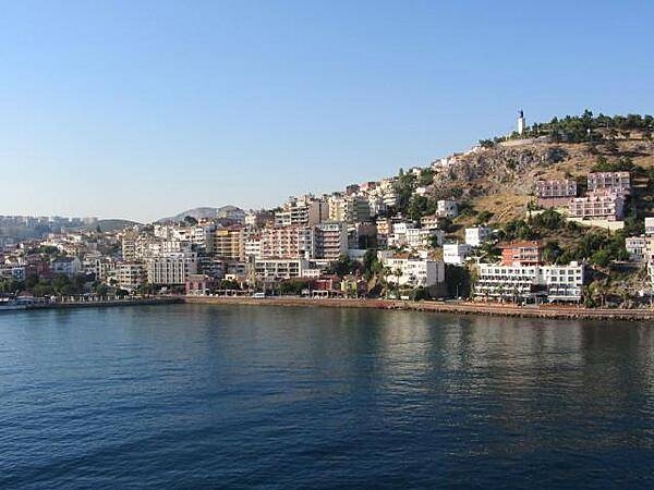
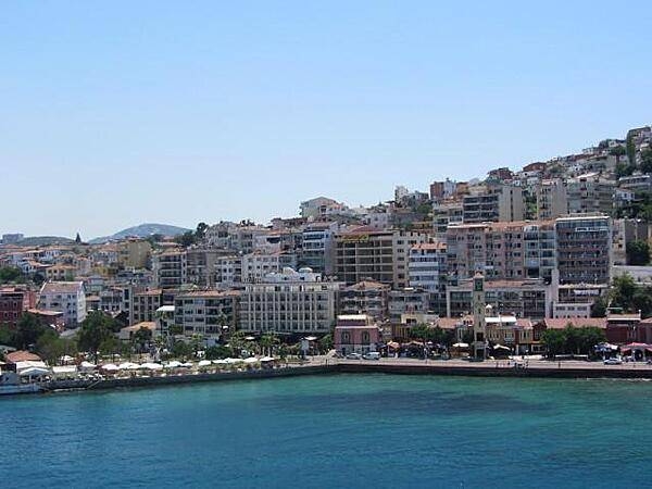
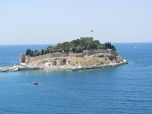
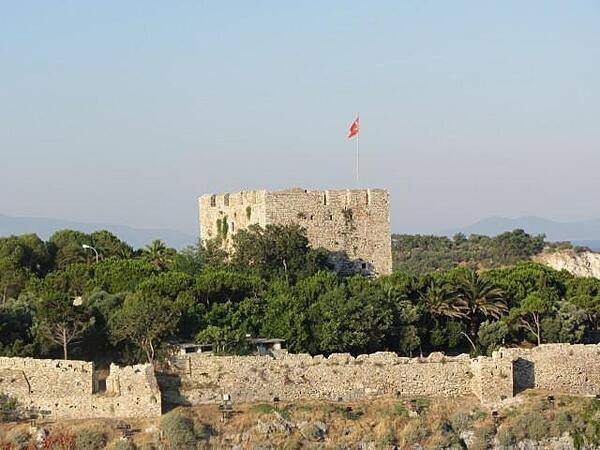
View of the port of Kusadasi on the Aegean Sea. The name Kusadasi means "Bird Island." In Byzantine times it was called "Ephesus Neopolis" and "Scala Nova" under the Genoese and Venetians. Its current name was officially adopted at the beginning of the 20th century by Turkish authorities. Kusadasi is the gateway to the Roman ruins at Ephesus. Some 95 km (57 mi) south of Izmir, it has grown since the late 1970s from a fishing village into a major tourist center serving thousands of tourists. A statue of Kemal Ataturk, the first president of Turkey and the founder of the Turkish Republic, stands on a hill overlooking the city.
View of the port of Kusadasi on the Aegean Sea. The name Kusadasi means "Bird Island." In Byzantine times it was called "Ephesus Neopolis" and "Scala Nova" under the Genoese and Venetians. Its current name was officially adopted at the beginning of the 20th century by Turkish authorities. Kusadasi is the gateway to the Roman ruins at Ephesus. Some 95 km (57 mi) south of Izmir, it has grown since the late 1970s from a fishing village into a major tourist center serving thousands of tourists. A statue of Kemal Ataturk, the first president of Turkey and the founder of the Turkish Republic, stands on a hill overlooking the city. • CIA World Factbook • 2020
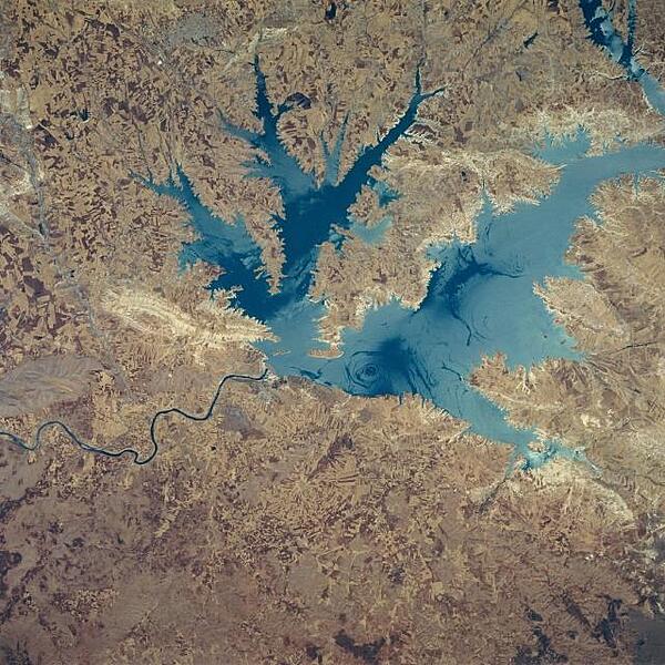
This northeast-looking view shows the Ataturk Reservoir and Dam, presently the largest man-made lake in Turkey. Located in south central Turkey on the Euphrates River, Ataturk Reservoir was completed in the early 1990's. The meandering Euphrates River (dark line) can be seen exiting the scene below the left center of the image. Smooth lake waters appear as dark blue, while wind-roughened waters appear light blue. The light area to the west of the dam (left center) is where rocks were quarried for the construction of the dam. Photo courtesy of NASA.
This northeast-looking view shows the Ataturk Reservoir and Dam, presently the largest man-made lake in Turkey. Located in south central Turkey on the Euphrates River, Ataturk Reservoir was completed in the early 1990's. The meandering Euphrates River (dark line) can be seen exiting the scene below the left center of the image. Smooth lake waters appear as dark blue, while wind-roughened waters appear light blue. The light area to the west of the dam (left center) is where rocks were quarried for the construction of the dam. Photo courtesy of NASA. • CIA World Factbook • 2020
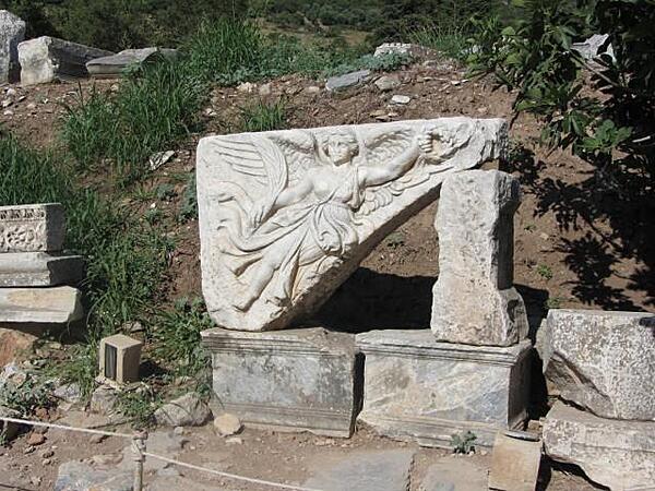
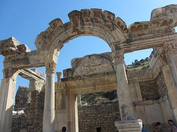
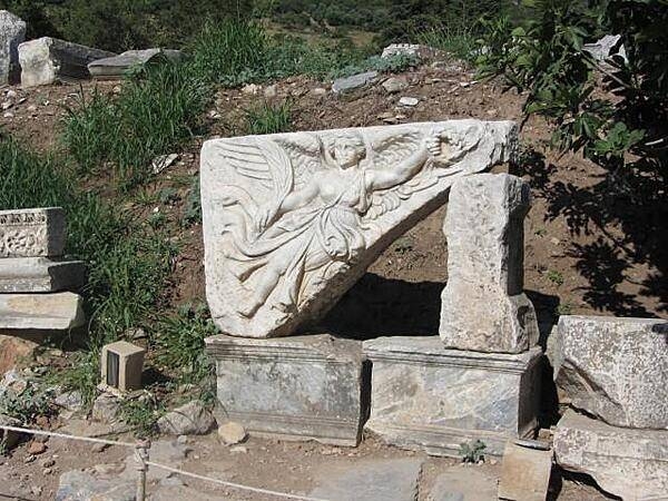
Image of the goddess Nike (Victory) in Ephesus, an important Greek and later Roman city in Asia Minor. Its fortunes declined because of invasions, earthquakes, and the silting up of its harbor. It was abandoned in the 15th century.
Image of the goddess Nike (Victory) in Ephesus, an important Greek and later Roman city in Asia Minor. Its fortunes declined because of invasions, earthquakes, and the silting up of its harbor. It was abandoned in the 15th century. • CIA World Factbook • 2020
CIA World Factbook • 2020
Area comparison map
Area comparison map • CIA World Factbook • 2020
CIA World Factbook • 2020
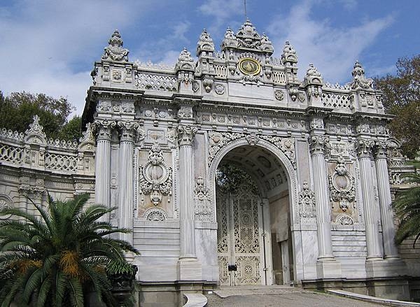
The Gate of the Sultan at the Dolmabahce Palace in Istanbul. The Palace served as the main administrative center of the Ottoman Empire through most of the second half of the 19th and early 20th centuries.
The Gate of the Sultan at the Dolmabahce Palace in Istanbul. The Palace served as the main administrative center of the Ottoman Empire through most of the second half of the 19th and early 20th centuries. • CIA World Factbook • 2020
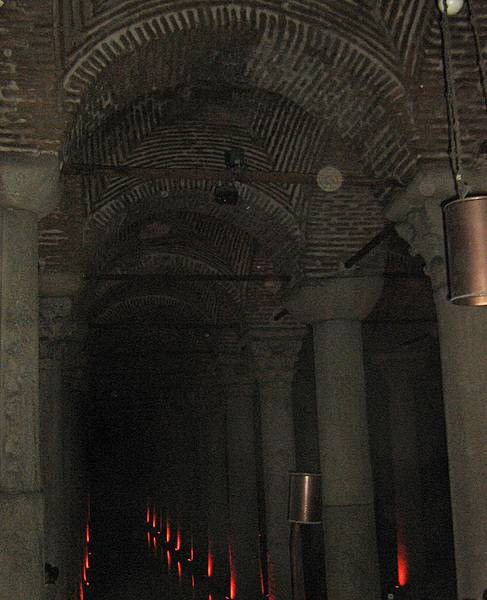
The Basilica Cistern is the largest of several hundred ancient cisterns that lie beneath the city of Istanbul; built in the 6th century A.D., it acquired its name from a great basilica that used to stand over the location. The cathedral-size cistern is an underground chamber approximately 138 m (453 ft) by 65 m (213 ft) capable of holding 80,000 cu m (2,800,000 cu ft) of water. The ceiling is supported by a forest of 336 marble columns, each 9 m (30 ft) high, arranged in 12 rows of 28 columns each spaced 5 m (16 ft) apart. The majority of the columns in the cistern appear to have been recycled from the ruins of older buildings from throughout the Byzantine Empire. They are carved and engraved out of various types of marble and granite.
The Basilica Cistern is the largest of several hundred ancient cisterns that lie beneath the city of Istanbul; built in the 6th century A.D., it acquired its name from a great basilica that used to stand over the location. The cathedral-size cistern is an underground chamber approximately 138 m (453 ft) by 65 m (213 ft) capable of holding 80,000 cu m (2,800,000 cu ft) of water. The ceiling is supported by a forest of 336 marble columns, each 9 m (30 ft) high, arranged in 12 rows of 28 columns each spaced 5 m (16 ft) apart. The majority of the columns in the cistern appear to have been recycled from the ruins of older buildings from throughout the Byzantine Empire. They are carved and engraved out of various types of marble and granite. • CIA World Factbook • 2020
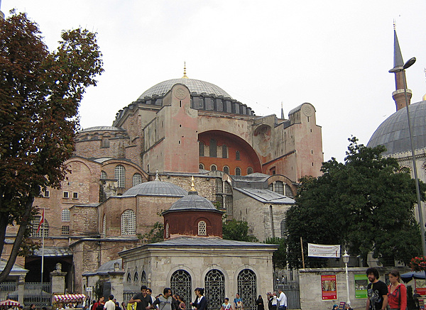
The Hagia Sofia (Church of the Holy Wisdom) in Istanbul is a former Christian Greek Orthodox cathedral, later an Ottoman imperial mosque, and now a museum. Completed in A.D. 537, it was the world's largest building and an engineering marvel of its time, chiefly renowned for its vast dome. It is considered the epitome of Byzantine architecture.
The Hagia Sofia (Church of the Holy Wisdom) in Istanbul is a former Christian Greek Orthodox cathedral, later an Ottoman imperial mosque, and now a museum. Completed in A.D. 537, it was the world's largest building and an engineering marvel of its time, chiefly renowned for its vast dome. It is considered the epitome of Byzantine architecture. • CIA World Factbook • 2020
The Tiled Kiosk Museum is one of the three museums that make up the Istanbul Archeology Museums.
The Tiled Kiosk Museum is one of the three museums that make up the Istanbul Archeology Museums. • CIA World Factbook • 2020
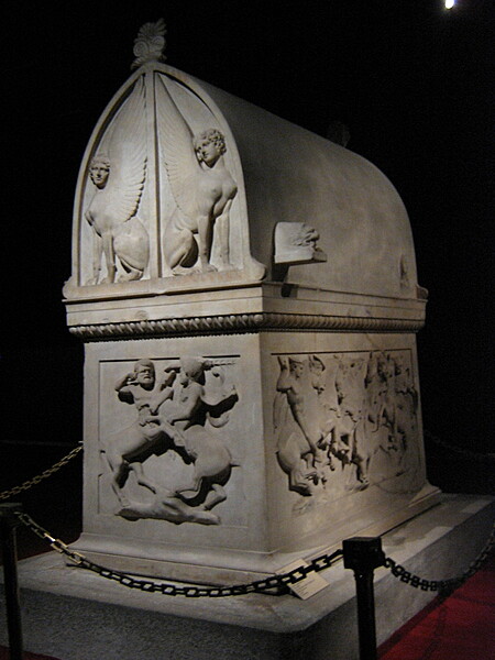
The Lycian Sarcophagus of Sidon at the Istanbul Archeological Museum dates to about 430-420 B.C.
The Lycian Sarcophagus of Sidon at the Istanbul Archeological Museum dates to about 430-420 B.C. • CIA World Factbook • 2020
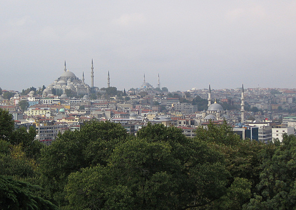
View of Istanbul from the Topkapi Palace.
View of Istanbul from the Topkapi Palace. • CIA World Factbook • 2020
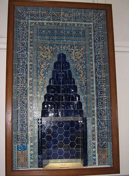
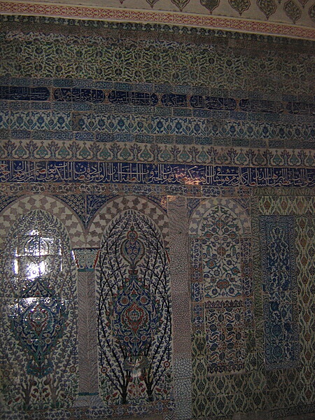
Tiled mihrab at the the Istanbul Archeology Museums.
Tiled mihrab at the the Istanbul Archeology Museums. • CIA World Factbook • 2020
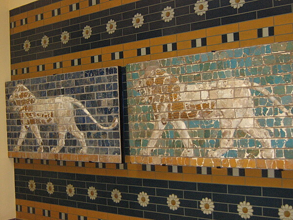
Glazed brick panels from a Babylonian processional way in the Istanbul Archeological Museum.
Glazed brick panels from a Babylonian processional way in the Istanbul Archeological Museum. • CIA World Factbook • 2020
The main harem entrance at Topkapi Palace in Istanbul.
The main harem entrance at Topkapi Palace in Istanbul. • CIA World Factbook • 2020
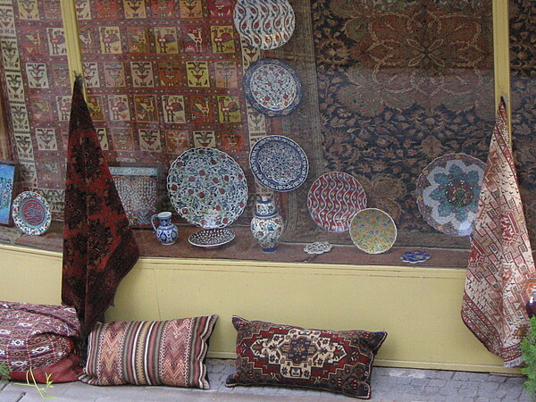
Rugs and ceramics for sale at an Istanbul shop.
Rugs and ceramics for sale at an Istanbul shop. • CIA World Factbook • 2020

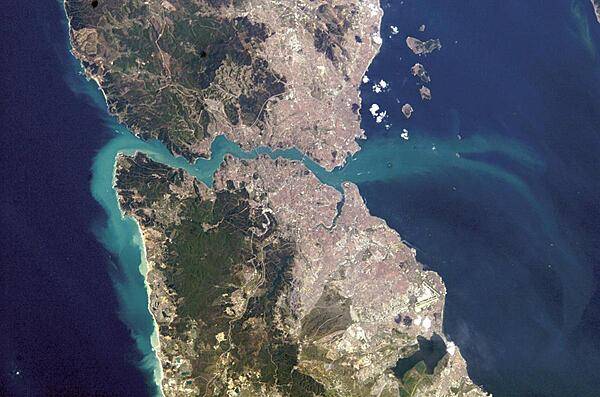
A view of Istanbul as taken from the International Space Station. The metropolis of 15 million occupies both sides of the entrance to the narrow, 32 km- (20 mi-) long Bosporus Strait connecting the Mediterranean and Sea of Marmara (south, on the right) to the Black Sea (north, on the left). When this image was taken, strong currents carried turbid coastal waters from the Black Sea through the Strait and into the Sea of Marmara. The sinuous waterway and harbor on the western shore are known as the Golden Horn. Image courtesy of NASA.
A view of Istanbul as taken from the International Space Station. The metropolis of 15 million occupies both sides of the entrance to the narrow, 32 km- (20 mi-) long Bosporus Strait connecting the Mediterranean and Sea of Marmara (south, on the right) to the Black Sea (north, on the left). When this image was taken, strong currents carried turbid coastal waters from the Black Sea through the Strait and into the Sea of Marmara. The sinuous waterway and harbor on the western shore are known as the Golden Horn. Image courtesy of NASA. • CIA World Factbook • 2020
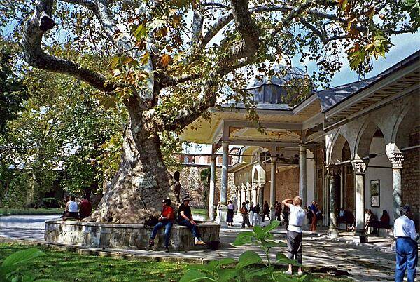
The Topkapi Palace courtyard in Istanbul. The Palace was the official residence of the Ottoman Sultans for 400 years. It is a UNESCO World Heritage Site and contains many holy relics of the Muslim world. Construction was begun in 1459, and at its height, the complex housed 4,000 people. In 1924, a governmental decree transformed the Palace into a museum of the imperial era.
The Topkapi Palace courtyard in Istanbul. The Palace was the official residence of the Ottoman Sultans for 400 years. It is a UNESCO World Heritage Site and contains many holy relics of the Muslim world. Construction was begun in 1459, and at its height, the complex housed 4,000 people. In 1924, a governmental decree transformed the Palace into a museum of the imperial era. • CIA World Factbook • 2020
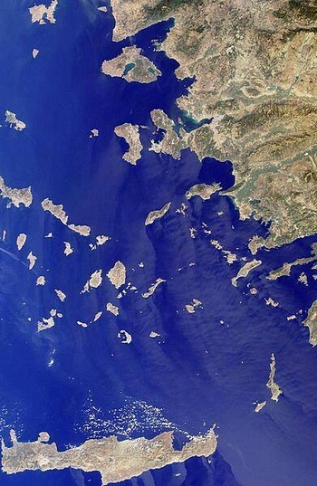
This image includes many of the islands of the East Aegean as well as part of mainland Turkey. The largest modern city in the Aegean coast is Izmir, Turkey, situated about one quarter of the image length from the top. The city is the bright coastal area near the greenish waters of Izmir Bay and southeast of the roughly triangular-shaped island of Lesvos. The lengthy island at the bottom of the photo is Crete. North of Crete, the small broken ring of islands are the remnants of the collapsed caldera of Santorini Volcano. Image courtesy of NASA.
This image includes many of the islands of the East Aegean as well as part of mainland Turkey. The largest modern city in the Aegean coast is Izmir, Turkey, situated about one quarter of the image length from the top. The city is the bright coastal area near the greenish waters of Izmir Bay and southeast of the roughly triangular-shaped island of Lesvos. The lengthy island at the bottom of the photo is Crete. North of Crete, the small broken ring of islands are the remnants of the collapsed caldera of Santorini Volcano. Image courtesy of NASA. • CIA World Factbook • 2020
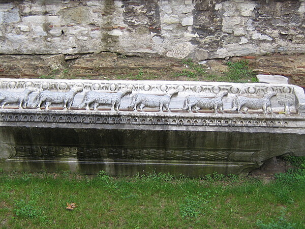
The Basilica of Hagia Sophia is actually the third church to be built at the site. A second church on the site was was inaugurated in A.D. 415 but burned to the ground in 532. Several marble blocks from the second church survive including this one showing lambs.
The Basilica of Hagia Sophia is actually the third church to be built at the site. A second church on the site was was inaugurated in A.D. 415 but burned to the ground in 532. Several marble blocks from the second church survive including this one showing lambs. • CIA World Factbook • 2020
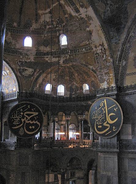
A view of the interior of the Hagia Sophia.
A view of the interior of the Hagia Sophia. • CIA World Factbook • 2020
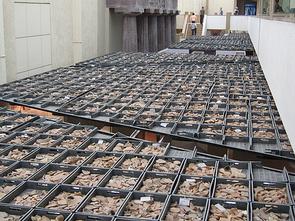
Ancient pottery shards at the Istanbul Archeological Museum.
Ancient pottery shards at the Istanbul Archeological Museum. • CIA World Factbook • 2020
CIA World Factbook • 2020
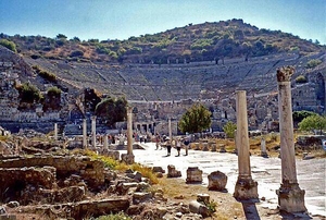
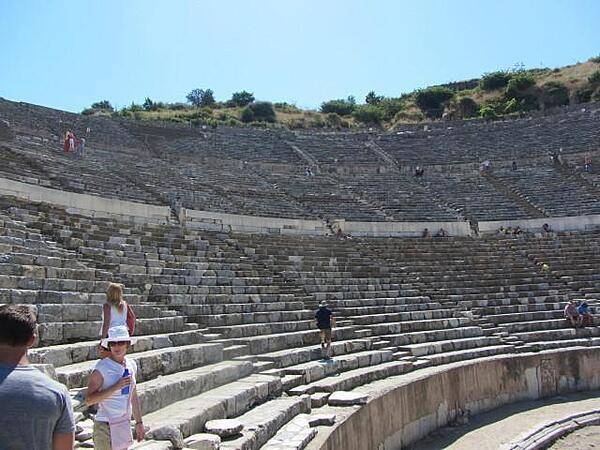
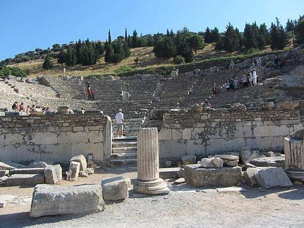
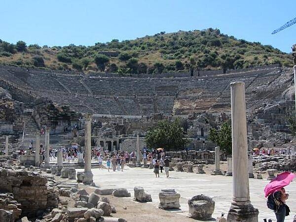
Seating estimates for the Great Roman Theater in Ephesus vary between 25,000 and 44,000. Regardless of actual capacity, the theater was in continuous use until the 5th century A.D. According to tradition, Saint Paul preached against paganism at this site. Today, partially restored, it is used for an annual festival of culture and art.
Seating estimates for the Great Roman Theater in Ephesus vary between 25,000 and 44,000. Regardless of actual capacity, the theater was in continuous use until the 5th century A.D. According to tradition, Saint Paul preached against paganism at this site. Today, partially restored, it is used for an annual festival of culture and art. • CIA World Factbook • 2020
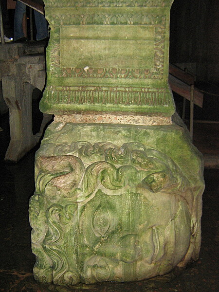
One of two Medusa head pillars in the Basilica Cistern beneath Istanbul. The Medusa heads heads were removed from a building of the late Roman period and brought to the cistern to be reused as pillar bases.
One of two Medusa head pillars in the Basilica Cistern beneath Istanbul. The Medusa heads heads were removed from a building of the late Roman period and brought to the cistern to be reused as pillar bases. • CIA World Factbook • 2020
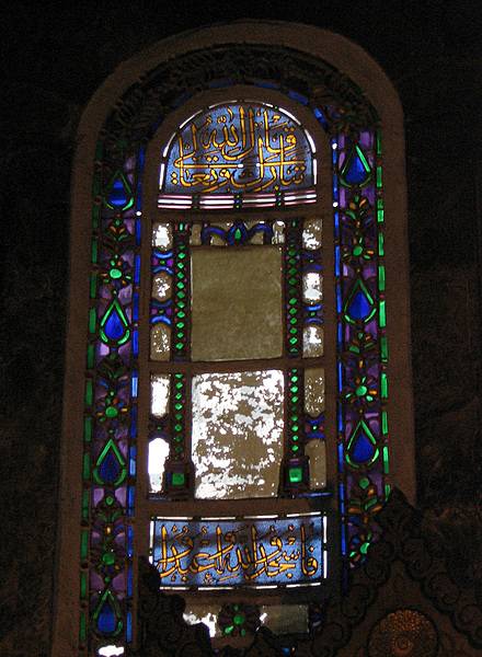
An Islamic stained glass window in the Hagia Sophia.
An Islamic stained glass window in the Hagia Sophia. • CIA World Factbook • 2020
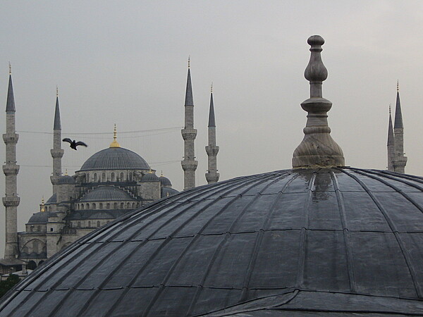
A view of the Blue Mosque from the Hagia Sophia.
A view of the Blue Mosque from the Hagia Sophia. • CIA World Factbook • 2020
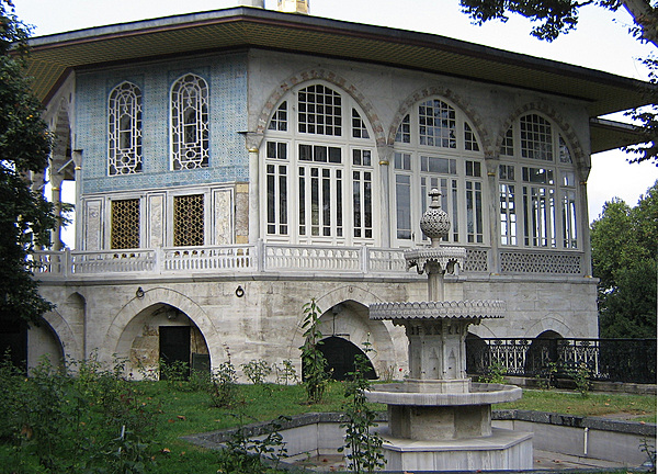
The Baghdad Kiosk in the Fourth Courtyard of the Topkapi Palace.
The Baghdad Kiosk in the Fourth Courtyard of the Topkapi Palace. • CIA World Factbook • 2020
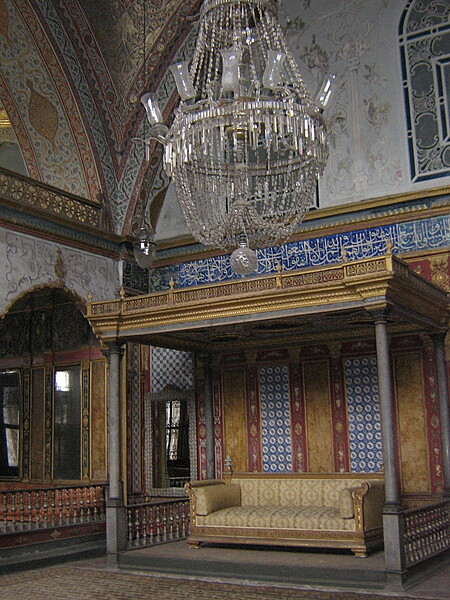
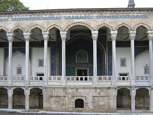
The Imperial Hall in the Topkapi Palace in Istanbul.
The Imperial Hall in the Topkapi Palace in Istanbul. • CIA World Factbook • 2020
Tile work in the harem of the Topkapi Palace in Istanbul.
Tile work in the harem of the Topkapi Palace in Istanbul. • CIA World Factbook • 2020
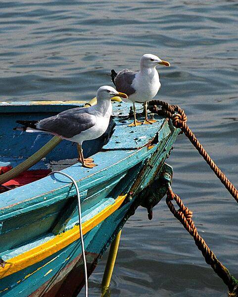
Seagulls come to rest on one of the colorful fishing boats anchored on the shore of the Bosporus Strait in the heart of historic Istanbul.
Seagulls come to rest on one of the colorful fishing boats anchored on the shore of the Bosporus Strait in the heart of historic Istanbul. • CIA World Factbook • 2020
CIA World Factbook • 2020
A southwest-looking photograph of south-central Turkey and northwest Syria. The Plain of Adana, an extensive agricultural region, is located northwest of the Gulf of Iskenderun (the roughly rectangular-shaped gulf near the center of the photo) and is irrigated by the Seyhan River. Adana, the largest city in the region, can be seen midway between the Gulf and the Taurus Mountains to the west. The coastlines of Syria, Lebanon, and Israel are visible along the eastern Mediterranean Sea. The island of Cyprus can be seen off the Turkish and Syrian coasts. Photo courtesy of NASA.
A southwest-looking photograph of south-central Turkey and northwest Syria. The Plain of Adana, an extensive agricultural region, is located northwest of the Gulf of Iskenderun (the roughly rectangular-shaped gulf near the center of the photo) and is irrigated by the Seyhan River. Adana, the largest city in the region, can be seen midway between the Gulf and the Taurus Mountains to the west. The coastlines of Syria, Lebanon, and Israel are visible along the eastern Mediterranean Sea. The island of Cyprus can be seen off the Turkish and Syrian coasts. Photo courtesy of NASA. • CIA World Factbook • 2020
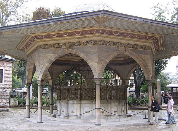
The fountain for ritual ablutions was added to the Hagia Sophia in 1740.
The fountain for ritual ablutions was added to the Hagia Sophia in 1740. • CIA World Factbook • 2020
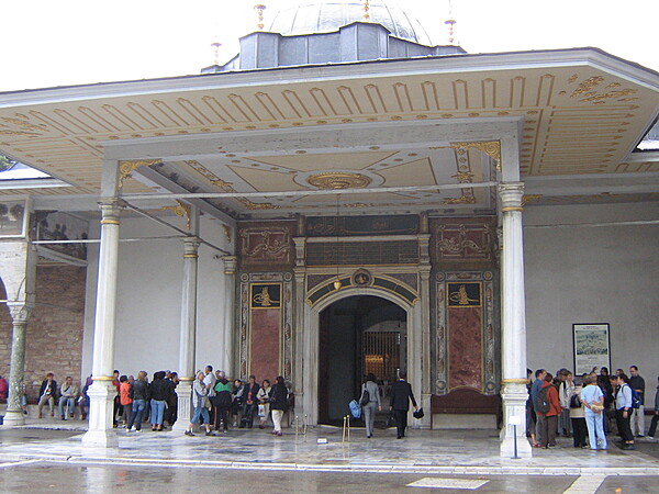
The Gate of Felicity at the Third Courtyard of the Topkapi Palace in Istanbul.
The Gate of Felicity at the Third Courtyard of the Topkapi Palace in Istanbul. • CIA World Factbook • 2020
CIA World Factbook • 2020
Distinctively shaped volcanic cones in the Cappadocia region of Turkey were shaped by centuries of wind and rain erosion. The soft rock is easily carved and hardens like concrete when exposed to the air. Many of these structures have been transformed into domestic dwellings.
Distinctively shaped volcanic cones in the Cappadocia region of Turkey were shaped by centuries of wind and rain erosion. The soft rock is easily carved and hardens like concrete when exposed to the air. Many of these structures have been transformed into domestic dwellings. • CIA World Factbook • 2020
CIA World Factbook • 2020
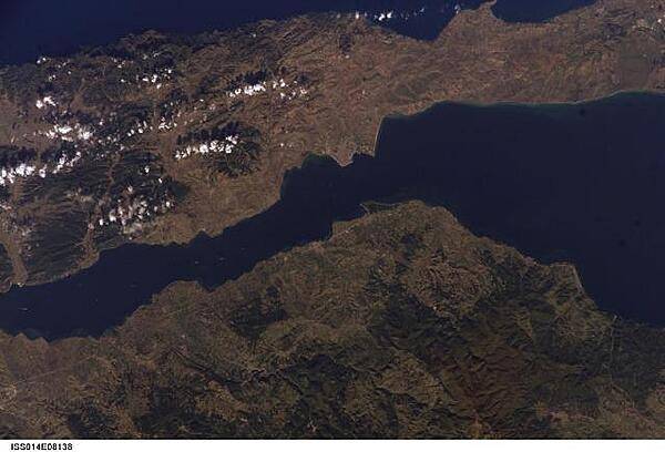
The city of Gallipoli (Gelibolu in Turkish; light gray to pink area in center of photo) sits at a crossroads between the Sea of Marmara (to the right) and the Dardanelles Strait (which leads to the Aegean Sea). Water in the Strait flows in both northeast and southwest directions due to opposite surface and undercurrents. Several ships are visible in the Strait to the southwest of Gallipoli (center left). Image courtesy of NASA.
The city of Gallipoli (Gelibolu in Turkish; light gray to pink area in center of photo) sits at a crossroads between the Sea of Marmara (to the right) and the Dardanelles Strait (which leads to the Aegean Sea). Water in the Strait flows in both northeast and southwest directions due to opposite surface and undercurrents. Several ships are visible in the Strait to the southwest of Gallipoli (center left). Image courtesy of NASA. • CIA World Factbook • 2020
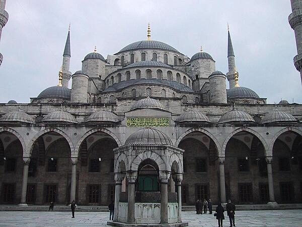
The Sultan Ahmed Mosque (also known as the Blue Mosque) in Istanbul is the national mosque of Turkey.
The Sultan Ahmed Mosque (also known as the Blue Mosque) in Istanbul is the national mosque of Turkey. • CIA World Factbook • 2020
CIA World Factbook • 2020
CIA World Factbook • 2020
CIA World Factbook • 2020
CIA World Factbook • 2020
CIA World Factbook • 2020
CIA World Factbook • 2020
A view of Istanbul as taken from the International Space Station. The metropolis of 15 million occupies both sides of the entrance to the narrow, 32 km- (20 mi-) long Bosporus Strait connecting the Mediterranean and Sea of Marmara (south, on the right) to the Black Sea (north, on the left). When this image was taken, strong currents carried turbid coastal waters from the Black Sea through the Strait and into the Sea of Marmara. The sinuous waterway and harbor on the western shore are known as the Golden Horn. Image courtesy of NASA.
A view of Istanbul as taken from the International Space Station. The metropolis of 15 million occupies both sides of the entrance to the narrow, 32 km- (20 mi-) long Bosporus Strait connecting the Mediterranean and Sea of Marmara (south, on the right) to the Black Sea (north, on the left). When this image was taken, strong currents carried turbid coastal waters from the Black Sea through the Strait and into the Sea of Marmara. The sinuous waterway and harbor on the western shore are known as the Golden Horn. Image courtesy of NASA. • CIA World Factbook • 2020

CIA World Factbook • 2020
CIA World Factbook • 2020
CIA World Factbook • 2020
CIA World Factbook • 2020
CIA World Factbook • 2020
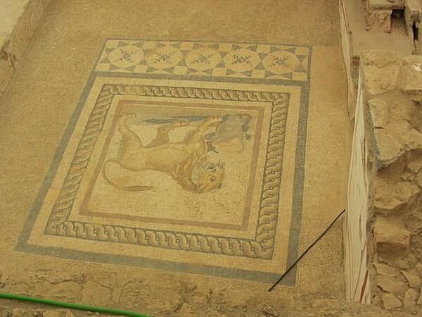
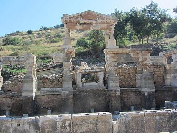
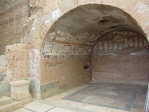
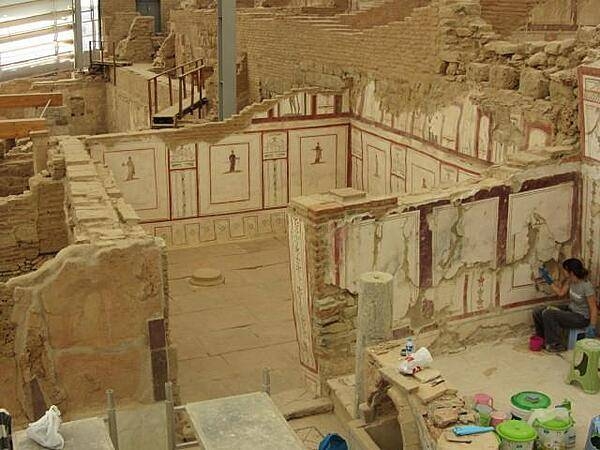
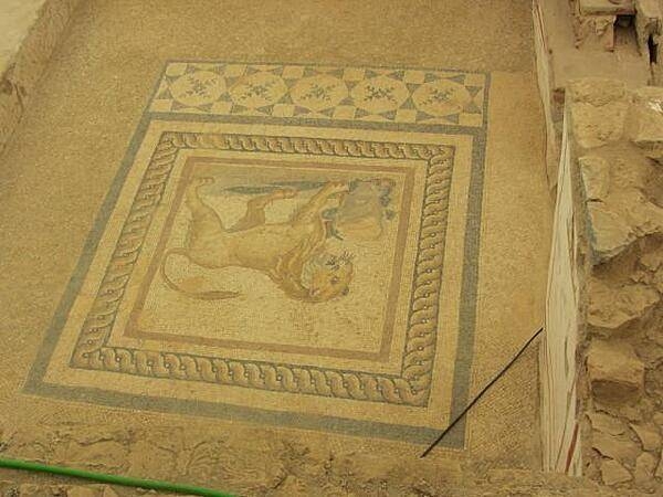
Floor mosaic in a terrace home in Ephesus built on a hill opposite the Temple of Hadrian. The wealthy families lived here in six multi-family homes built on three terraces. Most homes were highly decorated and were heated by use of hot water flowing through pipes in the floors and walls. The roof of one house formed the patio or terrace of the house above it. Work on restoring the houses began in 1960.
Floor mosaic in a terrace home in Ephesus built on a hill opposite the Temple of Hadrian. The wealthy families lived here in six multi-family homes built on three terraces. Most homes were highly decorated and were heated by use of hot water flowing through pipes in the floors and walls. The roof of one house formed the patio or terrace of the house above it. Work on restoring the houses began in 1960. • CIA World Factbook • 2020
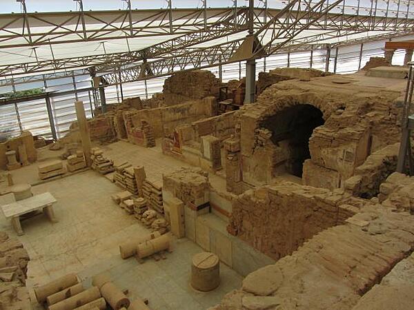
Terrace homes in Ephesus built on a hill opposite the Temple of Hadrian. The wealthy families lived here in six multi-family homes built on three terraces. Most homes were highly decorated and were heated by use of hot water flowing through pipes in the floors and walls. The roof of one house formed the patio or terrace of the house above it. Work on restoring the houses began in 1960.
Terrace homes in Ephesus built on a hill opposite the Temple of Hadrian. The wealthy families lived here in six multi-family homes built on three terraces. Most homes were highly decorated and were heated by use of hot water flowing through pipes in the floors and walls. The roof of one house formed the patio or terrace of the house above it. Work on restoring the houses began in 1960. • CIA World Factbook • 2020
Media source: CIA World Factbook (2020) — Public Domain