›››
United States — Media Gallery
377 items available (flags, maps, photos)
Photos
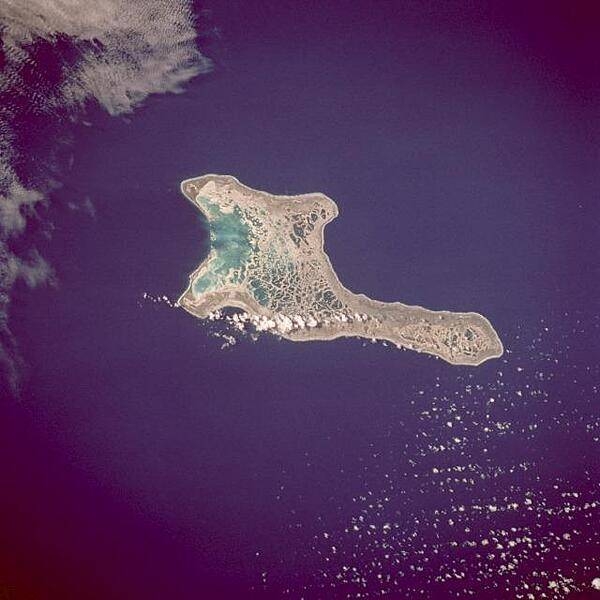
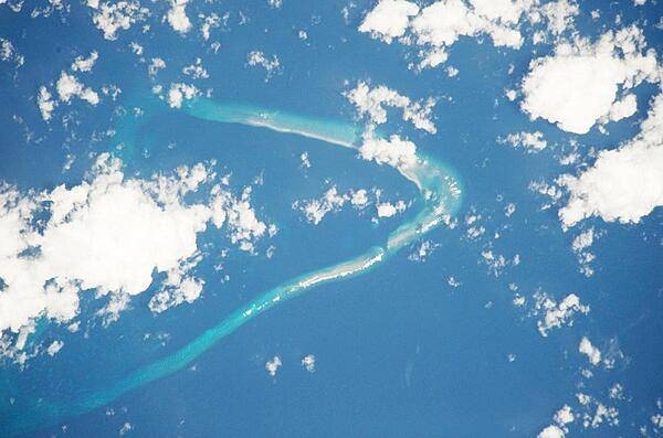
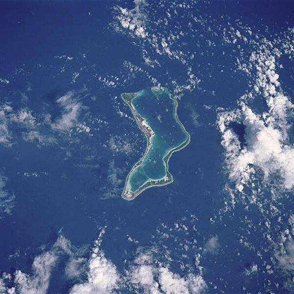
Kiritimati Island (formerly Christmas Island), the largest atoll in the Pacific Ocean, is the centerpiece of this low-oblique, northeast-looking photo. The atoll covers 606 sq km (234 sq mi), of which 243 sq km (94 sq mi) are land. The island was discovered by Captain James Cook in 1777. The majority of the island's inhabitants work on coconut plantations and in copra production. The island's major airbase is on the northeast side of the island. Nuclear tests were conducted on Kiritimati Island by the British in 1957 and 1958 and by the United States in 1962. Image courtesy of NASA.
Kiritimati Island (formerly Christmas Island), the largest atoll in the Pacific Ocean, is the centerpiece of this low-oblique, northeast-looking photo. The atoll covers 606 sq km (234 sq mi), of which 243 sq km (94 sq mi) are land. The island was discovered by Captain James Cook in 1777. The majority of the island's inhabitants work on coconut plantations and in copra production. The island's major airbase is on the northeast side of the island. Nuclear tests were conducted on Kiritimati Island by the British in 1957 and 1958 and by the United States in 1962. Image courtesy of NASA. • CIA World Factbook • 2020
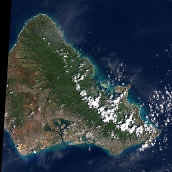
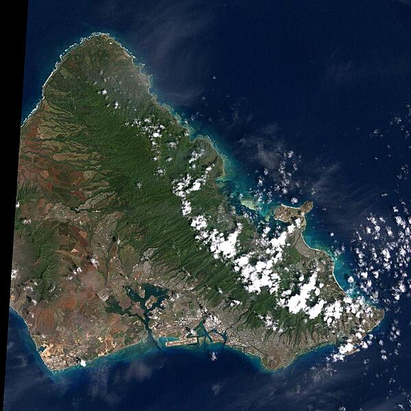
Oahu is the most populated of the Hawaiian Islands. Hawaii's capital of Honolulu stretches along its southern shore. Just to the east of Honolulu is Waikiki Beach, with throngs of tourists and dozens of high-rise hotels. Overlooking Waikiki is Diamond Head, a volcanic crater formed some 200,000 years ago (extinct for about 150,000 years). The clouds in the right hand corner of this image are an almost permanent feature of Oahu. Trade winds blowing from the northeast are stopped by the 960 m (3,000 ft) high mountain range, where they rain out most of their moisture. As a result, the windward side of Oahu is usually cloudy, and the leeward side is relatively clear and dry. The large indent in the lower left of the image is Pearl Harbor, site of the Japanese air raid which drew America into World War II. The harbor still serves as a US Navy base. Photo courtesy of NASA.
Oahu is the most populated of the Hawaiian Islands. Hawaii's capital of Honolulu stretches along its southern shore. Just to the east of Honolulu is Waikiki Beach, with throngs of tourists and dozens of high-rise hotels. Overlooking Waikiki is Diamond Head, a volcanic crater formed some 200,000 years ago (extinct for about 150,000 years). The clouds in the right hand corner of this image are an almost permanent feature of Oahu. Trade winds blowing from the northeast are stopped by the 960 m (3,000 ft) high mountain range, where they rain out most of their moisture. As a result, the windward side of Oahu is usually cloudy, and the leeward side is relatively clear and dry. The large indent in the lower left of the image is Pearl Harbor, site of the Japanese air raid which drew America into World War II. The harbor still serves as a US Navy base. Photo courtesy of NASA. • CIA World Factbook • 2020
In the southern Atlantic Ocean roughly midway between central South America and central Africa, sits Ascension Island. A small, rocky, volcanic outcrop covered in many places by lava flows and cinder cones of dormant volcanoes, the island sits just west of the Mid-Atlantic Ridge. In this detailed satellite image taken 24 February 2003, marbled-looking lava flows can be seen dominating the northwest coast, with smaller flows visible on the southwest coast below the island's Wideawake Airfield, as well as on the southeast coast. Northeast of the airstrip, a large cinder cone is visible, its dark brown center fading to tan in a series of pale rings. This crater, the island's largest, is called Devil's Riding School. Crisp, white surf breaks along the shores. Image courtesy of NASA.
In the southern Atlantic Ocean roughly midway between central South America and central Africa, sits Ascension Island. A small, rocky, volcanic outcrop covered in many places by lava flows and cinder cones of dormant volcanoes, the island sits just west of the Mid-Atlantic Ridge. In this detailed satellite image taken 24 February 2003, marbled-looking lava flows can be seen dominating the northwest coast, with smaller flows visible on the southwest coast below the island's Wideawake Airfield, as well as on the southeast coast. Northeast of the airstrip, a large cinder cone is visible, its dark brown center fading to tan in a series of pale rings. This crater, the island's largest, is called Devil's Riding School. Crisp, white surf breaks along the shores. Image courtesy of NASA. • CIA World Factbook • 2020
Palmyra Atoll is an unoccupied equatorial Northern Pacific atoll of some 12 sq km (4.6 sq mi) administered by the US Government. It is located almost due south of the Hawaiian Islands, roughly halfway between Hawaii and American Samoa. The atoll consists of an extensive reef, two shallow lagoons, and some 50 sand and reef-rock islets and bars covered with vegetation. The variable temporary population of 4 to 20 "non-occupants" consists of staff and scientists employed by various departments of the US Government and The Nature Conservancy, as well as a rotating mix of Palmyra Atoll Research Consortium scholars pursuing research. Photo courtesy of NASA.
Palmyra Atoll is an unoccupied equatorial Northern Pacific atoll of some 12 sq km (4.6 sq mi) administered by the US Government. It is located almost due south of the Hawaiian Islands, roughly halfway between Hawaii and American Samoa. The atoll consists of an extensive reef, two shallow lagoons, and some 50 sand and reef-rock islets and bars covered with vegetation. The variable temporary population of 4 to 20 "non-occupants" consists of staff and scientists employed by various departments of the US Government and The Nature Conservancy, as well as a rotating mix of Palmyra Atoll Research Consortium scholars pursuing research. Photo courtesy of NASA. • CIA World Factbook • 2020
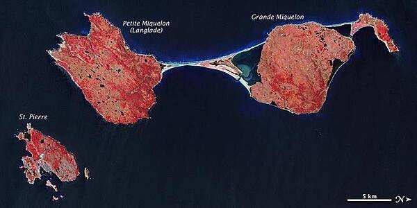
The last remnant of France's once-vast holdings in North America, this island archipelago off the coast of Newfoundland bears the scars of a complicated geologic history. Saint Pierre and Miquelon cover just 242 sq km (93 sq mi), and the three biggest islands lend the entire archipelago its name. In this false-color satellite image, vegetation appears in varying shades of pink and red, bare land is beige, urbanized areas are blue-gray, and water appears in shades of blue and blue-green. Saint Pierre is the smallest of the archipelago's major islands, a mostly northeast-southwest running landmass with several smaller islands and islets scattered around it. In the west (top of the image), Miquelon consists of three main sections: an arc-shaped body in the north (top right), Grande Miquelon immediately southeast of that, and Langlade (or Petite Miquelon) Island in the south. Grande Miquelon and Langlade are connected by a tombolo, a ridge of beach material (typically sand), built by wave action, that connects an island to the mainland. This tombolo formed in the eighteenth century. The terrain of the archipelago consists of mostly barren rock. Deforestation has claimed much of the vegetation, although woodland still covers 20 percent of the surface. Scrub vegetation and peatland are extensive. Cold, wet, foggy weather predominates, with windy springs and autumns. The islands, particularly Langlade, bear a scoured appearance, and this is no coincidence. During the Pleistocene Ice Age, glacial ice scraped the island. Today, wind and waves continue to erode these landmasses. For several months a year, winds regularly exceed 60 km (35 mi) per hour, and frequent storms pound the coastlines with high waves. Anecdotal evidence from local fishermen suggests that recent mild winters and less extensive sea ice might have allowed more erosion by ocean waves. Photo courtesy of NASA.
The last remnant of France's once-vast holdings in North America, this island archipelago off the coast of Newfoundland bears the scars of a complicated geologic history. Saint Pierre and Miquelon cover just 242 sq km (93 sq mi), and the three biggest islands lend the entire archipelago its name.
In this false-color satellite image, vegetation appears in varying shades of pink and red, bare land is beige, urbanized areas are blue-gray, and water appears in shades of blue and blue-green.
Saint Pierre is the smallest of the archipelago's major islands, a mostly northeast-southwest running landmass with several smaller islands and islets scattered around it. In the west (top of the image), Miquelon consists of three main sections: an arc-shaped body in the north (top right), Grande Miquelon immediately southeast of that, and Langlade (or Petite Miquelon) Island in the south. Grande Miquelon and Langlade are connected by a tombolo, a ridge of beach material (typically sand), built by wave action, that connects an island to the mainland. This tombolo formed in the eighteenth century.
The terrain of the archipelago consists of mostly barren rock. Deforestation has claimed much of the vegetation, although woodland still covers 20 percent of the surface. Scrub vegetation and peatland are extensive. Cold, wet, foggy weather predominates, with windy springs and autumns.
The islands, particularly Langlade, bear a scoured appearance, and this is no coincidence. During the Pleistocene Ice Age, glacial ice scraped the island. Today, wind and waves continue to erode these landmasses. For several months a year, winds regularly exceed 60 km (35 mi) per hour, and frequent storms pound the coastlines with high waves. Anecdotal evidence from local fishermen suggests that recent mild winters and less extensive sea ice might have allowed more erosion by ocean waves. Photo courtesy of NASA. • CIA World Factbook • 2020
Seaside view at Gloucester, Massacusetts. Settled in 1623, the city - long a fishing and seafood center - claims to be America's oldest seaport.
Seaside view at Gloucester, Massacusetts. Settled in 1623, the city - long a fishing and seafood center - claims to be America's oldest seaport. • CIA World Factbook • 2020
The Dry Tortugas are a group of islands located some 120 km (75 mi) west of Key West, Florida; they form the western end of the Florida Keys in the Gulf of Mexico. Like the Keys, the Dry Tortugas are formed primarily of coral reefs over older limestone formations. The islands were named "Dry Tortugas" upon discovery by Ponce de Leon in 1513 - "tortugas" means turtles in Spanish, and the islands are "dry" as no fresh water is found on them. Accessible only by boat or seaplane, the islands nevertheless have been designated a national park and are visited by hundreds every year. This view highlights three islands in the group: Bush Key, Hospital Key, and Garden Key - the site of hexagonal Civil War-era Fort Jefferson. Image courtesy of NASA.
The Dry Tortugas are a group of islands located some 120 km (75 mi) west of Key West, Florida; they form the western end of the Florida Keys in the Gulf of Mexico. Like the Keys, the Dry Tortugas are formed primarily of coral reefs over older limestone formations. The islands were named "Dry Tortugas" upon discovery by Ponce de Leon in 1513 - "tortugas" means turtles in Spanish, and the islands are "dry" as no fresh water is found on them. Accessible only by boat or seaplane, the islands nevertheless have been designated a national park and are visited by hundreds every year. This view highlights three islands in the group: Bush Key, Hospital Key, and Garden Key - the site of hexagonal Civil War-era Fort Jefferson. Image courtesy of NASA. • CIA World Factbook • 2020
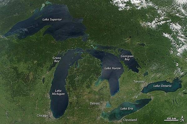
This image is a rare satellite view of a cloudless summer day over the entire Great Lakes region. The Great Lakes comprise the largest collective body of fresh water on the planet, containing roughly 18 percent of Earth's supply. Only the polar ice caps contain more fresh water. The region around the Great Lakes basin is home to more than 10 percent of the population of the United States and 25 percent of the population of Canada. Open water appears blue or nearly black. The pale blue and green swirls near the coasts are likely caused by algae or phytoplankton blooms, or by calcium carbonate (chalk) from the lake floor. Photo courtesy of NASA.
This image is a rare satellite view of a cloudless summer day over the entire Great Lakes region. The Great Lakes comprise the largest collective body of fresh water on the planet, containing roughly 18 percent of Earth's supply. Only the polar ice caps contain more fresh water. The region around the Great Lakes basin is home to more than 10 percent of the population of the United States and 25 percent of the population of Canada.
Open water appears blue or nearly black. The pale blue and green swirls near the coasts are likely caused by algae or phytoplankton blooms, or by calcium carbonate (chalk) from the lake floor. Photo courtesy of NASA. • CIA World Factbook • 2020
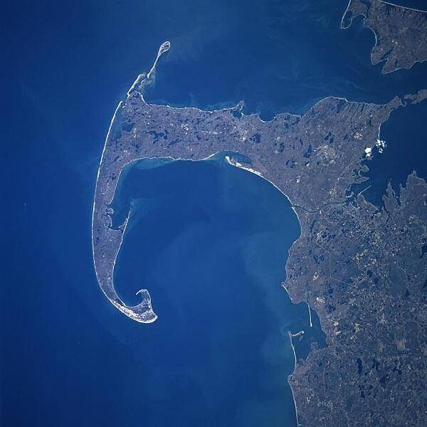
Cape Cod and Cape Cod Bay (visible at the center of the image) can be seen in this generally south-looking view. Cape Cod is a narrow peninsula, glacial in origin, that is constantly changing as winds and water move sand along the shoreline. Cape Cod extends 105 km (65 mi) east and north into the Atlantic Ocean. A portion of Martha's Vineyard may be seen in the upper right corner of the image. Photo courtesy of NASA.
Cape Cod and Cape Cod Bay (visible at the center of the image) can be seen in this generally south-looking view. Cape Cod is a narrow peninsula, glacial in origin, that is constantly changing as winds and water move sand along the shoreline. Cape Cod extends 105 km (65 mi) east and north into the Atlantic Ocean. A portion of Martha's Vineyard may be seen in the upper right corner of the image. Photo courtesy of NASA. • CIA World Factbook • 2020
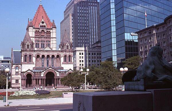
Built between 1872 and 1877, Trinity Church in Boston Massachusetts is the archetype of the Richardsonian Romanesque style (named after the architect), which is characterized by rough stone, heavy round-headed arches (often springing from clusters of short squat columns), clay roof tiles, and a massive tower. Trinity Church has been honored as one of the "Ten Most Significant Buildings in the United States"; it was designated a National Historic Landmark in 1970.
Built between 1872 and 1877, Trinity Church in Boston Massachusetts is the archetype of the Richardsonian Romanesque style (named after the architect), which is characterized by rough stone, heavy round-headed arches (often springing from clusters of short squat columns), clay roof tiles, and a massive tower. Trinity Church has been honored as one of the "Ten Most Significant Buildings in the United States"; it was designated a National Historic Landmark in 1970. • CIA World Factbook • 2020
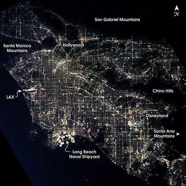
Los Angeles at night as seen from the International Space Station. After sunset, the borders of "The City of Angels" are defined as much by its dark terrain features as by its well-lit grid of streets and freeways. Over 13 million people inhabit the coastal basin bounded roughly by the Santa Monica and San Gabriel Mountains to the north and the Chino Hills and Santa Ana Mountains to the east and southeast. Image courtesy of NASA.
Los Angeles at night as seen from the International Space Station. After sunset, the borders of "The City of Angels" are defined as much by its dark terrain features as by its well-lit grid of streets and freeways. Over 13 million people inhabit the coastal basin bounded roughly by the Santa Monica and San Gabriel Mountains to the north and the Chino Hills and Santa Ana Mountains to the east and southeast. Image courtesy of NASA. • CIA World Factbook • 2020
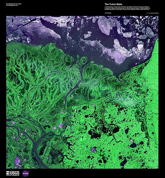
An intricate maze of small lakes and waterways define the Yukon Delta at the confluence of Alaska's Yukon and Kuskokwim Rivers with the frigid Bering Sea, shown in this false-color image. Wildlife abounds on the delta and offshore where sheets of sea ice form during the coldest months of the year. Image courtesy of USGS.
An intricate maze of small lakes and waterways define the Yukon Delta at the confluence of Alaska's Yukon and Kuskokwim Rivers with the frigid Bering Sea, shown in this false-color image. Wildlife abounds on the delta and offshore where sheets of sea ice form during the coldest months of the year. Image courtesy of USGS. • CIA World Factbook • 2020
Oahu is the most populated of the Hawaiian Islands. Hawaii's capital of Honolulu stretches along its southern shore. Just to the east of Honolulu is Waikiki Beach, with throngs of tourists and dozens of high-rise hotels. Overlooking Waikiki is Diamond Head, a volcanic crater formed some 200,000 years ago (extinct for about 150,000 years). The clouds in the right hand corner of this image are an almost permanent feature of Oahu. Trade winds blowing from the northeast are stopped by the 960 m (3,000 ft) high mountain range, where they rain out most of their moisture. As a result, the windward side of Oahu is usually cloudy, and the leeward side is relatively clear and dry. The large indent in the lower left of the image is Pearl Harbor, site of the Japanese air raid which drew America into World War II. The harbor still serves as a US Navy base. Photo courtesy of NASA.
Oahu is the most populated of the Hawaiian Islands. Hawaii's capital of Honolulu stretches along its southern shore. Just to the east of Honolulu is Waikiki Beach, with throngs of tourists and dozens of high-rise hotels. Overlooking Waikiki is Diamond Head, a volcanic crater formed some 200,000 years ago (extinct for about 150,000 years). The clouds in the right hand corner of this image are an almost permanent feature of Oahu. Trade winds blowing from the northeast are stopped by the 960 m (3,000 ft) high mountain range, where they rain out most of their moisture. As a result, the windward side of Oahu is usually cloudy, and the leeward side is relatively clear and dry. The large indent in the lower left of the image is Pearl Harbor, site of the Japanese air raid which drew America into World War II. The harbor still serves as a US Navy base. Photo courtesy of NASA. • CIA World Factbook • 2020
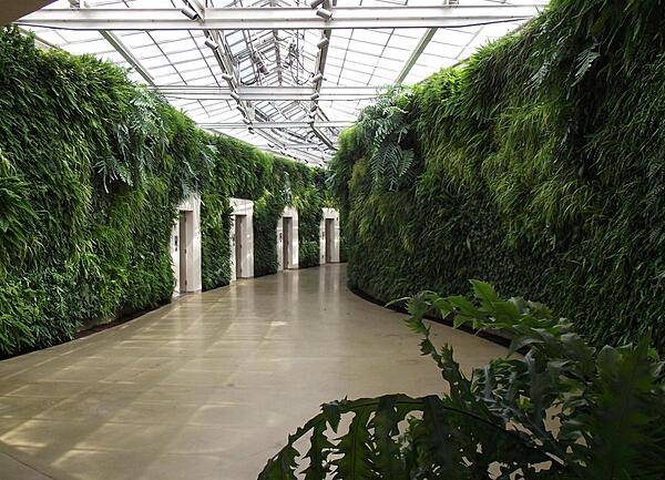
"Green walls" in one of the conservatories at Longwood Gardens, Kennett Square, Pennsylvania.
"Green walls" in one of the conservatories at Longwood Gardens, Kennett Square, Pennsylvania. • CIA World Factbook • 2020
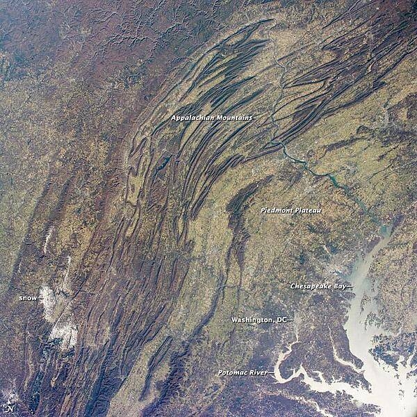
This regional view shows the striking visual effect of the valley-and-ridge topography of the Appalachian Mountains as viewed from the International Space Station. The image shows more than 500 km (300 mi) of this low mountain chain from northeast Pennsylvania (top right) to southern West Virginia, where a dusting of snow covers a patch of land (lower left). Sunglint reflections reveal details of the Chesapeake Bay and the great bend of the Potomac River. Cities are difficult to detect from space during daylight hours, so the sickle-shaped bend of the river is a good visual guide for astronauts trying to photograph the nation's capital, Washington D.C. The farm-dominated Piedmont Plateau is the light-toned area between the mountains and the bay. The Appalachian Mountains appear striped because the ridges are forested, providing a dense and dark canopy cover, while the valleys are farmed with crops that generally appear as lighter-toned areas. (Farmland is even lighter than usual in this image because the fields are fallow after the harvest.) Photo courtesy of NASA.
This regional view shows the striking visual effect of the valley-and-ridge topography of the Appalachian Mountains as viewed from the International Space Station. The image shows more than 500 km (300 mi) of this low mountain chain from northeast Pennsylvania (top right) to southern West Virginia, where a dusting of snow covers a patch of land (lower left).
Sunglint reflections reveal details of the Chesapeake Bay and the great bend of the Potomac River. Cities are difficult to detect from space during daylight hours, so the sickle-shaped bend of the river is a good visual guide for astronauts trying to photograph the nation's capital, Washington D.C. The farm-dominated Piedmont Plateau is the light-toned area between the mountains and the bay.
The Appalachian Mountains appear striped because the ridges are forested, providing a dense and dark canopy cover, while the valleys are farmed with crops that generally appear as lighter-toned areas. (Farmland is even lighter than usual in this image because the fields are fallow after the harvest.) Photo courtesy of NASA. • CIA World Factbook • 2020
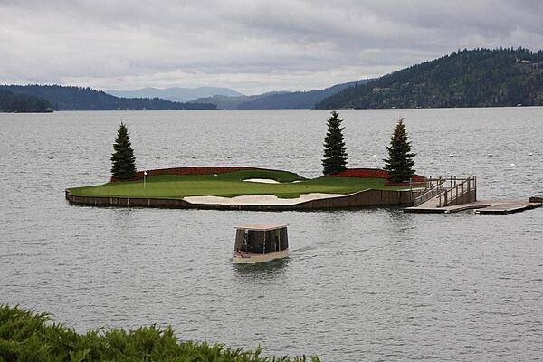
The Couer d'Alene Golf Course in Washington State is home to the world's only floating green.
The Couer d'Alene Golf Course in Washington State is home to the world's only floating green. • CIA World Factbook • 2020
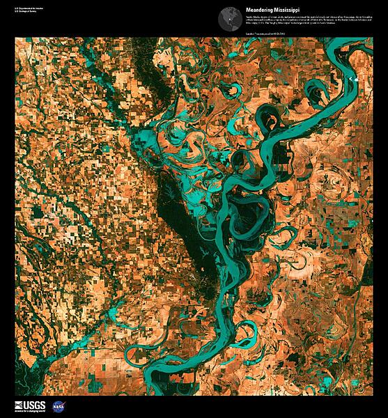
Small, blocky shapes of towns, fields, and pastures surround the graceful swirls and whorls of the Mississippi River shown in this false-color satellite image. Countless oxbow lakes and cutoffs accompany the meandering river south of Memphis, Tennessee, on the border between Arkansas and Mississippi. The "Mighty Mississippi" is the largest river system in North America. Image courtesy of USGS.
Small, blocky shapes of towns, fields, and pastures surround the graceful swirls and whorls of the Mississippi River shown in this false-color satellite image. Countless oxbow lakes and cutoffs accompany the meandering river south of Memphis, Tennessee, on the border between Arkansas and Mississippi. The "Mighty Mississippi" is the largest river system in North America. Image courtesy of USGS. • CIA World Factbook • 2020
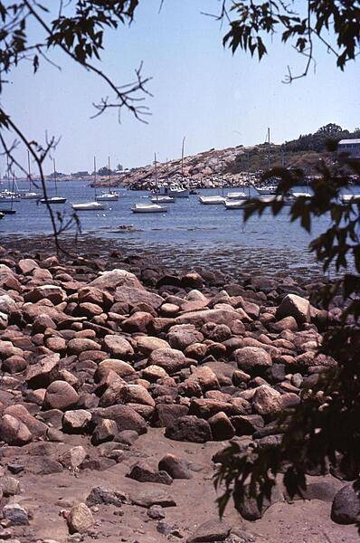
Another view of the harbor at Rockport, Massachusetts, some 40 km (25 mi) northeast of Boston, at the tip of the Cape Ann peninsula. The boulder-strewn shoreline accounts for the town's name.
Another view of the harbor at Rockport, Massachusetts, some 40 km (25 mi) northeast of Boston, at the tip of the Cape Ann peninsula. The boulder-strewn shoreline accounts for the town's name. • CIA World Factbook • 2020
As the westernmost point in North America, Attu is a rugged island dominated by snow-covered mountains (blue in this false-color photo). It is 32 by 56 km (20 by 35 mi) and lies at the far western end of the Aleutian chain, approximately 1770 km (1100 mi) from the Alaskan mainland and 402 km (250 mi) from the Siberian coastline. The weather is characterized by persistently overcast skies, fog, high winds, and frequent cyclonic storms. The Japanese invaded and occupied Attu in June 1942. Today, the island is home to a US Coastguard station and is a sanctuary to many of North America's rarest birds. Image courtesy of NASA.
As the westernmost point in North America, Attu is a rugged island dominated by snow-covered mountains (blue in this false-color photo). It is 32 by 56 km (20 by 35 mi) and lies at the far western end of the Aleutian chain, approximately 1770 km (1100 mi) from the Alaskan mainland and 402 km (250 mi) from the Siberian coastline. The weather is characterized by persistently overcast skies, fog, high winds, and frequent cyclonic storms. The Japanese invaded and occupied Attu in June 1942. Today, the island is home to a US Coastguard station and is a sanctuary to many of North America's rarest birds. Image courtesy of NASA. • CIA World Factbook • 2020
Close up view of the bow of the USS Constitution. The ship is constructed of white and longleaf pine, white oak, and, most importantly, southern live oak. The latter is particularly dense, heavy, and difficult to work, but very strong. Because her hull was built 53 cm (21 in) thick in an era when 47 cm (18 in) was common, she was able to withstand cannonades, thus earning the nickname of "Old Ironsides." The copper sheathing along the keel prevents the attachment of shipworms.
Close up view of the bow of the USS Constitution. The ship is constructed of white and longleaf pine, white oak, and, most importantly, southern live oak. The latter is particularly dense, heavy, and difficult to work, but very strong. Because her hull was built 53 cm (21 in) thick in an era when 47 cm (18 in) was common, she was able to withstand cannonades, thus earning the nickname of "Old Ironsides." The copper sheathing along the keel prevents the attachment of shipworms. • CIA World Factbook • 2020

The crowded cemetery on Tangier Island, Virginia is dominated by just a few families. Many of the island's population, which numbers about 600, still speak a distinct Cornish dialect dating to the late 17th century when the island was first settled.
The crowded cemetery on Tangier Island, Virginia is dominated by just a few families. Many of the island's population, which numbers about 600, still speak a distinct Cornish dialect dating to the late 17th century when the island was first settled. • CIA World Factbook • 2020
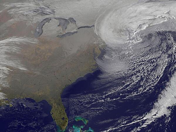
On 9 February 2013, two low pressure systems came together directly over New England. The resultant giant nor'easter created blizzards from Massachusetts to New York. Image courtesy of NASA.
On 9 February 2013, two low pressure systems came together directly over New England. The resultant giant nor'easter created blizzards from Massachusetts to New York. Image courtesy of NASA. • CIA World Factbook • 2020
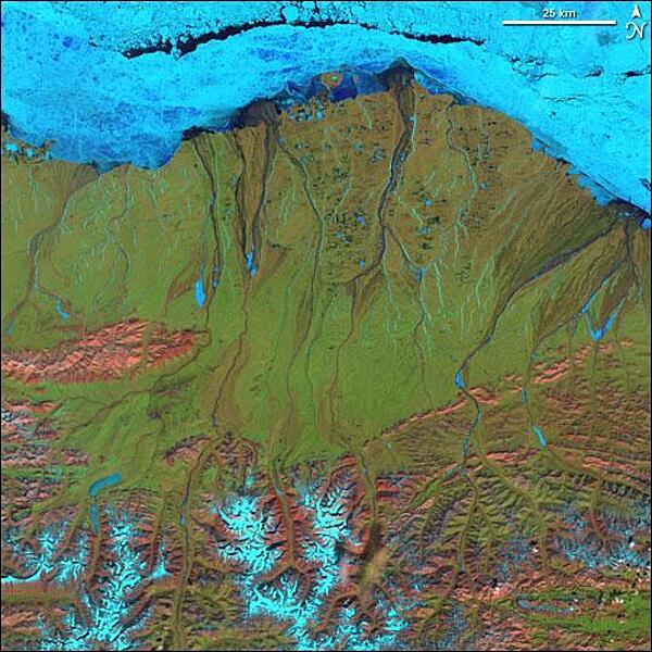
Along the northern Arctic shores of Alaska, ice, snow, and cold dominate the landscape, even on a sunny day in June. This false-color satellite image shows electric blue ice and snow, the green vegetation of the hardy plants and mosses of the tundra, the deep blue of flowing rivers and open ocean, and pink-hued outcrops of bare, rocky ground. The tundra runs the length of northern Alaska and is known as the North Slope. Only a surface "active layer" of the tundra thaws each season; most of the soil is permanently frozen year-round. On top of this permafrost, water flows to sea via shallow, braided streams or settles into pools and ponds. Along the bottom of the image, the rugged terrain of the Brooks Range Mountains is snow-covered in places (blue areas) and exposed (pink areas) in others. The sea is not surrendering to approaching summer. Along the coast, fast ice still clings to the shore in a solid, frozen sheet. Image courtesy of NASA.
Along the northern Arctic shores of Alaska, ice, snow, and cold dominate the landscape, even on a sunny day in June. This false-color satellite image shows electric blue ice and snow, the green vegetation of the hardy plants and mosses of the tundra, the deep blue of flowing rivers and open ocean, and pink-hued outcrops of bare, rocky ground. The tundra runs the length of northern Alaska and is known as the North Slope. Only a surface "active layer" of the tundra thaws each season; most of the soil is permanently frozen year-round. On top of this permafrost, water flows to sea via shallow, braided streams or settles into pools and ponds. Along the bottom of the image, the rugged terrain of the Brooks Range Mountains is snow-covered in places (blue areas) and exposed (pink areas) in others. The sea is not surrendering to approaching summer. Along the coast, fast ice still clings to the shore in a solid, frozen sheet. Image courtesy of NASA. • CIA World Factbook • 2020
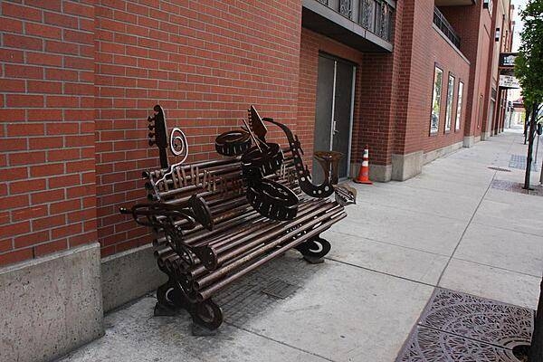
Music instrument sculptures represent Spokane's vibrant music legacy.
Music instrument sculptures represent Spokane's vibrant music legacy. • CIA World Factbook • 2020
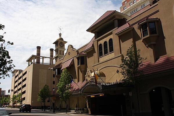
Spokane, Washington's Spanish Renaissance-style Davenport Hotel and Tower.
Spokane, Washington's Spanish Renaissance-style Davenport Hotel and Tower. • CIA World Factbook • 2020
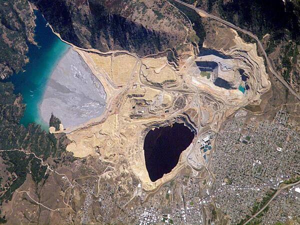
Mined for gold, silver, and copper, the region of Butte, Montana, had already earned the nickname of "The Richest Hill on Earth" by the end of the 19th century. The demand for electricity increased the requirement for copper so much that by World War I, the city of Butte was a boom town. Well before World War I, however, copper mining had spurred the creation of an intricate complex of underground drains and pumps to lower the groundwater level and continue the extraction of copper. Water extracted from the mines was so rich in dissolved copper sulfate that it was also "mined" by chemical precipitation for the copper it contained. In 1955, copper mining in the area expanded with the opening of the Berkeley Pit. The mine took advantage of the existing subterranean drainage and pump network to lower groundwater until 1982, when a new owner suspended operations. After the pumps were turned off, water from the surrounding rock basin began seeping into the pit. By the time an astronaut on the International Space Station took this picture on 2 August 2006, water in the pit was more than 275 m (900 ft) deep. This image shows many features of the mine workings, such as the terraced levels and access roadways of the open mine pits (gray and tan sculptured surfaces). A large gray tailings pile of waste rock and an adjacent tailings pond appear to the north of the Berkeley Pit. Color changes in the tailings pond result primarily from changing water depth. Because its water contains high concentrations of metals such as copper and zinc, the Berkeley Pit is listed as a federal Superfund site. Photo courtesy of NASA.
Mined for gold, silver, and copper, the region of Butte, Montana, had already earned the nickname of "The Richest Hill on Earth" by the end of the 19th century. The demand for electricity increased the requirement for copper so much that by World War I, the city of Butte was a boom town. Well before World War I, however, copper mining had spurred the creation of an intricate complex of underground drains and pumps to lower the groundwater level and continue the extraction of copper. Water extracted from the mines was so rich in dissolved copper sulfate that it was also "mined" by chemical precipitation for the copper it contained. In 1955, copper mining in the area expanded with the opening of the Berkeley Pit. The mine took advantage of the existing subterranean drainage and pump network to lower groundwater until 1982, when a new owner suspended operations. After the pumps were turned off, water from the surrounding rock basin began seeping into the pit. By the time an astronaut on the International Space Station took this picture on 2 August 2006, water in the pit was more than 275 m (900 ft) deep.
This image shows many features of the mine workings, such as the terraced levels and access roadways of the open mine pits (gray and tan sculptured surfaces). A large gray tailings pile of waste rock and an adjacent tailings pond appear to the north of the Berkeley Pit. Color changes in the tailings pond result primarily from changing water depth. Because its water contains high concentrations of metals such as copper and zinc, the Berkeley Pit is listed as a federal Superfund site. Photo courtesy of NASA. • CIA World Factbook • 2020
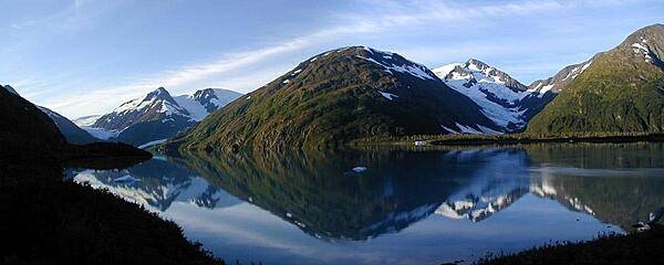
Portage Glacier and Lake Alaska in Alaska.
Portage Glacier and Lake Alaska in Alaska. • CIA World Factbook • 2020
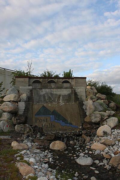
Post Falls is also known as Idaho's River City.
Post Falls is also known as Idaho's River City. • CIA World Factbook • 2020
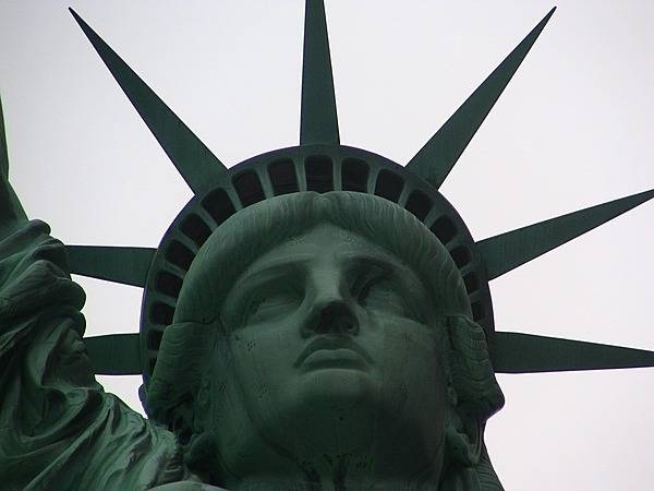
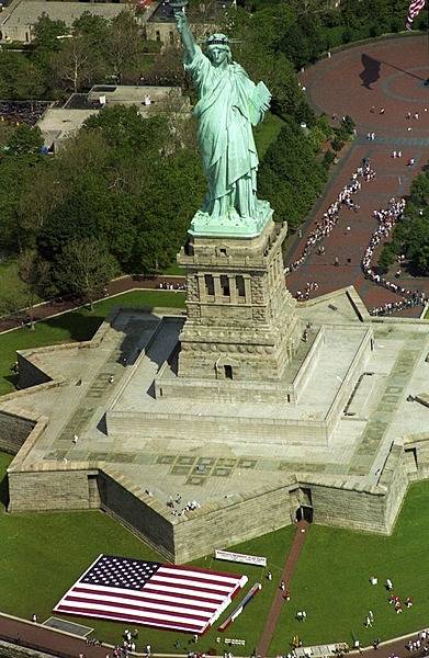
The Statue of Liberty's face and diadem (crown), whose seven rays symbolize the seven seas and continents of the world. Photo courtesy of the National Park Service.
The Statue of Liberty's face and diadem (crown), whose seven rays symbolize the seven seas and continents of the world. Photo courtesy of the National Park Service. • CIA World Factbook • 2020
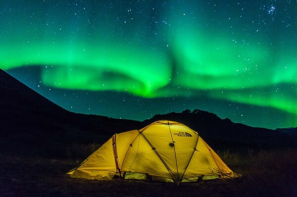
Northern lights are visible at night in Noatak National Preserve, Alaska from September through April. Photo courtesy of the US National Park Service/ Boris Koeten.
Northern lights are visible at night in Noatak National Preserve, Alaska from September through April. Photo courtesy of the US National Park Service/ Boris Koeten. • CIA World Factbook • 2020
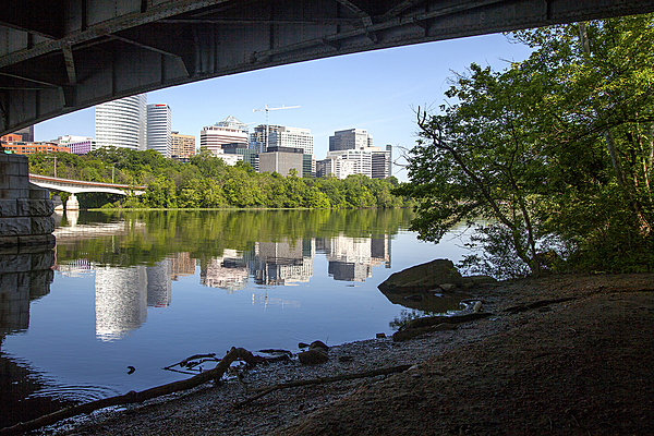
While the Theodore Roosevelt Island landscape is intended to evoke a sense of wilderness, it lies just over the Potomac River from Washington, D.C. proper and is accessed by footbridge from Rosslyn, Virginia (shown). Photo courtesy of the National Park Service.
While the Theodore Roosevelt Island landscape is intended to evoke a sense of wilderness, it lies just over the Potomac River from Washington, D.C. proper and is accessed by footbridge from Rosslyn, Virginia (shown). Photo courtesy of the National Park Service. • CIA World Factbook • 2020
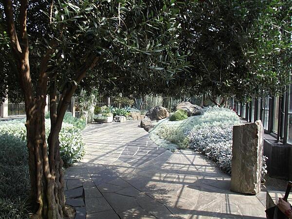
The silver garden inside one of the conservatories at Longwood Gardens, Kennett Square, Pennsylvania.
The silver garden inside one of the conservatories at Longwood Gardens, Kennett Square, Pennsylvania. • CIA World Factbook • 2020

A detail of the actual chair George Washington sat in while presiding over the Constitutional Convention in 1787. At the signing, Benjamin Franklin was optimistic about the document and said that now he had the happiness to know that the carving on the back was a rising, not a setting sun. Photo courtesy of the US National Park Service.
A detail of the actual chair George Washington sat in while presiding over the Constitutional Convention in 1787. At the signing, Benjamin Franklin was optimistic about the document and said that now he had the happiness to know that the carving on the back was a rising, not a setting sun. Photo courtesy of the US National Park Service. • CIA World Factbook • 2020

CIA World Factbook • 2020
The world famous view in Noatak National Preserve, Alaska that artist MK MacNaughton turned into a painting (see next image). Copter Peak is the large mountain in the center. Nunaviksak Creek runs along the base of the snow-capped mountain. Photo courtesy of the US National Park Service.
The world famous view in Noatak National Preserve, Alaska that artist MK MacNaughton turned into a painting (see next image). Copter Peak is the large mountain in the center. Nunaviksak Creek runs along the base of the snow-capped mountain. Photo courtesy of the US National Park Service. • CIA World Factbook • 2020
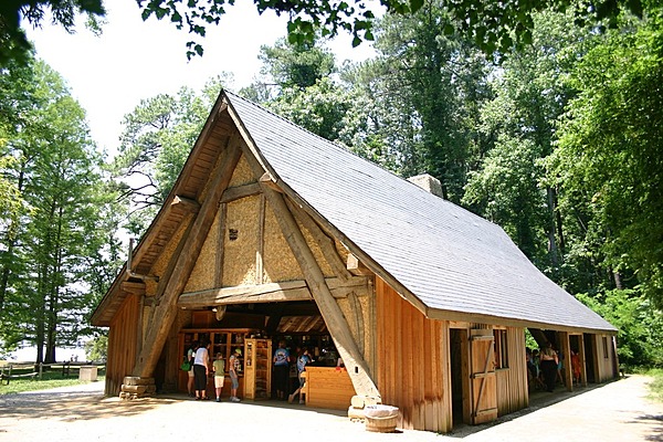
Exterior of the shop at Jamestown National Historic Site, Virginia where costumed interpreters demonstrate glassblowing techniques from the 17th century. Photo courtesy of the National Park Service.
Exterior of the shop at Jamestown National Historic Site, Virginia where costumed interpreters demonstrate glassblowing techniques from the 17th century. Photo courtesy of the National Park Service. • CIA World Factbook • 2020
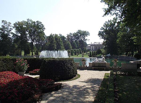
View of Nemours Mansion from beyond the Long Walk and Reflecting Pool. The Mansion was built in 1909-1910 by industrialist Alfred I. duPont and named after the French town from which his family emigrated in 1800.
View of Nemours Mansion from beyond the Long Walk and Reflecting Pool. The Mansion was built in 1909-1910 by industrialist Alfred I. duPont and named after the French town from which his family emigrated in 1800. • CIA World Factbook • 2020
CIA World Factbook • 2020
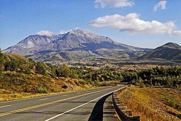
Approaching the blast zone of Mt. St. Helens in Washington state, 2007.
Approaching the blast zone of Mt. St. Helens in Washington state, 2007. • CIA World Factbook • 2020
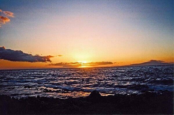
Sunset over Maui, Hawaii.
Sunset over Maui, Hawaii. • CIA World Factbook • 2020
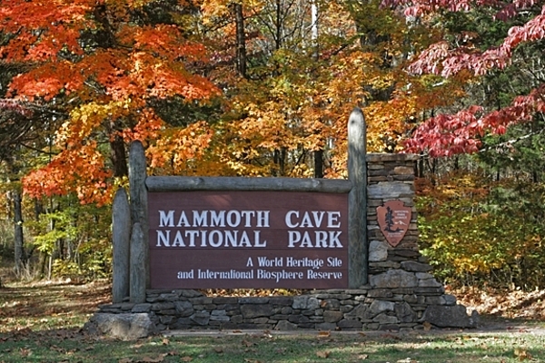
The Mammoth Cave National Park entrance sign at the park's eastern entrance in the fall. Mammoth Cave, discovered in 1791, is 668 km (415 mi) long and was designated a World Heritage Site in 1981. Image courtesy of the US National Park Service.
The Mammoth Cave National Park entrance sign at the park's eastern entrance in the fall. Mammoth Cave, discovered in 1791, is 668 km (415 mi) long and was designated a World Heritage Site in 1981. Image courtesy of the US National Park Service. • CIA World Factbook • 2020
CIA World Factbook • 2020
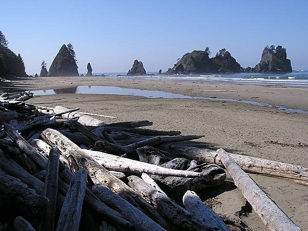
Stacked drift wood and offshore sea stacks at Point of the Arches, Olympic National Park, Washington state. Photo courtesy of the National Park Service.
Stacked drift wood and offshore sea stacks at Point of the Arches, Olympic National Park, Washington state. Photo courtesy of the National Park Service. • CIA World Factbook • 2020
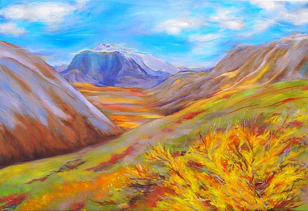
“Lunch Break With Copter Peak.” Artist-In-Residence MK MacNaughton created this dazzling painting for the National Park Service. It reflects her inspiration from a backcountry trip in Noatak National Preserve, Alaska. Photo courtesy of the US National Park Service.
“Lunch Break With Copter Peak.” Artist-In-Residence MK MacNaughton created this dazzling painting for the National Park Service. It reflects her inspiration from a backcountry trip in Noatak National Preserve, Alaska. Photo courtesy of the US National Park Service. • CIA World Factbook • 2020
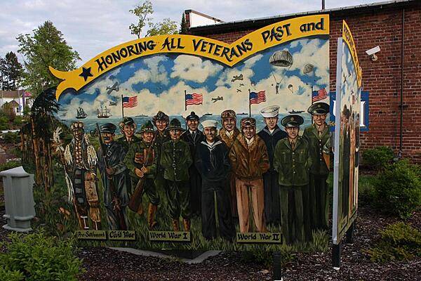
A local Post Falls artist painted this memorial that honors veterans of all conflicts dating back to the pre-settlement warrior and forward to . . .
A local Post Falls artist painted this memorial that honors veterans of all conflicts dating back to the pre-settlement warrior and forward to . . . • CIA World Factbook • 2020
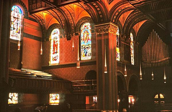
A view of the interior of Trinity Church, Boston, Massachusetts, showing some of the architectural details, stained glass windows, and the church organ.
A view of the interior of Trinity Church, Boston, Massachusetts, showing some of the architectural details, stained glass windows, and the church organ. • CIA World Factbook • 2020
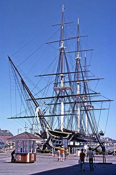
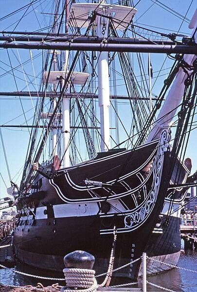
The USS Constitution, docked at Pier 1 of the Charleston Navy Yard (Boston), is the oldest floating commissioned naval vessel in the world. Launched in 1797, it was one of the first six original frigates built for the US Navy.
The USS Constitution, docked at Pier 1 of the Charleston Navy Yard (Boston), is the oldest floating commissioned naval vessel in the world. Launched in 1797, it was one of the first six original frigates built for the US Navy. • CIA World Factbook • 2020

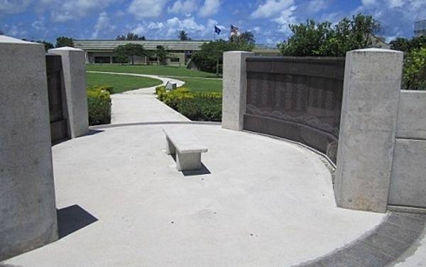
The World War II Memorial Wall in Washington, DC.
The World War II Memorial Wall in Washington, DC. • CIA World Factbook • 2020
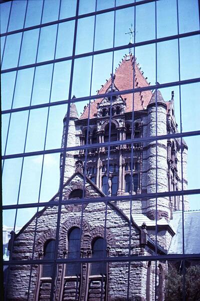
Trinity Church on Copley Square in Boston, Massachusetts lies literally within the shadow of the John Hancock Tower (New England's tallest). The church's reflection within the office building's windows creates an interesting juxtaposition of architectural styles.
Trinity Church on Copley Square in Boston, Massachusetts lies literally within the shadow of the John Hancock Tower (New England's tallest). The church's reflection within the office building's windows creates an interesting juxtaposition of architectural styles. • CIA World Factbook • 2020
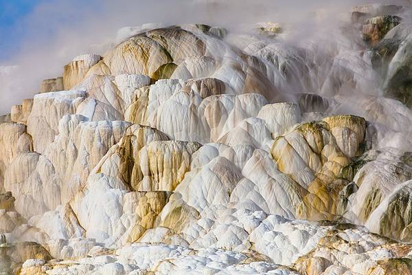
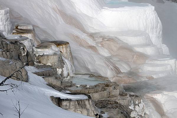
Closeup of travertine terraces colored orange, brown, and pink by thermophiles (simple microorganisms that thrive in hot water). Image courtesy of the US National Park Service/ Jacob W. Frank.
Closeup of travertine terraces colored orange, brown, and pink by thermophiles (simple microorganisms that thrive in hot water). Image courtesy of the US National Park Service/ Jacob W. Frank. • CIA World Factbook • 2020
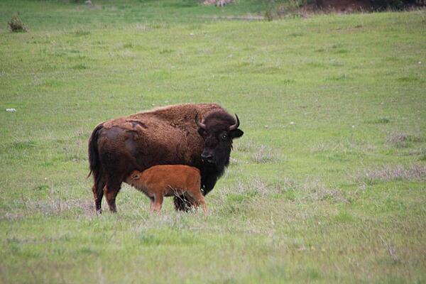
A bison and her calf on a farm near Post Falls, Idaho.
A bison and her calf on a farm near Post Falls, Idaho. • CIA World Factbook • 2020
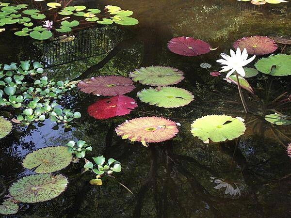
Lily pond at the Gibraltar Gardens in Wilmington, Delaware.
Lily pond at the Gibraltar Gardens in Wilmington, Delaware. • CIA World Factbook • 2020
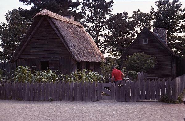
A couple of the dwellings at Plimouth Plantation, a living history museum in Plymouth, Massachusetts that recreates the original English colony of the 17th century.
A couple of the dwellings at Plimouth Plantation, a living history museum in Plymouth, Massachusetts that recreates the original English colony of the 17th century. • CIA World Factbook • 2020
CIA World Factbook • 2020
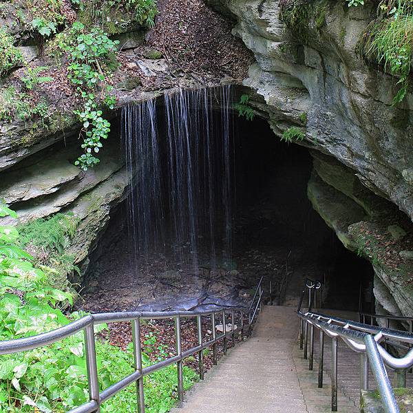
The Historic Entrance to Mammoth Cave, Kentucky is a natural opening that has been used by people for 5,000 years. Image courtesy of the US National Park Service.
The Historic Entrance to Mammoth Cave, Kentucky is a natural opening that has been used by people for 5,000 years. Image courtesy of the US National Park Service. • CIA World Factbook • 2020
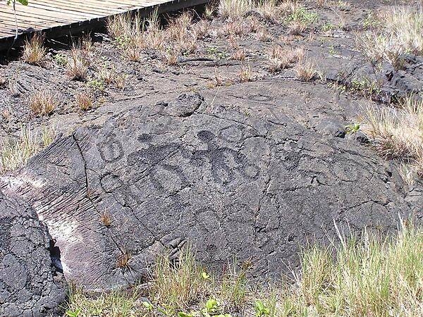
Petroglyphs at Hawaii Volcanoes National Park on the Big Island.
Petroglyphs at Hawaii Volcanoes National Park on the Big Island. • CIA World Factbook • 2020

The Fort McHenry Fife and Drum Corps plays on authentic War of 1812 rope tension snare drums. Photo courtesy of the National Park Service/Michelle Dunn.
The Fort McHenry Fife and Drum Corps plays on authentic War of 1812 rope tension snare drums. Photo courtesy of the National Park Service/Michelle Dunn. • CIA World Factbook • 2020
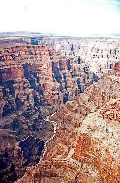
Aerial view of the Colorado River as it snakes through the majestic Grand Canyon in Arizona. The sedimentary layers exposed in the canyon date back 2 billion years!
Aerial view of the Colorado River as it snakes through the majestic Grand Canyon in Arizona. The sedimentary layers exposed in the canyon date back 2 billion years! • CIA World Factbook • 2020
Canary Spring at Mammoth Hot Springs in Yellowstone National Park. Mineralized water flowing downhill creates terraces. Image courtesy of the US National Park Service/Jim Peaco.
Canary Spring at Mammoth Hot Springs in Yellowstone National Park. Mineralized water flowing downhill creates terraces. Image courtesy of the US National Park Service/Jim Peaco. • CIA World Factbook • 2020
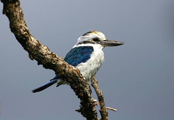
A collared kingfisher at the Pola Islands overlook in the Tutuila portion of the National Park of American Samoa. Photo courtesy of the US National Park Service.
A collared kingfisher at the Pola Islands overlook in the Tutuila portion of the National Park of American Samoa. Photo courtesy of the US National Park Service. • CIA World Factbook • 2020
With the Seward Peninsula of Alaska to the east, and Chukotskiy Poluostrov of Siberia to the west, the Bering Strait separates the United States and the Russian Federation by only 90 km (55 mi). It is named for Danish explorer Vitus Bering, who spotted the Alaskan mainland in 1741 while leading an expedition of Russian sailors. The boundary between the US and Russia lies between Big and Little Diomede Islands, which are visible in the middle of the Bering Strait. At the bottom of this image is St. Lawrence Island. Situated in the Bering Sea, it is part of Alaska. Image courtesy of NASA.
With the Seward Peninsula of Alaska to the east, and Chukotskiy Poluostrov of Siberia to the west, the Bering Strait separates the United States and the Russian Federation by only 90 km (55 mi). It is named for Danish explorer Vitus Bering, who spotted the Alaskan mainland in 1741 while leading an expedition of Russian sailors. The boundary between the US and Russia lies between Big and Little Diomede Islands, which are visible in the middle of the Bering Strait. At the bottom of this image is St. Lawrence Island. Situated in the Bering Sea, it is part of Alaska. Image courtesy of NASA. • CIA World Factbook • 2020
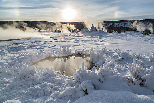
Parhelion (sundogs) and rime ice at the Upper Geyser Basin in December 2015 at Yellowstone National Park. A parhelion is an atmospheric optical phenomenon that consists of a bright spot to one or both sides of the sun; rime ice forms when supercooled liquid water droplets freeze onto surfaces. Image courtesy of the US National Park Service/Neal Herbert.
Parhelion (sundogs) and rime ice at the Upper Geyser Basin in December 2015 at Yellowstone National Park. A parhelion is an atmospheric optical phenomenon that consists of a bright spot to one or both sides of the sun; rime ice forms when supercooled liquid water droplets freeze onto surfaces. Image courtesy of the US National Park Service/Neal Herbert. • CIA World Factbook • 2020
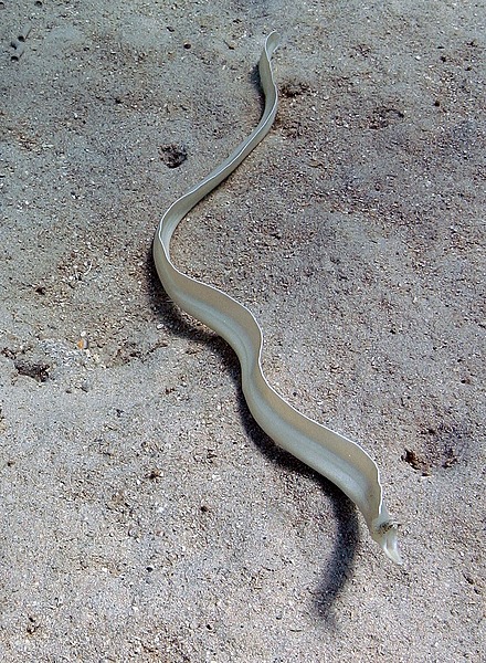
A marine eel at the National Park of American Samoa. Photo courtesy of the US National Park Service.
A marine eel at the National Park of American Samoa. Photo courtesy of the US National Park Service. • CIA World Factbook • 2020
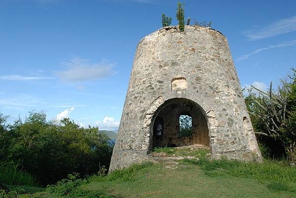
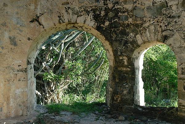
Peace Hill sugar mill ruin. The plantation that stood here was actually called Denis Bay. Established in 1718, it was one of only five plantations on St. John that employed wind power for the production of sugar cane. Photo courtesy of the US National Park Service/Susanna Pershern.
Peace Hill sugar mill ruin. The plantation that stood here was actually called Denis Bay. Established in 1718, it was one of only five plantations on St. John that employed wind power for the production of sugar cane. Photo courtesy of the US National Park Service/Susanna Pershern. • CIA World Factbook • 2020
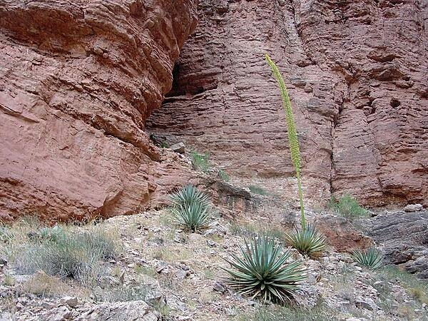
A group of spiky agave plants at Nautiloid Canyon in the Grand Canyon; the specimen in the center is in bloom. Image courtesy of the USGS.
A group of spiky agave plants at Nautiloid Canyon in the Grand Canyon; the specimen in the center is in bloom. Image courtesy of the USGS. • CIA World Factbook • 2020
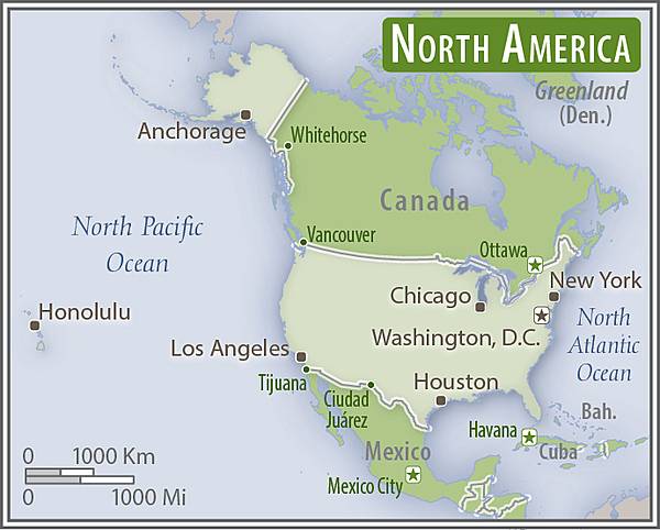
North America - US area comparison map
North America - US area comparison map • CIA World Factbook • 2020
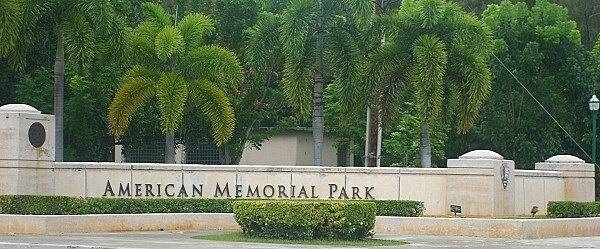
Entrance to American Memorial Park at Garapan. Photo courtesy of the US National Park Service.
Entrance to American Memorial Park at Garapan. Photo courtesy of the US National Park Service. • CIA World Factbook • 2020
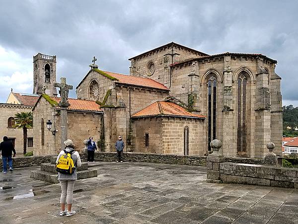
The Igrexa de San Francisco (Saint Francis Church) in the town of Betanzos dates to 1387.
The Igrexa de San Francisco (Saint Francis Church) in the town of Betanzos dates to 1387. • CIA World Factbook • 2020
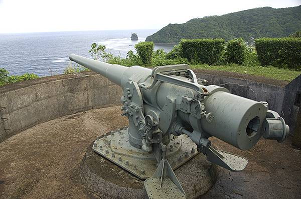
The tensions of World War II prompted the US Government to begin fortifying American Samoa in 1940. US Marines installed the two 5 inch coast defense guns on the west side of Pago Pago Harbor at Blunts Point, and another two on the east side of the harbor at Breakers Point. Following the Japanese attack on Pearl Harbor in December 1941 and the capture of Guam shortly thereafter, American Samoa became of critical importance as the only major American base in the western Pacific, and it was further fortified in anticipation of attack. Although no attack ever came, American Samoa was a critical supply and training point for American military actions in the Pacific. Photo courtesy of the US National Park Service.
The tensions of World War II prompted the US Government to begin fortifying American Samoa in 1940. US Marines installed the two 5 inch coast defense guns on the west side of Pago Pago Harbor at Blunts Point, and another two on the east side of the harbor at Breakers Point. Following the Japanese attack on Pearl Harbor in December 1941 and the capture of Guam shortly thereafter, American Samoa became of critical importance as the only major American base in the western Pacific, and it was further fortified in anticipation of attack. Although no attack ever came, American Samoa was a critical supply and training point for American military actions in the Pacific. Photo courtesy of the US National Park Service. • CIA World Factbook • 2020
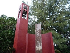
American Memorial and Carillon Bell Tower at American Memorial Park in Garapan. Photo courtesy of the US National Park Service.
American Memorial and Carillon Bell Tower at American Memorial Park in Garapan. Photo courtesy of the US National Park Service. • CIA World Factbook • 2020
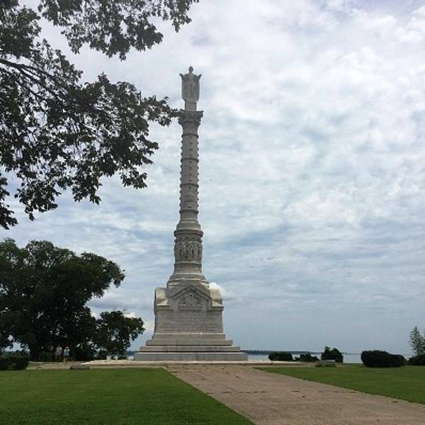
The Yorktown Victory Monument in Yorktown, Virginia commemorates the decisive 1781 battle of the Revolutionary War in which the combined forces of the United States and France defeated those of Great Britain and set the stage for ending the conflict and for British recognition of American independence. Atop the shaft of the monument is a figure representing Liberty. Photo courtesy of the National Park Service.
The Yorktown Victory Monument in Yorktown, Virginia commemorates the decisive 1781 battle of the Revolutionary War in which the combined forces of the United States and France defeated those of Great Britain and set the stage for ending the conflict and for British recognition of American independence. Atop the shaft of the monument is a figure representing Liberty. Photo courtesy of the National Park Service. • CIA World Factbook • 2020
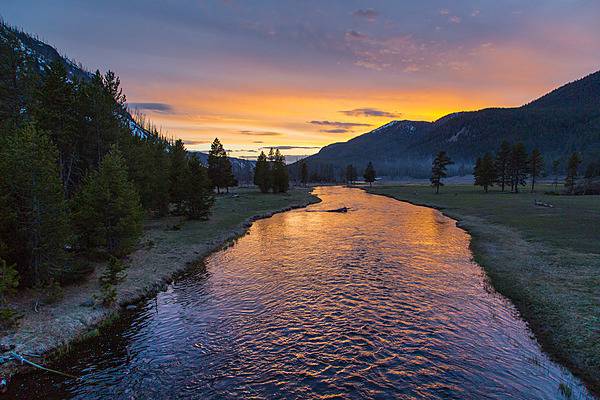
Sunset on the Madison River near Madison Junction in Yellowstone National Park. Image courtesy of the US National Park Service/Neal Herbert.
Sunset on the Madison River near Madison Junction in Yellowstone National Park. Image courtesy of the US National Park Service/Neal Herbert. • CIA World Factbook • 2020
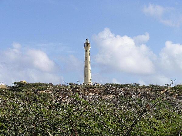
The California lighthouse on the northwest tip of Aruba gets its name from a steamship that wrecked nearby in 1891.
The California lighthouse on the northwest tip of Aruba gets its name from a steamship that wrecked nearby in 1891. • CIA World Factbook • 2020
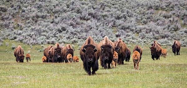
A nursery group of bison cows and calves makes its way through Lamar Valley in Yellowstone National Park. Due to high rates of survival and reproduction, the bison population increases by 10 to 17% every year: ten times faster than the human population grows worldwide. Image courtesy of the US National Park Service/Neal Herbert.
A nursery group of bison cows and calves makes its way through Lamar Valley in Yellowstone National Park. Due to high rates of survival and reproduction, the bison population increases by 10 to 17% every year: ten times faster than the human population grows worldwide. Image courtesy of the US National Park Service/Neal Herbert. • CIA World Factbook • 2020
Arches at the Peace Hill sugar mill ruin. The plantation that stood here was actually called Denis Bay. Established in 1718, it was one of only five plantations on St. John that employed wind power for the production of sugar cane. Photo courtesy of the US National Park Service/Susanna Pershern.
Arches at the Peace Hill sugar mill ruin. The plantation that stood here was actually called Denis Bay. Established in 1718, it was one of only five plantations on St. John that employed wind power for the production of sugar cane. Photo courtesy of the US National Park Service/Susanna Pershern. • CIA World Factbook • 2020
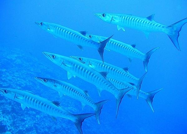
Giant barracuda at the National Park of American Samoa. Photo courtesy of the US National Park Service.
Giant barracuda at the National Park of American Samoa. Photo courtesy of the US National Park Service. • CIA World Factbook • 2020
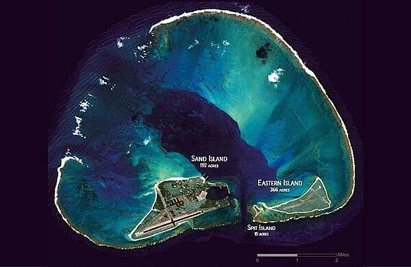
Midway Atoll is a 6.2 sq km (2.4 sq mi) atoll in the North Pacific Ocean. As its name suggests, Midway is roughly equidistant between North America and Asia, and lies almost halfway around the world from Greenwich, England. It is near the northwestern end of the Hawaiian archipelago, about one-third of the way from Honolulu, Hawaii to Tokyo, Japan. Photo courtesy of NASA.
Midway Atoll is a 6.2 sq km (2.4 sq mi) atoll in the North Pacific Ocean. As its name suggests, Midway is roughly equidistant between North America and Asia, and lies almost halfway around the world from Greenwich, England. It is near the northwestern end of the Hawaiian archipelago, about one-third of the way from Honolulu, Hawaii to Tokyo, Japan. Photo courtesy of NASA. • CIA World Factbook • 2020
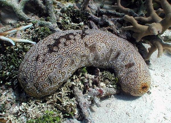
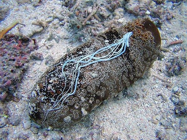
A sea cucumber (Samoan name loli) at the National Park of American Samoa. Photo courtesy of the US National Park Service.
A sea cucumber (Samoan name loli) at the National Park of American Samoa. Photo courtesy of the US National Park Service. • CIA World Factbook • 2020
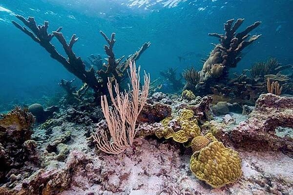
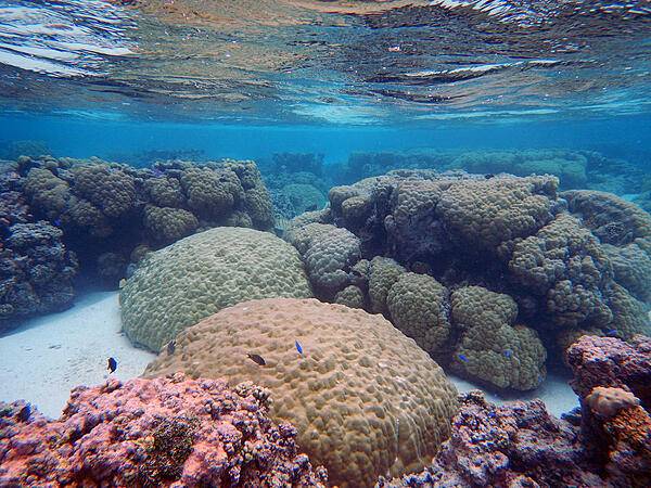
Corals and fish at Buck Island Reef National Monument. Photo courtesy of the US National Park Service/Susanna Pershern.
Corals and fish at Buck Island Reef National Monument. Photo courtesy of the US National Park Service/Susanna Pershern. • CIA World Factbook • 2020
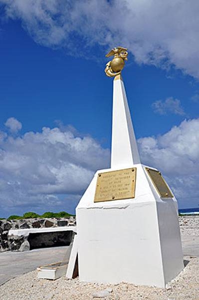
United States Marine Corps memorial to the defenders of Wake Island in December 1941. For 16 days, beginning 8 December 1941, a combined military force of Marine ground and air units, Naval aviation personnel, and an Army detachment - augmented by civilian contractors - resisted near constant attacks by Japanese forces. In the end the island defenders were overwhelmed by the Japanese forces who then occupied the atoll until the end of World War II. Photo courtesy of the US Air Force.
United States Marine Corps memorial to the defenders of Wake Island in December 1941. For 16 days, beginning 8 December 1941, a combined military force of Marine ground and air units, Naval aviation personnel, and an Army detachment - augmented by civilian contractors - resisted near constant attacks by Japanese forces. In the end the island defenders were overwhelmed by the Japanese forces who then occupied the atoll until the end of World War II. Photo courtesy of the US Air Force. • CIA World Factbook • 2020
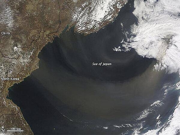
A dust plume arose over Inner Mongolia and on April 9, 2012, began its eastward journey over the Sea of Japan. New research shows that dust accounts for most of the 64 million tons of foreign aerosol imports that arrive in the air over North America each year. Credit: NASA Earth Observatory/Jeff Schmaltz.
A dust plume arose over Inner Mongolia and on April 9, 2012, began its eastward journey over the Sea of Japan. New research shows that dust accounts for most of the 64 million tons of foreign aerosol imports that arrive in the air over North America each year. Credit: NASA Earth Observatory/Jeff Schmaltz. • CIA World Factbook • 2020
After renovation: the Statue of Liberty's re-opening on 4 July 1986, complete with a huge flag cake. Photo courtesy of the National Park Service.
After renovation: the Statue of Liberty's re-opening on 4 July 1986, complete with a huge flag cake. Photo courtesy of the National Park Service. • CIA World Factbook • 2020
A medusa spaghetti worm at the National Park of American Samoa. Photo courtesy of the US National Park Service.
A medusa spaghetti worm at the National Park of American Samoa. Photo courtesy of the US National Park Service. • CIA World Factbook • 2020
Porites and Acropora coral species in reef flat pools in the National Park of American Samoa on Ofu, Manuʻa Islands Group. Photo courtesy of the USGS/ Curt Storlazzi.
Porites and Acropora coral species in reef flat pools in the National Park of American Samoa on Ofu, Manuʻa Islands Group. Photo courtesy of the USGS/ Curt Storlazzi. • CIA World Factbook • 2020
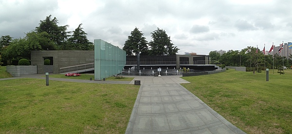
The United States Korean War Memorial at the United Nations Memorial Cemetery in Busan.
The United States Korean War Memorial at the United Nations Memorial Cemetery in Busan. • CIA World Factbook • 2020
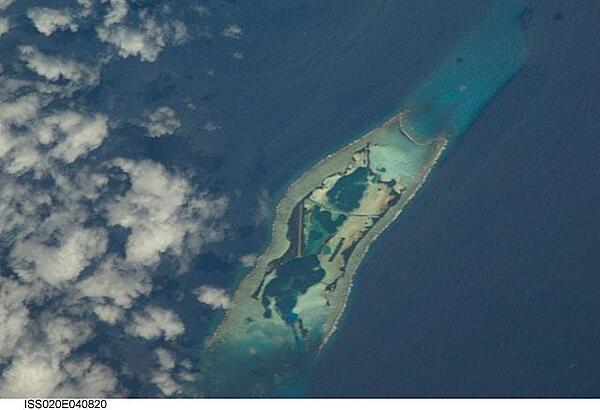
Astronaut photo of Kingman Reef, a largely submerged, uninhabited triangular structure in the North Pacific Ocean, roughly halfway between the Hawaiian Islands and American Samoa. The reef lagoon is 82 m (270 ft) deep at the western part and the total enclosed area is about 76 sq km (29 sq mi). The east-west and northwest-southeast trending small strips of dry land (gray color) are composed of coral rubble and giant clamshells. The highest point on the reef is less than 1.5 m (5 ft) above sea level, which is awash most of the time, making Kingman Reef a maritime hazard. Image courtesy of NASA.
Astronaut photo of Kingman Reef, a largely submerged, uninhabited triangular structure in the North Pacific Ocean, roughly halfway between the Hawaiian Islands and American Samoa. The reef lagoon is 82 m (270 ft) deep at the western part and the total enclosed area is about 76 sq km (29 sq mi). The east-west and northwest-southeast trending small strips of dry land (gray color) are composed of coral rubble and giant clamshells. The highest point on the reef is less than 1.5 m (5 ft) above sea level, which is awash most of the time, making Kingman Reef a maritime hazard. Image courtesy of NASA. • CIA World Factbook • 2020
Aerial view of Asan Ridge and the War in the Pacific National Historical Park. Established in 1978, the Park is composed of various sites on the western shore of the island; it is unique in the US National Park System in that it honors all those who participated in the Pacific Theater of World War II. During the Second World War, Guam was captured by Japanese forces in 1941 and liberated by the Americans in 1944. The Park includes former battlefields, gun emplacements, trenches, caves, and historic structures. Photo courtesy of the US National Park Service.
Aerial view of Asan Ridge and the War in the Pacific National Historical Park. Established in 1978, the Park is composed of various sites on the western shore of the island; it is unique in the US National Park System in that it honors all those who participated in the Pacific Theater of World War II. During the Second World War, Guam was captured by Japanese forces in 1941 and liberated by the Americans in 1944. The Park includes former battlefields, gun emplacements, trenches, caves, and historic structures. Photo courtesy of the US National Park Service. • CIA World Factbook • 2020
Flame tree blossom at the American Memorial Park at Garapan. Photo courtesy of the US National Park Service.
Flame tree blossom at the American Memorial Park at Garapan. Photo courtesy of the US National Park Service. • CIA World Factbook • 2020
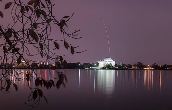
The Thomas Jefferson Memorial in Washington, DC as seen during the early morning hours of 17 November 2018. A flight trail of an Antares rocket - with a Cygnus resupply spacecraft onboard - appears over the memorial. The rocket was launched from NASA's Wallops Flight Facility in Virginia, about 185 km (115 mi) southeast of the capital. The cargo resupply mission to the International Space Station delivered about 3,350 kg (7,400 lb) of scientific research equipment and crew supplies to the orbital laboratory and its crew. Photo Credit: NASA/Aubrey Gemignani.
The Thomas Jefferson Memorial in Washington, DC as seen during the early morning hours of 17 November 2018. A flight trail of an Antares rocket - with a Cygnus resupply spacecraft onboard - appears over the memorial. The rocket was launched from NASA's Wallops Flight Facility in Virginia, about 185 km (115 mi) southeast of the capital. The cargo resupply mission to the International Space Station delivered about 3,350 kg (7,400 lb) of scientific research equipment and crew supplies to the orbital laboratory and its crew. Photo Credit: NASA/Aubrey Gemignani. • CIA World Factbook • 2020
The largest of the coral atolls of the Chagos Archipelago, Diego Garcia, is visible in this northwest-looking view. Diego Garcia is approximately 560 km (350 mi) south of the Maldive Islands in the central Indian Ocean. The crescent shape of the coral island encloses a lagoon that forms the harbor. Diego Garcia is the site of a large Anglo-American Naval Air and Communications facility located on the northwest part of the atoll. Image courtesy of NASA.
The largest of the coral atolls of the Chagos Archipelago, Diego Garcia, is visible in this northwest-looking view. Diego Garcia is approximately 560 km (350 mi) south of the Maldive Islands in the central Indian Ocean. The crescent shape of the coral island encloses a lagoon that forms the harbor. Diego Garcia is the site of a large Anglo-American Naval Air and Communications facility located on the northwest part of the atoll. Image courtesy of NASA. • CIA World Factbook • 2020
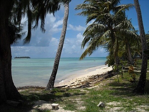
Deserted beach near Pago Pago. American Samoa is an incorporated, self-governing territory of the US. A part of the Samoan island chain, it is the southernmost territory of the US. The large harbor at Pago Pago contains a full US naval station. The inhabitants of American Samoa are American nationals, but not necessarily American citizens.
Deserted beach near Pago Pago. American Samoa is an incorporated, self-governing territory of the US. A part of the Samoan island chain, it is the southernmost territory of the US. The large harbor at Pago Pago contains a full US naval station. The inhabitants of American Samoa are American nationals, but not necessarily American citizens. • CIA World Factbook • 2020
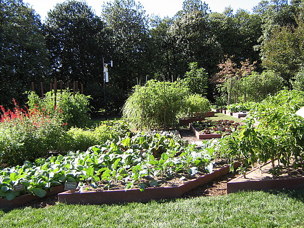
Vegetable garden at the White House in Washington, D.C.
Vegetable garden at the White House in Washington, D.C. • CIA World Factbook • 2020
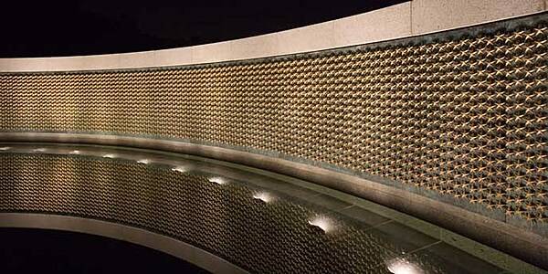
A wall of 4,048 gold stars – each representing 100 killed – at the World War II Memorial in Washington, D.C.; a sobering reminder to all of the price over 400,000 Americans paid to secure victory. Photo courtesy of the National Park Service.
A wall of 4,048 gold stars – each representing 100 killed – at the World War II Memorial in Washington, D.C.; a sobering reminder to all of the price over 400,000 Americans paid to secure victory. Photo courtesy of the National Park Service. • CIA World Factbook • 2020
Marianas Memorial at American Memorial Park. Ten granite panels inscribed with 929 names of indigenous Chamorros and Carolinians who died during World War II. Photo courtesy of the US National Park Service.
Marianas Memorial at American Memorial Park. Ten granite panels inscribed with 929 names of indigenous Chamorros and Carolinians who died during World War II. Photo courtesy of the US National Park Service. • CIA World Factbook • 2020
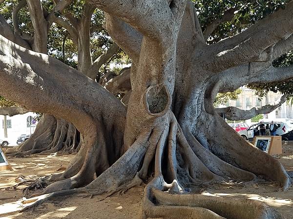
Huge Ficus Centenario tree in Cadiz. The city is among the oldest settlements in Spain, founded by the Phoenicians about 1100 B.C. It was a major port for trade with the Americas.
Huge Ficus Centenario tree in Cadiz. The city is among the oldest settlements in Spain, founded by the Phoenicians about 1100 B.C. It was a major port for trade with the Americas. • CIA World Factbook • 2020
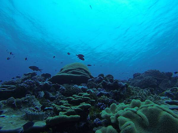
Healthy coral reef system at Kingman Reef National Wildlife Refuge. Image courtesy of USFWS/Susan White.
Healthy coral reef system at Kingman Reef National Wildlife Refuge. Image courtesy of USFWS/Susan White. • CIA World Factbook • 2020
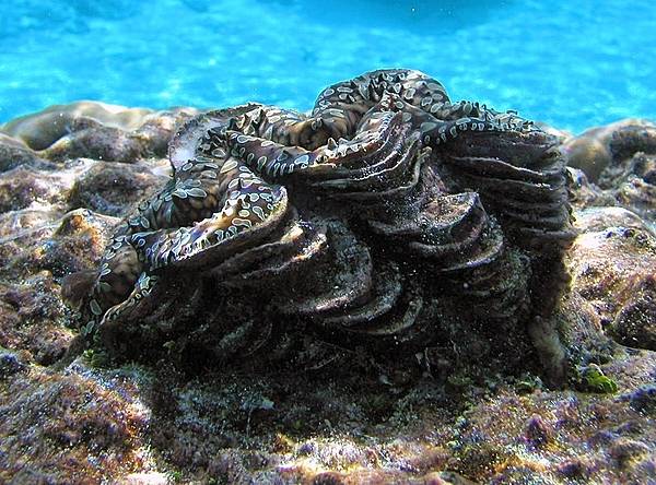
A giant clam (Samoan name faisua) at the National Park of American Samoa. Photo courtesy of the US National Park Service.
A giant clam (Samoan name faisua) at the National Park of American Samoa. Photo courtesy of the US National Park Service. • CIA World Factbook • 2020

Jagalchi Fish Market is located on the edge of Nampo Port in Busan. Considered to be the largest fish market in South Korea, it is listed as one of the ten landmarks of Busan and attracts myriads of tourists who visit to shop.
Jagalchi Fish Market is located on the edge of Nampo Port in Busan. Considered to be the largest fish market in South Korea, it is listed as one of the ten landmarks of Busan and attracts myriads of tourists who visit to shop. • CIA World Factbook • 2020
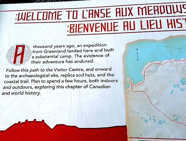
Welcoming sign at L’Anse Aux Meadows in Newfoundland. The archeological site dates from about 1000 A.D. It is thought to be the first Norse holding in North America - predating Columbus' arrival by five centuries. The site probably was ship repair station, serving Norse ships from Greenland, rather than a settlement. At the time, it was closer to the water and surrounded by trees. The site may only have been in use for about a century before being abandoned.
Welcoming sign at L’Anse Aux Meadows in Newfoundland. The archeological site dates from about 1000 A.D. It is thought to be the first Norse holding in North America - predating Columbus' arrival by five centuries. The site probably was ship repair station, serving Norse ships from Greenland, rather than a settlement. At the time, it was closer to the water and surrounded by trees. The site may only have been in use for about a century before being abandoned. • CIA World Factbook • 2020
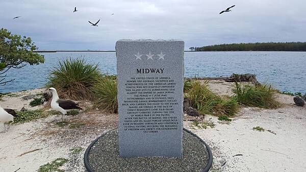
The American Battle Monuments Commission authorized the creation of a Midway Memorial Marker in May 2013 to commemorate the 4–7 June 1942 Battle of Midway. On 12 August 2015, the Midway Memorial Marker was officially erected on the island. Image courtesy USFWS/ Megan Nagel.
The American Battle Monuments Commission authorized the creation of a Midway Memorial Marker in May 2013 to commemorate the 4–7 June 1942 Battle of Midway. On 12 August 2015, the Midway Memorial Marker was officially erected on the island. Image courtesy USFWS/ Megan Nagel. • CIA World Factbook • 2020
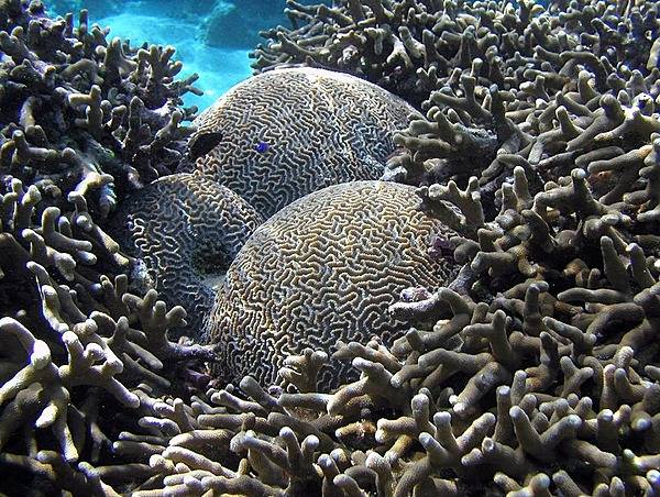
Brain coral surrounded by staghorn coral at the National Park of American Samoa. Photo courtesy of the US National Park Service.
Brain coral surrounded by staghorn coral at the National Park of American Samoa. Photo courtesy of the US National Park Service. • CIA World Factbook • 2020
American settlers arrived on Baker Island in 1935 and built a lighthouse; the settlement was evacuated at the start of World War II and the island has been uninhabited and very rarely visited since then. The lighthouse tower still stands; it is now charted as a day beacon (an unlighted nautical sea mark). Image courtesy of the US Fish and and Wildlife Service.
American settlers arrived on Baker Island in 1935 and built a lighthouse; the settlement was evacuated at the start of World War II and the island has been uninhabited and very rarely visited since then. The lighthouse tower still stands; it is now charted as a day beacon (an unlighted nautical sea mark). Image courtesy of the US Fish and and Wildlife Service. • CIA World Factbook • 2020
A hexagonal monument, dedicated in 1994 on the 50th anniversary of the liberation of Guam, stands at the War in the Pacific National Historical Park under the flags of the United States and Guam. The monument's inscription reads: "Honors to heroic and gallant effort of the US Armed Forces". Photo courtesy of the US National Park Service.
A hexagonal monument, dedicated in 1994 on the 50th anniversary of the liberation of Guam, stands at the War in the Pacific National Historical Park under the flags of the United States and Guam. The monument's inscription reads: "Honors to heroic and gallant effort of the US Armed Forces". Photo courtesy of the US National Park Service. • CIA World Factbook • 2020
The topography of Tutuila, largest of the islands of American Samoa, is distinctively shown in this color-coded perspective view generated with digital elevation data from the space. Two visualization methods were combined to produce the image: shading and color coding of topographic height. The total area of Tutuila is about 142 sq km (55 sq mi), slightly larger than San Francisco. The large bay near the center in this view is Pago Pago Harbor, actually a submerged volcanic crater whose south wall collapsed millions of years ago. Adjacent to the harbor is Pago Pago, the capital of American Samoa, and to the left (west) of the harbor in this view is Matafao Peak, Tutuila's highest point at 653 m (2,142 ft). Image courtesy of NASA/JPL/NGA.
The topography of Tutuila, largest of the islands of American Samoa, is distinctively shown in this color-coded perspective view generated with digital elevation data from the space. Two visualization methods were combined to produce the image: shading and color coding of topographic height. The total area of Tutuila is about 142 sq km (55 sq mi), slightly larger than San Francisco. The large bay near the center in this view is Pago Pago Harbor, actually a submerged volcanic crater whose south wall collapsed millions of years ago. Adjacent to the harbor is Pago Pago, the capital of American Samoa, and to the left (west) of the harbor in this view is Matafao Peak, Tutuila's highest point at 653 m (2,142 ft). Image courtesy of NASA/JPL/NGA. • CIA World Factbook • 2020

Exterior of the Palace of the People in Bucharest. The building was constructed between 1984 and 1997 on orders of Nicolae Ceausescu, the dictator of communist Romania. The structure is the world's third-largest building by floor area (after the Pentagon in Washington, DC and the Long'ao Building in China) with 1,100 rooms; it consists of 12 floors above ground and 8 floors below. The edifice hosts the two houses of Romania's Parliament (the Senate and the Chamber of Deputies), three museums, and an international conference center. Nonetheless, about two-thirds of the building remains unoccupied.
Exterior of the Palace of the People in Bucharest. The building was constructed between 1984 and 1997 on orders of Nicolae Ceausescu, the dictator of communist Romania. The structure is the world's third-largest building by floor area (after the Pentagon in Washington, DC and the Long'ao Building in China) with 1,100 rooms; it consists of 12 floors above ground and 8 floors below. The edifice hosts the two houses of Romania's Parliament (the Senate and the Chamber of Deputies), three museums, and an international conference center. Nonetheless, about two-thirds of the building remains unoccupied. • CIA World Factbook • 2020
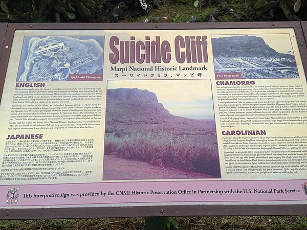
Sign at Suicide Cliff - at the northern end of Saipan - where, at the conclusion of the Battle of Saipan (15 June to 9 July 1944), many Japanese defenders and civilians took their own lives rather than let themselves be captured by the American military.
Sign at Suicide Cliff - at the northern end of Saipan - where, at the conclusion of the Battle of Saipan (15 June to 9 July 1944), many Japanese defenders and civilians took their own lives rather than let themselves be captured by the American military. • CIA World Factbook • 2020

Beomeosa is a head temple of the Jogye Order of Korean Buddhism in Busan. Built on the slopes of Geumjeongsan, it is one of the country's best known urban temples. This Three Story Stone Pagoda dates back to the Silla Era (first millennium A.D.) and was probably erected between 826-836, as part of the original temple that was destroyed by fire in 1592.
Beomeosa is a head temple of the Jogye Order of Korean Buddhism in Busan. Built on the slopes of Geumjeongsan, it is one of the country's best known urban temples. This Three Story Stone Pagoda dates back to the Silla Era (first millennium A.D.) and was probably erected between 826-836, as part of the original temple that was destroyed by fire in 1592. • CIA World Factbook • 2020
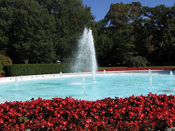
The south lawn fountain at the White House in Washington, D.C.
The south lawn fountain at the White House in Washington, D.C. • CIA World Factbook • 2020
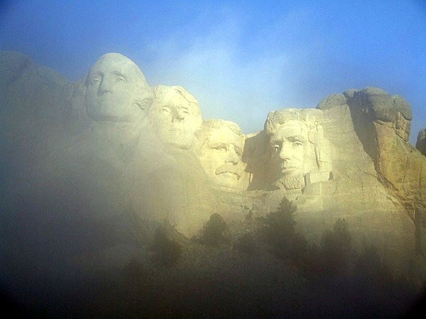
Mount Rushmore emerging from the fog. Image courtesy of the US National Park Service.
Mount Rushmore emerging from the fog. Image courtesy of the US National Park Service. • CIA World Factbook • 2020
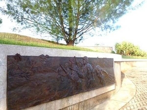
Bronze relief on a memorial at the War in the Pacific National Historical Park. Established in 1978, the Park is composed of various sites on the western shore of the island; it is unique in the US National Park System in that it honors all those who participated in the Pacific Theater of World War II. During the Second World War, Guam was captured by Japanese forces in 1941 and liberated by the Americans in 1944. The Park includes former battlefields, gun emplacements, trenches, caves, and historic structures. Photo courtesy of the US National Park Service.
Bronze relief on a memorial at the War in the Pacific National Historical Park. Established in 1978, the Park is composed of various sites on the western shore of the island; it is unique in the US National Park System in that it honors all those who participated in the Pacific Theater of World War II. During the Second World War, Guam was captured by Japanese forces in 1941 and liberated by the Americans in 1944. The Park includes former battlefields, gun emplacements, trenches, caves, and historic structures. Photo courtesy of the US National Park Service. • CIA World Factbook • 2020
Scenic pathway at the American Memorial Park at Garapan. Photo courtesy of the US National Park Service.
Scenic pathway at the American Memorial Park at Garapan. Photo courtesy of the US National Park Service. • CIA World Factbook • 2020
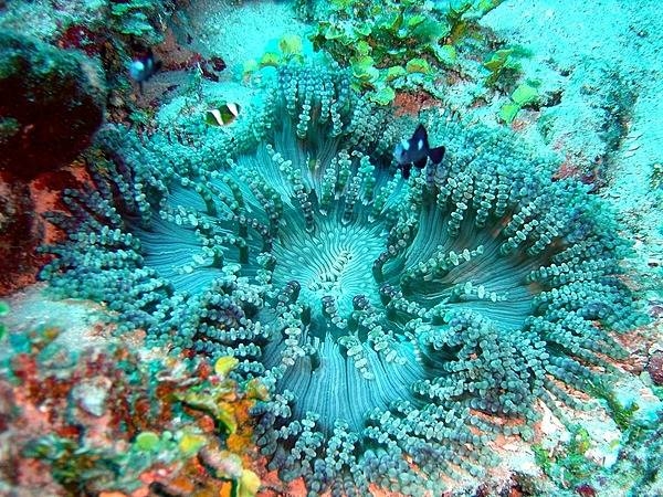
A beaded sea anemone at the National Park of American Samoa. Photo courtesy of the US National Park Service.
A beaded sea anemone at the National Park of American Samoa. Photo courtesy of the US National Park Service. • CIA World Factbook • 2020
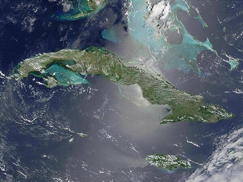
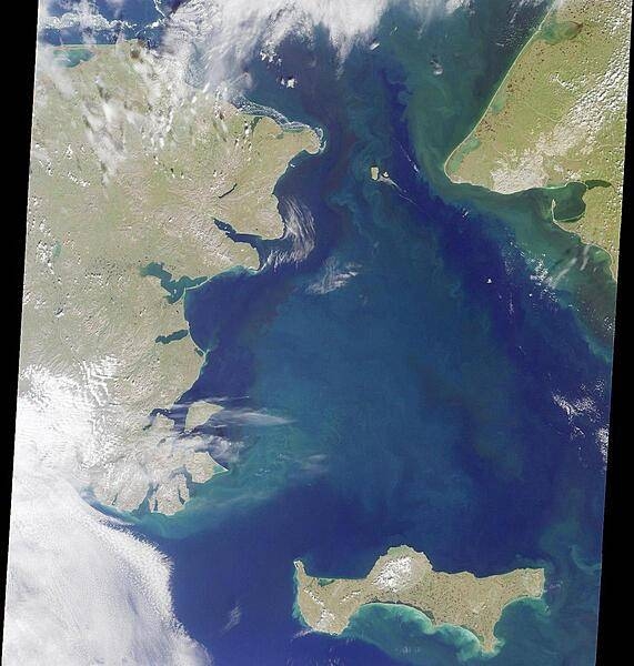
Satellite image of Cuba (center) and Jamaica (lower right). The southern tip of Florida, the Florida Keys, and the Florida Strait appear at the top. The bright blue green color around the islands, particularly around those of the Bahamas in the upper right, is likely due to the brighter solar reflection over the more shallow waters that surround the islands. Image courtesy of NASA.
Satellite image of Cuba (center) and Jamaica (lower right). The southern tip of Florida, the Florida Keys, and the Florida Strait appear at the top. The bright blue green color around the islands, particularly around those of the Bahamas in the upper right, is likely due to the brighter solar reflection over the more shallow waters that surround the islands. Image courtesy of NASA. • CIA World Factbook • 2020
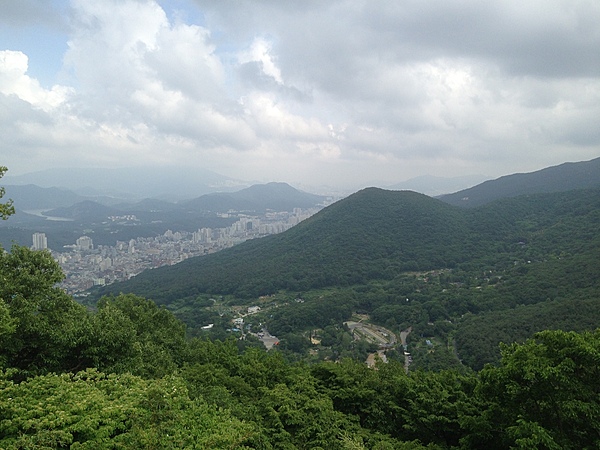
View of Busan from a surrounding mountainside.
View of Busan from a surrounding mountainside. • CIA World Factbook • 2020
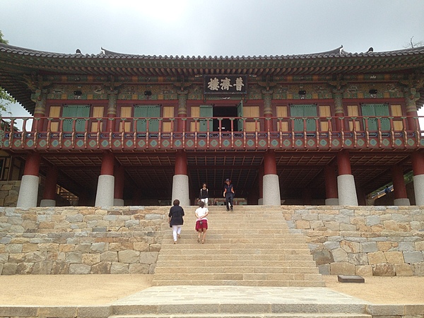
The Beomeosa temple complex is located on the eastern edge of Geumjeongsan, a famous mountain outside Busan. The photo shows the entrance to the main temple.
The Beomeosa temple complex is located on the eastern edge of Geumjeongsan, a famous mountain outside Busan. The photo shows the entrance to the main temple. • CIA World Factbook • 2020
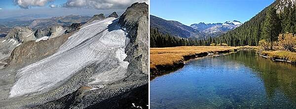
The Lyell Glacier on the left is located beneath 13,114 foot Mount Lyell, the highest peak in Yosemite National Park, California. The Lyell and Maclure glaciers sit at the headwaters of the Tuolumne River (right) and are an important source of water for alpine ecosystems (and hikers). Images courtesy of the US National Park Service.
The Lyell Glacier on the left is located beneath 13,114 foot Mount Lyell, the highest peak in Yosemite National Park, California. The Lyell and Maclure glaciers sit at the headwaters of the Tuolumne River (right) and are an important source of water for alpine ecosystems (and hikers). Images courtesy of the US National Park Service. • CIA World Factbook • 2020
Micro Beach is adjacent to the American Memorial Park in Garapan. Photo courtesy of the US National Park Service.
Micro Beach is adjacent to the American Memorial Park in Garapan. Photo courtesy of the US National Park Service. • CIA World Factbook • 2020
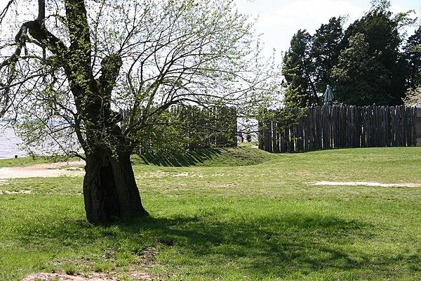
A view of the modern palisades marking the 1607 James Fort location at Jamestown National Historic Site, Virginia. The statue inside the fort is of John Smith, who played an important role in the establishment of a colony at Jamestown, Virginia - the first permanent English settlement in America. Photo courtesy of the National Park Service.
A view of the modern palisades marking the 1607 James Fort location at Jamestown National Historic Site, Virginia. The statue inside the fort is of John Smith, who played an important role in the establishment of a colony at Jamestown, Virginia - the first permanent English settlement in America. Photo courtesy of the National Park Service. • CIA World Factbook • 2020
South America-US area comparison map
South America-US area comparison map • CIA World Factbook • 2020
Many parts of the American Samoa shoreline are composed of steep volcanic cliffs. Photo courtesy of the US National Park Service.
Many parts of the American Samoa shoreline are composed of steep volcanic cliffs. Photo courtesy of the US National Park Service. • CIA World Factbook • 2020
The Kuge Memorial Tower located at the Cornerstone Peace Park honors Toshiya Kuge, 20, of Osaka, Japan who died on 11 September 2001. Kuge was on Flight 93, which crashed into a field in Somerset County, Pennsylvania during an attempt by the passengers and crew to regain control of the plane from four highjackers. All 44 people on board were killed, including the highjackers. Kuge was an athlete and scholar who was determined to become proficient in English and earn a Master's degree in engineering from an American university. He loved American football and was a linebacker in his first year of college at Waseda University where he was an engineering student. On this two-week vacation trip, the friendly, outgoing college sophomore went whitewater rafting in the Canadian Rockies, and visited Niagara Falls and the Statue of Liberty. This was his second visit to the US. Kuge was traveling alone in order to immerse himself in the English language. Flight 93 was the first leg of Kuge's journey home.
The Kuge Memorial Tower located at the Cornerstone Peace Park honors Toshiya Kuge, 20, of Osaka, Japan who died on 11 September 2001. Kuge was on Flight 93, which crashed into a field in Somerset County, Pennsylvania during an attempt by the passengers and crew to regain control of the plane from four highjackers. All 44 people on board were killed, including the highjackers.
Kuge was an athlete and scholar who was determined to become proficient in English and earn a Master's degree in engineering from an American university. He loved American football and was a linebacker in his first year of college at Waseda University where he was an engineering student. On this two-week vacation trip, the friendly, outgoing college sophomore went whitewater rafting in the Canadian Rockies, and visited Niagara Falls and the Statue of Liberty. This was his second visit to the US. Kuge was traveling alone in order to immerse himself in the English language. Flight 93 was the first leg of Kuge's journey home. • CIA World Factbook • 2020
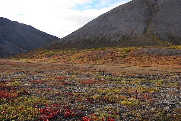
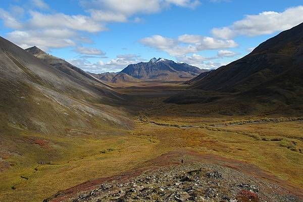
Distant caribou in Noatak National Preserve, Alaska migrate south through the DeLong Mountains in small groups. Photo courtesy of the US National Park Service.
Distant caribou in Noatak National Preserve, Alaska migrate south through the DeLong Mountains in small groups. Photo courtesy of the US National Park Service. • CIA World Factbook • 2020
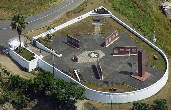
The World War II Guadalcanal American Memorial on Skyline Drive on Guadalcanal overlooks the town of Honiara and the Pacific Ocean. The site, located on the first hill occupied by US forces, honors those Americans and Allies who lost their lives during the Guadalcanal Campaign of World War II (7 August 1942 to 9 February 1943). The memorial consists of a 4-foot square, 24-foot tall pylon on which is inscribed: “This memorial has been erected by the United States of America in humble tribute to its sons and its allies who paid the ultimate sacrifice for the liberation of the Solomon Islands 1942-1943.” The four directional walls point to the four major battle areas. Inscribed on these walls are descriptions of the battles and a listing of the US and Allied ships that were lost. The monument was dedicated on 7 August 1992, the 50th anniversary of the American landing on Guadalcanal. Photo courtesy of the American Battle Monuments Commission.
The World War II Guadalcanal American Memorial on Skyline Drive on Guadalcanal overlooks the town of Honiara and the Pacific Ocean. The site, located on the first hill occupied by US forces, honors those Americans and Allies who lost their lives during the Guadalcanal Campaign of World War II (7 August 1942 to 9 February 1943). The memorial consists of a 4-foot square, 24-foot tall pylon on which is inscribed: “This memorial has been erected by the United States of America in humble tribute to its sons and its allies who paid the ultimate sacrifice for the liberation of the Solomon Islands 1942-1943.” The four directional walls point to the four major battle areas. Inscribed on these walls are descriptions of the battles and a listing of the US and Allied ships that were lost. The monument was dedicated on 7 August 1992, the 50th anniversary of the American landing on Guadalcanal. Photo courtesy of the American Battle Monuments Commission. • CIA World Factbook • 2020
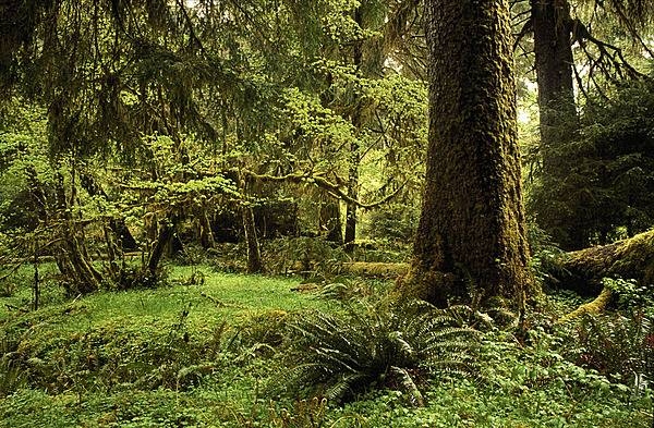
Rain forest at Olympic National Park, Washington state. Photo courtesy of the National Park Service.
Rain forest at Olympic National Park, Washington state. Photo courtesy of the National Park Service. • CIA World Factbook • 2020

Exterior of the Palace of the People in Bucharest. The building was constructed between 1984 and 1997 on orders of Nicolae Ceausescu, the dictator of communist Romania. The structure is the world's third-largest building by floor area (after the Pentagon in Washington, DC and the Long'ao Building in China) with 1,100 rooms; it consists of 12 floors above ground and 8 floors below. The edifice hosts the two houses of Romania's Parliament (the Senate and the Chamber of Deputies), three museums, and an international conference center. Nonetheless, about two-thirds of the building remains unoccupied.
Exterior of the Palace of the People in Bucharest. The building was constructed between 1984 and 1997 on orders of Nicolae Ceausescu, the dictator of communist Romania. The structure is the world's third-largest building by floor area (after the Pentagon in Washington, DC and the Long'ao Building in China) with 1,100 rooms; it consists of 12 floors above ground and 8 floors below. The edifice hosts the two houses of Romania's Parliament (the Senate and the Chamber of Deputies), three museums, and an international conference center. Nonetheless, about two-thirds of the building remains unoccupied. • CIA World Factbook • 2020
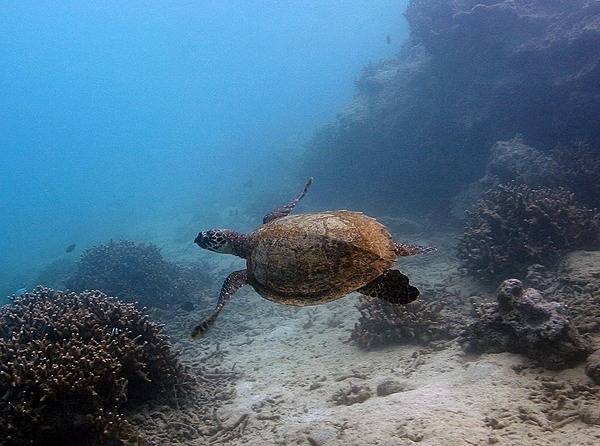
A green sea turtle (Samoan name laumei) at the National Park of American Samoa. Photo courtesy of the US National Park Service.
A green sea turtle (Samoan name laumei) at the National Park of American Samoa. Photo courtesy of the US National Park Service. • CIA World Factbook • 2020
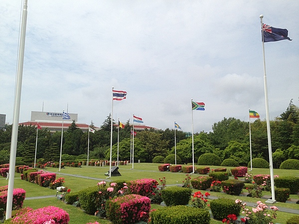
Located at Tanggok in the Nam district of Busan, the United Nations Memorial Cemetery is the burial ground for United Nations Command casualties of the Korean War. It contains 2,300 graves and is the only UN cemetery in the world. Laid out over 14 hectares (35 acres), the graves are set out in 22 sites designated by the nationalities of the buried service members.
Located at Tanggok in the Nam district of Busan, the United Nations Memorial Cemetery is the burial ground for United Nations Command casualties of the Korean War. It contains 2,300 graves and is the only UN cemetery in the world. Laid out over 14 hectares (35 acres), the graves are set out in 22 sites designated by the nationalities of the buried service members. • CIA World Factbook • 2020
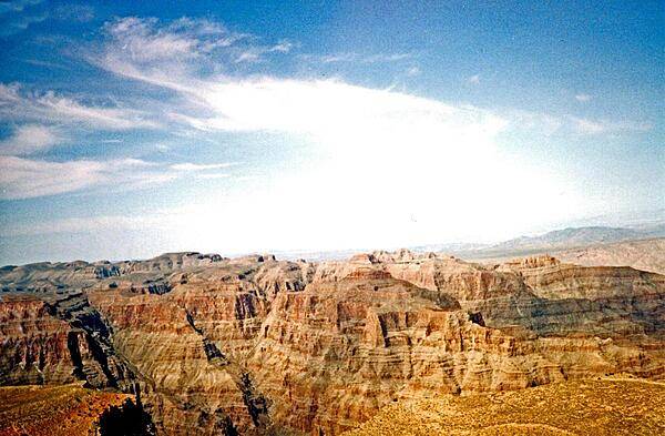
A view of the Grand Canyon, Arizona.
A view of the Grand Canyon, Arizona. • CIA World Factbook • 2020
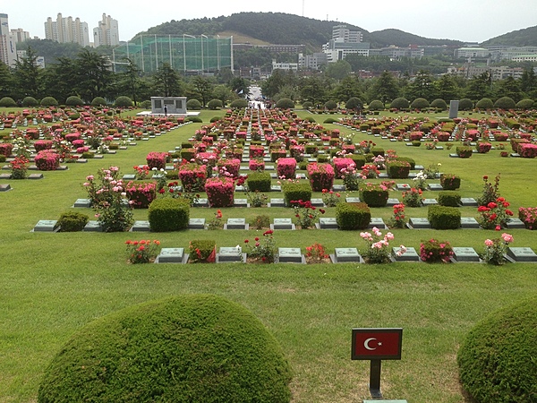
Located at Tanggok in the Nam district of Busan, the United Nations Memorial Cemetery is the burial ground for United Nations Command casualties of the Korean War. It contains 2,300 graves and is the only UN cemetery in the world. Laid out over 14 hectares (35 acres), the graves are set out in 22 sites designated by the nationalities of the buried service members.
Located at Tanggok in the Nam district of Busan, the United Nations Memorial Cemetery is the burial ground for United Nations Command casualties of the Korean War. It contains 2,300 graves and is the only UN cemetery in the world. Laid out over 14 hectares (35 acres), the graves are set out in 22 sites designated by the nationalities of the buried service members. • CIA World Factbook • 2020
The dome of a one-meter telescope opens as it prepares to view and track space objects. The telescope is located at the Ground Based Electro-optical Deep Space Surveillance System in Diego Garcia. The site is responsible for tracking thousands of man-made objects in deep space - 10,000 to 45,000 km from earth. Photo courtesy of US Air Force photo/Senior Airman Brian Ferguson.
The dome of a one-meter telescope opens as it prepares to view and track space objects. The telescope is located at the Ground Based Electro-optical Deep Space Surveillance System in Diego Garcia. The site is responsible for tracking thousands of man-made objects in deep space - 10,000 to 45,000 km from earth. Photo courtesy of US Air Force photo/Senior Airman Brian Ferguson. • CIA World Factbook • 2020
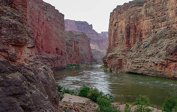
View of Marble Canyon, which marks the beginning section of the Grand Canyon, from near the mouth of Nautiloid Canyon. Image courtesy of the USGS.
View of Marble Canyon, which marks the beginning section of the Grand Canyon, from near the mouth of Nautiloid Canyon. Image courtesy of the USGS. • CIA World Factbook • 2020
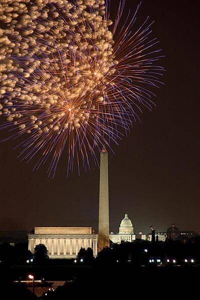
Fourth of July fireworks in Washington, DC; view of the Lincoln Memorial, the Washington Monument, and the US Capitol.
Fourth of July fireworks in Washington, DC; view of the Lincoln Memorial, the Washington Monument, and the US Capitol. • CIA World Factbook • 2020
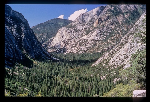
Hiking in the wilderness of Kings Canyon National Park offers spectacular views, including this U-shaped valley carved by a glacier thousands of years ago. Photo courtesy of the US National Park Service.
Hiking in the wilderness of Kings Canyon National Park offers spectacular views, including this U-shaped valley carved by a glacier thousands of years ago. Photo courtesy of the US National Park Service. • CIA World Factbook • 2020
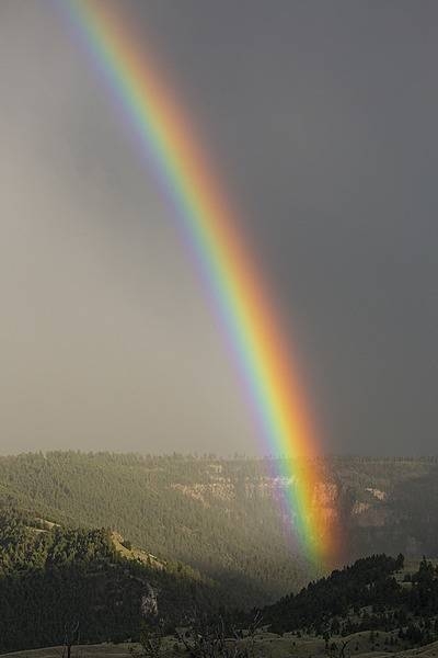
Rainbow over the Gardner River Canyon near Mammoth in Yellowstone National Park. Image courtesy of the US National Park Service/Neal Herbert.
Rainbow over the Gardner River Canyon near Mammoth in Yellowstone National Park. Image courtesy of the US National Park Service/Neal Herbert. • CIA World Factbook • 2020
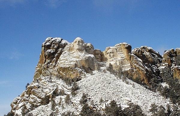
Mount Rushmore after a brief December snow storm. Image courtesy of the US National Park Service.
Mount Rushmore after a brief December snow storm. Image courtesy of the US National Park Service. • CIA World Factbook • 2020

The lawn and southern facade of the White House in Washington, D.C.
The lawn and southern facade of the White House in Washington, D.C. • CIA World Factbook • 2020
Snow pillows in Pebble Creek in Yellowstone National Park. Image courtesy of the US National Park Service/Neal Herbert.
Snow pillows in Pebble Creek in Yellowstone National Park. Image courtesy of the US National Park Service/Neal Herbert. • CIA World Factbook • 2020
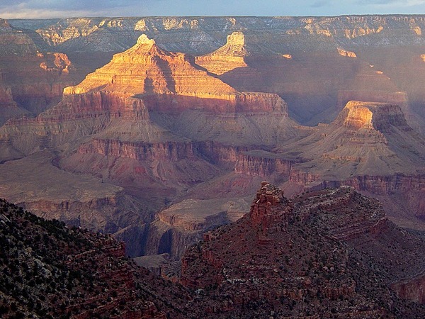
Sunset in the Grand Canyon in Arizona as seen from Grand Canyon Village. Photo courtesy of the US National Park Service.
Sunset in the Grand Canyon in Arizona as seen from Grand Canyon Village. Photo courtesy of the US National Park Service. • CIA World Factbook • 2020
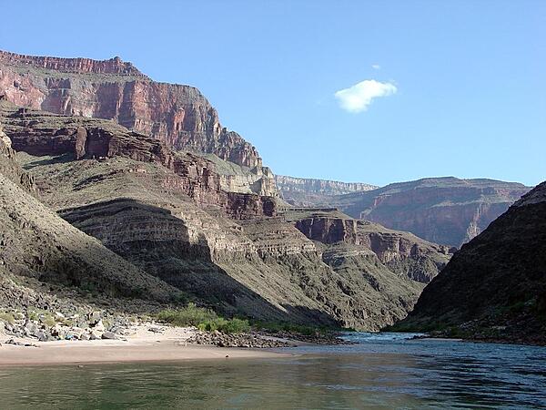
Multiple geologic strata, all hundreds of millions of years old, line the shores of the Colorado River in the Grand Canyon. Image courtesy of the USGS.
Multiple geologic strata, all hundreds of millions of years old, line the shores of the Colorado River in the Grand Canyon. Image courtesy of the USGS. • CIA World Factbook • 2020
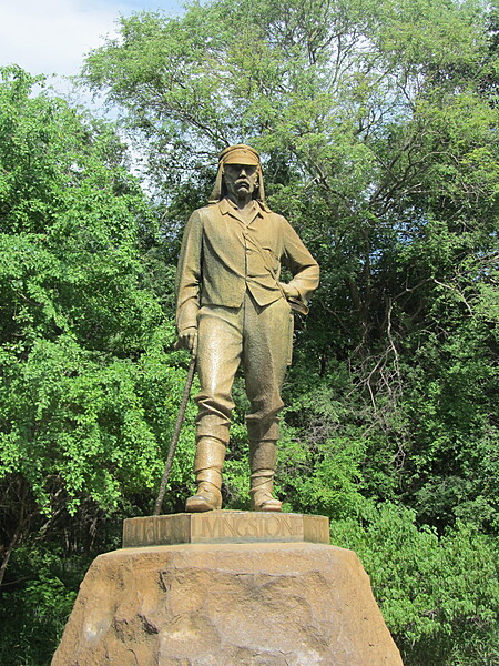
The David Livingstone Memorial at Victoria Falls, on the Zimbabwe side. Livingstone, an explorer, missionary, and anti-slavery crusader, was the first European to see the falls on 16 November 1855.
The David Livingstone Memorial at Victoria Falls, on the Zimbabwe side. Livingstone, an explorer, missionary, and anti-slavery crusader, was the first European to see the falls on 16 November 1855. • CIA World Factbook • 2020
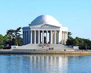
The Jefferson Memorial in Washington, DC.
The Jefferson Memorial in Washington, DC. • CIA World Factbook • 2020

CIA World Factbook • 2020
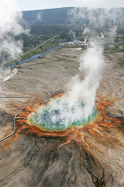
Grand Prismatic Spring in Yellowstone National Park is the largest hot spring in the US, and the third largest in the world. The vivid colors in the spring are the result of microbial mats around the edges of the mineral-rich water. Image courtesy of the US National Park Service/Jim Peaco.
Grand Prismatic Spring in Yellowstone National Park is the largest hot spring in the US, and the third largest in the world. The vivid colors in the spring are the result of microbial mats around the edges of the mineral-rich water. Image courtesy of the US National Park Service/Jim Peaco. • CIA World Factbook • 2020
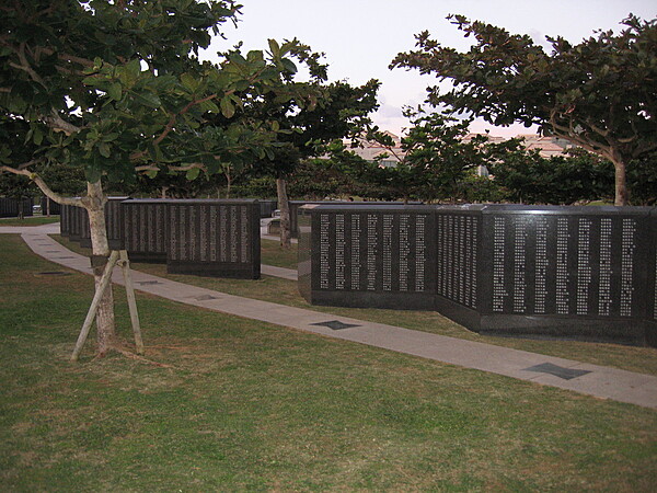
The Cornerstone of Peace is a monument park in Itoman commemorating the Battle of Okinawa and the role of Okinawa during World War II. The names of all who lost their lives in the fighting regardless of nationality and civilian or military status - over two hundred and forty thousand people - are inscribed on some 116 stones at the memorial. The memorial park was opened on 23 June 1995, marking the 50th anniversary of the conclusion of the 82-day battle.
The Cornerstone of Peace is a monument park in Itoman commemorating the Battle of Okinawa and the role of Okinawa during World War II. The names of all who lost their lives in the fighting regardless of nationality and civilian or military status - over two hundred and forty thousand people - are inscribed on some 116 stones at the memorial. The memorial park was opened on 23 June 1995, marking the 50th anniversary of the conclusion of the 82-day battle. • CIA World Factbook • 2020
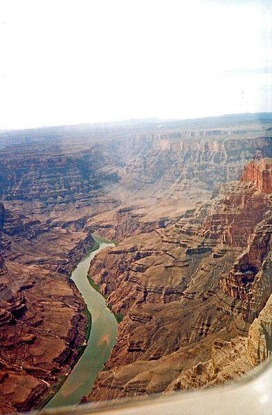
Areas of greenery along the banks of the Colorado River as it winds through the Grand Canyon in Arizona. In places, the canyon is 1.6 km (1 mi) deep.
Areas of greenery along the banks of the Colorado River as it winds through the Grand Canyon in Arizona. In places, the canyon is 1.6 km (1 mi) deep. • CIA World Factbook • 2020
Gray clouds reflected over a calm Yellowstone Lake. Image courtesy of the US National Park Service/Neal Herbert.
Gray clouds reflected over a calm Yellowstone Lake. Image courtesy of the US National Park Service/Neal Herbert. • CIA World Factbook • 2020
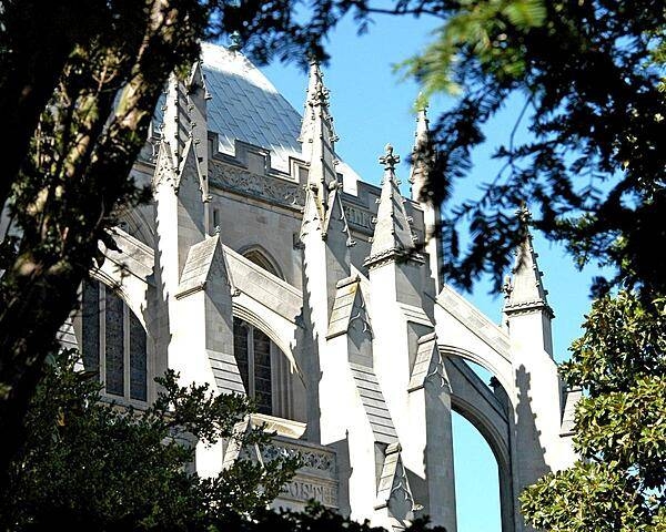
Flying buttresses of the Cathedral Church of St. Peter and Saint Paul - also referred to as the National Cathedral - in Washington, DC.
Flying buttresses of the Cathedral Church of St. Peter and Saint Paul - also referred to as the National Cathedral - in Washington, DC. • CIA World Factbook • 2020
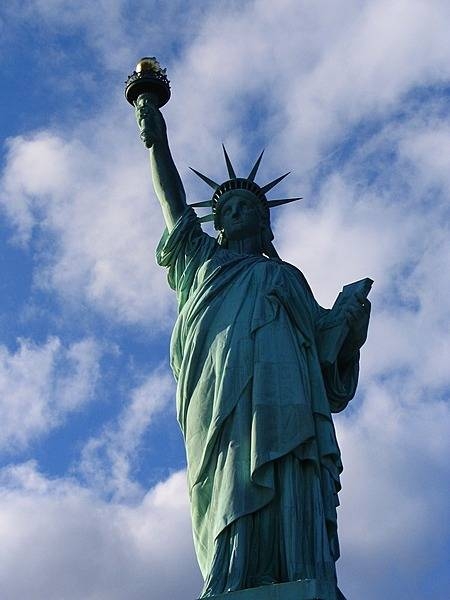
Originally, the Statue of Liberty was a dull copper color, but shortly after 1900 a green patina, caused by the oxidation of the copper skin, began to spread. As early as 1902 it was mentioned in the press; by 1906 it had entirely covered the statue. Photo courtesy of the National Park Service.
Originally, the Statue of Liberty was a dull copper color, but shortly after 1900 a green patina, caused by the oxidation of the copper skin, began to spread. As early as 1902 it was mentioned in the press; by 1906 it had entirely covered the statue. Photo courtesy of the National Park Service. • CIA World Factbook • 2020
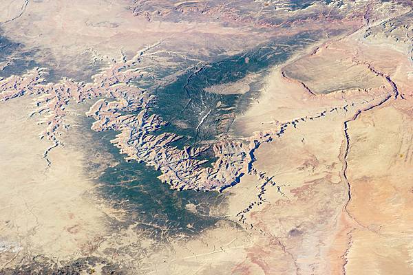
Image of the Grand Canyon and surrounding area taken from the International Space Station. Photo courtesy of NASA.
Image of the Grand Canyon and surrounding area taken from the International Space Station. Photo courtesy of NASA. • CIA World Factbook • 2020
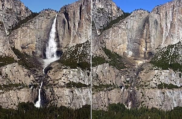
Yosemite Falls generally peaks in late spring (left), during the snowmelt pulse, and dries up in late summer (right), before fall storms arrive. Images courtesy of the US National Park Service/Greg Stock.
Yosemite Falls generally peaks in late spring (left), during the snowmelt pulse, and dries up in late summer (right), before fall storms arrive. Images courtesy of the US National Park Service/Greg Stock. • CIA World Factbook • 2020
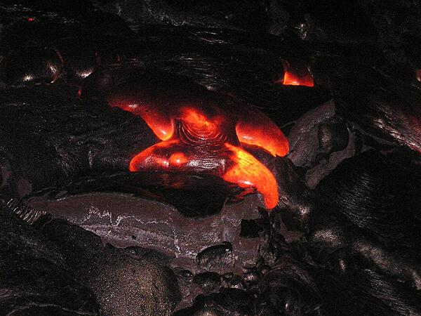
Molten lava at Kilauea Volcano, Hawaii Volcanoes National Park on the Big Island.
Molten lava at Kilauea Volcano, Hawaii Volcanoes National Park on the Big Island. • CIA World Factbook • 2020
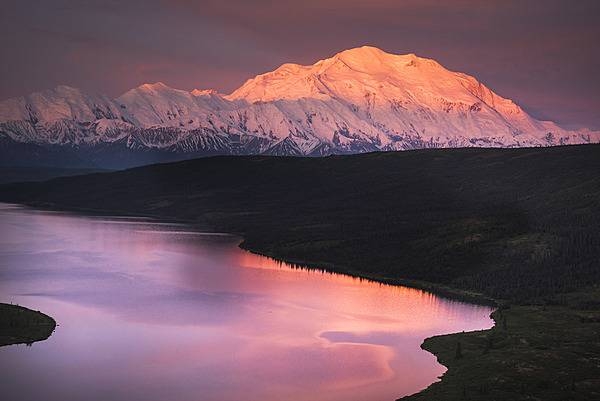
Denali in the light of an intensely vivid sunset. Photo courtesy of the US National Park Service/ Emily Mesner.
Denali in the light of an intensely vivid sunset. Photo courtesy of the US National Park Service/ Emily Mesner. • CIA World Factbook • 2020
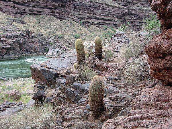
Barrel cactus along the Deer Creek Trail in the Grand Canyon. The Colorado River is in the background. Image courtesy of the USGS.
Barrel cactus along the Deer Creek Trail in the Grand Canyon. The Colorado River is in the background. Image courtesy of the USGS. • CIA World Factbook • 2020
Another view of New York and environs taken from the International Space Station on 11 September 2001 following the attack on the World Trade Center. This image is one of a series taken that day of metropolitan New York City that shows the smoke plume rising from the Manhattan. Photo courtesy of NASA.
Another view of New York and environs taken from the International Space Station on 11 September 2001 following the attack on the World Trade Center. This image is one of a series taken that day of metropolitan New York City that shows the smoke plume rising from the Manhattan. Photo courtesy of NASA. • CIA World Factbook • 2020
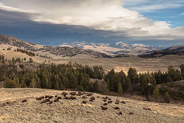
A bison herd grazes in Yellowstone National Park oblivious to the approaching thunderstorm. Image courtesy of the US National Park Service/ Jacob W. Frank.
A bison herd grazes in Yellowstone National Park oblivious to the approaching thunderstorm. Image courtesy of the US National Park Service/ Jacob W. Frank. • CIA World Factbook • 2020
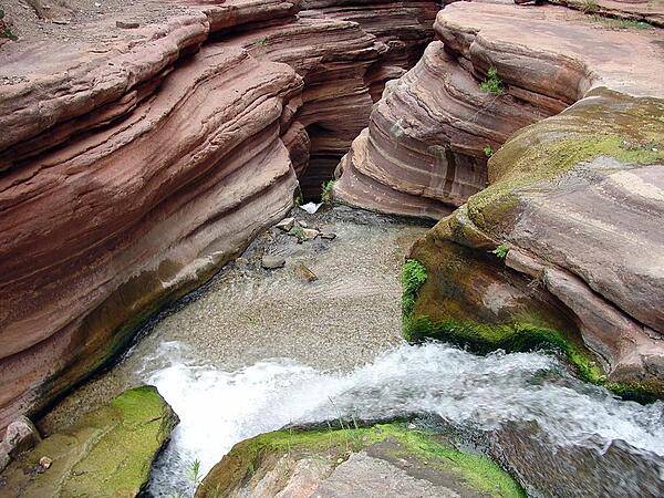
Looking down over a waterfall near the head of the chasm along Deer Creek in the Grand Canyon. Image courtesy of the USGS.
Looking down over a waterfall near the head of the chasm along Deer Creek in the Grand Canyon. Image courtesy of the USGS. • CIA World Factbook • 2020
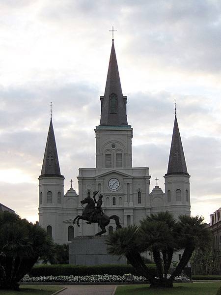
The Cathedral-Basilica of Saint Louis is the oldest cathedral in continuous use in what would become the United States. Founded in 1720, it is dedicated to Saint Louis, who was also King Louis IX of France (r. 1226-1270).
The Cathedral-Basilica of Saint Louis is the oldest cathedral in continuous use in what would become the United States. Founded in 1720, it is dedicated to Saint Louis, who was also King Louis IX of France (r. 1226-1270). • CIA World Factbook • 2020
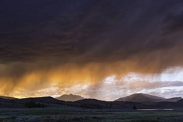
A thunderstorm at sunset at Swan Lake Flat in Yellowstone National Park. Image courtesy of the US National Park Service/Neal Herbert.
A thunderstorm at sunset at Swan Lake Flat in Yellowstone National Park. Image courtesy of the US National Park Service/Neal Herbert. • CIA World Factbook • 2020
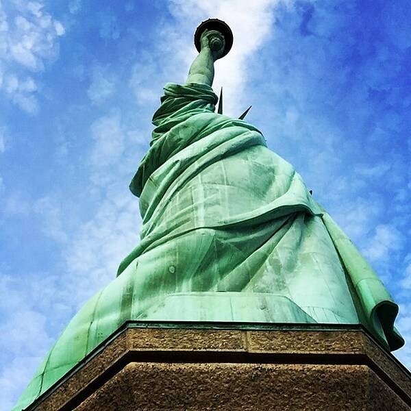
Dramatic, stark view looking up at the Statue of Liberty from its pedestal. Image courtesy of the US National Park Service.
Dramatic, stark view looking up at the Statue of Liberty from its pedestal. Image courtesy of the US National Park Service. • CIA World Factbook • 2020
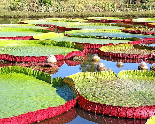
At the Kenilworth Aquatic Gardens in Washington, DC.
At the Kenilworth Aquatic Gardens in Washington, DC. • CIA World Factbook • 2020
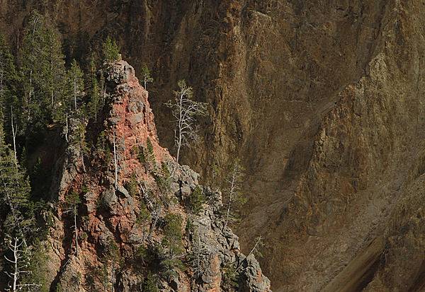
Red Rock in the Grand Canyon of the Yellowstone. Image courtesy of the US National Park Service/Jim Peaco.
Red Rock in the Grand Canyon of the Yellowstone. Image courtesy of the US National Park Service/Jim Peaco. • CIA World Factbook • 2020

Kings Canyon National Park in California, which borders on Sequoia National Park, also sequesters its own sequoias, including these giants at Grant Grove. Photo courtesy of the US National Park Service.
Kings Canyon National Park in California, which borders on Sequoia National Park, also sequesters its own sequoias, including these giants at Grant Grove. Photo courtesy of the US National Park Service. • CIA World Factbook • 2020
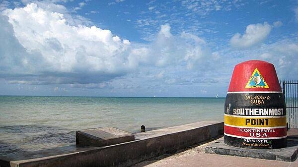
Marker in Key West, Florida proclaiming the southernmost point in the continental US. (The southernmost point in the entire US lies on the Big Island of Hawaii.)
Marker in Key West, Florida proclaiming the southernmost point in the continental US. (The southernmost point in the entire US lies on the Big Island of Hawaii.) • CIA World Factbook • 2020
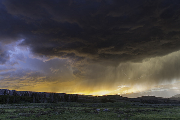
A thunderstorm at sunset at Swan Lake Flat in Yellowstone National Park. Image courtesy of the US National Park Service/Neal Herbert.
A thunderstorm at sunset at Swan Lake Flat in Yellowstone National Park. Image courtesy of the US National Park Service/Neal Herbert. • CIA World Factbook • 2020
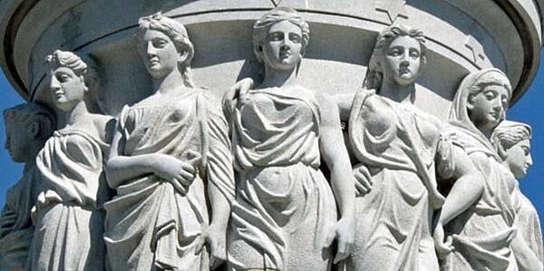
Close up of a group of figures representing the thirteen original American colonies as seen on the podium of the Yorktown Victory Monument in Yorktown, Virginia. Photo courtesy of the National Park Service.
Close up of a group of figures representing the thirteen original American colonies as seen on the podium of the Yorktown Victory Monument in Yorktown, Virginia. Photo courtesy of the National Park Service. • CIA World Factbook • 2020
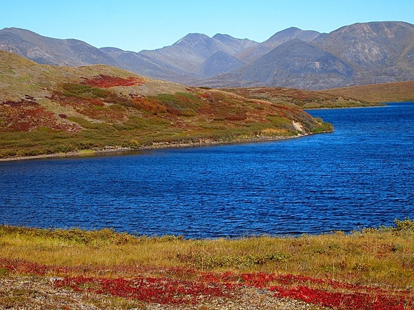
Nature's bluest blue and reddest red in Noatak National Preserve, Alaska. Even an amateur photographer looks good when the fall colors are at their peak and a clear September sky makes the blue water pop out of the image. Photo courtesy of the US National Park Service.
Nature's bluest blue and reddest red in Noatak National Preserve, Alaska. Even an amateur photographer looks good when the fall colors are at their peak and a clear September sky makes the blue water pop out of the image. Photo courtesy of the US National Park Service. • CIA World Factbook • 2020
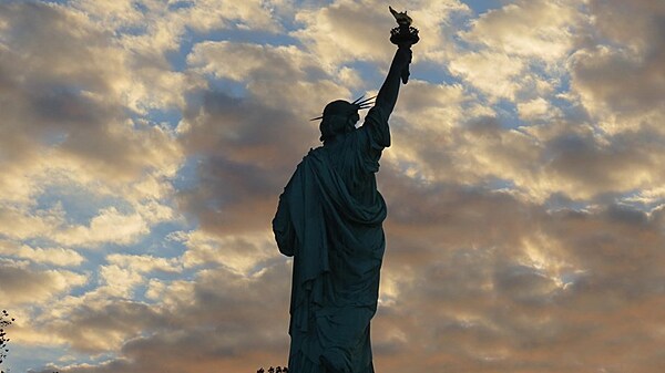
The Statue of Liberty faces a dramatic cloud display. Photo courtesy of the National Park Service.
The Statue of Liberty faces a dramatic cloud display. Photo courtesy of the National Park Service. • CIA World Factbook • 2020
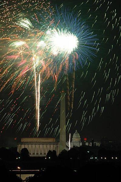
Fourth of July fireworks in Washington, DC; view of the Lincoln Memorial, the Washington Monument, and the US Capitol.
Fourth of July fireworks in Washington, DC; view of the Lincoln Memorial, the Washington Monument, and the US Capitol. • CIA World Factbook • 2020
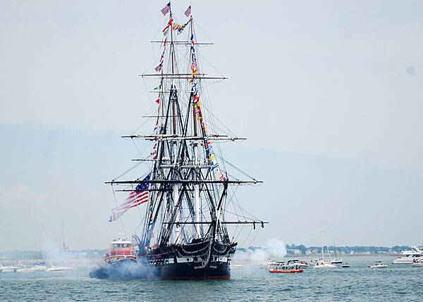
The USS Constitution fires a 21-gun salute during the ship's July 4th underway as part of Boston Harborfest. The six-day Fourth of July festival showcases Boston's Colonial and maritime heritage to honor and remember the past, celebrate the present, and educate the future with reenactments, concerts, and historical tours. Photo courtesy of the US Navy/ Mass Communication Specialist Seaman Shannon Heavin.
The USS Constitution fires a 21-gun salute during the ship's July 4th underway as part of Boston Harborfest. The six-day Fourth of July festival showcases Boston's Colonial and maritime heritage to honor and remember the past, celebrate the present, and educate the future with reenactments, concerts, and historical tours. Photo courtesy of the US Navy/ Mass Communication Specialist Seaman Shannon Heavin. • CIA World Factbook • 2020
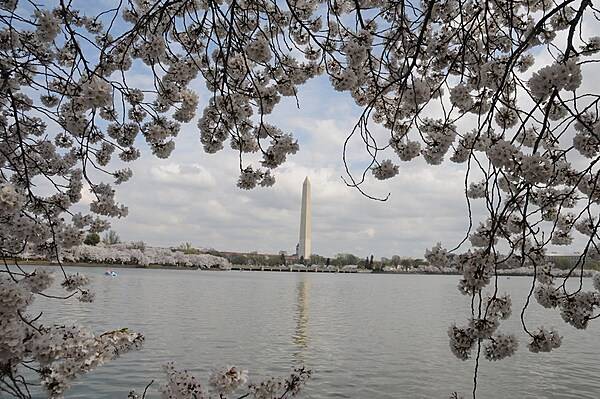
Cherry blossoms frame a view of the Washington Monument from across the Tidal Basin. Photo courtesy of the National Park Service/ Sarah Eddy.
Cherry blossoms frame a view of the Washington Monument from across the Tidal Basin. Photo courtesy of the National Park Service/ Sarah Eddy. • CIA World Factbook • 2020
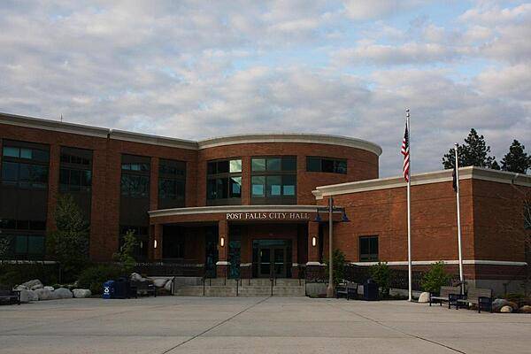
Post Falls City Hall and Civic Center in Idaho.
Post Falls City Hall and Civic Center in Idaho. • CIA World Factbook • 2020
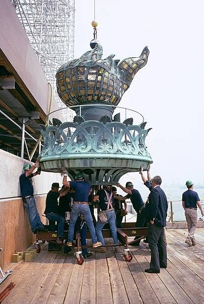
The old Statue of Liberty torch being brought to the ground in 1984; it is now housed and on display at the Statue of Liberty Museum on Liberty Island. Photo courtesy of the National Park Service.
The old Statue of Liberty torch being brought to the ground in 1984; it is now housed and on display at the Statue of Liberty Museum on Liberty Island. Photo courtesy of the National Park Service. • CIA World Factbook • 2020
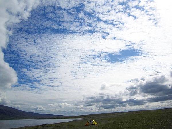
Phenomenal grandeur. Big sky and big clouds overhead dwarf a single tent set up in the wilderness for an archeology research project in Noatak National Preserve, Alaska. Photo courtesy of the US National Park Service.
Phenomenal grandeur. Big sky and big clouds overhead dwarf a single tent set up in the wilderness for an archeology research project in Noatak National Preserve, Alaska. Photo courtesy of the US National Park Service. • CIA World Factbook • 2020
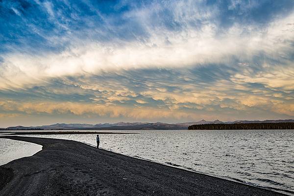
Clearing storm on Yellowstone Lake near Flat Mountain Arm in Yellowstone National Park. Image courtesy of the US National Park Service/Neal Herbert.
Clearing storm on Yellowstone Lake near Flat Mountain Arm in Yellowstone National Park. Image courtesy of the US National Park Service/Neal Herbert. • CIA World Factbook • 2020
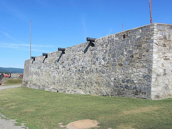
Cannon in Fort Ticonderoga facing north towards Lake Champlain. The fort was constructed by the French between 1755 and 1758 to protect the lake from British forces approaching from the south. Reconstruction on the fort began in the early 20th century and continues. The fort was rearmed in the 20th century with 14 24-pound cannon provided by the British Government. The cannon had been cast in England for use during the American Revolutionary War, but the war ended before they were shipped.
Cannon in Fort Ticonderoga facing north towards Lake Champlain. The fort was constructed by the French between 1755 and 1758 to protect the lake from British forces approaching from the south. Reconstruction on the fort began in the early 20th century and continues. The fort was rearmed in the 20th century with 14 24-pound cannon provided by the British Government. The cannon had been cast in England for use during the American Revolutionary War, but the war ended before they were shipped. • CIA World Factbook • 2020
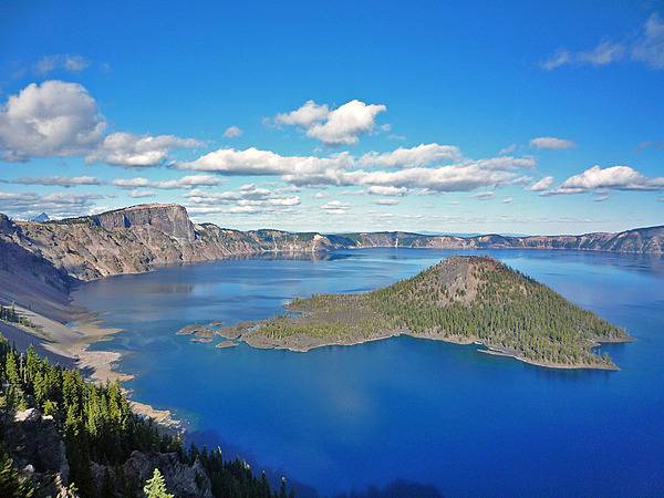
Crater Lake, Oregon in summer I. A view from the West Rim, taken near the Lightning Springs Picnic Area. The island’s name is Wizard Island. Formed 7,700 years ago when a violent eruption triggered the collapse of a tall peak, scientists today marvel at the lake’s purity: fed by rain and snow. It is the deepest lake in the US and one of the most pristine on earth. Artists, photographers, and sightseers gaze in wonder at its blue water and stunning setting atop the Cascade Mountain Range. Photo courtesy of the US National Park Service.
Crater Lake, Oregon in summer I. A view from the West Rim, taken near the Lightning Springs Picnic Area. The island’s name is Wizard Island.
Formed 7,700 years ago when a violent eruption triggered the collapse of a tall peak, scientists today marvel at the lake’s purity: fed by rain and snow. It is the deepest lake in the US and one of the most pristine on earth. Artists, photographers, and sightseers gaze in wonder at its blue water and stunning setting atop the Cascade Mountain Range. Photo courtesy of the US National Park Service. • CIA World Factbook • 2020
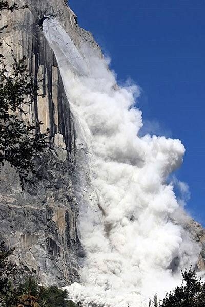
Due to its steep, glacier-carved cliffs, Yosemite Valley experiences many rockfalls each year. This one from El Capitan occurred on 28 September 2017 and was an estimated 10,324 cubic meters in volume, or about 25,400 tonnes (28,000 tons). Image courtesy of the US National Park Service/ Hennette Olsboe Foreyen.
Due to its steep, glacier-carved cliffs, Yosemite Valley experiences many rockfalls each year. This one from El Capitan occurred on 28 September 2017 and was an estimated 10,324 cubic meters in volume, or about 25,400 tonnes (28,000 tons). Image courtesy of the US National Park Service/ Hennette Olsboe Foreyen. • CIA World Factbook • 2020
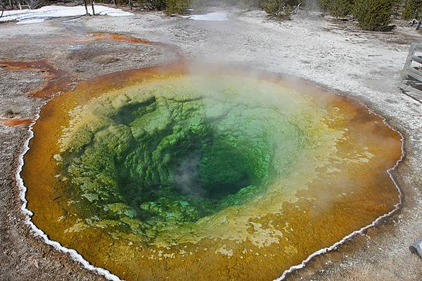
Morning Glory Pool is a hot spring in the Upper Geyser Basin of Yellowstone National Park. The distinct color of the pool is due to thermophiles (bacteria that thrive in hot water). Image courtesy of the US National Park Service/Jim Peaco.
Morning Glory Pool is a hot spring in the Upper Geyser Basin of Yellowstone National Park. The distinct color of the pool is due to thermophiles (bacteria that thrive in hot water). Image courtesy of the US National Park Service/Jim Peaco. • CIA World Factbook • 2020
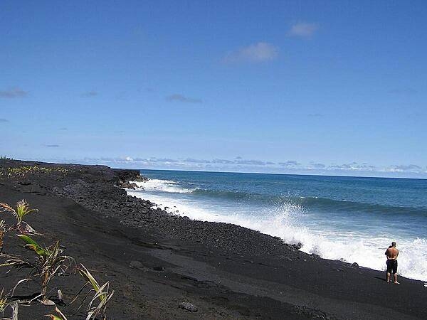
Big Island of Hawaii, new black sand beach.
Big Island of Hawaii, new black sand beach. • CIA World Factbook • 2020
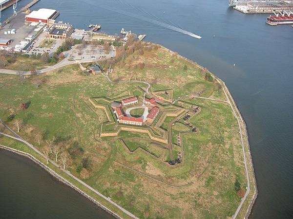
Aerial view of Fort McHenry National Monument and Historic Shrine in Baltimore, Maryland showing the entire tip of Locust Point. The fort is best known for its role in the War of 1812, when it successfully defended Baltimore Harbor from an attack by the British navy on 13-14 September 1814. The flying of the fort’s larger American garrison flag on the morning of the 14th following 25 hours of continuous bombardment signaled American victory and inspired Francis Scott Key to compose the poem “Defence of Fort M’Henry” that was later set to music and became known as “The Star Spangled Banner,” the national anthem of the United States. Photo courtesy of the National Park Service.
Aerial view of Fort McHenry National Monument and Historic Shrine in Baltimore, Maryland showing the entire tip of Locust Point. The fort is best known for its role in the War of 1812, when it successfully defended Baltimore Harbor from an attack by the British navy on 13-14 September 1814. The flying of the fort’s larger American garrison flag on the morning of the 14th following 25 hours of continuous bombardment signaled American victory and inspired Francis Scott Key to compose the poem “Defence of Fort M’Henry” that was later set to music and became known as “The Star Spangled Banner,” the national anthem of the United States. Photo courtesy of the National Park Service. • CIA World Factbook • 2020
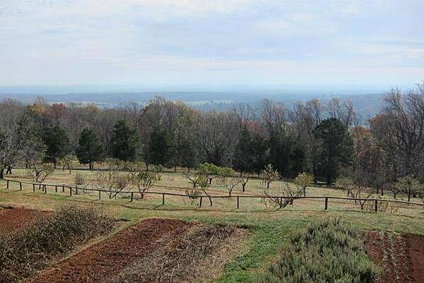
CIA World Factbook • 2020
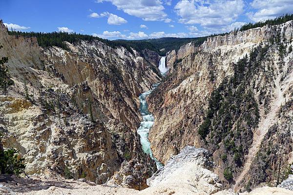
The Lower Falls of the Yellowstone River as seen from Artist Point. Image courtesy of the US National Park Service/Diane Renkin.
The Lower Falls of the Yellowstone River as seen from Artist Point. Image courtesy of the US National Park Service/Diane Renkin. • CIA World Factbook • 2020
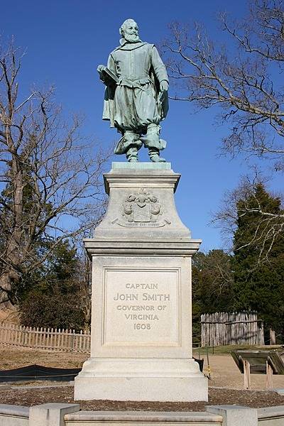
Statue of John Smith at Jamestown National Historic Site, Virginia. Smith was a leader of the Virginia Colony from September 1608 to August 1609 and was the first English explorer to map the Chesapeake Bay area. Photo courtesy of the National Park Service.
Statue of John Smith at Jamestown National Historic Site, Virginia. Smith was a leader of the Virginia Colony from September 1608 to August 1609 and was the first English explorer to map the Chesapeake Bay area. Photo courtesy of the National Park Service. • CIA World Factbook • 2020
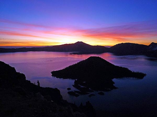
Sunrise Over Crater Lake, Oregon. A view from the top of Watchman Peak, just before sunrise. Photo courtesy of the US National Park Service.
Sunrise Over Crater Lake, Oregon. A view from the top of Watchman Peak, just before sunrise. Photo courtesy of the US National Park Service. • CIA World Factbook • 2020
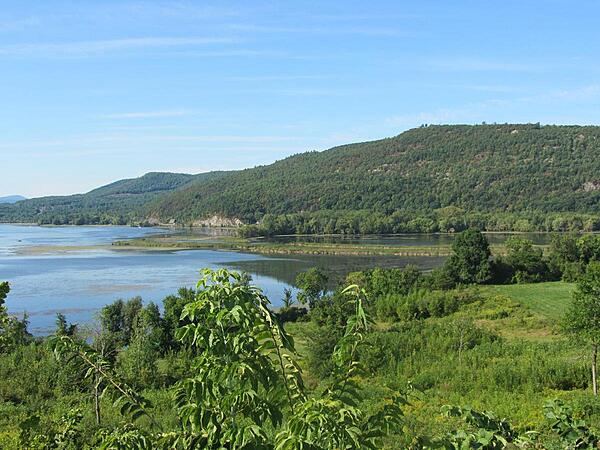
Mount Defiance in New York state on Lake Champlain overlooks Fort Ticonderoga 1.6 km (1 mi) to the southwest. British forces placed cannon on the 260 m (855 ft) hill forcing the American garrison to abandon the fort on 5 July 1777.
Mount Defiance in New York state on Lake Champlain overlooks Fort Ticonderoga 1.6 km (1 mi) to the southwest. British forces placed cannon on the 260 m (855 ft) hill forcing the American garrison to abandon the fort on 5 July 1777. • CIA World Factbook • 2020
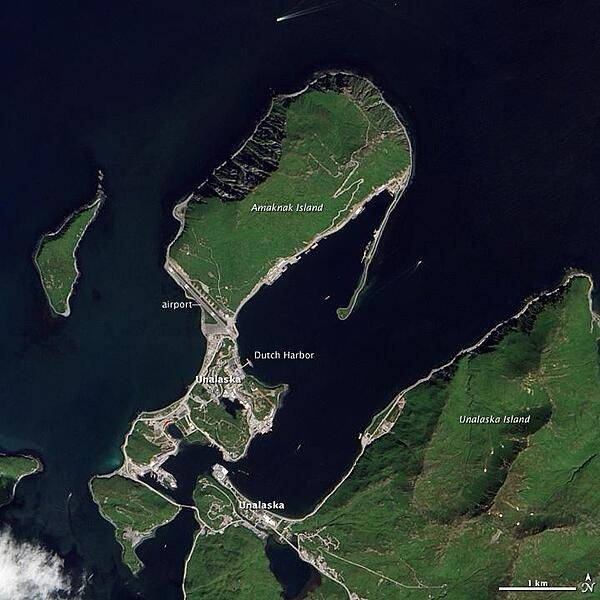
This natural-color satellite image shows Unalaska and Amaknak Islands, which are part of the Aleutian Island chain that separates the North Pacific Ocean from the Bering Sea. The city of Unalaska is split between the two islands: the northern part, where Dutch Harbor is located, is connected to the southern part by a bridge. The wakes of several ships are visible in the surrounding waters. Image courtesy of NASA.
This natural-color satellite image shows Unalaska and Amaknak Islands, which are part of the Aleutian Island chain that separates the North Pacific Ocean from the Bering Sea. The city of Unalaska is split between the two islands: the northern part, where Dutch Harbor is located, is connected to the southern part by a bridge. The wakes of several ships are visible in the surrounding waters. Image courtesy of NASA. • CIA World Factbook • 2020
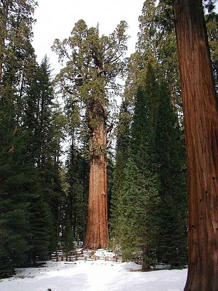
Sequoia National Park in California is notable for its giant sequoia trees, including the General Sherman, the largest tree and the largest organism on earth. The General Sherman tree, shown here in the winter, grows in the Giant Forest, which contains five of the ten largest trees in the world. Photo courtesy of the US National Park Service.
Sequoia National Park in California is notable for its giant sequoia trees, including the General Sherman, the largest tree and the largest organism on earth. The General Sherman tree, shown here in the winter, grows in the Giant Forest, which contains five of the ten largest trees in the world. Photo courtesy of the US National Park Service. • CIA World Factbook • 2020
CIA World Factbook • 2020
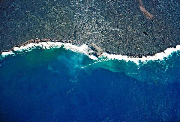
Lava flowing into the sea on the Big Island of Hawaii.
Lava flowing into the sea on the Big Island of Hawaii. • CIA World Factbook • 2020
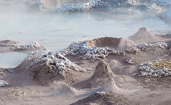
Fountain Paint Pot in the Lower Geyser Basin of Yellowstone National Park. Splatter cones are encrusted with newly fallen snow that will soon melt in the steam. Image courtesy of the US National Park Service/Diane Renkin.
Fountain Paint Pot in the Lower Geyser Basin of Yellowstone National Park. Splatter cones are encrusted with newly fallen snow that will soon melt in the steam. Image courtesy of the US National Park Service/Diane Renkin. • CIA World Factbook • 2020
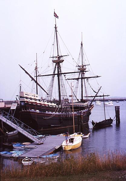
The Mayflower II at State Pier in Plymouth, Massachusetts. The ship is a replica of the 17th century Mayflower that transported the Pilgrims (some of the earliest English settlers) to the New World.
The Mayflower II at State Pier in Plymouth, Massachusetts. The ship is a replica of the 17th century Mayflower that transported the Pilgrims (some of the earliest English settlers) to the New World. • CIA World Factbook • 2020
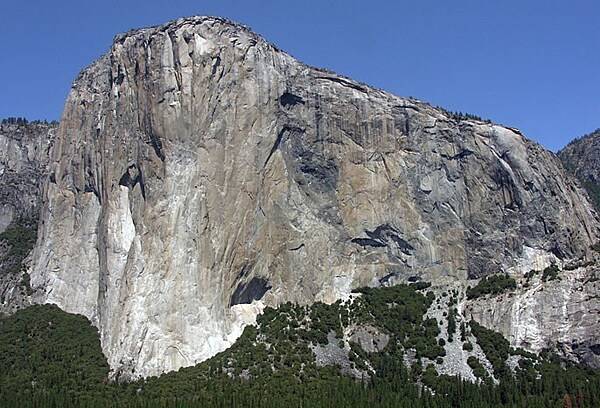
Granitic rocks of different compositions (and colors) are juxtaposed on the southeast face of El Capitan in Yosemite National Park, California. The monolith is about 914 m (3,000 ft) from base to summit along its tallest face, and is a popular objective for rock climbers. Image courtesy of the US National Park Service.
Granitic rocks of different compositions (and colors) are juxtaposed on the southeast face of El Capitan in Yosemite National Park, California. The monolith is about 914 m (3,000 ft) from base to summit along its tallest face, and is a popular objective for rock climbers. Image courtesy of the US National Park Service. • CIA World Factbook • 2020
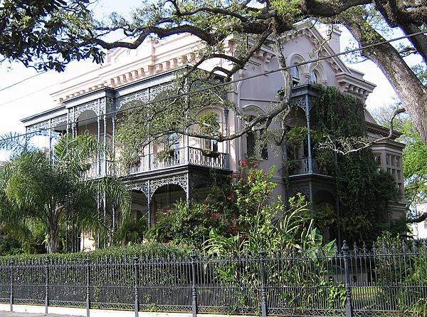
The Carroll-Crawford House in the Garden District of New Orleans.
The Carroll-Crawford House in the Garden District of New Orleans. • CIA World Factbook • 2020

The striking, yet approachable statue of Abraham Lincoln in the Lincoln Memorial, Washington, D.C. Photo courtesy of the National Park Service.
The striking, yet approachable statue of Abraham Lincoln in the Lincoln Memorial, Washington, D.C. Photo courtesy of the National Park Service. • CIA World Factbook • 2020
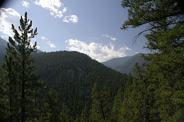
View of Gallatin National Forest from Storm Castle Trail, Gallatin, Montana.
View of Gallatin National Forest from Storm Castle Trail, Gallatin, Montana. • CIA World Factbook • 2020
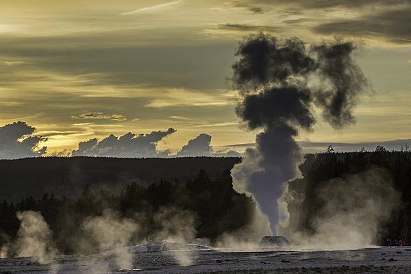
Steam rises from Lion Geyser at sunset. Note steam from other geysers in the background. Image courtesy of the US National Park Service/Neal Herbert.
Steam rises from Lion Geyser at sunset. Note steam from other geysers in the background. Image courtesy of the US National Park Service/Neal Herbert. • CIA World Factbook • 2020
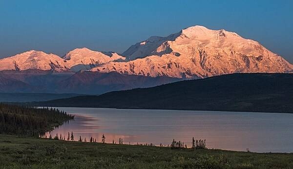
Denali, North America’s tallest mountain at 6,190 m (20,308 ft), is tinged orange-pink by alpenglow (an optical phenomenon that appears as a reddish glow near the horizon opposite the sun when the solar disk is just below the horizon). Photo courtesy of the US National Park Service/ Kent Miller.
Denali, North America’s tallest mountain at 6,190 m (20,308 ft), is tinged orange-pink by alpenglow (an optical phenomenon that appears as a reddish glow near the horizon opposite the sun when the solar disk is just below the horizon). Photo courtesy of the US National Park Service/ Kent Miller. • CIA World Factbook • 2020
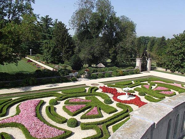
Formal garden as seen from a balcony at the Nemours Mansion, Wilmington, Delaware.
Formal garden as seen from a balcony at the Nemours Mansion, Wilmington, Delaware. • CIA World Factbook • 2020
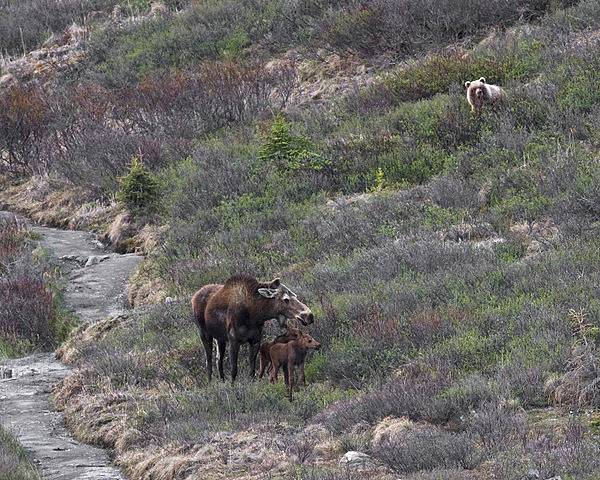
A grizzly bear peeks out of the brush at a mother moose and her two young calves near the Savage River in Denali National Park and Preserve, Alaska. Photo courtesy of the US National Park Service/ Ken Conger.
A grizzly bear peeks out of the brush at a mother moose and her two young calves near the Savage River in Denali National Park and Preserve, Alaska. Photo courtesy of the US National Park Service/ Ken Conger. • CIA World Factbook • 2020
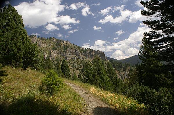
View of mountain ridges in Gallatin National Forest from the Storm Castle Trail, Gallatin, Montana.
View of mountain ridges in Gallatin National Forest from the Storm Castle Trail, Gallatin, Montana. • CIA World Factbook • 2020
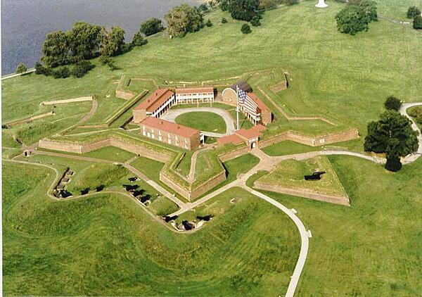
A closer aerial view of pentagonal Fort McHenry near the harbor in Baltimore, Maryland. Photo courtesy of the National Park Service.
A closer aerial view of pentagonal Fort McHenry near the harbor in Baltimore, Maryland. Photo courtesy of the National Park Service. • CIA World Factbook • 2020
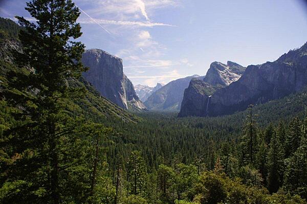
A view of Yosemite Valley as seen when exiting the tunnel on Wawona Road (Rt. 41) into the valley; it is probably one of the most photographed views of the valley. During the summer one may be hard pressed to find parking here.
A view of Yosemite Valley as seen when exiting the tunnel on Wawona Road (Rt. 41) into the valley; it is probably one of the most photographed views of the valley. During the summer one may be hard pressed to find parking here. • CIA World Factbook • 2020
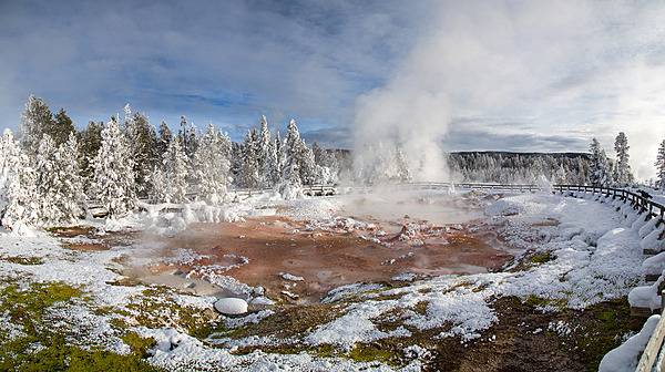
Snow dusts the area around Fountain Paint Pot in Yellowstone National Park. Image courtesy of the US National Park Service/Neal Herbert.
Snow dusts the area around Fountain Paint Pot in Yellowstone National Park. Image courtesy of the US National Park Service/Neal Herbert. • CIA World Factbook • 2020
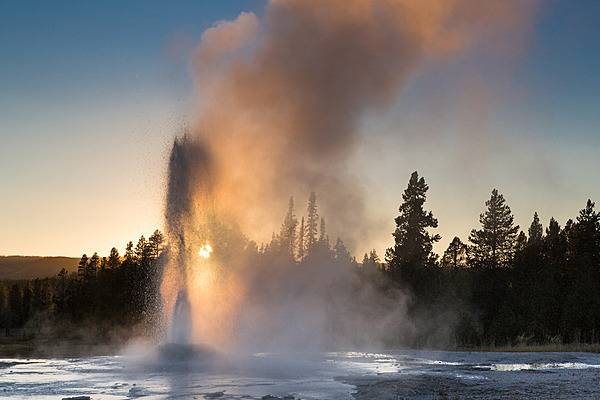
The setting sun shines through an eruption of Pink Cone Geyser in Yellowstone National Park. Image courtesy of the US National Park Service/Neal Herbert.
The setting sun shines through an eruption of Pink Cone Geyser in Yellowstone National Park. Image courtesy of the US National Park Service/Neal Herbert. • CIA World Factbook • 2020
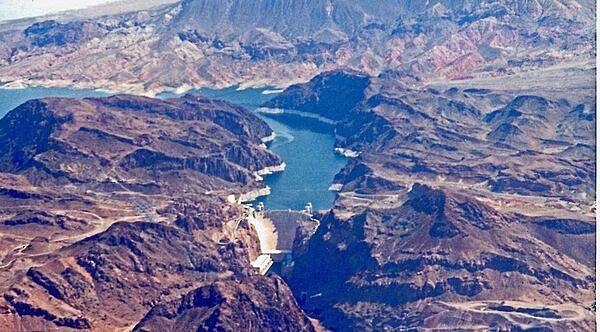
Completed in 1935, Hoover Dam on the Colorado River straddles the Arizona-Nevada border.
Completed in 1935, Hoover Dam on the Colorado River straddles the Arizona-Nevada border. • CIA World Factbook • 2020
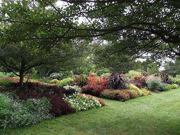
Some outdoor flower beds at Longwood Gardens, Kennett Square, Pennsylvania.
Some outdoor flower beds at Longwood Gardens, Kennett Square, Pennsylvania. • CIA World Factbook • 2020
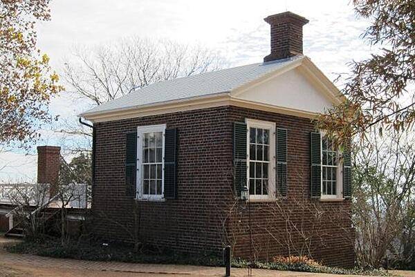
CIA World Factbook • 2020
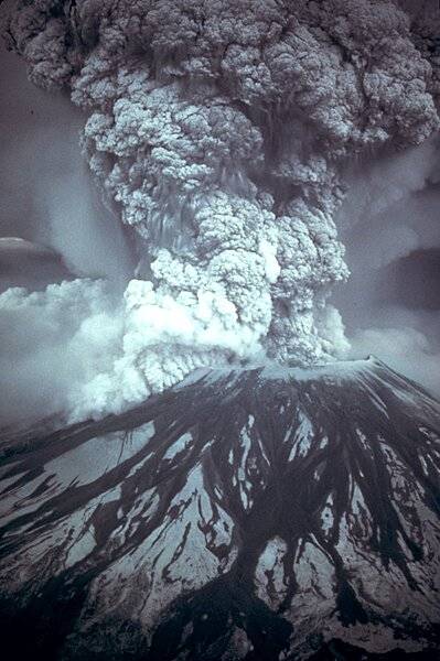
On 18 May 18 1980, at 8:32 a.m. Pacific Daylight Time, a magnitude 5.1 earthquake shook Mount St. Helens in Washington state. The bulge and surrounding area slid away in a gigantic rockslide and debris avalanche, releasing pressure, and triggering a major pumice and ash eruption of the volcano. Four hundred meters (1,300 ft) of the peak collapsed or blew outwards. As a result, 62 sq km (24 sq mi) of valley was filled by a debris avalanche, 650 sq km (250 sq mi) of recreation, timber, and private lands were damaged by a lateral blast, and an estimated 150 million cu m (200 million cu yd) of material was deposited directly by lahars (volcanic mudflows) into the river channels. Sixty-one people were killed or are still missing. Photo courtesy of USGS/Austin Post.
On 18 May 18 1980, at 8:32 a.m. Pacific Daylight Time, a magnitude 5.1 earthquake shook Mount St. Helens in Washington state. The bulge and surrounding area slid away in a gigantic rockslide and debris avalanche, releasing pressure, and triggering a major pumice and ash eruption of the volcano. Four hundred meters (1,300 ft) of the peak collapsed or blew outwards. As a result, 62 sq km (24 sq mi) of valley was filled by a debris avalanche, 650 sq km (250 sq mi) of recreation, timber, and private lands were damaged by a lateral blast, and an estimated 150 million cu m (200 million cu yd) of material was deposited directly by lahars (volcanic mudflows) into the river channels. Sixty-one people were killed or are still missing. Photo courtesy of USGS/Austin Post. • CIA World Factbook • 2020
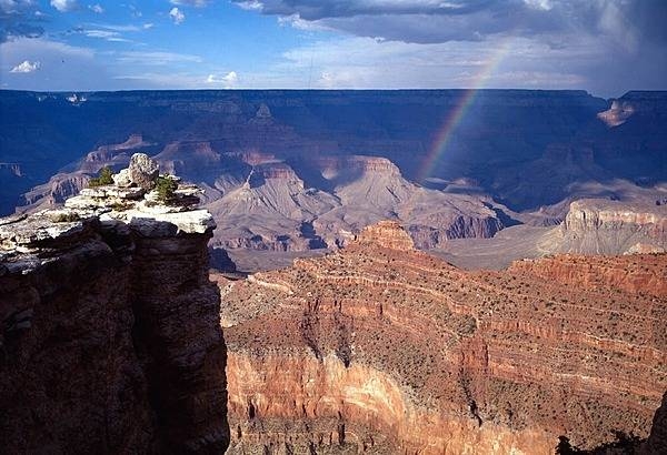
Rainbow in the Grand Canyon as seen from near Mather Point on the South Rim. Photo courtesy of the US National Park Service.
Rainbow in the Grand Canyon as seen from near Mather Point on the South Rim. Photo courtesy of the US National Park Service. • CIA World Factbook • 2020
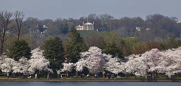
Arlington House and Arlington National Cemetery stand on a hill In Virginia beyond the intervening Potomac River (not visible) and the Tidal Basin, bordered by flowering cherry trees. Photo courtesy of the National Park Service/Anthony DeYoung.
Arlington House and Arlington National Cemetery stand on a hill In Virginia beyond the intervening Potomac River (not visible) and the Tidal Basin, bordered by flowering cherry trees. Photo courtesy of the National Park Service/Anthony DeYoung. • CIA World Factbook • 2020
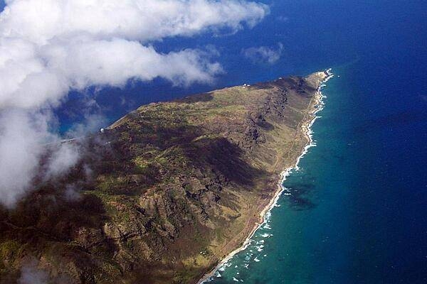
Flying over the island of Oahu in Hawaii.
Flying over the island of Oahu in Hawaii. • CIA World Factbook • 2020

A wall of 4,048 gold stars – each representing 100 killed – at the World War II Memorial in Washington, D.C.; a sobering reminder to all of the price over 400,000 Americans paid to secure victory. Photo courtesy of the National Park Service.
A wall of 4,048 gold stars – each representing 100 killed – at the World War II Memorial in Washington, D.C.; a sobering reminder to all of the price over 400,000 Americans paid to secure victory. Photo courtesy of the National Park Service. • CIA World Factbook • 2020
This false-color satellite image shows greater New York City. The Island of Manhattan is jutting southward from top center, bordered by the Hudson River to the west and the East River to the east. (North is straight up in this scene.) In the middle of Manhattan, Central Park appears as a long green rectangle running roughly north-south with a large lake in the middle. Also visible are parts of Staten Island (bottom left corner) and Long Island (lower right). Photo courtesy of NASA.
This false-color satellite image shows greater New York City. The Island of Manhattan is jutting southward from top center, bordered by the Hudson River to the west and the East River to the east. (North is straight up in this scene.) In the middle of Manhattan, Central Park appears as a long green rectangle running roughly north-south with a large lake in the middle. Also visible are parts of Staten Island (bottom left corner) and Long Island (lower right). Photo courtesy of NASA. • CIA World Factbook • 2020
Visible from space, a smoke plume rises from the Manhattan area after two planes crashed into the towers of the World Trade Center. This photo was taken of metropolitan New York City (and other parts of New York as well as New Jersey) the morning of 11 September 2001. Image courtesy of NASA.
Visible from space, a smoke plume rises from the Manhattan area after two planes crashed into the towers of the World Trade Center. This photo was taken of metropolitan New York City (and other parts of New York as well as New Jersey) the morning of 11 September 2001. Image courtesy of NASA. • CIA World Factbook • 2020
Rising nearly 1,500 m (5,000 ft) above Yosemite Valley, Half Dome is a Yosemite National Park icon and a great challenge to many hikers. This view is looking eastward and shows Stoneman Bridge in the middle distance. Image courtesy of the US National Park Service.
Rising nearly 1,500 m (5,000 ft) above Yosemite Valley, Half Dome is a Yosemite National Park icon and a great challenge to many hikers. This view is looking eastward and shows Stoneman Bridge in the middle distance. Image courtesy of the US National Park Service. • CIA World Factbook • 2020
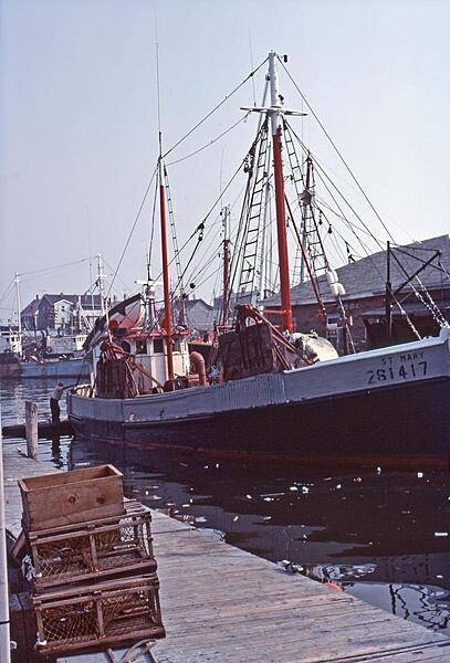
A typical lobster boat docked along Cape Cod in Massachusetts.
A typical lobster boat docked along Cape Cod in Massachusetts. • CIA World Factbook • 2020
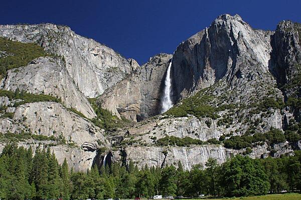
This iconic view of Yosemite Falls, a major attraction in Yosemite National Park in California, shows both the upper and lower falls. The falls come from Yosemite Creek, rushing in the spring from snow melt. The upper fall plunges some 436 m (1,430 ft) from the valley rim, making it alone among the 20 highest falls in the world. The combined drop of 739 m (2,425 ft) for the upper fall, middle cascades, and lower fall make Yosemite Falls the highest measured falls in the United States.
This iconic view of Yosemite Falls, a major attraction in Yosemite National Park in California, shows both the upper and lower falls. The falls come from Yosemite Creek, rushing in the spring from snow melt. The upper fall plunges some 436 m (1,430 ft) from the valley rim, making it alone among the 20 highest falls in the world. The combined drop of 739 m (2,425 ft) for the upper fall, middle cascades, and lower fall make Yosemite Falls the highest measured falls in the United States. • CIA World Factbook • 2020
Colonel Short's Villa on Fourth Street in the Garden District of New Orleans.
Colonel Short's Villa on Fourth Street in the Garden District of New Orleans. • CIA World Factbook • 2020
View of the southern entrance to Independence Hall in Philadelphia. Photo courtesy of the US National Park Service.
View of the southern entrance to Independence Hall in Philadelphia. Photo courtesy of the US National Park Service. • CIA World Factbook • 2020
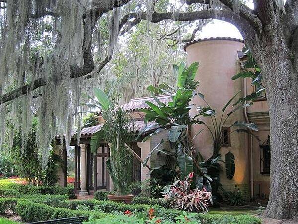
CIA World Factbook • 2020
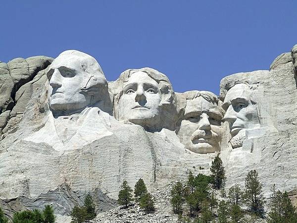
Full view of Mount Rushmore near Keystone, South Dakota. The impressive monument - never completely finished - was sculpted between 1927 and 1941. Image courtesy of the US National Park Service.
Full view of Mount Rushmore near Keystone, South Dakota. The impressive monument - never completely finished - was sculpted between 1927 and 1941. Image courtesy of the US National Park Service. • CIA World Factbook • 2020
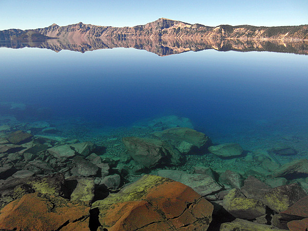
Crater Lake, Oregon in summer III. A view from the lake shore, with Llao Rock in the distance. Photo courtesy of the US National Park Service.
Crater Lake, Oregon in summer III. A view from the lake shore, with Llao Rock in the distance. Photo courtesy of the US National Park Service. • CIA World Factbook • 2020
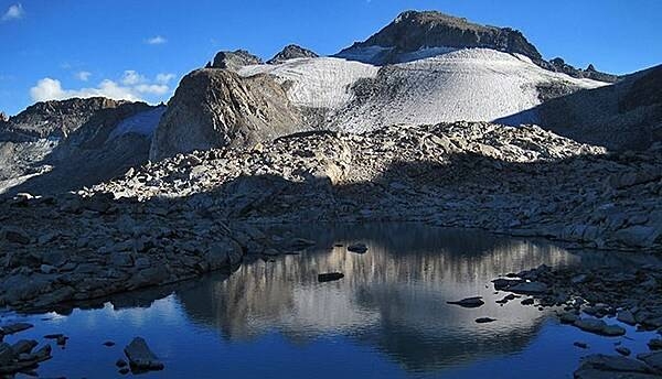
Ice age glaciers played an essential role in shaping Yosemite’s landscape. Most of this ice had melted away due to natural warming by about 10,000 years ago. During a more recent cold period called the Little Ice Age, small glaciers formed below the highest peaks. Currently, two remain: the Maclure glacier and the Lyell glacier (shown). These ice bodies are important to local ecosystems because they provide a year-round supply of cold water to the Lyell Fork of the Tuolumne River, especially during the late summer and fall after the winter snowpack has melted. Image courtesy of the US National Park Service.
Ice age glaciers played an essential role in shaping Yosemite’s landscape. Most of this ice had melted away due to natural warming by about 10,000 years ago. During a more recent cold period called the Little Ice Age, small glaciers formed below the highest peaks. Currently, two remain: the Maclure glacier and the Lyell glacier (shown). These ice bodies are important to local ecosystems because they provide a year-round supply of cold water to the Lyell Fork of the Tuolumne River, especially during the late summer and fall after the winter snowpack has melted. Image courtesy of the US National Park Service. • CIA World Factbook • 2020
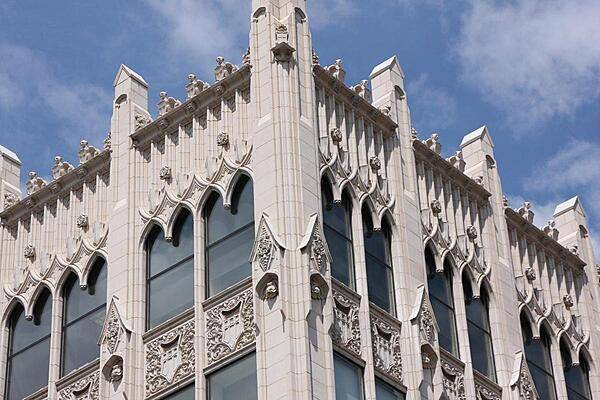
The Chronicle Building in Spokane, Washington, is the home of the Spokane Daily Chronicle.
The Chronicle Building in Spokane, Washington, is the home of the Spokane Daily Chronicle. • CIA World Factbook • 2020
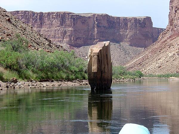
Ten-Mile Rock is a slab of sandstone embedded in middle of the Colorado River in Marble Canyon section of the Grand Canyon. Image courtesy of the USGS.
Ten-Mile Rock is a slab of sandstone embedded in middle of the Colorado River in Marble Canyon section of the Grand Canyon. Image courtesy of the USGS. • CIA World Factbook • 2020
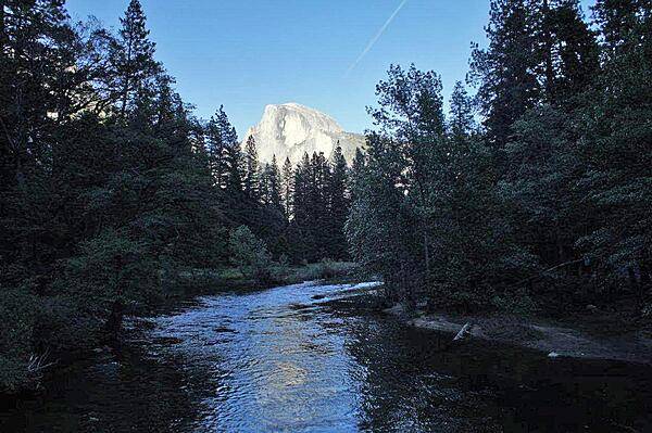
This image from Sentinel Bridge shows Yosemite Valley at sunset. Half Dome, the brightly lit rock formation in the background, is one of the last places in the valley to receive sunlight as the day ends.
This image from Sentinel Bridge shows Yosemite Valley at sunset. Half Dome, the brightly lit rock formation in the background, is one of the last places in the valley to receive sunlight as the day ends. • CIA World Factbook • 2020
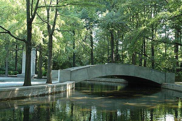
A stone footbridge, moat, and willow oaks at the presidential memorial on Theodore Roosevelt Island, Washington, D.C. Photo courtesy of the National Park Service.
A stone footbridge, moat, and willow oaks at the presidential memorial on Theodore Roosevelt Island, Washington, D.C. Photo courtesy of the National Park Service. • CIA World Factbook • 2020
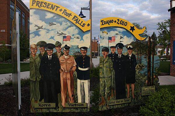
. . . the present. Some of the soldiers in the murals are locals.
. . . the present. Some of the soldiers in the murals are locals. • CIA World Factbook • 2020
Cape Cod beach, North Eastham, Massachusetts.
Cape Cod beach, North Eastham, Massachusetts. • CIA World Factbook • 2020
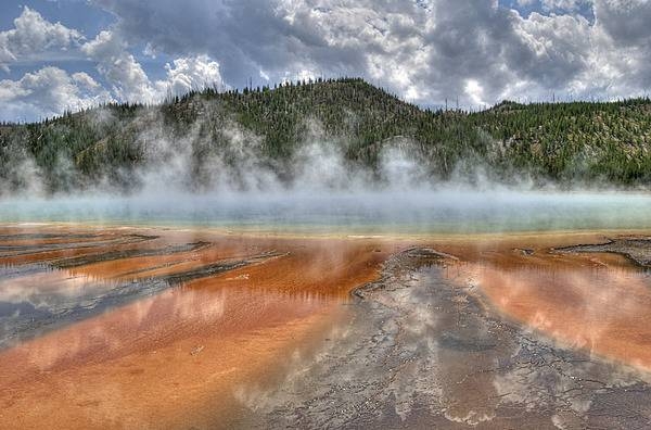
Close-up of Grand Prismatic Spring colored by thermophiles (simple microorganisms that thrive in hot water). Boardwalks allow visitors to safely approach such thermal features. Image courtesy of the US National Park Service/Curtis Akin.
Close-up of Grand Prismatic Spring colored by thermophiles (simple microorganisms that thrive in hot water). Boardwalks allow visitors to safely approach such thermal features. Image courtesy of the US National Park Service/Curtis Akin. • CIA World Factbook • 2020
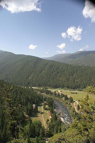
View of the Gallatin River from Storm Castle Trail, Gallatin, Montana.
View of the Gallatin River from Storm Castle Trail, Gallatin, Montana. • CIA World Factbook • 2020
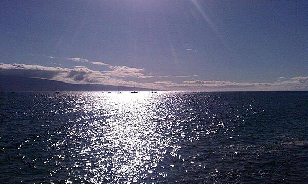
The late afternoon sun sparkles on the channel between Lahaina, Maui and the island of Lanai.
The late afternoon sun sparkles on the channel between Lahaina, Maui and the island of Lanai. • CIA World Factbook • 2020
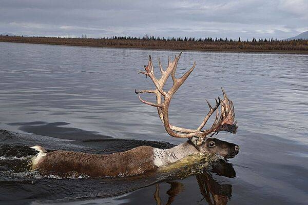
Caribou bull swimming across a river in Noatak National Preserve, Alaska. Photo courtesy of the US National Park Service/ Kyle Joly.
Caribou bull swimming across a river in Noatak National Preserve, Alaska. Photo courtesy of the US National Park Service/ Kyle Joly. • CIA World Factbook • 2020
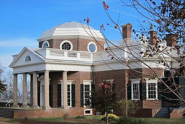
CIA World Factbook • 2020
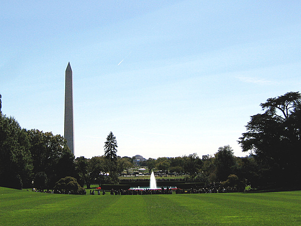
View from the south lawn of the White House; in the distance is the Washington Monument (on the left) and the Jefferson Memorial (at center).
View from the south lawn of the White House; in the distance is the Washington Monument (on the left) and the Jefferson Memorial (at center). • CIA World Factbook • 2020
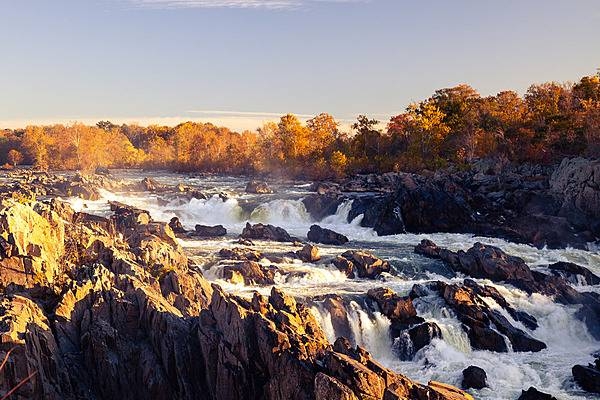
Great Falls are a series of rapids and waterfalls on the Potomac River between Virginia and Maryland some 23 km (14 mi) upstream from Washington, DC. Photo courtesy of the National Park Service.
Great Falls are a series of rapids and waterfalls on the Potomac River between Virginia and Maryland some 23 km (14 mi) upstream from Washington, DC. Photo courtesy of the National Park Service. • CIA World Factbook • 2020
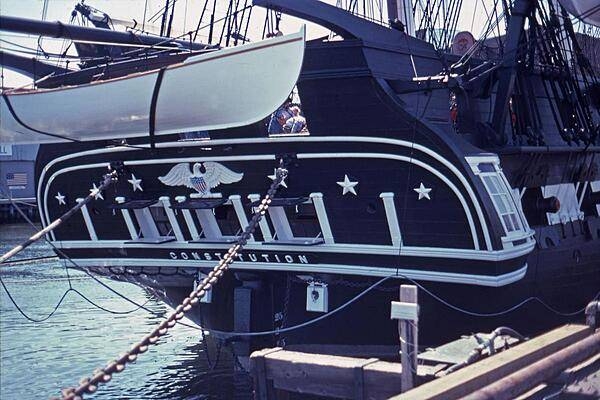
The stern of the frigate USS Constitution docked at Pier 1 of the Charleston Navy Yard (Boston).
The stern of the frigate USS Constitution docked at Pier 1 of the Charleston Navy Yard (Boston). • CIA World Factbook • 2020
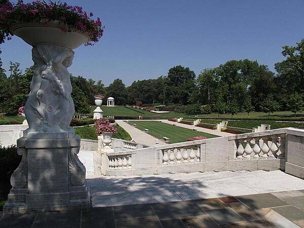
A view of the Sunken Garden, part of the Nemours Gardens that extends beyond the Long Walk and pool. The Temple of Diana is in the far background.
A view of the Sunken Garden, part of the Nemours Gardens that extends beyond the Long Walk and pool. The Temple of Diana is in the far background. • CIA World Factbook • 2020
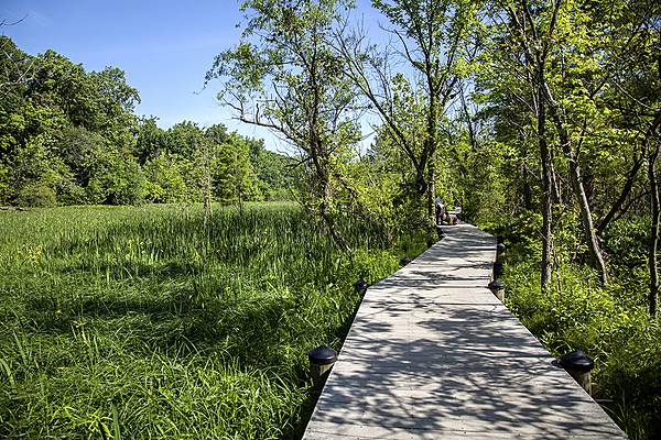
The boardwalk that winds the through the Theodore Roosevelt Island landscape provides a multi-sensory experience. Photo courtesy of the National Park Service.
The boardwalk that winds the through the Theodore Roosevelt Island landscape provides a multi-sensory experience. Photo courtesy of the National Park Service. • CIA World Factbook • 2020
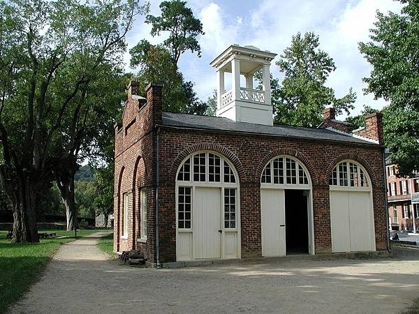
John Brown’s Fort at Harpers Ferry, West Virginia. The building was originally constructed in 1848 for use as a guard and fire engine house. The abolitionist John Brown and his small army captured the armory at Harpers Ferry on the night of 16 October 1859 and took 60 citizens of the town as hostage. The local militia and armed townspeople killed several of the insurrectionists and forced the remainder to take up a position inside the fire engine house. US marines battered down the door and stormed the fire house on the morning of the 18th, capturing Brown and killing several more of his men, while suffering one fatality and freeing all the hostages. Photo courtesy of the National Park Service.
John Brown’s Fort at Harpers Ferry, West Virginia. The building was originally constructed in 1848 for use as a guard and fire engine house. The abolitionist John Brown and his small army captured the armory at Harpers Ferry on the night of 16 October 1859 and took 60 citizens of the town as hostage. The local militia and armed townspeople killed several of the insurrectionists and forced the remainder to take up a position inside the fire engine house. US marines battered down the door and stormed the fire house on the morning of the 18th, capturing Brown and killing several more of his men, while suffering one fatality and freeing all the hostages. Photo courtesy of the National Park Service. • CIA World Factbook • 2020
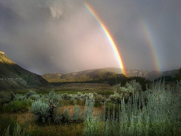
Double rainbow seen from Lower Mammoth in Yellowstone National Park. Image courtesy of the US National Park Service/Dan Hottle.
Double rainbow seen from Lower Mammoth in Yellowstone National Park. Image courtesy of the US National Park Service/Dan Hottle. • CIA World Factbook • 2020
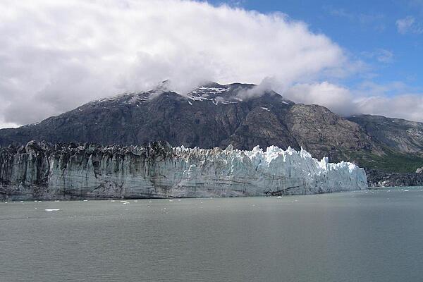
Margerie Glacier in Glacier Bay, Alaska.
Margerie Glacier in Glacier Bay, Alaska. • CIA World Factbook • 2020
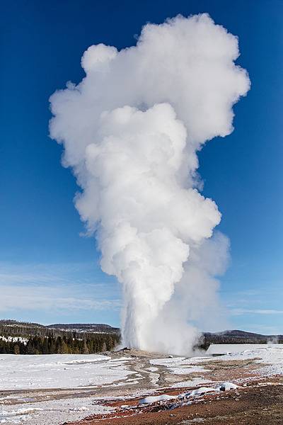
Water and steam shoot straight up as Old Faithful erupts on a clear winter day in Yellowstone National Park. The geyser erupts regularly on average about every 90 minutes (intervals can range from 60 to 110 minutes); eruption times can range from 1.5 to 5 minutes. Image courtesy of the US National Park Service/ Jacob W. Frank.
Water and steam shoot straight up as Old Faithful erupts on a clear winter day in Yellowstone National Park. The geyser erupts regularly on average about every 90 minutes (intervals can range from 60 to 110 minutes); eruption times can range from 1.5 to 5 minutes. Image courtesy of the US National Park Service/ Jacob W. Frank. • CIA World Factbook • 2020
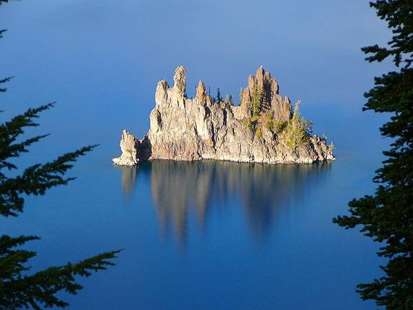
The Phantom Ship in Crater Lake, as seen from the Sun Notch Trail. Photo courtesy of the US National Park Service.
The Phantom Ship in Crater Lake, as seen from the Sun Notch Trail. Photo courtesy of the US National Park Service. • CIA World Factbook • 2020
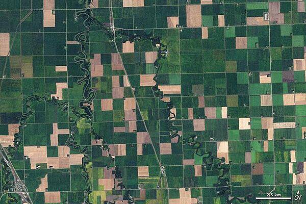
Farms in northwest Minnesota viewed from space resemble a patchwork quilt in this 10 September 2009 image. Fields change hue with the season and with the alternating plots of organic wheat, soybeans, corn, alfalfa, flax, or hay. Although lush green fields dominate the image, some crops have already been harvested leaving squares of tan and brown. Photo courtesy of NASA.
Farms in northwest Minnesota viewed from space resemble a patchwork quilt in this 10 September 2009 image. Fields change hue with the season and with the alternating plots of organic wheat, soybeans, corn, alfalfa, flax, or hay. Although lush green fields dominate the image, some crops have already been harvested leaving squares of tan and brown. Photo courtesy of NASA. • CIA World Factbook • 2020

CIA World Factbook • 2020
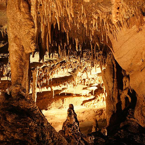
Stalactites and stalagmites, made of travertine, can be seen on the Frozen Niagara tour of Mammoth Cave in Kentucky. Travertine, or traveling stone, is made of limestone that has crystalized out of dripping water. Image courtesy of the US National Park Service.
Stalactites and stalagmites, made of travertine, can be seen on the Frozen Niagara tour of Mammoth Cave in Kentucky. Travertine, or traveling stone, is made of limestone that has crystalized out of dripping water. Image courtesy of the US National Park Service. • CIA World Factbook • 2020
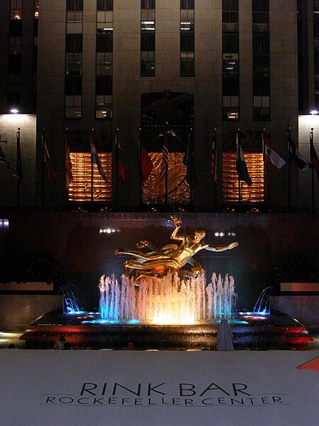
Rockefeller Center in New York City.
Rockefeller Center in New York City. • CIA World Factbook • 2020
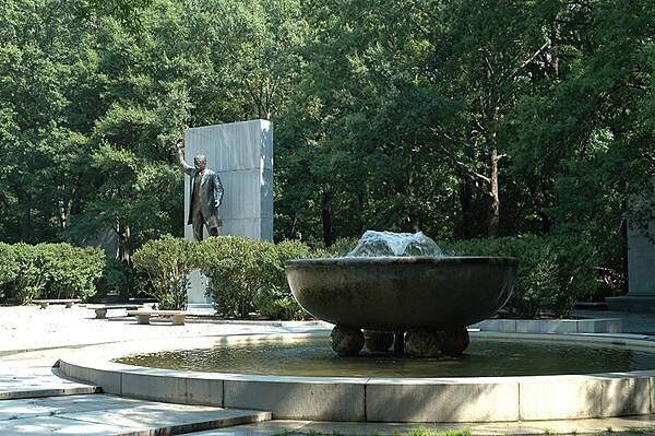
Memorial plaza, statue, and fountain among the trees of Theodore Roosevelt Island. Photo courtesy of the National Park Service.
Memorial plaza, statue, and fountain among the trees of Theodore Roosevelt Island. Photo courtesy of the National Park Service. • CIA World Factbook • 2020
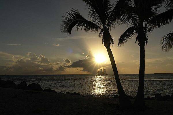
Sunset over Key West, Florida.
Sunset over Key West, Florida. • CIA World Factbook • 2020
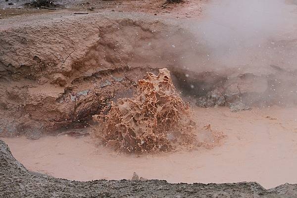
Red Spouter at Fountain Paint Pot in Yellowstone National Park. Image courtesy of the US National Park Service/Jim Peaco.
Red Spouter at Fountain Paint Pot in Yellowstone National Park. Image courtesy of the US National Park Service/Jim Peaco. • CIA World Factbook • 2020
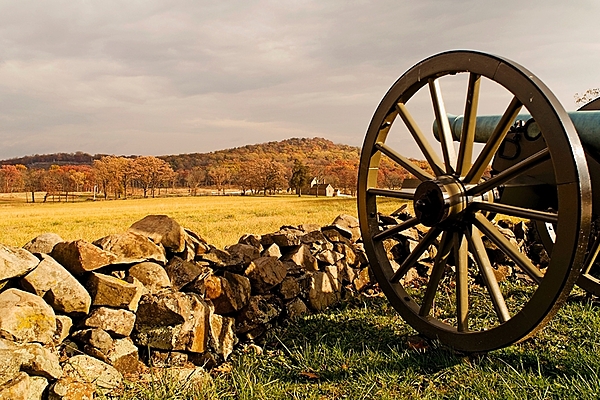
A view of the Round Tops as seen from a southern cannon in Gettysburg National Military Park, Gettysburg, Pennsylvania. The three-day Battle of Gettysburg (1-3 July 1863) in the US Civil War was the largest ever battle fought in the Western Hemisphere involving roughly 175,000 Union and Confederate soldiers. Union forces’ ability to hold Little Round Top hill on the Union extreme left flank on the second day of fighting helped blunt the Confederate attack and set the stage for victory the following day. Image courtesy of the US National Park Service.
A view of the Round Tops as seen from a southern cannon in Gettysburg National Military Park, Gettysburg, Pennsylvania. The three-day Battle of Gettysburg (1-3 July 1863) in the US Civil War was the largest ever battle fought in the Western Hemisphere involving roughly 175,000 Union and Confederate soldiers. Union forces’ ability to hold Little Round Top hill on the Union extreme left flank on the second day of fighting helped blunt the Confederate attack and set the stage for victory the following day. Image courtesy of the US National Park Service. • CIA World Factbook • 2020

A miniature crepe myrtle in the bonsai garden at Longwood Gardens, Kennett Square, Pennsylvania.
A miniature crepe myrtle in the bonsai garden at Longwood Gardens, Kennett Square, Pennsylvania. • CIA World Factbook • 2020
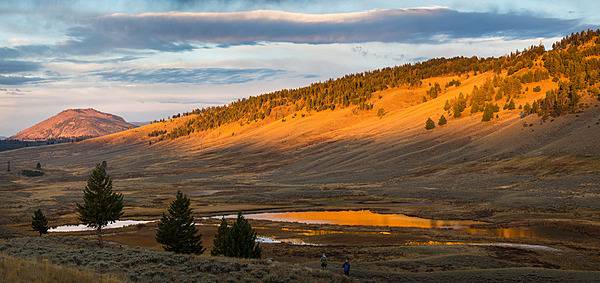
Sunrise at Blacktail Pond in Yellowstone National Park. Image courtesy of the US National Park Service/Neal Herbert.
Sunrise at Blacktail Pond in Yellowstone National Park. Image courtesy of the US National Park Service/Neal Herbert. • CIA World Factbook • 2020
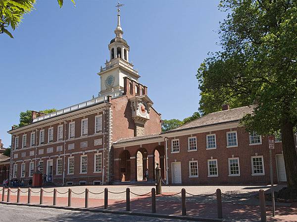
Independence Hall in Philadelphia is where both the Declaration of Independence and the United States Constitution were debated and signed. Photo courtesy of the US National Park Service.
Independence Hall in Philadelphia is where both the Declaration of Independence and the United States Constitution were debated and signed. Photo courtesy of the US National Park Service. • CIA World Factbook • 2020
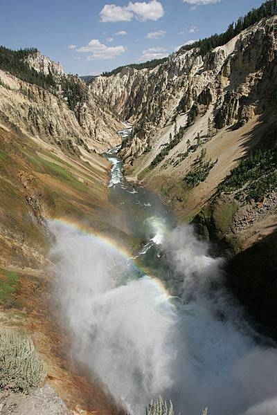
Grand Canyon of the Yellowstone as seen from the brink of the Lower Falls. Image courtesy of the US National Park Service/Jim Peaco.
Grand Canyon of the Yellowstone as seen from the brink of the Lower Falls. Image courtesy of the US National Park Service/Jim Peaco. • CIA World Factbook • 2020
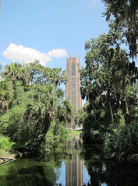
CIA World Factbook • 2020
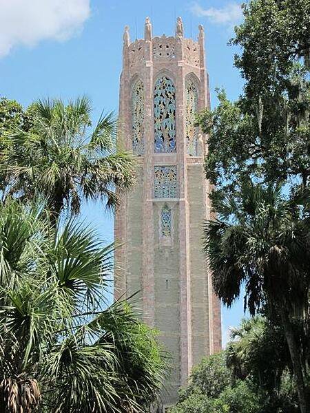
CIA World Factbook • 2020
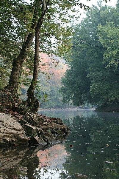
Mammoth Cave National Park on the surface. A view of the Green River at Turnhole Bend in Autumn. Image courtesy of the US National Park Service.
Mammoth Cave National Park on the surface. A view of the Green River at Turnhole Bend in Autumn. Image courtesy of the US National Park Service. • CIA World Factbook • 2020
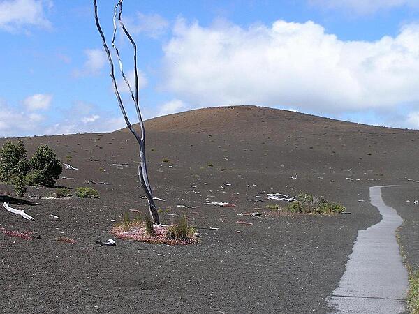
Devastation Trail at Hawaii Volcanoes National Park on the Big Island.
Devastation Trail at Hawaii Volcanoes National Park on the Big Island. • CIA World Factbook • 2020
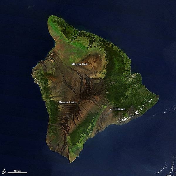
A satellite image of the Big Island of Hawaii. The three largest of the five shield volcanoes that make up the island are labeled. Mauna Kea is dormant, but Mauna Loa and Kilauea remain active and contribute to the island's continued growth. Mauna Loa has historically been considered the largest volcano on Earth. Image courtesy of NASA.
A satellite image of the Big Island of Hawaii. The three largest of the five shield volcanoes that make up the island are labeled. Mauna Kea is dormant, but Mauna Loa and Kilauea remain active and contribute to the island's continued growth. Mauna Loa has historically been considered the largest volcano on Earth. Image courtesy of NASA. • CIA World Factbook • 2020

Even the trash bins on Tangier Island, Virginia show a lighthouse motif. There are very few cars on the island; most folks get around by golf cart, bicycle, or on foot.
Even the trash bins on Tangier Island, Virginia show a lighthouse motif. There are very few cars on the island; most folks get around by golf cart, bicycle, or on foot. • CIA World Factbook • 2020
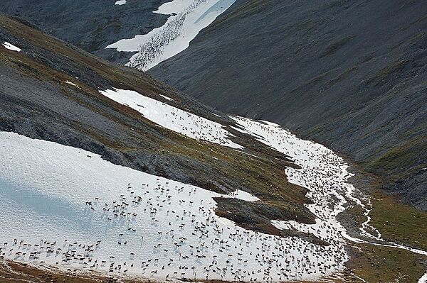
Caribou migration in Noatak National Preserve, Alaska. Some 300,000 caribou reside in the preserve. Every spring and fall, these animals pass through the preserve on the 1,000 km (600 mi) trek between their summer and winter grounds. Noatak National Preserve helps protect this millennia-old journey that is vital to both the caribou and the people who live along their path. Photo courtesy of the US National Park Service.
Caribou migration in Noatak National Preserve, Alaska. Some 300,000 caribou reside in the preserve. Every spring and fall, these animals pass through the preserve on the 1,000 km (600 mi) trek between their summer and winter grounds. Noatak National Preserve helps protect this millennia-old journey that is vital to both the caribou and the people who live along their path. Photo courtesy of the US National Park Service. • CIA World Factbook • 2020
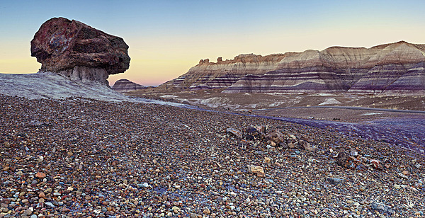
A pedestal log along the Blue Mesa Trail in Petrified Forest National Park in northeastern Arizona. Image courtesy of the US National Park Service/ Andrew V. Kearns.
A pedestal log along the Blue Mesa Trail in Petrified Forest National Park in northeastern Arizona. Image courtesy of the US National Park Service/ Andrew V. Kearns. • CIA World Factbook • 2020
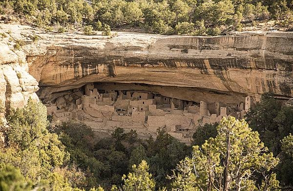
Mesa Verde's largest cliff dwelling is Cliff Palace, here viewed from across the canyon at Sun Temple in Mesa Verde National Park, Colorado. Image courtesy of the US National Park Service/Sandy Groves.
Mesa Verde's largest cliff dwelling is Cliff Palace, here viewed from across the canyon at Sun Temple in Mesa Verde National Park, Colorado. Image courtesy of the US National Park Service/Sandy Groves. • CIA World Factbook • 2020
Close up of cherry blossoms along the Tidal Basin. Photo courtesy of the National Park Service.
Close up of cherry blossoms along the Tidal Basin. Photo courtesy of the National Park Service. • CIA World Factbook • 2020

A modified 1923 Ford convertible with a rumble seat at an antique car show in Sandpoint, Idaho.
A modified 1923 Ford convertible with a rumble seat at an antique car show in Sandpoint, Idaho. • CIA World Factbook • 2020
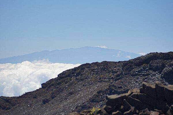
A vista from the visitors center at the top of Haleakala in Maui. In the distance, 130 km (80 mi) away, lies the peak of Mauna Kea on the big island of Hawaii.
A vista from the visitors center at the top of Haleakala in Maui. In the distance, 130 km (80 mi) away, lies the peak of Mauna Kea on the big island of Hawaii. • CIA World Factbook • 2020
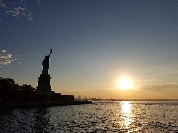
Statue of Liberty in silhouette with the sun rising in the distance. Photo courtesy of the National Park Service.
Statue of Liberty in silhouette with the sun rising in the distance. Photo courtesy of the National Park Service. • CIA World Factbook • 2020
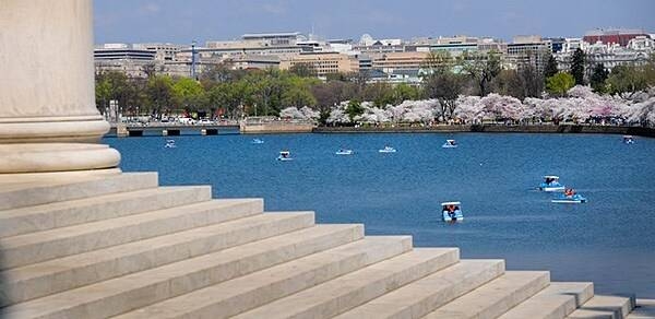
The Tidal Basin in Washington D.C. as seen from the steps of the Thomas Jefferson Memorial. The Tidal Basin is fringed with a variety of cherry trees that give rise to the National Cherry Blossom Festival that takes place annually in late March-early April. Paddle boats offer one of the best ways to experience the cherry tree blossoms. Photo courtesy of the National Park Service.
The Tidal Basin in Washington D.C. as seen from the steps of the Thomas Jefferson Memorial. The Tidal Basin is fringed with a variety of cherry trees that give rise to the National Cherry Blossom Festival that takes place annually in late March-early April. Paddle boats offer one of the best ways to experience the cherry tree blossoms. Photo courtesy of the National Park Service. • CIA World Factbook • 2020
Brandywine Falls and observation area in Cuyahoga Valley National Park, Ohio. Photo courtesy of the US National Park Service/ D.J. Reiser.
Brandywine Falls and observation area in Cuyahoga Valley National Park, Ohio. Photo courtesy of the US National Park Service/ D.J. Reiser. • CIA World Factbook • 2020
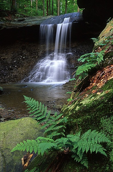
Blue Hen Falls in the spring in Cuyahoga Valley National Park, Ohio. Photo courtesy of the US National Park Service.
Blue Hen Falls in the spring in Cuyahoga Valley National Park, Ohio. Photo courtesy of the US National Park Service. • CIA World Factbook • 2020
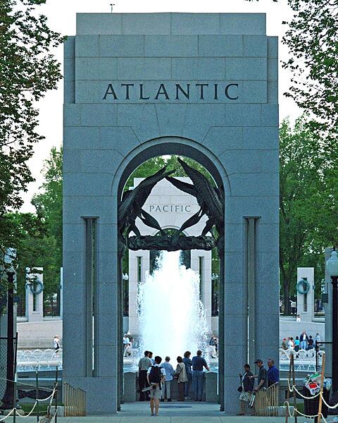
A look through the Atlantic Arch at the northern end of the National World War II Memorial in Washington D.C.
A look through the Atlantic Arch at the northern end of the National World War II Memorial in Washington D.C. • CIA World Factbook • 2020
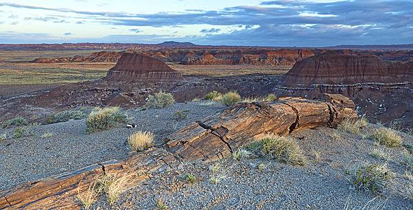
A petrified log erodes from the Painted Desert at Petrified Forest National Park in Arizona. Image courtesy of the US National Park Service/ Andrew V. Kearns.
A petrified log erodes from the Painted Desert at Petrified Forest National Park in Arizona. Image courtesy of the US National Park Service/ Andrew V. Kearns. • CIA World Factbook • 2020
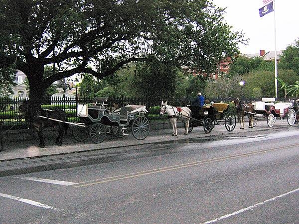
Mule-drawn carriage rides are an iconic and popular way to tour the French Quarter of New Orleans.
Mule-drawn carriage rides are an iconic and popular way to tour the French Quarter of New Orleans. • CIA World Factbook • 2020
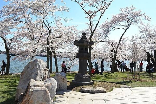
Just north of the Tidal Basin, in a grove of cherry trees where rests a centuries-old granite Japanese lantern. Photo courtesy of the National Park Service.
Just north of the Tidal Basin, in a grove of cherry trees where rests a centuries-old granite Japanese lantern. Photo courtesy of the National Park Service. • CIA World Factbook • 2020
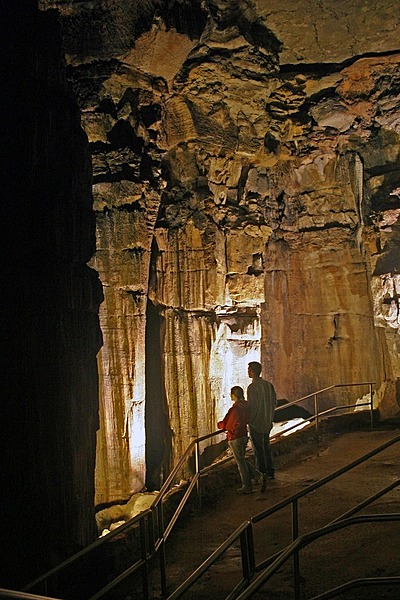
The Ruins of Karnak formation inside Mammoth Cave, Kentucky. Image courtesy of the US National Park Service.
The Ruins of Karnak formation inside Mammoth Cave, Kentucky. Image courtesy of the US National Park Service. • CIA World Factbook • 2020
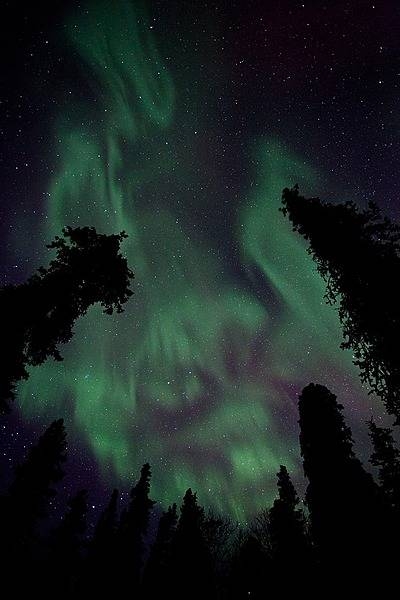
A particularly vivid auroral display in Denali National Park and Preserve, Alaska almost makes the trees appear to be aflame. Photo courtesy of the US National Park Service.
A particularly vivid auroral display in Denali National Park and Preserve, Alaska almost makes the trees appear to be aflame. Photo courtesy of the US National Park Service. • CIA World Factbook • 2020
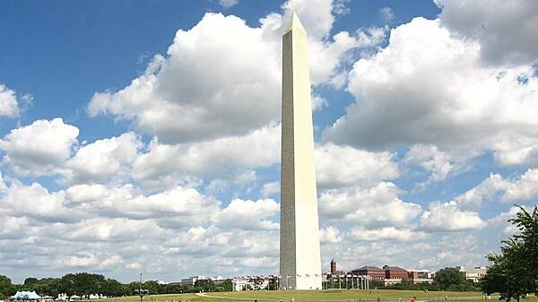
The imposing Washington Monument in Washington, D.C. is 169 m (555 ft) tall. A difference in the shading of the marble, visible approximately 48 m (150 ft) up, shows where construction was halted and later resumed with marble from a different source. Photo courtesy of the National Park Service.
The imposing Washington Monument in Washington, D.C. is 169 m (555 ft) tall. A difference in the shading of the marble, visible approximately 48 m (150 ft) up, shows where construction was halted and later resumed with marble from a different source. Photo courtesy of the National Park Service. • CIA World Factbook • 2020
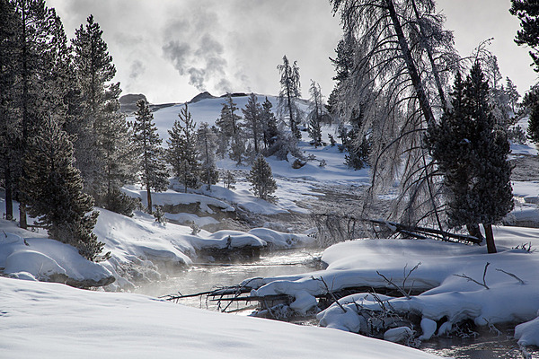
Firehole River in the Upper Geyser Basin in winter in Yellowstone National Park. Image courtesy of the US National Park Service/Neal Herbert.
Firehole River in the Upper Geyser Basin in winter in Yellowstone National Park. Image courtesy of the US National Park Service/Neal Herbert. • CIA World Factbook • 2020
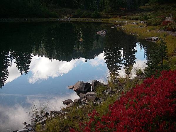
Reflection on an utterly still high mountain lake in Olympic National Park, Washington state. Photo courtesy of the National Park Service/Danielle Archuleta.
Reflection on an utterly still high mountain lake in Olympic National Park, Washington state. Photo courtesy of the National Park Service/Danielle Archuleta. • CIA World Factbook • 2020
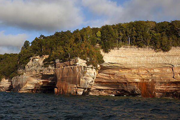
Orange-red sandstone cliffs at Pictured Rocks National Park, Michigan. Photo courtesy of the USGS.
Orange-red sandstone cliffs at Pictured Rocks National Park, Michigan. Photo courtesy of the USGS. • CIA World Factbook • 2020
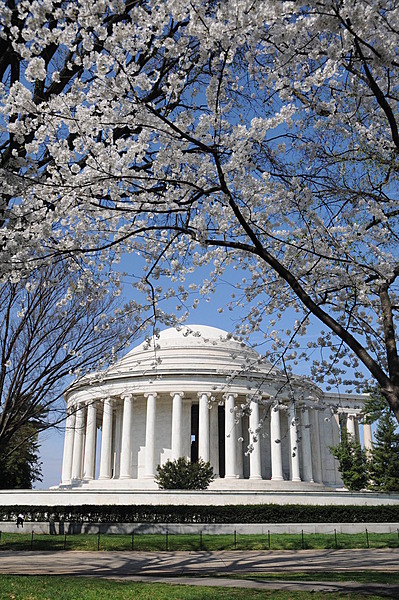
Cherry blossoms frame the Thomas Jefferson Memorial, which stands at the edge of the Tidal Basin in the monumental core of Washington, D.C. Photo courtesy of the National Park Service/ Sarah Eddy.
Cherry blossoms frame the Thomas Jefferson Memorial, which stands at the edge of the Tidal Basin in the monumental core of Washington, D.C. Photo courtesy of the National Park Service/ Sarah Eddy. • CIA World Factbook • 2020
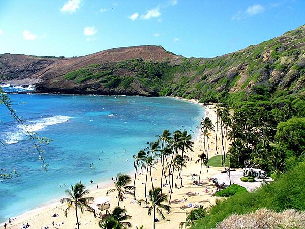
Hanauma Bay is a snorkeler's paradise on the Hawaiian Island of Oahu.
Hanauma Bay is a snorkeler's paradise on the Hawaiian Island of Oahu. • CIA World Factbook • 2020
CIA World Factbook • 2020

CIA World Factbook • 2020
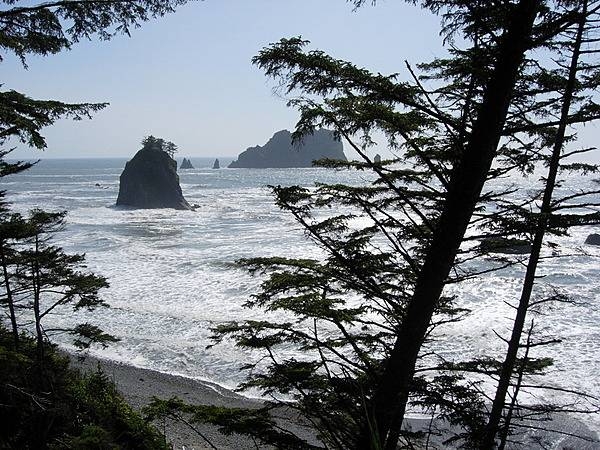
Beach and offshore sea stacks at Olympic National Park, Washington state. Photo courtesy of the National Park Service.
Beach and offshore sea stacks at Olympic National Park, Washington state. Photo courtesy of the National Park Service. • CIA World Factbook • 2020
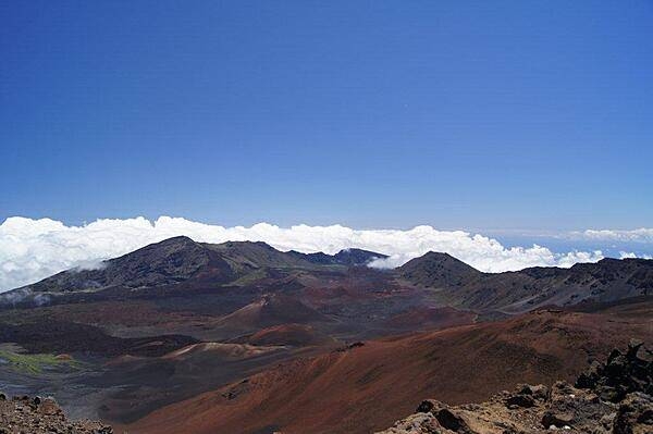
Multicolored cinder cones in Haleakala (House of the Sun) Crater on the island of Maui. The tallest peak on the mountain is 3,055 m (10,023 ft) above sea level, which is frequently high enough to overlook the clouds.
Multicolored cinder cones in Haleakala (House of the Sun) Crater on the island of Maui. The tallest peak on the mountain is 3,055 m (10,023 ft) above sea level, which is frequently high enough to overlook the clouds. • CIA World Factbook • 2020
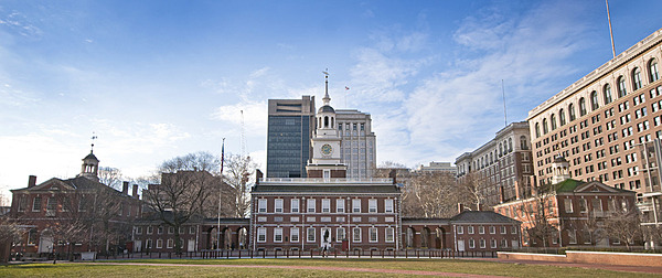
Independence Hall in Philadelphia, the scene of the signing of both the Declaration of Independence and the US Constitution, is flanked by two buildings. Congress Hall, on the right, housed the US Congress from 1790 to 1800. To the left is Old City Hall in which the US Supreme Court presided in the 1790s. Photo courtesy of the US National Park Service.
Independence Hall in Philadelphia, the scene of the signing of both the Declaration of Independence and the US Constitution, is flanked by two buildings. Congress Hall, on the right, housed the US Congress from 1790 to 1800. To the left is Old City Hall in which the US Supreme Court presided in the 1790s. Photo courtesy of the US National Park Service. • CIA World Factbook • 2020
Theodore Roosevelt Island landscape. Photo courtesy of the National Park Service.
Theodore Roosevelt Island landscape. Photo courtesy of the National Park Service. • CIA World Factbook • 2020
CIA World Factbook • 2020
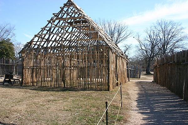
Inside the reconstructed 1607 James Fort at Jamestown National Historic Site, Virginia. The building frame displays the first phase of 17th century house construction. Photo courtesy of the National Park Service.
Inside the reconstructed 1607 James Fort at Jamestown National Historic Site, Virginia. The building frame displays the first phase of 17th century house construction. Photo courtesy of the National Park Service. • CIA World Factbook • 2020
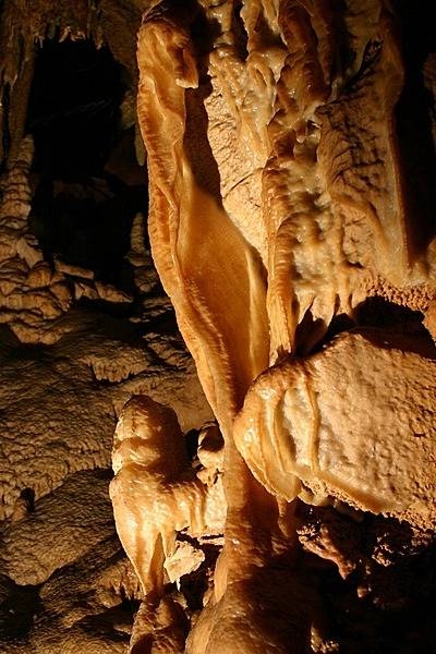
Flowstone in the Frozen Niagara section of Mammoth Cave, Kentucky. Image courtesy of the US National Park Service.
Flowstone in the Frozen Niagara section of Mammoth Cave, Kentucky. Image courtesy of the US National Park Service. • CIA World Factbook • 2020
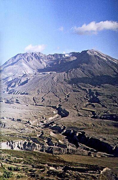
The caldera of Mt. St. Helens in Washington state, 2007. Some volcanic gases and a slowly rebuilding dome are visible.
The caldera of Mt. St. Helens in Washington state, 2007. Some volcanic gases and a slowly rebuilding dome are visible. • CIA World Factbook • 2020
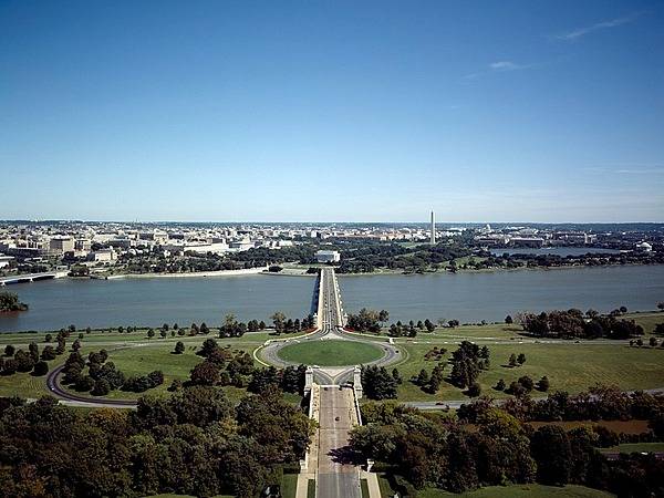
Memorial Bridge and Avenue from Arlington, Virginia is the ceremonial entrance into Washington, D.C.; the roadway leads to the Lincoln Memorial. To the right on the image is the tall Washington Monument, and at the far right is the Jefferson Memorial on the Tidal Pool. To the left one can see the Theodore Roosevelt Memorial Bridge and just the corner of the Kennedy Center. Image courtesy of the US National Park Service.
Memorial Bridge and Avenue from Arlington, Virginia is the ceremonial entrance into Washington, D.C.; the roadway leads to the Lincoln Memorial. To the right on the image is the tall Washington Monument, and at the far right is the Jefferson Memorial on the Tidal Pool. To the left one can see the Theodore Roosevelt Memorial Bridge and just the corner of the Kennedy Center. Image courtesy of the US National Park Service. • CIA World Factbook • 2020
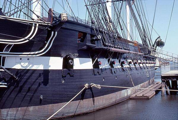
Gun ports of the USS Constitution. Although rated as a 44-gun frigate, the ship would often carry over 50 guns at a time. Constitution is 62 m (204 ft) long and 13.3 m (43.5 ft) at the beam. The height of the central mainmast is 67 m (220 ft).
Gun ports of the USS Constitution. Although rated as a 44-gun frigate, the ship would often carry over 50 guns at a time. Constitution is 62 m (204 ft) long and 13.3 m (43.5 ft) at the beam. The height of the central mainmast is 67 m (220 ft). • CIA World Factbook • 2020
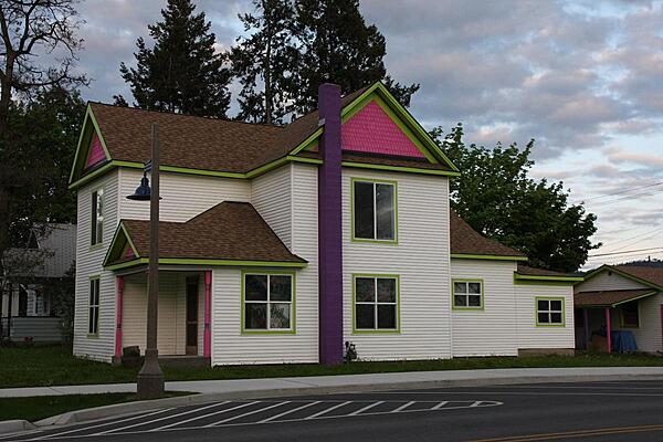
Many businesses in Post Falls, Idaho set themselves up in colorful houses.
Many businesses in Post Falls, Idaho set themselves up in colorful houses. • CIA World Factbook • 2020
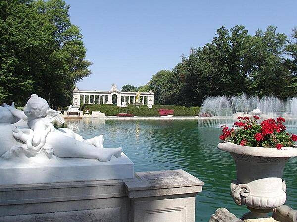
The one-acre (0.4 hectare) Reflecting Pool at the foot of the Long Walk at Nemours Gardens, Wilmington, Delaware features 157 jets shooting water 12 ft (3.5 m) into the air. When they are turned off, the entire Long Walk is reflected in the pool. The pool, 5.5 ft (1.7 m) deep at its deepest section, holds 800,000 gallons (3.028 million liters) of water and takes three days to fill.
The one-acre (0.4 hectare) Reflecting Pool at the foot of the Long Walk at Nemours Gardens, Wilmington, Delaware features 157 jets shooting water 12 ft (3.5 m) into the air. When they are turned off, the entire Long Walk is reflected in the pool. The pool, 5.5 ft (1.7 m) deep at its deepest section, holds 800,000 gallons (3.028 million liters) of water and takes three days to fill. • CIA World Factbook • 2020
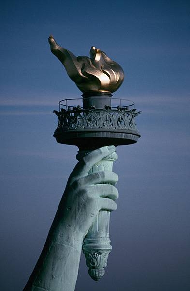
The torch of the Statue of Liberty contains webcams, so virtual visitors from around the world can enjoy views from the “Torchcam” on the website of the US National Park Service. The original copper torch was replaced during restoration from 1984-86. The flame of the new torch is covered in 24k gold leaf and reflects the sun’s rays in daytime and is illuminated by 16 floodlights at night. Photo courtesy of the National Park Service.
The torch of the Statue of Liberty contains webcams, so virtual visitors from around the world can enjoy views from the “Torchcam” on the website of the US National Park Service. The original copper torch was replaced during restoration from 1984-86. The flame of the new torch is covered in 24k gold leaf and reflects the sun’s rays in daytime and is illuminated by 16 floodlights at night. Photo courtesy of the National Park Service. • CIA World Factbook • 2020
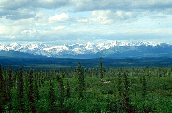
White spruce taiga in the Alaska Range, Alaska. Image courtesy of NOAA/ L.B. Brubaker.
White spruce taiga in the Alaska Range, Alaska. Image courtesy of NOAA/ L.B. Brubaker. • CIA World Factbook • 2020
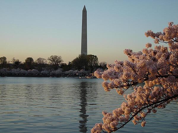
Cherry blossoms along the Tidal Basin in Washington, DC; the Washington Monument looms in the background.
Cherry blossoms along the Tidal Basin in Washington, DC; the Washington Monument looms in the background. • CIA World Factbook • 2020
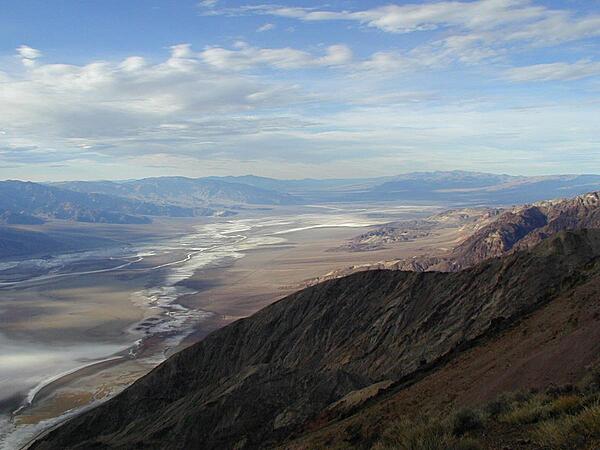
The Devil's Golf Course in Death Valley, California as seen from Dante's View. The "whiteness" is not water but a salt crust that is 1 to 2 meters thick.
The Devil's Golf Course in Death Valley, California as seen from Dante's View. The "whiteness" is not water but a salt crust that is 1 to 2 meters thick. • CIA World Factbook • 2020
Red Spouter spray at Fountain Paint Pot in Yellowstone National Park. Image courtesy of the US National Park Service/Neal Herbert.
Red Spouter spray at Fountain Paint Pot in Yellowstone National Park. Image courtesy of the US National Park Service/Neal Herbert. • CIA World Factbook • 2020
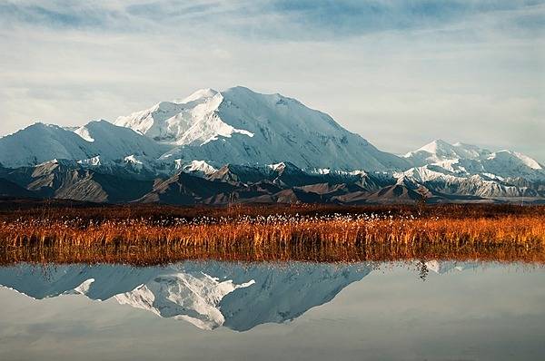
Reflection Pond in Denali National Park and Preserve, Alaska is a popular spot to capture a mirror image of Denali. Photo courtesy of the US National Park Service/ Tim Rains.
Reflection Pond in Denali National Park and Preserve, Alaska is a popular spot to capture a mirror image of Denali. Photo courtesy of the US National Park Service/ Tim Rains. • CIA World Factbook • 2020
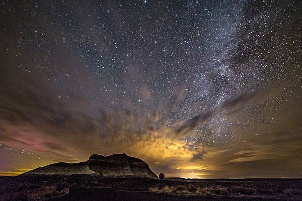
Stars of the Milky Way shine from behind lit clouds above The Battleship, a butte near Crystal Forest in Petrified Forest National Park, Arizona. Image courtesy of the US National Park Service/Jacob Holgerson.
Stars of the Milky Way shine from behind lit clouds above The Battleship, a butte near Crystal Forest in Petrified Forest National Park, Arizona. Image courtesy of the US National Park Service/Jacob Holgerson. • CIA World Factbook • 2020
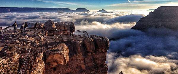
Natural fog sometimes fills the canyon, during temperature inversions. Image courtesy of the US National Park Service/Erin Whittaker.
Natural fog sometimes fills the canyon, during temperature inversions. Image courtesy of the US National Park Service/Erin Whittaker. • CIA World Factbook • 2020
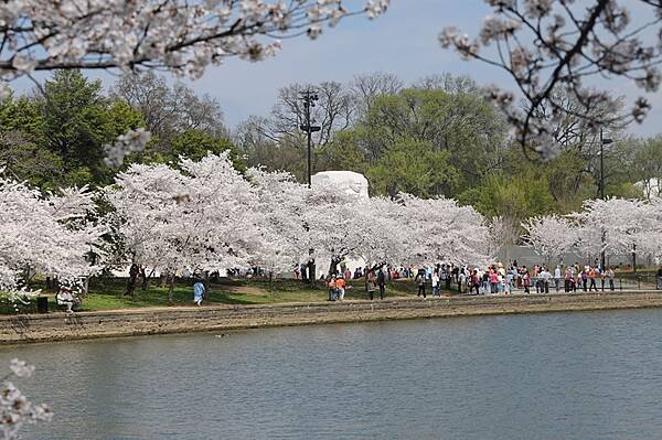
Spring is a popular time for visitors to experience the cherry blossoms and monuments that surround the Tidal Basin. The Martin Luther King Memorial appears in the background. Photo courtesy of the National Park Service.
Spring is a popular time for visitors to experience the cherry blossoms and monuments that surround the Tidal Basin. The Martin Luther King Memorial appears in the background. Photo courtesy of the National Park Service. • CIA World Factbook • 2020
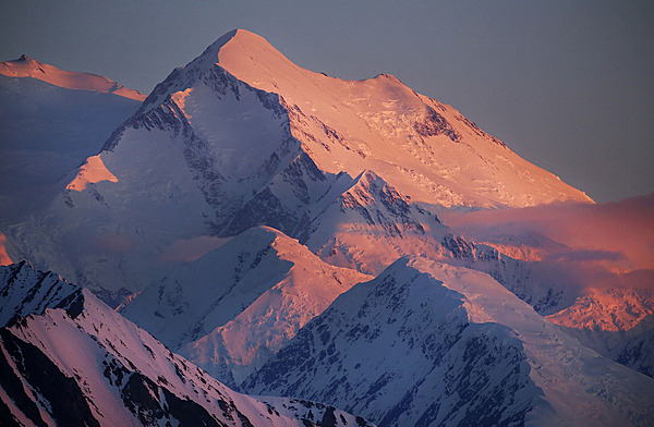
Spectacular view of the peak of Denali bathed in alpenglow during sunset at midnight on 14 June 2019. Photo courtesy of the US National Park Service/ Emily Mesner.
Spectacular view of the peak of Denali bathed in alpenglow during sunset at midnight on 14 June 2019. Photo courtesy of the US National Park Service/ Emily Mesner. • CIA World Factbook • 2020
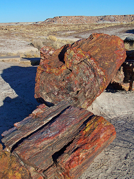
Large logs of petrified wood reveal their colors from naturally caused breaks at Giant Logs in Petrified Forest National Park, Arizona. Image courtesy of the US National Park Service/Hallie Larsen.
Large logs of petrified wood reveal their colors from naturally caused breaks at Giant Logs in Petrified Forest National Park, Arizona. Image courtesy of the US National Park Service/Hallie Larsen. • CIA World Factbook • 2020
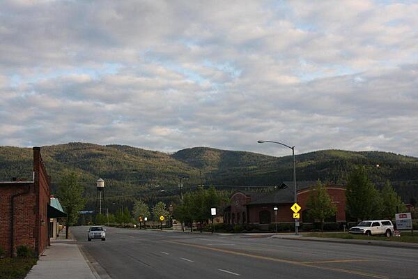
A typical wide road in Post Falls, Idaho, with a mountain view and a western-style building on one side, and a contemporary building on the other.
A typical wide road in Post Falls, Idaho, with a mountain view and a western-style building on one side, and a contemporary building on the other. • CIA World Factbook • 2020
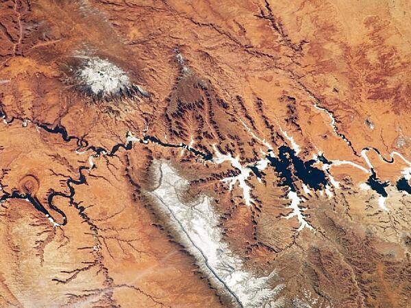
The Colorado Plateau spans northern Arizona, southern Utah, northwestern New Mexico, and southwestern Colorado and is well known for its striking landscapes and broad vistas - an impression enhanced in this view from the International Space Station. This astronaut photograph highlights part of the Utah-Arizona border region of the Plateau, and includes several prominent landforms. The Colorado River, dammed to form Lake Powell in 1963, crosses from east to west (which is left to right here because the astronaut was looking south; north is towards the bottom of the image). The confluence of the Colorado and San Juan Rivers is also visible. Sunglint - sunlight reflected off a water surface back towards the observer - provides a silvery, mirror-like sheen to some areas of the water surfaces. The geologic uplift of the Colorado Plateau led to rapid downcutting of rivers into the flat sedimentary bedrock, leaving spectacular erosional landforms. One such feature, The Rincon (left center), preserves evidence of a former meander bend of the Colorado River. Photo courtesy of NASA.
The Colorado Plateau spans northern Arizona, southern Utah, northwestern New Mexico, and southwestern Colorado and is well known for its striking landscapes and broad vistas - an impression enhanced in this view from the International Space Station. This astronaut photograph highlights part of the Utah-Arizona border region of the Plateau, and includes several prominent landforms. The Colorado River, dammed to form Lake Powell in 1963, crosses from east to west (which is left to right here because the astronaut was looking south; north is towards the bottom of the image). The confluence of the Colorado and San Juan Rivers is also visible. Sunglint - sunlight reflected off a water surface back towards the observer - provides a silvery, mirror-like sheen to some areas of the water surfaces. The geologic uplift of the Colorado Plateau led to rapid downcutting of rivers into the flat sedimentary bedrock, leaving spectacular erosional landforms. One such feature, The Rincon (left center), preserves evidence of a former meander bend of the Colorado River. Photo courtesy of NASA. • CIA World Factbook • 2020
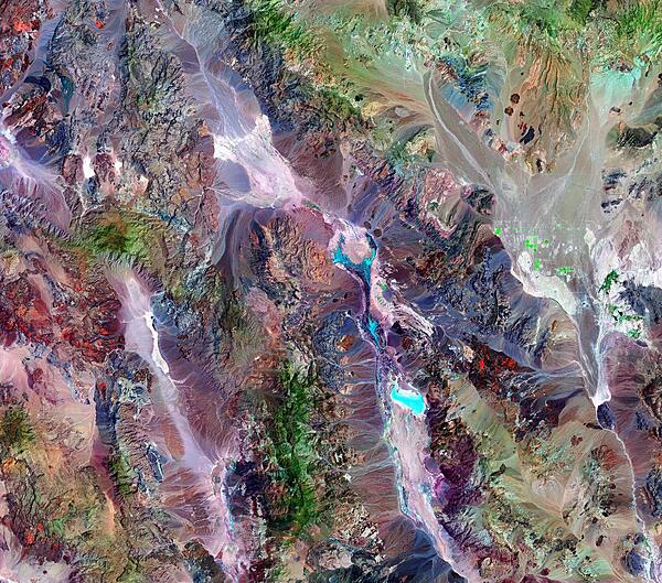
At 86 m (282 ft) below sea level, Death Valley, California, is one of the hottest, driest places on the planet. On average, the area sees only about 5 cm (2 in) of rain a year, and summer temperatures routinely soar above 38 degrees Celsius (100 degrees Fahrenheit). At night, temperatures drop considerably, and many animals in Death Valley are nocturnal as a result. Plants and animals living in this punishing environment have had to adapt to extremes of temperature and aridity. This Landsat image is compiled from observations on 11 June and 20 July 2000. Green indicates vegetation, which increases with altitude. The peaks of Death Valley National Park sport forests of juniper and pine. The dots of brilliant green near the right edge of the image fall outside park boundaries, and probably result from irrigation. On the floor of the valley, vegetation is sparse, yet more than 1,000 different species eke out an existence in the park. The varying shades of brown, beige, and rust indicate bare ground; the different colors result from varying mineral compositions in the rocks and dirt. Although they appear to be pools of water, the bright blue-green patches in the scene are actually salt pans that hold only a little moisture. Image courtesy of NASA.
At 86 m (282 ft) below sea level, Death Valley, California, is one of the hottest, driest places on the planet. On average, the area sees only about 5 cm (2 in) of rain a year, and summer temperatures routinely soar above 38 degrees Celsius (100 degrees Fahrenheit). At night, temperatures drop considerably, and many animals in Death Valley are nocturnal as a result. Plants and animals living in this punishing environment have had to adapt to extremes of temperature and aridity.
This Landsat image is compiled from observations on 11 June and 20 July 2000. Green indicates vegetation, which increases with altitude. The peaks of Death Valley National Park sport forests of juniper and pine. The dots of brilliant green near the right edge of the image fall outside park boundaries, and probably result from irrigation. On the floor of the valley, vegetation is sparse, yet more than 1,000 different species eke out an existence in the park. The varying shades of brown, beige, and rust indicate bare ground; the different colors result from varying mineral compositions in the rocks and dirt. Although they appear to be pools of water, the bright blue-green patches in the scene are actually salt pans that hold only a little moisture. Image courtesy of NASA. • CIA World Factbook • 2020
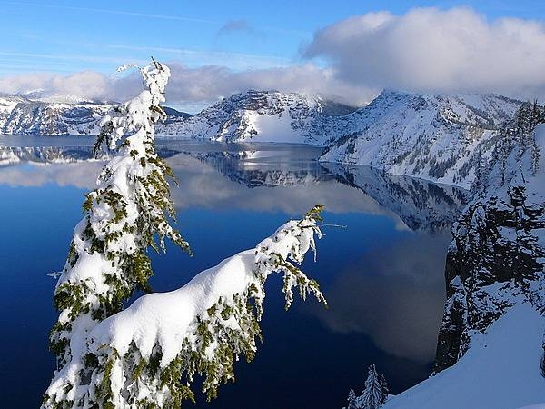
A winter view of Crater Lake, Oregon, taken near the top of Watchman Peak. Photo courtesy of the US National Park Service.
A winter view of Crater Lake, Oregon, taken near the top of Watchman Peak. Photo courtesy of the US National Park Service. • CIA World Factbook • 2020
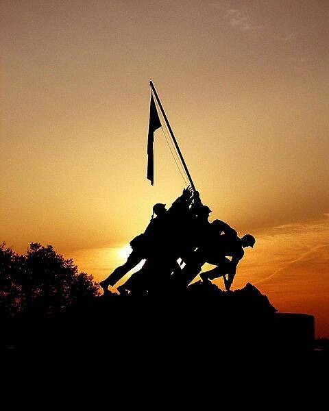
The Marine Corps War Memorial in Washington, DC.
The Marine Corps War Memorial in Washington, DC. • CIA World Factbook • 2020

The altar of Trinity Church, Boston, Massachusetts.
The altar of Trinity Church, Boston, Massachusetts. • CIA World Factbook • 2020
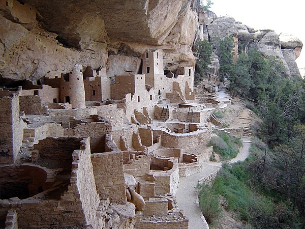
Close-up of Cliff Palace in Mesa Verde National Park, Colorado. The park protects some of the best-preserved Ancestral Puebloan (Anasazi) archaeological sites in the US. Cliff Palace was continuously occupied from about 1190 to 1260 and only abandoned around 1300. Image courtesy of the US National Park Service.
Close-up of Cliff Palace in Mesa Verde National Park, Colorado. The park protects some of the best-preserved Ancestral Puebloan (Anasazi) archaeological sites in the US. Cliff Palace was continuously occupied from about 1190 to 1260 and only abandoned around 1300. Image courtesy of the US National Park Service. • CIA World Factbook • 2020
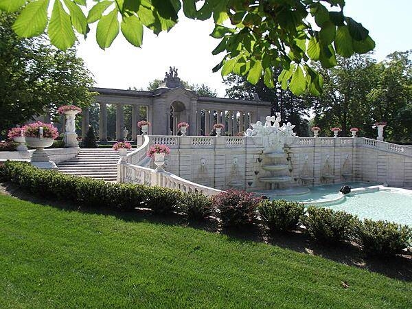
Wall fountains and pool in the Sunken Garden portion of Nemours Gardens in Wilmington, Delaware.
Wall fountains and pool in the Sunken Garden portion of Nemours Gardens in Wilmington, Delaware. • CIA World Factbook • 2020
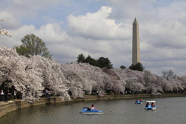
Visitors enjoy the cherry blossoms that line the Tidal Basin from the land and the water. Photo courtesy of the National Park Service/Anthony DeYoung.
Visitors enjoy the cherry blossoms that line the Tidal Basin from the land and the water. Photo courtesy of the National Park Service/Anthony DeYoung. • CIA World Factbook • 2020
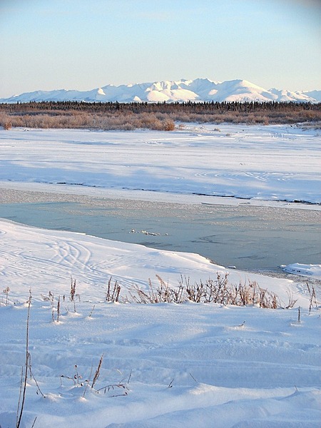
Winter in the Lower Noatak Basin. In November there is still enough sunshine to capture the shadows and bright white of snow and ice on the landscape in Noatak National Preserve, Alaska. Photo courtesy of the US National Park Service.
Winter in the Lower Noatak Basin. In November there is still enough sunshine to capture the shadows and bright white of snow and ice on the landscape in Noatak National Preserve, Alaska. Photo courtesy of the US National Park Service. • CIA World Factbook • 2020
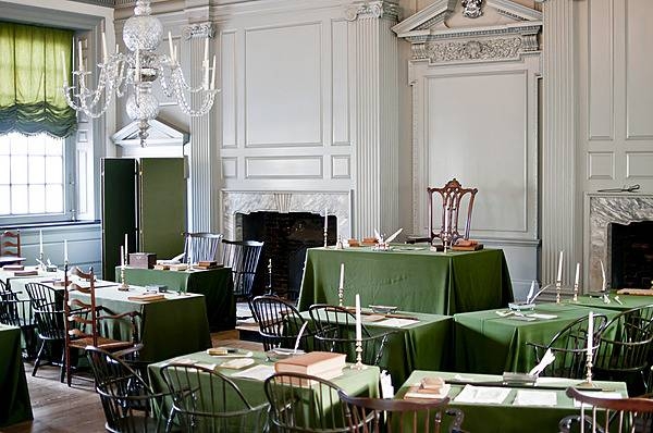
The Assembly Room of the Pennsylvania State House in Philadelphia served as the meeting place of the Pennsylvania Assembly for over sixty years until the state capital moved away from Philadelphia in 1799. In 1776, the Continental Congress declared Independence in this room and in 1787 the US Constitution was debated and signed here. Most historians consider this room one of the most historic rooms in the US. Photo courtesy of the US National Park Service.
The Assembly Room of the Pennsylvania State House in Philadelphia served as the meeting place of the Pennsylvania Assembly for over sixty years until the state capital moved away from Philadelphia in 1799. In 1776, the Continental Congress declared Independence in this room and in 1787 the US Constitution was debated and signed here. Most historians consider this room one of the most historic rooms in the US. Photo courtesy of the US National Park Service. • CIA World Factbook • 2020
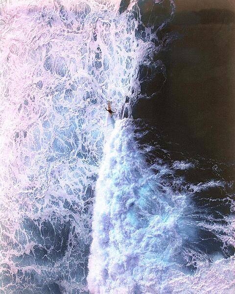
Solitary surfer along the North Shore of the Big Island of Hawaii.
Solitary surfer along the North Shore of the Big Island of Hawaii. • CIA World Factbook • 2020
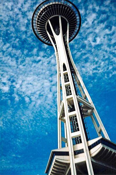
Space Needle, Seattle, Washington.
Space Needle, Seattle, Washington. • CIA World Factbook • 2020
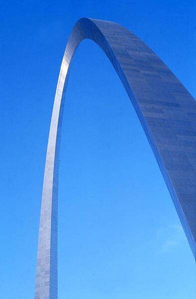
The Gateway Arch in St. Louis, Missouri, the iconic symbol of the city. The monument honors the westward expansion of the United States, much of which began in this city. Built between 1963 and 1965 (but not opened to the public until 1967), the stainless steel-sheathed structure is hollow to accommodate a unique tram system that takes visitors to an observation deck at the top. Both the height and width of the arch are 192 m (630 ft). The structure is the tallest monument in the United States and the tallest stainless steel monument in the world.
The Gateway Arch in St. Louis, Missouri, the iconic symbol of the city. The monument honors the westward expansion of the United States, much of which began in this city. Built between 1963 and 1965 (but not opened to the public until 1967), the stainless steel-sheathed structure is hollow to accommodate a unique tram system that takes visitors to an observation deck at the top. Both the height and width of the arch are 192 m (630 ft). The structure is the tallest monument in the United States and the tallest stainless steel monument in the world. • CIA World Factbook • 2020
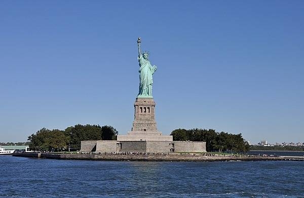
The Statue of Liberty on Liberty Island, New York. Photo courtesy of the National Park Service.
The Statue of Liberty on Liberty Island, New York. Photo courtesy of the National Park Service. • CIA World Factbook • 2020
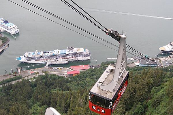
Mount Roberts Tram above Juneau Harbor, Alaska.
Mount Roberts Tram above Juneau Harbor, Alaska. • CIA World Factbook • 2020
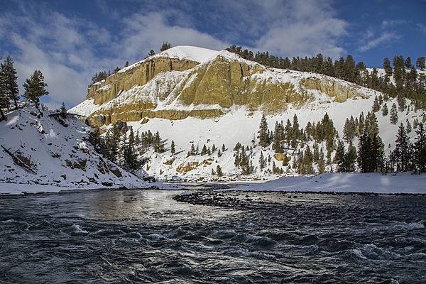
The Yellowstone River near Tower Fall in Yellowstone National Park. Image courtesy of the US National Park Service/Neal Herbert.
The Yellowstone River near Tower Fall in Yellowstone National Park. Image courtesy of the US National Park Service/Neal Herbert. • CIA World Factbook • 2020
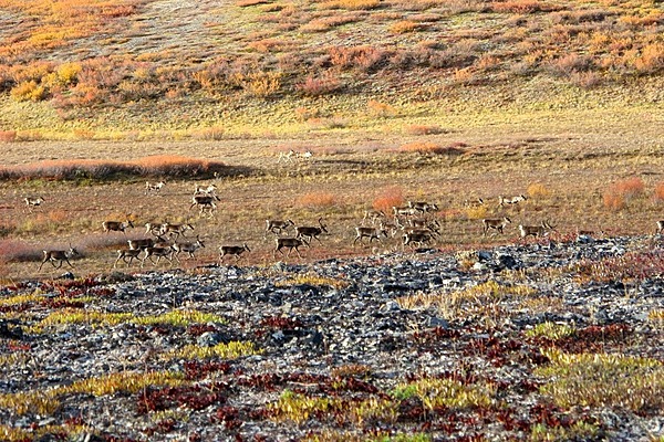
Caribou on the move across the tundra in Noatak National Preserve, Alaska. There are more animals in this view than one might first think, caribou blend into their surroundings very well. Photo courtesy of the US National Park Service.
Caribou on the move across the tundra in Noatak National Preserve, Alaska. There are more animals in this view than one might first think, caribou blend into their surroundings very well. Photo courtesy of the US National Park Service. • CIA World Factbook • 2020
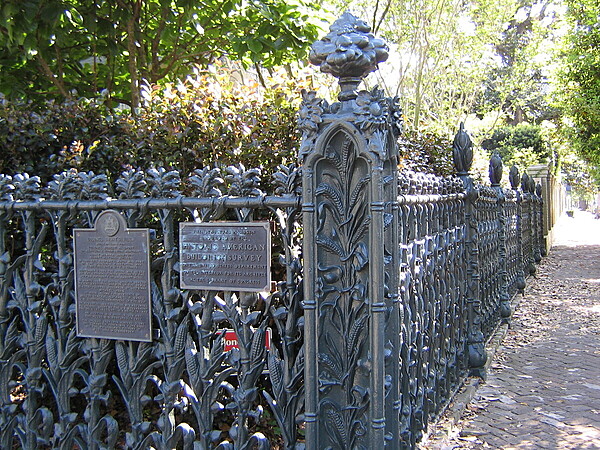
An unusual cornstalk and morning glory cast iron fence surrounds the Colonel Short Villa located on the corner of Fourth and Prytania Street in the Garden District of New Orleans.
An unusual cornstalk and morning glory cast iron fence surrounds the Colonel Short Villa located on the corner of Fourth and Prytania Street in the Garden District of New Orleans. • CIA World Factbook • 2020

The inscription in the Lincoln Memorial glows behind the statue at night. Photo courtesy of the National Park Service.
The inscription in the Lincoln Memorial glows behind the statue at night. Photo courtesy of the National Park Service. • CIA World Factbook • 2020
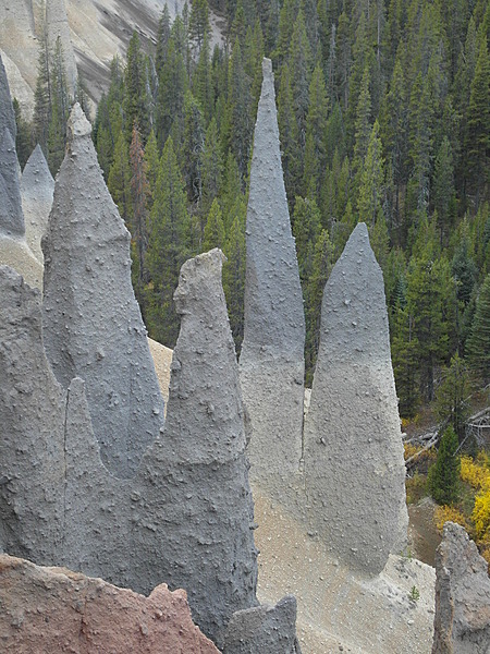
Some of the volcanic spires seen along the Pinnacles Trail at Crater Lake National Park, Oregon. Photo courtesy of the US National Park Service.
Some of the volcanic spires seen along the Pinnacles Trail at Crater Lake National Park, Oregon. Photo courtesy of the US National Park Service. • CIA World Factbook • 2020
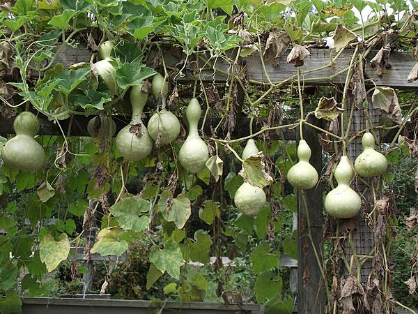
Ripening gourds at the vegetable garden display at Longwood Gardens, Kennett Square, Pennsylvania.
Ripening gourds at the vegetable garden display at Longwood Gardens, Kennett Square, Pennsylvania. • CIA World Factbook • 2020
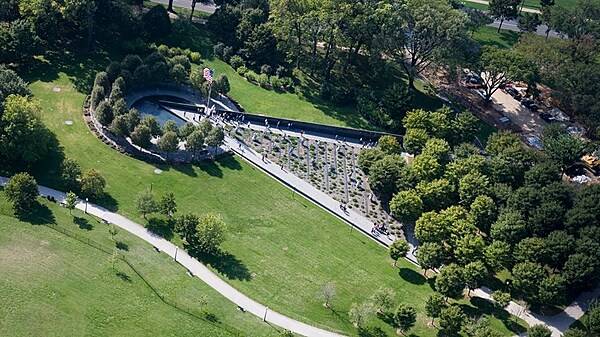
Aerial view of the Korean War Veterans Memorial in Washington, D.C. Photo courtesy of the National Park Service.
Aerial view of the Korean War Veterans Memorial in Washington, D.C. Photo courtesy of the National Park Service. • CIA World Factbook • 2020
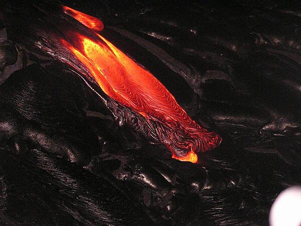
Molten lava at Kilauea Volcano, Hawaii Volcanoes National Park on the Big Island.
Molten lava at Kilauea Volcano, Hawaii Volcanoes National Park on the Big Island. • CIA World Factbook • 2020
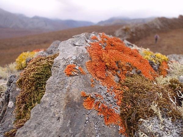
Lichens and mosses in a variety of shapes and colors grow slowly and patiently on a rock in the backcountry wilderness of Noatak National Preserve, Alaska. Photo courtesy of the US National Park Service.
Lichens and mosses in a variety of shapes and colors grow slowly and patiently on a rock in the backcountry wilderness of Noatak National Preserve, Alaska. Photo courtesy of the US National Park Service. • CIA World Factbook • 2020
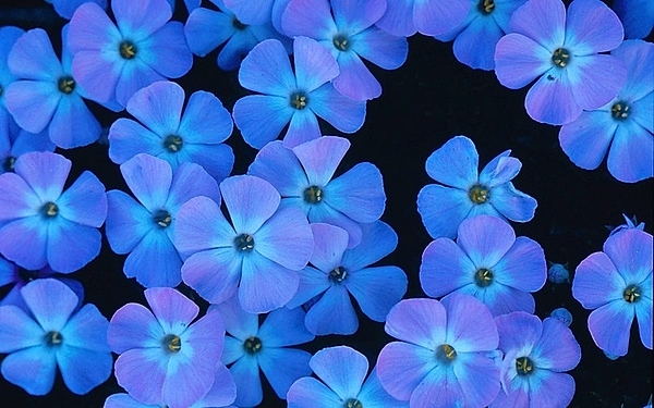
Spreading phlox at Olympic National Park, Washington state. Photo courtesy of the National Park Service/Shawn Shletren.
Spreading phlox at Olympic National Park, Washington state. Photo courtesy of the National Park Service/Shawn Shletren. • CIA World Factbook • 2020
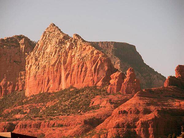
Part of the Red Rocks sandstone formation in the Sedona area of Arizona. The rocks appear to glow reddish orange in the early morning or evening sunlight.
Part of the Red Rocks sandstone formation in the Sedona area of Arizona. The rocks appear to glow reddish orange in the early morning or evening sunlight. • CIA World Factbook • 2020
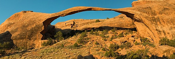
Landscape Arch in Arches National Park, Utah is the longest in the park and the fifth-longest in the world. Photo courtesy of the US National Park Service/Neal Herbert.
Landscape Arch in Arches National Park, Utah is the longest in the park and the fifth-longest in the world. Photo courtesy of the US National Park Service/Neal Herbert. • CIA World Factbook • 2020
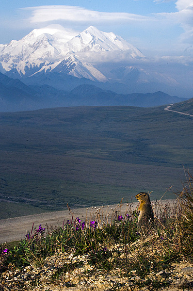
A ground squirrel checks its surroundings in Denali National Park and Preserve, Alaska; Denali looms in the background. Photo courtesy of the US National Park Service.
A ground squirrel checks its surroundings in Denali National Park and Preserve, Alaska; Denali looms in the background. Photo courtesy of the US National Park Service. • CIA World Factbook • 2020
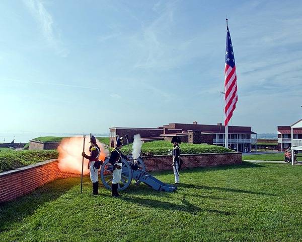
The Fort McHenry Guard fires the morning gun. Photo courtesy of the National Park Service.
The Fort McHenry Guard fires the morning gun. Photo courtesy of the National Park Service. • CIA World Factbook • 2020
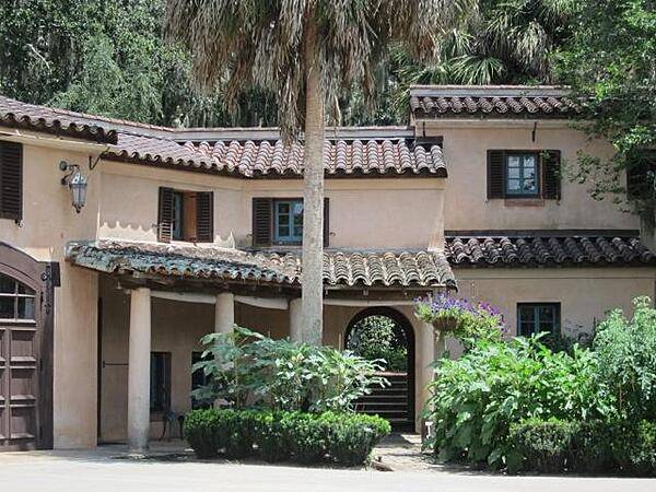
CIA World Factbook • 2020
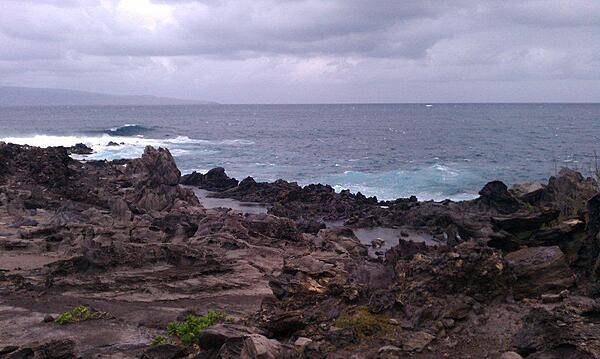
Kapalua Beach Trail on the island of Maui. The trail runs for 2.8 km (1.8 mi) along the Kapalua coast, passing white sand beaches, stunning homes, and lava flows, as shown in this picture.
Kapalua Beach Trail on the island of Maui. The trail runs for 2.8 km (1.8 mi) along the Kapalua coast, passing white sand beaches, stunning homes, and lava flows, as shown in this picture. • CIA World Factbook • 2020
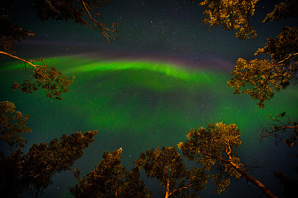
Early fall aurora framed by aspen trees. Summer skies are too bright to see aurora, but by the end of August, the sun goes far enough below the horizon to allow the northern lights to be seen in Denali National Park and Preserve, Alaska. Photo courtesy of the US National Park Service/ Kent Miller.
Early fall aurora framed by aspen trees. Summer skies are too bright to see aurora, but by the end of August, the sun goes far enough below the horizon to allow the northern lights to be seen in Denali National Park and Preserve, Alaska. Photo courtesy of the US National Park Service/ Kent Miller. • CIA World Factbook • 2020

Tangier Island, Virginia is located in the lower Chesapeake Bay. This house is typical of the local architecture. House facades generally display white siding, while shutters and roofs are of matching colors.
Tangier Island, Virginia is located in the lower Chesapeake Bay. This house is typical of the local architecture. House facades generally display white siding, while shutters and roofs are of matching colors. • CIA World Factbook • 2020
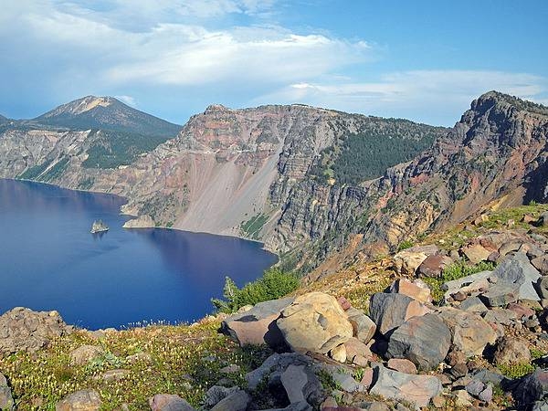
Crater Lake, Oregon in summer II. A view of the Phantom Ship (center left), with Mount Scott in the distance. Taken near the summit of Garfield Peak. Photo courtesy of the US National Park Service.
Crater Lake, Oregon in summer II. A view of the Phantom Ship (center left), with Mount Scott in the distance. Taken near the summit of Garfield Peak. Photo courtesy of the US National Park Service. • CIA World Factbook • 2020
A Japanese pagoda among the cherry trees lining the Tidal Basin in Washington D.C. Photo courtesy of the National Park Service/John Donoghue.
A Japanese pagoda among the cherry trees lining the Tidal Basin in Washington D.C. Photo courtesy of the National Park Service/John Donoghue. • CIA World Factbook • 2020

CIA World Factbook • 2020
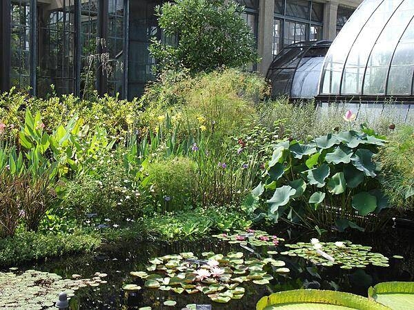
Aquatic flora outside one of the conservatories at Longwood Gardens, Kennett Square, Pennsylvania. The Gardens are one of the premier botanical gardens in the United States.
Aquatic flora outside one of the conservatories at Longwood Gardens, Kennett Square, Pennsylvania. The Gardens are one of the premier botanical gardens in the United States. • CIA World Factbook • 2020
The statue of Paul Revere in front of the Old North Church in Boston. Image courtesy of the US National Park Service.
The statue of Paul Revere in front of the Old North Church in Boston. Image courtesy of the US National Park Service. • CIA World Factbook • 2020
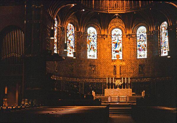
The sanctuary of Trinity Church in Boston, Massachusetts.
The sanctuary of Trinity Church in Boston, Massachusetts. • CIA World Factbook • 2020
Tidal Basin weeping cherry blossoms in sunlight. Photo courtesy of the National Park Service.
Tidal Basin weeping cherry blossoms in sunlight. Photo courtesy of the National Park Service. • CIA World Factbook • 2020
Overhead view of the Washington Monument in Washington, D.C. Image courtesy of NASA/Bill Ingalls.
Overhead view of the Washington Monument in Washington, D.C. Image courtesy of NASA/Bill Ingalls. • CIA World Factbook • 2020
The Assembly Room of the Pennsylvania State House served as the meeting place of the Pennsylvania Assembly for over sixty years until the state capital moved away from Philadelphia in 1799. In 1776, the Continental Congress declared Independence in this room and in 1787 the US Constitution was debated and signed here. Most historians consider this room one of the most historic rooms in the US. Photo courtesy of the US National Park Service.
The Assembly Room of the Pennsylvania State House served as the meeting place of the Pennsylvania Assembly for over sixty years until the state capital moved away from Philadelphia in 1799. In 1776, the Continental Congress declared Independence in this room and in 1787 the US Constitution was debated and signed here. Most historians consider this room one of the most historic rooms in the US. Photo courtesy of the US National Park Service. • CIA World Factbook • 2020
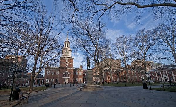
Independence Hall in Philadelphia is situated on Independence Square. On 8 July 1776, this was the scene of the first public reading of the Declaration of Independence. Photo courtesy of the US National Park Service.
Independence Hall in Philadelphia is situated on Independence Square. On 8 July 1776, this was the scene of the first public reading of the Declaration of Independence. Photo courtesy of the US National Park Service. • CIA World Factbook • 2020
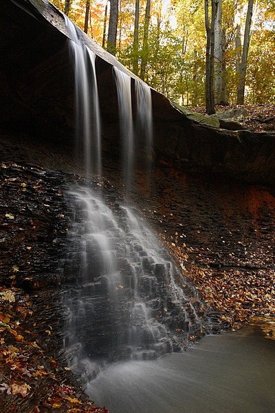
Autumn view of Blue Hen Falls in Cuyahoga Valley National Park, Ohio. Photo courtesy of the US National Park Service.
Autumn view of Blue Hen Falls in Cuyahoga Valley National Park, Ohio. Photo courtesy of the US National Park Service. • CIA World Factbook • 2020
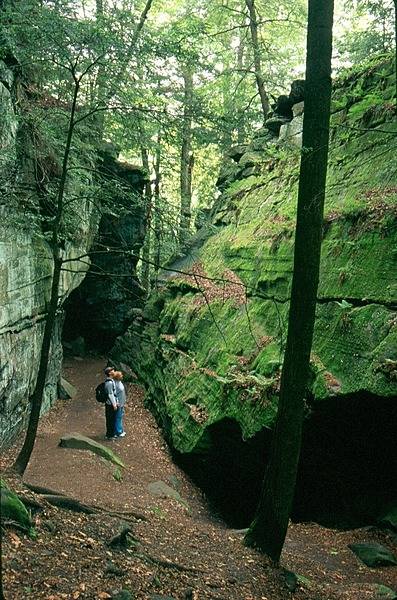
Hikers explore some of the Ritchie Ledges at Cayahoga Valley National Park, Ohio. Photo courtesy of the US National Park Service.
Hikers explore some of the Ritchie Ledges at Cayahoga Valley National Park, Ohio. Photo courtesy of the US National Park Service. • CIA World Factbook • 2020
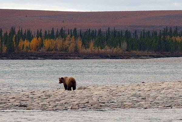
A grizzly bear in Noatak National Preserve, Alaska shuffles along the edge of the Noatak River in September, looking for one of the many salmon carcasses that wash up on the gravel bars after spawning. Photo courtesy of the US National Park Service.
A grizzly bear in Noatak National Preserve, Alaska shuffles along the edge of the Noatak River in September, looking for one of the many salmon carcasses that wash up on the gravel bars after spawning. Photo courtesy of the US National Park Service. • CIA World Factbook • 2020
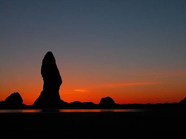
Sea stack at sunset at Olympic National Park, Washington state. Photo courtesy of the National Park Service.
Sea stack at sunset at Olympic National Park, Washington state. Photo courtesy of the National Park Service. • CIA World Factbook • 2020
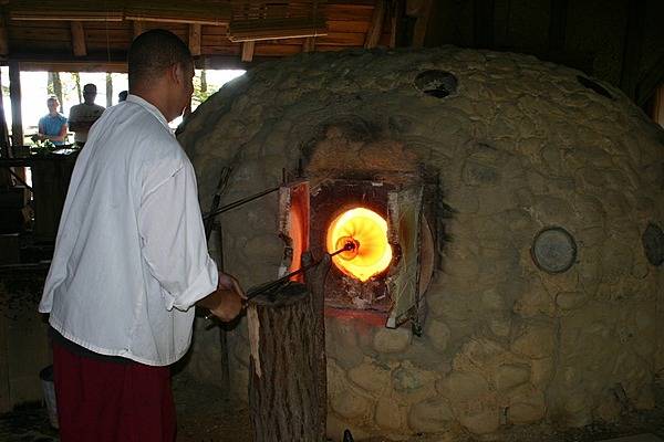
Glass making demonstration at Jamestown National Historic Site, Virginia where costumed interpreters demonstrate glass making techniques from the 17th century. Photo courtesy of the National Park Service.
Glass making demonstration at Jamestown National Historic Site, Virginia where costumed interpreters demonstrate glass making techniques from the 17th century. Photo courtesy of the National Park Service. • CIA World Factbook • 2020

Walruses at rest on an ice floe in the Chukchi Sea, Alaska. Photo courtesy of the USGS.
Walruses at rest on an ice floe in the Chukchi Sea, Alaska. Photo courtesy of the USGS. • CIA World Factbook • 2020
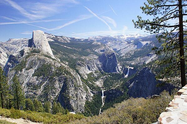
On the road to Glacier Point in Yosemite National Park one turns a corner and comes to a parking lot for Washburn Point. This view from the Point shows Half Dome (far left), Nevada Falls (on the right), Vernal Falls (below center).
On the road to Glacier Point in Yosemite National Park one turns a corner and comes to a parking lot for Washburn Point. This view from the Point shows Half Dome (far left), Nevada Falls (on the right), Vernal Falls (below center). • CIA World Factbook • 2020

CIA World Factbook • 2020
The front or back yards of homes on Tangier Island, Virginia are well tended. Miniature lighthouses decorate many a front or back yard.
The front or back yards of homes on Tangier Island, Virginia are well tended. Miniature lighthouses decorate many a front or back yard. • CIA World Factbook • 2020
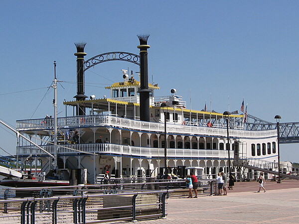
Steamboat rides on the Mississippi River are popular with both tourists and locals.
Steamboat rides on the Mississippi River are popular with both tourists and locals. • CIA World Factbook • 2020
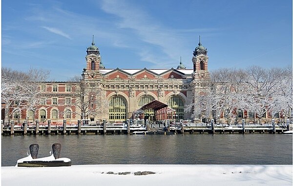
The entrance to the main building on Ellis Island National Immigration Museum in the winter. Image courtesy of the US National Park Service.
The entrance to the main building on Ellis Island National Immigration Museum in the winter. Image courtesy of the US National Park Service. • CIA World Factbook • 2020
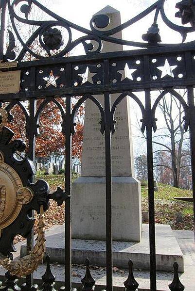
CIA World Factbook • 2020
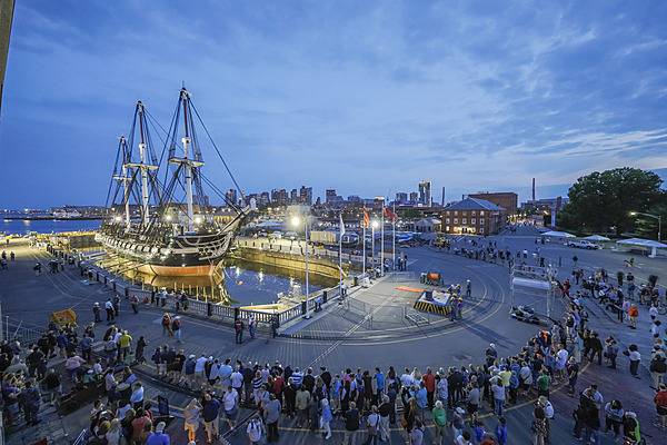
The USS Constitution leaves dry dock at the Charleston Navy Yard (Boston) and returns to sea on 23 July 2017 after a two-year restoration program that replaced the copper sheets on the ship's hull as well as various deck boards. Photo courtesy of the US National Park Service/ Matt Teuten.
The USS Constitution leaves dry dock at the Charleston Navy Yard (Boston) and returns to sea on 23 July 2017 after a two-year restoration program that replaced the copper sheets on the ship's hull as well as various deck boards. Photo courtesy of the US National Park Service/ Matt Teuten. • CIA World Factbook • 2020

The statue of Abraham Lincoln at Richmond National Battlefield. On 4 April 1865, just after Union troops took control of Richmond, Virginia, the Confederate capital, President Lincoln and his 12-year-old son Tad toured the hostile city. This full-size bronze grouping symbolizes that moment in time, as depicted by sculptor David Frech. Behind the figures is a phrase from Lincoln's Second Inaugural Address, delivered one month before: “To bind up the nation’s wounds.” Amazingly, Lincoln survived this dangerous visit, only to be murdered by a Confederate activist in Washington just 10 days later. Photo courtesy of the National Park Service.
The statue of Abraham Lincoln at Richmond National Battlefield. On 4 April 1865, just after Union troops took control of Richmond, Virginia, the Confederate capital, President Lincoln and his 12-year-old son Tad toured the hostile city. This full-size bronze grouping symbolizes that moment in time, as depicted by sculptor David Frech. Behind the figures is a phrase from Lincoln's Second Inaugural Address, delivered one month before: “To bind up the nation’s wounds.” Amazingly, Lincoln survived this dangerous visit, only to be murdered by a Confederate activist in Washington just 10 days later. Photo courtesy of the National Park Service. • CIA World Factbook • 2020
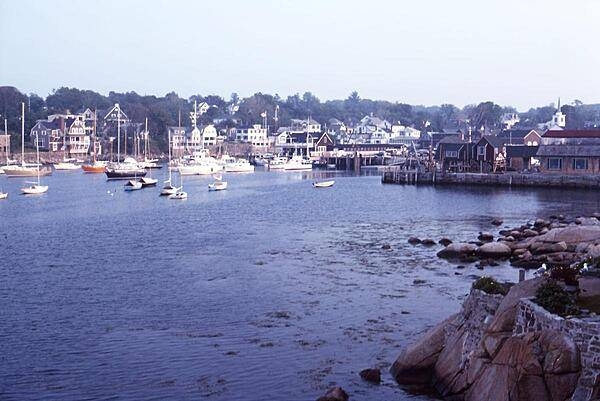
A view of Rockport, Massachusetts, some 40 km (25 mi) northeast of Boston, at the tip of the Cape Ann peninsula. First settled in the 17th century, the town's economy was long based on timber, fishing, and granite quarrying. Today it is a popular tourist site and artists colony.
A view of Rockport, Massachusetts, some 40 km (25 mi) northeast of Boston, at the tip of the Cape Ann peninsula. First settled in the 17th century, the town's economy was long based on timber, fishing, and granite quarrying. Today it is a popular tourist site and artists colony. • CIA World Factbook • 2020
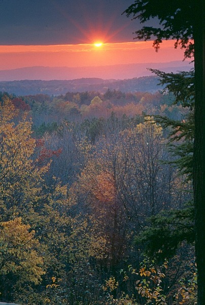
Sunset view from the Ritchie Ledges at Cayahoga Valley National Park, Ohio. Photo courtesy of the US National Park Service.
Sunset view from the Ritchie Ledges at Cayahoga Valley National Park, Ohio. Photo courtesy of the US National Park Service. • CIA World Factbook • 2020
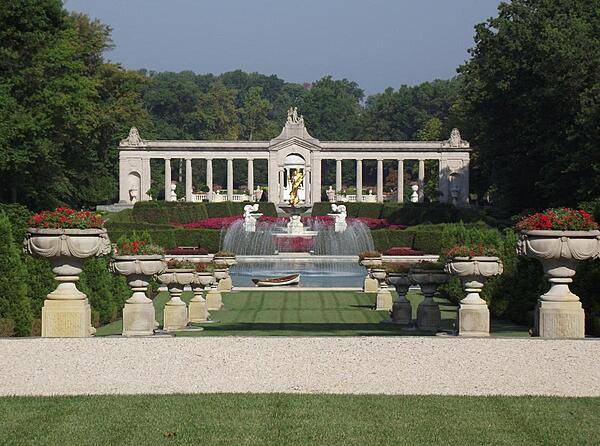
Fountain and pool at the end of the Long Walk at the Nemours Gardens, Wilmington, Delaware. The Gardens are the largest French formal gardens in North America and are patterned after the gardens of Versailles. The gilded statue represents Achievement.
Fountain and pool at the end of the Long Walk at the Nemours Gardens, Wilmington, Delaware. The Gardens are the largest French formal gardens in North America and are patterned after the gardens of Versailles. The gilded statue represents Achievement. • CIA World Factbook • 2020
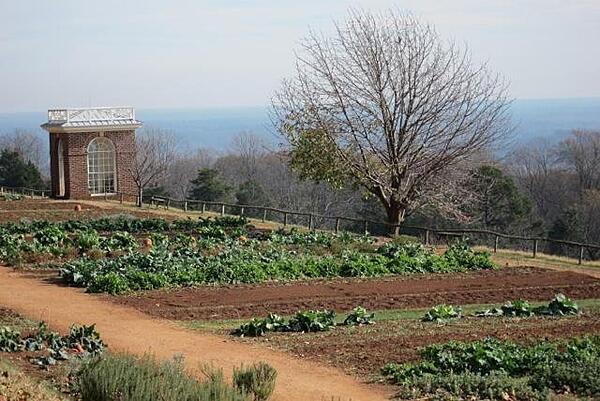
CIA World Factbook • 2020
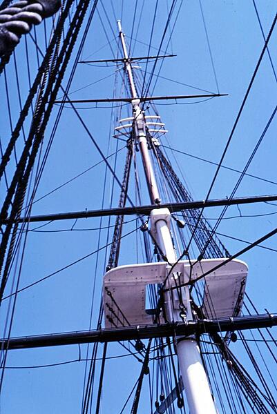
A top (platform) and some of the rigging on the frigate USS Constitution.
A top (platform) and some of the rigging on the frigate USS Constitution. • CIA World Factbook • 2020
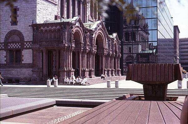
The facade of Trinity Church in Boston Massachusetts vividly displays many details of the Richardsonian Romanesque style.
The facade of Trinity Church in Boston Massachusetts vividly displays many details of the Richardsonian Romanesque style. • CIA World Factbook • 2020
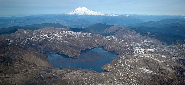
Mount Rainier in the state of Washington as seen from the crater rim of Mount St. Helens, overlooking Spirit Lake. Photo courtesy of the USGS.
Mount Rainier in the state of Washington as seen from the crater rim of Mount St. Helens, overlooking Spirit Lake. Photo courtesy of the USGS. • CIA World Factbook • 2020
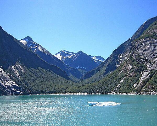
View along the Inside Passage of the Alaska panhandle.
View along the Inside Passage of the Alaska panhandle. • CIA World Factbook • 2020
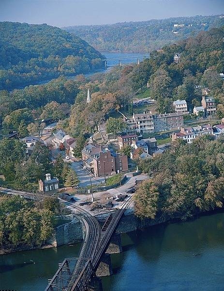
Harpers Ferry is a historic town in Jefferson County, West Virginia, in the lower Shenandoah Valley. Happily situated at the confluence of the Potomac and Shenandoah Rivers, it marks the spot where the US states of Maryland, Virginia, and West Virginia meet. This view of Harpers Ferry is taken from Maryland Heights. Photo courtesy of the National Park Service.
Harpers Ferry is a historic town in Jefferson County, West Virginia, in the lower Shenandoah Valley. Happily situated at the confluence of the Potomac and Shenandoah Rivers, it marks the spot where the US states of Maryland, Virginia, and West Virginia meet. This view of Harpers Ferry is taken from Maryland Heights. Photo courtesy of the National Park Service. • CIA World Factbook • 2020
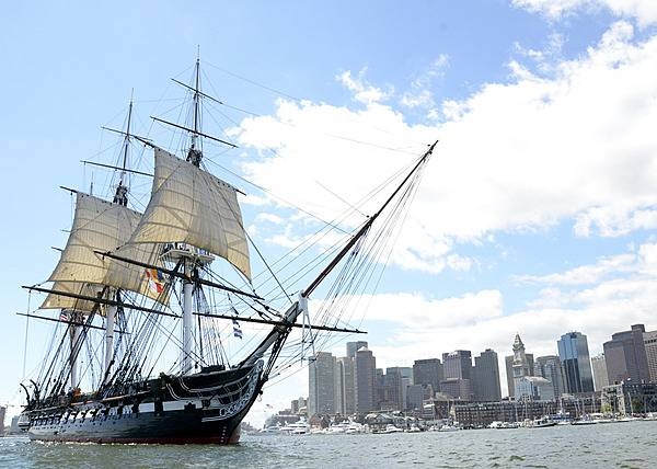
The USS Constitution under sail in Boston Harbor. Photo courtesy of the US Navy/MC3 Victoria Kinney.
The USS Constitution under sail in Boston Harbor. Photo courtesy of the US Navy/MC3 Victoria Kinney. • CIA World Factbook • 2020
Media source: CIA World Factbook (2020) — Public Domain